Evelyn Wood

Wood, Forest in Staffordshire Lichfield

England

Evelyn Wood

The Gazebo The Gazebo is a folly at the top of Borrowcop Hill which has excellent views to the south and north.
The Gazebo Credit: Andy Malbon

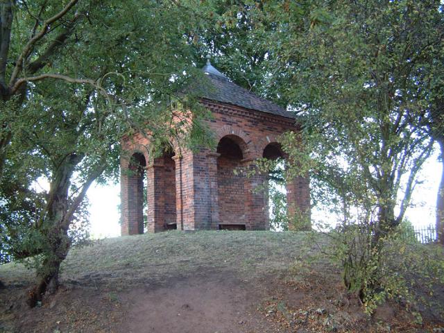
Evelyn Wood is a small village located in the county of Staffordshire, England. Situated within the Cannock Chase district, this picturesque village is nestled within the beautiful and sprawling Cannock Chase Forest, offering residents and visitors alike a serene and tranquil environment.

The village itself is characterized by its charming cottages and traditional architecture, giving it a quaint and cozy feel. The area is surrounded by stunning natural landscapes, with the forest providing a plethora of outdoor recreational activities for nature enthusiasts. From walking and hiking trails to cycling and wildlife spotting, Evelyn Wood offers endless opportunities to explore and connect with nature.

Despite its rural setting, Evelyn Wood is conveniently located near major transportation routes, making it easily accessible for residents and visitors. The nearby town of Stafford offers a range of amenities, including shopping centers, schools, and healthcare facilities, providing residents with all the necessary conveniences.

The village also has a strong sense of community, with various social events and activities organized throughout the year. The local community center serves as a hub for gatherings and celebrations, fostering a close-knit and friendly atmosphere among residents.

Overall, Evelyn Wood in Staffordshire provides a peaceful and idyllic setting for those seeking a rural lifestyle with easy access to modern amenities. With its stunning natural surroundings and strong community spirit, it is a truly delightful place to call home.

If you have any feedback on the listing, please let us know in the comments section below.

Evelyn Wood Images

Images are sourced within 2km of 52.658534/-1.8083118 or Grid Reference SK1306. Thanks to Geograph Open Source API. All images are credited.

The Gazebo The Gazebo is a folly at the top of Borrowcop Hill which has excellent views to the south and north.
The Gazebo
The Gazebo is a folly at the top of Borrowcop Hill which has excellent views to the south and north.
Golf Club Club house at Whittington
Golf Club
Club house at Whittington
Ingleyhill Farm This farm is viewed from the Heart of England Way.
Ingleyhill Farm
This farm is viewed from the Heart of England Way.
Packington Moor This farm, with its long drive, is viewed from the Heart of England Way.
Packington Moor
This farm, with its long drive, is viewed from the Heart of England Way.
Heart of England Craft Centre These old buildings have been given a new lease of life. There are many craft units and eating places on this site. There are also woodland walks.
Heart of England Craft Centre
These old buildings have been given a new lease of life. There are many craft units and eating places on this site. There are also woodland walks.
Cricket Lane
Cricket Lane
Knowle Farm Probably a Norman Motte and Bailey Manor lying next to Ryknield Street Roman road skirting Lichfield.
Knowle Farm
Probably a Norman Motte and Bailey Manor lying next to Ryknield Street Roman road skirting Lichfield.
Lichfield Friary Lawn Tennis Club These splendid hedges form part of this floodlit club. The grounds can be used all year round.
Lichfield Friary Lawn Tennis Club
These splendid hedges form part of this floodlit club. The grounds can be used all year round.
The Horse and Jockey This public house is close to the site of a former race course. The former grandstand of this racecourse is now the club house of Whittington Golf club.
The Horse and Jockey
This public house is close to the site of a former race course. The former grandstand of this racecourse is now the club house of Whittington Golf club.
Muddy Field and Toll Road A gantry on the M6 Toll Road can be seen at the far side of this field.  A footpath is indicated on the map but given the uninviting mud it is not surprising that it doesn't appear to be that well used.
Muddy Field and Toll Road
A gantry on the M6 Toll Road can be seen at the far side of this field. A footpath is indicated on the map but given the uninviting mud it is not surprising that it doesn't appear to be that well used.
Bridleway and Sofa This long distance bridleway between Wall and Hopwas caters for the weary traveller by providing an old sofa.
Bridleway and Sofa
This long distance bridleway between Wall and Hopwas caters for the weary traveller by providing an old sofa.
Footpath Jungle The access to this footpath I assume is via the farm entrance and not through the tangle of hawthorn hedge.
Footpath Jungle
The access to this footpath I assume is via the farm entrance and not through the tangle of hawthorn hedge.
Bridleway and Freeford This bridleway also doubles as a farm road to Freeford Farm.
Bridleway and Freeford
This bridleway also doubles as a farm road to Freeford Farm.
Streetway House The farmhouse backs directly onto the A5 Watling Street Trunk Road. A bridge over the new M6 Toll can be seen beyond the farm.
Streetway House
The farmhouse backs directly onto the A5 Watling Street Trunk Road. A bridge over the new M6 Toll can be seen beyond the farm.
Lock Restoration, Lichfield Canal <span class="nowrap"><a title="http://www.lhcrt.org.uk/lich.htm" rel="nofollow ugc noopener" href="http://www.lhcrt.org.uk/lich.htm">Link</a><img style="margin-left:2px;" alt="External link" title="External link - shift click to open in new window" src="https://s1.geograph.org.uk/img/external.png" width="10" height="10"/></span>
Lock Restoration, Lichfield Canal
Bridleway across the Freeford Estate
Bridleway, Freeford
Bridleway, Freeford
Show me another place!

Evelyn Wood is located at Grid Ref: SK1306 (Lat: 52.658534, Lng: -1.8083118)

Administrative County: Staffordshire

District: Lichfield

Police Authority: Staffordshire

What 3 Words

///boils.capacity.digital. Near Lichfield, Staffordshire

Related Wikis

Swinfen

Swinfen is a small community about two miles south of Lichfield in the civil parish of Swinfen and Packington, Staffordshire. Swinfen is referred to in...

HM Prison Swinfen Hall

HM Prison Swinfen Hall is a Category C men's prison and Young Offenders Institution, located in the village of Swinfen (near Lichfield) in Staffordshire...
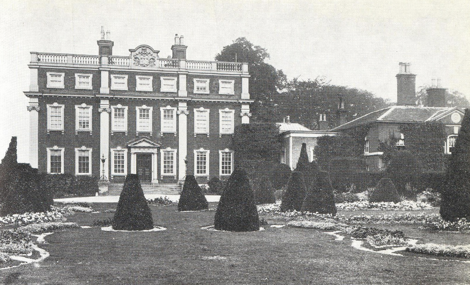
Swinfen Hall

Swinfen Hall is an 18th-century country mansion house, now converted into a hotel, situated at Swinfen, in the Lichfield District of Staffordshire in England...
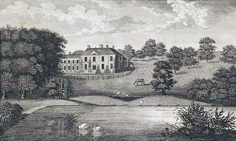
Freeford Hall

Freeford Manor (previously known as Freeford Hall) is a privately owned 18th-century country house at Freeford, near Lichfield, Staffordshire. It is the...

Swinfen and Packington

Swinfen and Packington is a civil parish in Lichfield District, Staffordshire, England. The parish was newly formed in 1934 by division from Weeford. The...

Staffordshire Regiment Museum

The Staffordshire Regiment Museum is a military museum in Staffordshire, England, preserving the history of the Staffordshire Regiment (The Prince of Wales...

King Edward VI School, Lichfield

King Edward VI School, Lichfield, is a co-educational secondary school and sixth form located near the heart of the city of Lichfield, Staffordshire, England...

DMS Whittington

DMS Whittington, otherwise known as Defence Medical Services Whittington (formerly Whittington Barracks), is a military base in Whittington, Staffordshire...

Nearby Amenities

Located within 500m of 52.658534,-1.8083118
Crossing
Crossing: unmarked
Lat/Long: 52.6592212/-1.8108739
Power: pole
Lat/Long: 52.6585246/-1.815368
Power: pole
Lat/Long: 52.6592852/-1.8149504
Crossing
Crossing: unmarked
Lat/Long: 52.6590349/-1.8105026
The data included in this document is from www.openstreetmap.org. The data is made available under ODbL.

Have you been to Evelyn Wood?

Leave your review of Evelyn Wood below (or comments, questions and feedback).