Clough Wood

Wood, Forest in Staffordshire Staffordshire Moorlands

England

Clough Wood

Autumn view from Blore Pastures  Taken from Blore Pastures Picnic site looking across towards Bunster Hill and the mouth of Dovedale.
Autumn view from Blore Pastures Credit: Trevor Harris

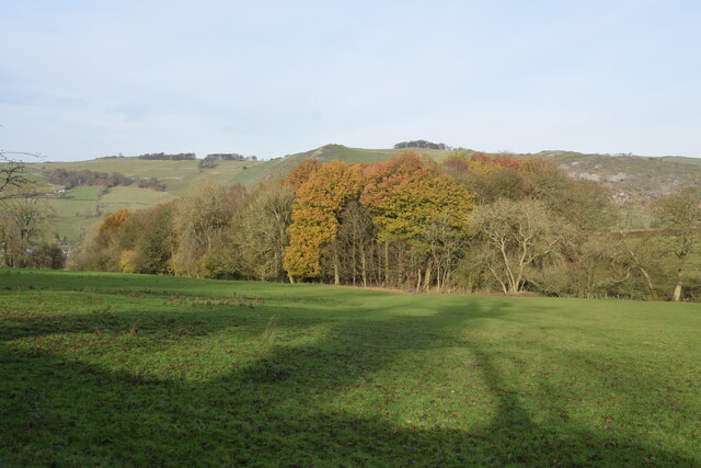
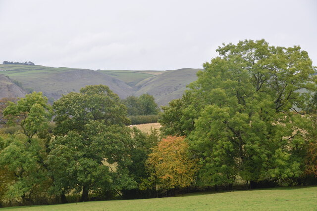
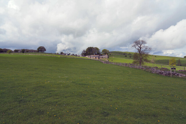
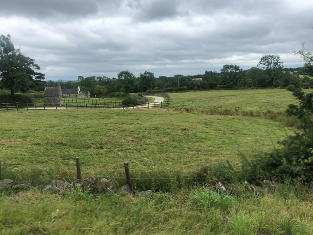
Clough Wood is a picturesque woodland located in the county of Staffordshire, England. This enchanting forest covers an area of approximately 100 acres and is nestled within the beautiful Cannock Chase area of outstanding natural beauty.

The woodland is known for its diverse range of flora and fauna, offering a tranquil and serene environment for nature enthusiasts and visitors alike. The forest floor is carpeted with a variety of wildflowers, including bluebells and primroses, creating a vibrant and colorful display during the spring months. Tall, majestic oak and beech trees dominate the canopy, providing shade and shelter for a wide array of wildlife.

Clough Wood is also home to a diverse range of bird species, making it a haven for birdwatchers. Visitors may catch a glimpse of woodland birds such as woodpeckers, nuthatches, and tawny owls. There are several well-maintained walking trails that wind their way through the woodland, allowing visitors to explore the area at their own pace. These trails offer stunning views of the surrounding countryside and provide an opportunity to spot elusive woodland creatures such as deer and foxes.

The woodland is managed by the local council, ensuring its preservation and protection for future generations to enjoy. It is a popular destination for families, walkers, and nature enthusiasts seeking a peaceful escape from the hustle and bustle of everyday life. Clough Wood truly offers a slice of natural beauty in the heart of Staffordshire.

If you have any feedback on the listing, please let us know in the comments section below.

Clough Wood Images

Images are sourced within 2km of 53.033216/-1.8158127 or Grid Reference SK1248. Thanks to Geograph Open Source API. All images are credited.

Autumn view from Blore Pastures  Taken from Blore Pastures Picnic site looking across towards Bunster Hill and the mouth of Dovedale.
Autumn view from Blore Pastures
Taken from Blore Pastures Picnic site looking across towards Bunster Hill and the mouth of Dovedale.
Trees in the last of the light
Speed Camera Warning Signage
Dog & Partridge - Swinscoe
Speed Limit change
Speed Limit change
Junction signage
Junction signage
Bend at Miles Knoll
Bend at Miles Knoll
View towards Dove Dale  Taken from the picnic area on Blore Pasture.
View towards Dove Dale
Taken from the picnic area on Blore Pasture.
The Waterings Farm The farm is off Blore Lane and has a good view across and down the valley.
The Waterings Farm
The farm is off Blore Lane and has a good view across and down the valley.
Looking along Blore Lane Looking back down the road from the position of the previous submission <a href="https://www.geograph.org.uk/photo/7479439">SK1249 : The Waterings Farm</a>.
Looking along Blore Lane
Looking back down the road from the position of the previous submission SK1249 : The Waterings Farm.
Dog and Partridge Inn On the edge of the Peak District National Park
Dog and Partridge Inn
On the edge of the Peak District National Park
Drive to Little Moor Cottage
View south-west from the A523
The Dog and Partridge at Swinscoe
Drive to Littlemoor Cottage (a footpath)
Milepost by A523 near Calton Moor House And a distant wind turbine
Milepost by A523 near Calton Moor House
And a distant wind turbine
Lay-by by A523
Lay-by by A523
Long straight length of A52, west of Swinscoe The A52 is a major east-west road in the East Midlands. It runs east from a junction with the A53 at Newcastle-under-Lyme near Stoke-on-Trent (just east of the M6) to the Lincolnshire coast at Mablethorpe. Running for approximately 147 miles, its route passes via Ashbourne, Derby, Stapleford, Nottingham, West Bridgford, Bingham, Grantham, Boston and Skegness.
Long straight length of A52, west of Swinscoe
The A52 is a major east-west road in the East Midlands. It runs east from a junction with the A53 at Newcastle-under-Lyme near Stoke-on-Trent (just east of the M6) to the Lincolnshire coast at Mablethorpe. Running for approximately 147 miles, its route passes via Ashbourne, Derby, Stapleford, Nottingham, West Bridgford, Bingham, Grantham, Boston and Skegness.
Show me another place!

Clough Wood is located at Grid Ref: SK1248 (Lat: 53.033216, Lng: -1.8158127)

Administrative County: Staffordshire

District: Staffordshire Moorlands

Police Authority: Staffordshire

What 3 Words

///meatballs.talked.buns. Near Mayfield, Staffordshire

Nearby Locations

Clough Wood

Related Wikis

Blore

Blore (grid reference SK137493) is a small village and parish in the Staffordshire Moorlands District of England. It is on an acclivity above Dovedale...

Swinscoe

Swinscoe is a small hamlet within the Staffordshire Moorlands in Staffordshire, England. Administratively, the hamlet is part of the civil parish of Blore...

Blore with Swinscoe

Blore with Swinscoe is a civil parish north-west of Ashbourne, in the Staffordshire Moorlands district of Staffordshire, England, on the edge of the Peak...

Thorswood

Thorswood is a nature reserve of the Staffordshire Wildlife Trust, situated in the Weaver Hills near the village of Stanton, in Staffordshire, England...

Nearby Amenities

Located within 500m of 53.033216,-1.8158127
Barrier: stile
Material: wood
Source: survey;gps
Stile: stepover
Lat/Long: 53.0317667/-1.8094812
The Old Barn
Source: Sign on road;Bing
Tourism: self_catering
Lat/Long: 53.034922/-1.8098008
Ford: yes
Lat/Long: 53.0310521/-1.8099251
The data included in this document is from www.openstreetmap.org. The data is made available under ODbL.

Have you been to Clough Wood?

Leave your review of Clough Wood below (or comments, questions and feedback).