Berwick Bassett Clump

Wood, Forest in Wiltshire

England

Berwick Bassett Clump

Preshute Down, Wiltshire Looking over farmland in the vicinity of Preshute Down.
Preshute Down, Wiltshire Credit: Rebecca A Wills

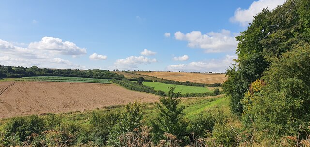
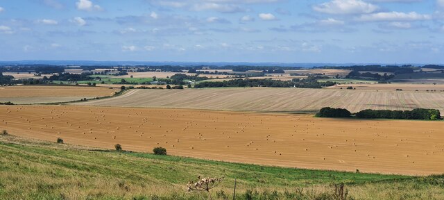
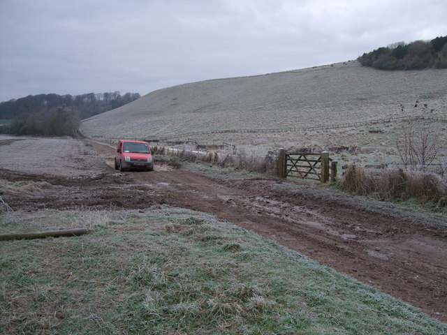
Berwick Bassett Clump is an enchanting woodland located in the county of Wiltshire, England. Situated near the village of Berwick Bassett, this captivating forest covers an area of approximately 20 acres and is a beloved destination for nature enthusiasts and walkers alike.

The clump is predominantly composed of deciduous trees, with a mix of ash, oak, beech, and birch trees dominating the landscape. These majestic trees create a dense canopy, providing a sheltered and serene environment. The forest floor is adorned with a rich carpet of wildflowers, adding vibrant splashes of color to the woodland.

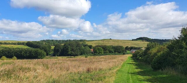
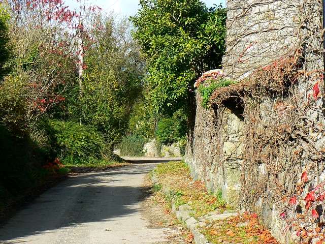
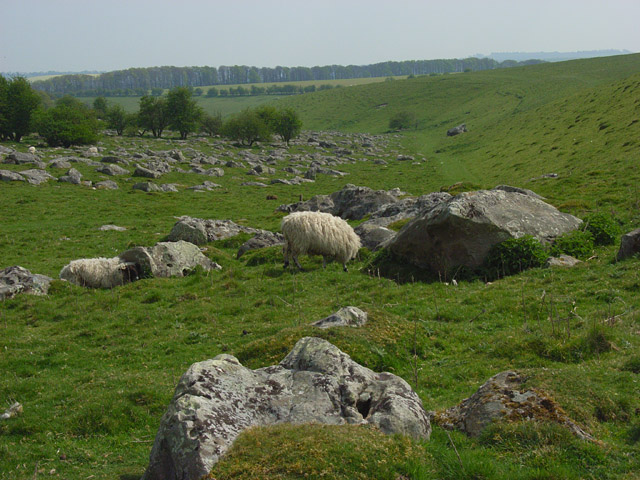
Tranquil footpaths meander through the clump, allowing visitors to explore its natural beauty. The paths are well-maintained and offer easy access for all levels of walkers. The clump is also home to an abundance of wildlife, with sightings of deer, foxes, and various bird species being common.

At the heart of Berwick Bassett Clump lies a clearing, where visitors can take a moment to relax and soak in the tranquility of their surroundings. This idyllic spot is perfect for picnics or simply enjoying the gentle breeze rustling through the trees.

Throughout the year, the clump showcases the changing seasons, with vibrant autumnal colors, delicate spring blossoms, and lush summer foliage. Its natural beauty and peaceful atmosphere make it a popular destination for photographers, artists, and those seeking solace in nature.

In conclusion, Berwick Bassett Clump is a hidden gem in Wiltshire's countryside, offering a captivating woodland experience that is sure to leave a lasting impression on all who visit.

If you have any feedback on the listing, please let us know in the comments section below.

Berwick Bassett Clump Images

Images are sourced within 2km of 51.459034/-1.8258216 or Grid Reference SU1273. Thanks to Geograph Open Source API. All images are credited.

Preshute Down, Wiltshire Looking over farmland in the vicinity of Preshute Down.
Preshute Down, Wiltshire
Looking over farmland in the vicinity of Preshute Down.
Wick Down, Wiltshire An interesting sign on the side of a bridleway on Wick Down.
Wick Down, Wiltshire
An interesting sign on the side of a bridleway on Wick Down.
Rough Hill, Wiltshire Looking over farmland towards Temple Bottom from Rough Hill.
Rough Hill, Wiltshire
Looking over farmland towards Temple Bottom from Rough Hill.
Wick Down Farm, Wiltshire Looking towards Wick Down Farm from Rough Hill.
Wick Down Farm, Wiltshire
Looking towards Wick Down Farm from Rough Hill.
Rough Hill, Wiltshire Walking northwest on the White Horse Trail on Rough Hill.
Rough Hill, Wiltshire
Walking northwest on the White Horse Trail on Rough Hill.
Berwick Bassett Down, Wiltshire A bank of Rosebay Willowherb on the side of the Ridgeway trail.
Berwick Bassett Down, Wiltshire
A bank of Rosebay Willowherb on the side of the Ridgeway trail.
Berwick Bassett Down, Wiltshire Harvesting on Berwick Bassett Down, Wiltshire.
Berwick Bassett Down, Wiltshire
Harvesting on Berwick Bassett Down, Wiltshire.
Winterbourne Down, Wiltshire Harvesting on Winterbourne Down.
Winterbourne Down, Wiltshire
Harvesting on Winterbourne Down.
Farmland, Winterbourne Bassett Barley near the foot of the scarp of Winterbourne Down.
Farmland, Winterbourne Bassett
Barley near the foot of the scarp of Winterbourne Down.
Track and farmland, Berwick Bassett The bridleway below Berwick Bassett Clump approaches Field Barn.
Track and farmland, Berwick Bassett
The bridleway below Berwick Bassett Clump approaches Field Barn.
Farmland, Winterbourne Monkton Wheat at the foot of the scarp of Monkton Down.
Farmland, Winterbourne Monkton
Wheat at the foot of the scarp of Monkton Down.
Farmland, Avebury The line of the bridleway has already been cut in a field of hay or silage.
Farmland, Avebury
The line of the bridleway has already been cut in a field of hay or silage.
Walkers and riders on the Ridgeway at Hackpen Hill
Hackpen Hill White Horse Taken from the slopes of Hackpen Hill after snowfall in December 2010, with the tail of the White Horse in the foreground.
Hackpen Hill White Horse
Taken from the slopes of Hackpen Hill after snowfall in December 2010, with the tail of the White Horse in the foreground.
Farm track beneath Wick Down The post van splashes through icy puddles on its way to Wick Down Farm. Wick Down is on the lee of the chalk escarpment at Hackpen Hill.
Farm track beneath Wick Down
The post van splashes through icy puddles on its way to Wick Down Farm. Wick Down is on the lee of the chalk escarpment at Hackpen Hill.
Reservoir, Man's Head Covered reservoir on summit of down known as "Man's Head".
Reservoir, Man's Head
Covered reservoir on summit of down known as "Man's Head".
Track to Temple Farm 12 noon on 12th December 2012 found me searching for sarsen stones (called "grey wethers" because of their resemblance to sheep) in this frozen landscape near Rough Hill. I finally found some nearer the distant the hedge on the right.
Track to Temple Farm
12 noon on 12th December 2012 found me searching for sarsen stones (called "grey wethers" because of their resemblance to sheep) in this frozen landscape near Rough Hill. I finally found some nearer the distant the hedge on the right.
Sarsen stone near track to Temple Bottom This is one of about a dozen sarsens (also called "grey wethers" because of their resemblance to sheep) I found near the track leading from the Ridgeway to Temple Bottom. Judging by earlier photographs taken for this website, the number seems to have diminished. I suspect that most of them have been cleared, as I saw a quantity of them piled up in an enclosure near Temple Farm, and indeed this one appears to have been tampered with, having a large chip out of its side.
Sarsen stone near track to Temple Bottom
This is one of about a dozen sarsens (also called "grey wethers" because of their resemblance to sheep) I found near the track leading from the Ridgeway to Temple Bottom. Judging by earlier photographs taken for this website, the number seems to have diminished. I suspect that most of them have been cleared, as I saw a quantity of them piled up in an enclosure near Temple Farm, and indeed this one appears to have been tampered with, having a large chip out of its side.
Show me another place!

Berwick Bassett Clump is located at Grid Ref: SU1273 (Lat: 51.459034, Lng: -1.8258216)

Unitary Authority: Wiltshire

Police Authority: Wiltshire

What 3 Words

///feared.reduce.think. Near Avebury, Wiltshire

Related Wikis

Berwick Bassett

Berwick Bassett is a small village and civil parish in Wiltshire, England, about 6 miles (10 km) northwest of Marlborough and 8 miles (13 km) southwest...

St Nicholas's Church, Berwick Bassett

St Nicholas's Church in Berwick Bassett, Wiltshire, England dates from the early 13th century. It is recorded in the National Heritage List for England...

Broad Hinton and Winterbourne Bassett

Broad Hinton and Winterbourne Bassett is a parish council area comprising the adjacent civil parishes of Broad Hinton and Winterbourne Bassett, in the...

Winterbourne Bassett

Winterbourne Bassett is a small village and civil parish in Wiltshire, England, about 6 miles (10 km) southwest of Swindon and 7 miles (11 km) northwest...

Winterbourne Monkton

Winterbourne Monkton is a small village and civil parish in Wiltshire, England, about 1 mile (1.6 km) north of Avebury Stone Circle and 6 miles (10 km...

Church of St Mary Magdalene, Winterbourne Monkton

The Church of St Mary Magdalene is the Anglican church in the village of Winterbourne Monkton, north of Avebury in Wiltshire, England. It is a 19th-century...

Overton Down

Overton Down Experimental Earthwork (often referred to simply as Overton Down) is a long-term project in experimental archaeology in Wiltshire, England...

Fyfield Down

Fyfield Down (grid reference SU136709) is part of the Marlborough Downs, about 1.5 miles (2.4 km) north of the village of Fyfield, Wiltshire. The down...

Have you been to Berwick Bassett Clump?

Leave your review of Berwick Bassett Clump below (or comments, questions and feedback).