Bullpark Plantation

Wood, Forest in Yorkshire Richmondshire

England

Bullpark Plantation

Cattle Grid, Coldstorms Farm Track leading from A6108 Walburnhead to the farm.
Cattle Grid, Coldstorms Farm Credit: wfmillar

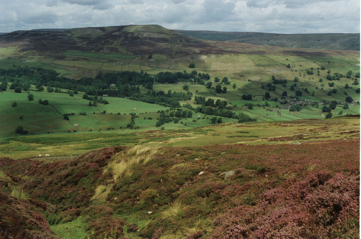
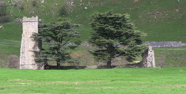
Bullpark Plantation, located in Yorkshire, England, is a captivating woodland area known for its rich biodiversity and stunning natural beauty. Covering a vast expanse, the plantation is a haven for nature enthusiasts and provides a peaceful retreat for visitors seeking to immerse themselves in the tranquility of the forest.

The plantation is primarily composed of deciduous trees, with a diverse range of species including oak, beech, and birch, among others. This variety of trees creates a tapestry of colors throughout the year, with vibrant greens in the spring and summer, and striking hues of red, orange, and gold during the autumn months.

The woodland is teeming with wildlife, making it a popular destination for birdwatchers and animal lovers. Visitors may spot various species of birds, such as woodpeckers, owls, and buzzards, as well as small mammals like squirrels, foxes, and rabbits. The plantation also supports a wide range of plant life, including wildflowers, ferns, and mosses, adding to its natural charm.

Paths and trails crisscross the plantation, allowing visitors to explore its enchanting surroundings at their own pace. These pathways lead to hidden clearings and picturesque viewpoints, offering breathtaking vistas of the surrounding countryside. The plantation is also home to a small lake, providing a tranquil spot for picnicking or simply enjoying the serenity of the water.

Bullpark Plantation is a true gem of Yorkshire, offering a sanctuary for both nature lovers and those seeking respite from the hustle and bustle of everyday life. With its diverse flora and fauna, scenic landscapes, and peaceful atmosphere, it presents an idyllic setting for a leisurely stroll or a moment of reflection in the heart of nature.

If you have any feedback on the listing, please let us know in the comments section below.

Bullpark Plantation Images

Images are sourced within 2km of 54.354276/-1.8176251 or Grid Reference SE1195. Thanks to Geograph Open Source API. All images are credited.

Cattle Grid, Coldstorms Farm Track leading from A6108 Walburnhead to the farm.
Cattle Grid, Coldstorms Farm
Track leading from A6108 Walburnhead to the farm.
Walburnhead, A6108 Near track to Coldstorms Farm.
Walburnhead, A6108
Near track to Coldstorms Farm.
Boston Bridge Carries the A6108 over Black Beck. View from Boston Farm track. Notice the crows gathering.
Boston Bridge
Carries the A6108 over Black Beck. View from Boston Farm track. Notice the crows gathering.
Boston Beck A6108 crossing the beck near Boston Farm.
Boston Beck
A6108 crossing the beck near Boston Farm.
Walburn Hall Viewed from the junction of A6108 and minor road to Wathgill Camp.
Walburn Hall
Viewed from the junction of A6108 and minor road to Wathgill Camp.
Fields near Downholme View across sheep grazing land with Gill Beck on the immediate left leading to Swaledale.
Fields near Downholme
View across sheep grazing land with Gill Beck on the immediate left leading to Swaledale.
Junction, A6108 Near Halfpenny House.
Junction, A6108
Near Halfpenny House.
Fields towards Crow Woods Approaching Walburnhead
Fields towards Crow Woods
Approaching Walburnhead
A6108 passing Walburn Hall
Road junction at Walburn Hall
Road junction signs south of Boston Bridge A6108 southbound
Road junction signs south of Boston Bridge
A6108 southbound
Approaching Bellerby road junction From A6108 towards Leyburn
Approaching Bellerby road junction
From A6108 towards Leyburn
Walburn Hall Grade I Listed fortified manor house previously larger than the present working farmhouse and possibly on the site of a 12th century house. Originally 15th and 16th century built by the Scrope family it was restored by Timothy Hutton of Marske in Swaledale early in the 19th century and virtually all that remains of a deserted medieval village. Reputed to have accommodated Mary Queen of Scots. The hall and moorland was in the hands of the Hutton family from 1755 to the 20th century.
Walburn Hall
Grade I Listed fortified manor house previously larger than the present working farmhouse and possibly on the site of a 12th century house. Originally 15th and 16th century built by the Scrope family it was restored by Timothy Hutton of Marske in Swaledale early in the 19th century and virtually all that remains of a deserted medieval village. Reputed to have accommodated Mary Queen of Scots. The hall and moorland was in the hands of the Hutton family from 1755 to the 20th century.
Traces of snow above Gill Beck There was still snow in banks from road-ploughing and in the shelter of drystone walls, though it felt pretty hot to me cycling up from Richmond before the bitter wind set in later in the day.
Traces of snow above Gill Beck
There was still snow in banks from road-ploughing and in the shelter of drystone walls, though it felt pretty hot to me cycling up from Richmond before the bitter wind set in later in the day.
The Gate to Range 6A The gate on the track to range 6A near Wathgill Camp, taken from the parking area next to the range console.
The Gate to Range 6A
The gate on the track to range 6A near Wathgill Camp, taken from the parking area next to the range console.
Track over Walburn Moor The range track across the top of Walburn Moor, with part of Wathgill Camp in the foreground.
Track over Walburn Moor
The range track across the top of Walburn Moor, with part of Wathgill Camp in the foreground.
Pillbox above Halfpenny House Pillbox situated on the edge of MOD ranges facing southwest in the general direction of Leyburn
Pillbox above Halfpenny House
Pillbox situated on the edge of MOD ranges facing southwest in the general direction of Leyburn
Show me another place!

Bullpark Plantation is located at Grid Ref: SE1195 (Lat: 54.354276, Lng: -1.8176251)

Division: North Riding

Administrative County: North Yorkshire

District: Richmondshire

Police Authority: North Yorkshire

What 3 Words

///pounds.tilts.replaying. Near Leyburn, North Yorkshire

Related Wikis

Walburn, North Yorkshire

Walburn is a hamlet and civil parish in North Yorkshire, England. It is located in lower Swaledale, 5 miles (8 km) south-west of Richmond. The population...

Swaledale

Swaledale is a valley in North Yorkshire, England. It is one of the Yorkshire Dales, which are part of the Pennines, and within the Yorkshire Dales National...

Stainton, west North Yorkshire

Stainton is a hamlet and civil parish in the North Yorkshire district of North Yorkshire, England. It is located just outside the Yorkshire Dales National...

Bellerby

Bellerby is a village and civil parish in North Yorkshire, England, about 7 miles (11 km) south-west of Richmond. The village has one pub, the Cross Keys...

Downholme

Downholme is a village and civil parish in North Yorkshire, England. It is situated approximately 4 miles (6 km) west from the market town of Richmond...
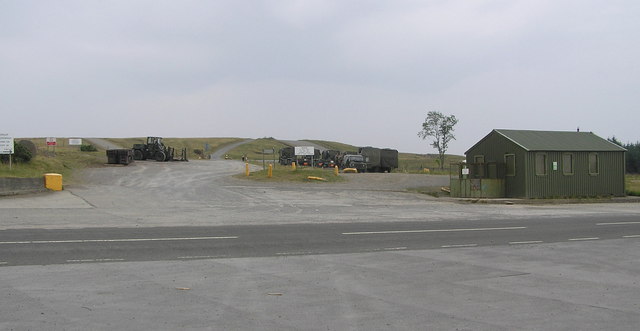
Hipswell Moor

Hipswell Moor is an area used for military training, near Catterick Garrison in North Yorkshire, England. It includes parts of the civil parishes of Barden...

Barden, Richmondshire

Barden is a hamlet and civil parish in North Yorkshire, England. It is about 5 miles (8 km) south of Richmond. According to the 2001 census the parish...

Ellerton Priory (Swaledale)

Ellerton Priory was a priory of Cistercian nuns in Swaledale in North Yorkshire, England. Its ruins lie in the civil parish of Ellerton Abbey. == History... ==

Nearby Amenities

Located within 500m of 54.354276,-1.8176251
Boston Farm
Place: farm
Lat/Long: 54.3533284/-1.8176449
Power: pole
Lat/Long: 54.3541992/-1.8100722
Power: pole
Lat/Long: 54.3548035/-1.8108646
Power: pole
Lat/Long: 54.3553621/-1.8116275
Power: pole
Lat/Long: 54.3558438/-1.8122536
Power: pole
Lat/Long: 54.3562058/-1.8127916
Power: pole
Lat/Long: 54.3566304/-1.813354
Power: pole
Lat/Long: 54.3570294/-1.813936
Power: pole
Lat/Long: 54.3576336/-1.8143958
Power: pole
Lat/Long: 54.3582948/-1.8149142
Power: pole
Lat/Long: 54.3552278/-1.8137612
Power: pole
Lat/Long: 54.3545737/-1.814514
Power: pole
Lat/Long: 54.3540353/-1.8156432
Power: pole
Lat/Long: 54.3534889/-1.8167108
Power: pole
Lat/Long: 54.3529585/-1.8178126
The data included in this document is from www.openstreetmap.org. The data is made available under ODbL.

Have you been to Bullpark Plantation?

Leave your review of Bullpark Plantation below (or comments, questions and feedback).