Snelslow Plantation

Wood, Forest in Derbyshire High Peak

England

Snelslow Plantation

Peak Forest Church St Charles the King and Martyr in the village of Peak Forest
Peak Forest Church Credit: George Griffin

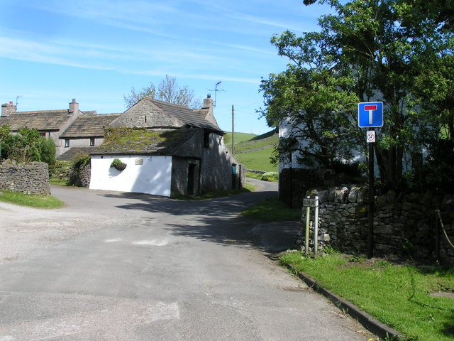
Snelslow Plantation is a picturesque woodland located in Derbyshire, England. Covering an area of approximately 200 acres, it is renowned for its natural beauty and diverse ecosystem. The plantation is situated in the heart of the county, near the town of Wood, and is easily accessible to visitors.

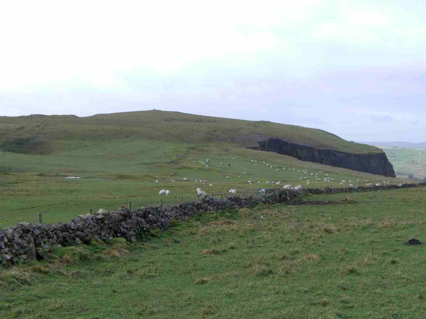
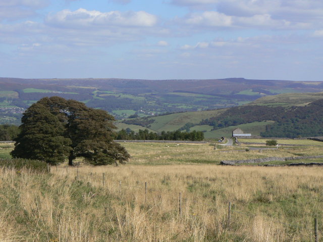
The woodland is predominantly made up of various species of trees, including oak, beech, and birch. These majestic trees create a dense canopy, providing a tranquil and shaded environment for both wildlife and visitors alike. The undergrowth is filled with an array of wildflowers, ferns, and mosses, adding to the enchanting atmosphere of the woodland.

Snelslow Plantation is home to a wide range of fauna, making it a popular spot for nature enthusiasts and wildlife photographers. The woodland is teeming with birdlife, including woodpeckers, owls, and songbirds. In addition, small mammals such as squirrels, rabbits, and hedgehogs can often be spotted scurrying through the underbrush.

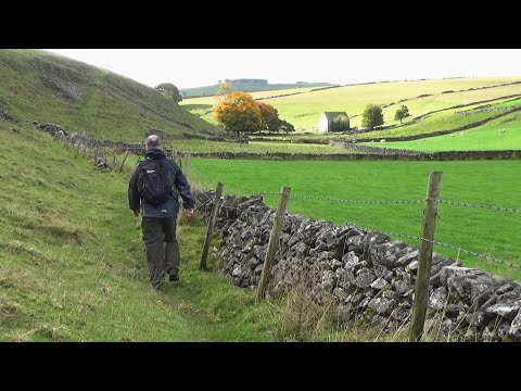
Walking trails have been established throughout the plantation, allowing visitors to explore the woodland at their leisure. These trails offer stunning views of the surrounding landscape, including rolling hills and meandering streams. The plantation is also equipped with picnic areas, making it an ideal location for a family day out or a peaceful retreat.

Snelslow Plantation truly captures the essence of Derbyshire's natural beauty. With its diverse flora and fauna, peaceful ambiance, and well-maintained trails, it is a must-visit destination for nature lovers and those seeking a tranquil escape in the heart of the English countryside.

If you have any feedback on the listing, please let us know in the comments section below.

Snelslow Plantation Images

Images are sourced within 2km of 53.311345/-1.8237297 or Grid Reference SK1179. Thanks to Geograph Open Source API. All images are credited.

Peak Forest Church St Charles the King and Martyr in the village of Peak Forest
Peak Forest Church
St Charles the King and Martyr in the village of Peak Forest
The Cop House restoration within SK1279
The Cop
House restoration within SK1279
Batham Gate Roman road, near Peak Forest The line of the Roman road is vaguely visible in snow beyond the point where the modern road swings left. In the background the A623 can be seen snaking up the hill in the northwestern corner of square <a href="https://www.geograph.org.uk/gridref/SK1278">SK1278</a>.
Batham Gate Roman road, near Peak Forest
The line of the Roman road is vaguely visible in snow beyond the point where the modern road swings left. In the background the A623 can be seen snaking up the hill in the northwestern corner of square SK1278.
Wheston House on Batham Gate Wheston House stands at a sharp bend in the lane which criss-crosses Batham Gate - the course of the old Roman road which runs straight up from near Buxton. The electricity poles behind the house march in a straight line down the course of the old road.
Wheston House on Batham Gate
Wheston House stands at a sharp bend in the lane which criss-crosses Batham Gate - the course of the old Roman road which runs straight up from near Buxton. The electricity poles behind the house march in a straight line down the course of the old road.
Limestone Way Farm Farm below Dam Cliff just off the A623 near Peak Forest.
Limestone Way Farm
Farm below Dam Cliff just off the A623 near Peak Forest.
Pennine Bridleway Bridleway leading to Peak Forest, 2.25 miles distant. From Limestone way.
Pennine Bridleway
Bridleway leading to Peak Forest, 2.25 miles distant. From Limestone way.
Lower Bee Low From Chamber Farm; much of Bee Low to the west (<a href="https://www.geograph.org.uk/gridref/SK0979">SK0979</a>) has been quarried out of existence but Lower Bee Low remains intact.
Lower Bee Low
From Chamber Farm; much of Bee Low to the west (SK0979) has been quarried out of existence but Lower Bee Low remains intact.
Chamberknoll From the A623 (with Eldon Hill <a href="https://www.geograph.org.uk/gridref/SK115811">SK115811</a> behind).
Chamberknoll
From the A623 (with Eldon Hill SK115811 behind).
Chamber Farm From the footpath to Lower Bee Low.
Chamber Farm
From the footpath to Lower Bee Low.
Backlane Farm From below Lower Bee Low (try saying that quickly!). Part of upper Dam Dale is just visible behind the farm; the tree-capped hill to the right is Kemp's Hill.
Backlane Farm
From below Lower Bee Low (try saying that quickly!). Part of upper Dam Dale is just visible behind the farm; the tree-capped hill to the right is Kemp's Hill.
Kemp's Hill From the north-western end of the bridleway to the north.
Kemp's Hill
From the north-western end of the bridleway to the north.
Dam Dale Looking south down the dale from the footpath above Dam Dale Farm.
Dam Dale
Looking south down the dale from the footpath above Dam Dale Farm.
Lower Dam Dale From the northern edge of the square, below Loosehill Farm.
Lower Dam Dale
From the northern edge of the square, below Loosehill Farm.
Dogmanslack Farm From the footpath to the east.
Dogmanslack Farm
From the footpath to the east.
Old Dam Lane Looking west towards Peak Forest, with Snels Low to the left. I believe the flowers in the foreground are Sweet Cicely (Myrrhis odorata), which smells strongly of aniseed when crushed.
Old Dam Lane
Looking west towards Peak Forest, with Snels Low to the left. I believe the flowers in the foreground are Sweet Cicely (Myrrhis odorata), which smells strongly of aniseed when crushed.
Old Dam Lane Sweetknowle Farm left of the lane, the entrance to Greenhead Farm on the right.
Old Dam Lane
Sweetknowle Farm left of the lane, the entrance to Greenhead Farm on the right.
Damside Farm With (I believe) a former dam in the foreground. Rather confusingly, this is at the opposite end of the village to the area known as Old Dam - perhaps there were two and this (at the head of Dam Dale) was the "new" dam?
Damside Farm
With (I believe) a former dam in the foreground. Rather confusingly, this is at the opposite end of the village to the area known as Old Dam - perhaps there were two and this (at the head of Dam Dale) was the "new" dam?
Dam Dale Farm From the footpath that climbs the dale side to the southeast. A farm worker was using a tractor to unload plastic-wrapped bales from a trailer.
Dam Dale Farm
From the footpath that climbs the dale side to the southeast. A farm worker was using a tractor to unload plastic-wrapped bales from a trailer.
Show me another place!

Snelslow Plantation is located at Grid Ref: SK1179 (Lat: 53.311345, Lng: -1.8237297)

Administrative County: Derbyshire

District: High Peak

Police Authority: Derbyshire

What 3 Words

///kiosk.trials.parade. Near Dove Holes, Derbyshire

Related Wikis

Old Dam

Old Dam is a hamlet in Derbyshire, England. It is located 3 miles (4.8 km) south-west of Castleton on the edge of the village of Peak Forest. == References ==

Peak Forest

Peak Forest is a small village and civil parish on the main road the (A623) from Chapel-en-le-Frith to Chesterfield in Derbyshire. The population of the...

Eldon Hill

Eldon Hill is a hill in the Peak District National Park in the county of Derbyshire, England, 4 kilometres (2.5 mi) southwest of the village of Castleton...

Hay Dale

Hay Dale is a short dry valley near Buxton, Derbyshire, in the Peak District of England. It is part of a longer valley that runs for approximately 4 miles...

Peak District

The Peak District is an upland area in England, at the southern end of the Pennines. Mostly in Derbyshire, it extends into Cheshire, Greater Manchester...

Bradwell Moor

Bradwell Moor is a moorland hill above the village of Bradwell, Derbyshire in the Peak District. The summit is 471 metres (1,545 ft) above sea level.Batham...

Oxlow Cavern

Oxlow Cavern is a part-natural and part-mined cavern near Castleton in Derbyshire, England. It is situated on the south side of the road running from the...

Sparrowpit

Sparrowpit is a small village between Chapel-en-le-Frith and Peak Forest in the High Peak area of the Peak District, Derbyshire, England.The name is derived...

Related Videos

peak District walk Christmas day vlog 1, three shires head travel hikking

short video from our trip started in Flash village in peak District . Enjoy bit of snowing and had stunning view all the way to ...

The Walk - EP 22 - Peak Forest Tramway - Derbyshire

I walked the 1796 Peak Forest Tramway from Bugsworth Basin to Chapel Milton Viaducts, before searching for the second oldest ...

183: Dam Dale, Hay Dale and Peak Forest (Peak District 2022)

PEAK DISTRICT WALK FEATURING PEAK FOREST, DAM DALE, HAY DALE AND WHESTON "Dam Dale, Hay Dale and Peak ...

Nearby Amenities

Located within 500m of 53.311345,-1.8237297
Peak Forest
Is In: Derbyshire, England, UK
Place: village
Lat/Long: 53.310377/-1.8298231
Post Box
Ele: 311.3503418
Lat/Long: 53.3109996/-1.8303635
Post Box
Ele: 313.7535400
Lat/Long: 53.3141442/-1.8284265
Defibrillator
Access: yes
Booth: KX100
Check Date: 2023-03-09
Covered: booth
Defibrillator Location: in phonebox at junction of Church Lane and Hernstone Lane, Peak Forest
Disused Amenity: telephone
Ele: 311.3503418
Emergency: defibrillator
Indoor: no
Lat/Long: 53.3102663/-1.8307762
Ele: 318.3198242
Lat/Long: 53.3074422/-1.8240952
Barrier: stile
Ele: 318.0795898
Steps: 2
Stile: wall
Lat/Long: 53.3074654/-1.8241284
Barrier: stile
Ele: 317.8392334
Material: stone
Source: survey;bing;gps
Steps: 3
Stile: stepover
Lat/Long: 53.3075662/-1.8239495
Barrier: entrance
Ele: 312.3116455
Lat/Long: 53.3080931/-1.8225597
Barrier: stile
Ele: 330.3361816
Material: stone
Source: survey;bing;gps
Steps: 2
Stile: stepover
Lat/Long: 53.3099362/-1.8178273
Barrier: stile
Material: stone
Source: survey;bing;gps
Stile: stepover
Lat/Long: 53.3075944/-1.8272795
Barrier: stile
Material: stone
Source: survey;bing;gps
Stile: stepover
Lat/Long: 53.3080899/-1.8275135
Fixme: Footpath line seem to go through drive but there is not gate or stile to allow access to the field. Reported to Derbyshire Public Rights of was. Ref. FP95180. October 2015
Lat/Long: 53.3080796/-1.8257793
Barrier: entrance
Source: survey;gps
Lat/Long: 53.3090517/-1.8282593
Barrier: stile
Material: stone
Source: survey;gps
Stile: stepover
Lat/Long: 53.309934/-1.8177587
Barrier: stile
Material: stone
Source: survey;gps
Stile: stepover
Lat/Long: 53.3144686/-1.8234234
Barrier: stile
Material: stone
Source: survey;gps
Stile: stepover
Lat/Long: 53.3146949/-1.8199886
Barrier: stile
Material: stone
Source: survey;gps
Stile: stepover
Lat/Long: 53.3148933/-1.821457
Barrier: stile
Material: stone
Source: survey;gps
Stile: stepover
Lat/Long: 53.3149972/-1.8251078
Barrier: stile
Material: stone
Source: survey;gps
Stile: stepover
Lat/Long: 53.3151334/-1.8258123
Barrier: entrance
Source: survey;gps
Lat/Long: 53.3102728/-1.8181835
Barrier: stile
Material: stone
Source: survey;gps
Stile: stepover
Lat/Long: 53.3109408/-1.8190007
Fixme: needs survey as couldn't find stile. Had to use one at end of drive
Lat/Long: 53.3111942/-1.8187549
Barrier: stile
Material: stone
Source: survey;gps
Stile: stepover
Lat/Long: 53.314719/-1.8197848
Barrier: stile
Source: survey;gps
Lat/Long: 53.3083056/-1.8268001
Barrier: stile
Material: stone
Source: survey;gps
Stile: stepover
Lat/Long: 53.3109814/-1.8286589
Barrier: stile
Material: stone
Source: survey;gps
Stile: stepover
Lat/Long: 53.3117156/-1.8282765
Barrier: stile
Material: stone
Source: survey;gps
Stile: stepover
Lat/Long: 53.3125101/-1.8283462
Barrier: stile
Material: wood
Source: survey;gps
Stile: stepover
Lat/Long: 53.3132577/-1.8280857
Barrier: stile
Material: stone
Source: survey;gps
Stile: stepover
Lat/Long: 53.3135366/-1.8240145
Barrier: stile
Material: stone
Source: survey;gps
Stile: stepover
Lat/Long: 53.30904/-1.8298225
Barrier: entrance
Source: survey;gps
Lat/Long: 53.309399/-1.8297874
Traffic Signals
Source: DigitalGlobe-Standard
Lat/Long: 53.3103396/-1.8307927
Traffic Signals
Source: DigitalGlobe-Standard
Lat/Long: 53.310043/-1.8305737
Leisure: playground
Lat/Long: 53.3085604/-1.8296169
Bench
Source: survey;gps
Lat/Long: 53.3139178/-1.8277578
The data included in this document is from www.openstreetmap.org. The data is made available under ODbL.

Have you been to Snelslow Plantation?

Leave your review of Snelslow Plantation below (or comments, questions and feedback).