Combehillhead Rookery

Wood, Forest in Gloucestershire Cotswold

England

Combehillhead Rookery

Windrush Way Windrush Way heading past Downs Barn
Windrush Way Credit: Shaun Ferguson

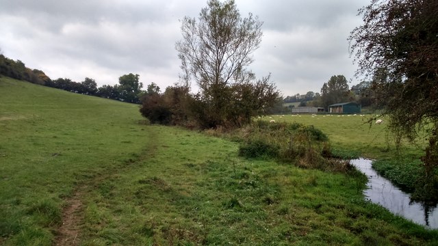
Combehillhead Rookery is a picturesque woodland located in Gloucestershire, England. Situated in the heart of the Forest of Dean, this enchanting area covers approximately 200 acres of diverse woodland habitat. The rookery is characterized by its lush greenery, towering trees, and tranquil atmosphere, making it a popular destination for nature enthusiasts and wildlife lovers.

The woodland is home to a wide variety of plant and animal species, creating a rich and vibrant ecosystem. Ancient oak trees dominate the area, some estimated to be over 500 years old, providing a haven for numerous bird species, including rooks, which give the rookery its name. The constant cawing of these black birds can be heard throughout the year.

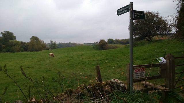
Combehillhead Rookery offers a network of walking trails, allowing visitors to explore the woods and discover its hidden treasures. As visitors wander through the forest, they may come across charming streams, wildflower meadows, and peaceful clearings. The rookery also boasts several viewpoints that offer breathtaking vistas of the surrounding countryside.

In addition to its natural beauty, Combehillhead Rookery holds historical significance. The woods have been managed sustainably for centuries, providing timber for local industries. Remnants of charcoal platforms and old sawpits can still be found, serving as a reminder of the area's past.

Overall, Combehillhead Rookery is a captivating woodland that offers a tranquil escape from the hustle and bustle of everyday life. Its diverse flora and fauna, coupled with its rich history, make it a must-visit destination for anyone seeking to reconnect with nature.

If you have any feedback on the listing, please let us know in the comments section below.

Combehillhead Rookery Images

Images are sourced within 2km of 51.889227/-1.832492 or Grid Reference SP1121. Thanks to Geograph Open Source API. All images are credited.

Windrush Way Windrush Way heading past Downs Barn
Windrush Way
Windrush Way heading past Downs Barn
Windrush Way Windrush Way by the river heading to Lower Harford
Windrush Way
Windrush Way by the river heading to Lower Harford
Windrush Way Windrush Way heading to Aston Farm
Windrush Way
Windrush Way heading to Aston Farm
Windrush Way Windrush Way heading along the valley to Aylworth
Windrush Way
Windrush Way heading along the valley to Aylworth
Windrush Way Windrush Way heading past Aylworth
Windrush Way
Windrush Way heading past Aylworth
Windrush Way Windrush Way heading to Downs Barn
Windrush Way
Windrush Way heading to Downs Barn
North end of the village green, Notgrove This small estate village houses holidaymakers and estate workers.
North end of the village green, Notgrove
This small estate village houses holidaymakers and estate workers.
Post-box in Notgrove A small estate village housing holidaymakers and estate workers.
Post-box in Notgrove
A small estate village housing holidaymakers and estate workers.
Spring flowers, Notgrove A small estate village housing holidaymakers and estate workers.
Spring flowers, Notgrove
A small estate village housing holidaymakers and estate workers.
Flying the flag at the village hall, Notgrove A small estate village housing holidaymakers and estate workers.
Flying the flag at the village hall, Notgrove
A small estate village housing holidaymakers and estate workers.
The Old Post Office, Notgrove At the southern exit from this small estate village, housing holidaymakers and estate workers.
The Old Post Office, Notgrove
At the southern exit from this small estate village, housing holidaymakers and estate workers.
Glamping pods, Notgrove Estate Installed 2016-17 at Village Farm. A profitable crop in the Cotswolds.
Glamping pods, Notgrove Estate
Installed 2016-17 at Village Farm. A profitable crop in the Cotswolds.
Tree is a field called Scholars London, Notgrove Estate In a sea of winter wheat.
Tree is a field called Scholars London, Notgrove Estate
In a sea of winter wheat.
Aylworth, Hill Farm
Aylworth, Hill Farm
Naunton, Church Farm
Aylworth: The road into the village
Old Milestone by the B4068, south of Naunton Stone post (plate lost) by the B4068, in parish of NAUNTON (COTSWOLD District), by stone wall, on South side of road. Stow iron plate, erected by the Foss & Cross (Stow on the Wold) turnpike trust in the 19th century. 

Inscription once read:- : (Cheltenham 13) / (Stow on the Wold 5) : 
Carved benchmark bottom right side.

Milestone Society National ID: GL_SWCM05.
Old Milestone by the B4068, south of Naunton
Stone post (plate lost) by the B4068, in parish of NAUNTON (COTSWOLD District), by stone wall, on South side of road. Stow iron plate, erected by the Foss & Cross (Stow on the Wold) turnpike trust in the 19th century. Inscription once read:- : (Cheltenham 13) / (Stow on the Wold 5) : Carved benchmark bottom right side. Milestone Society National ID: GL_SWCM05.
The Gloucestershire Way near Cold Aston The Gloucestershire Way follows this belt of trees to the village of Not grove.  I photographed a similar view in December 2005 <a href="https://www.geograph.org.uk/photo/92969">SP1220 : The Gloucestershire Way near Cold Aston</a>.
The Gloucestershire Way near Cold Aston
The Gloucestershire Way follows this belt of trees to the village of Not grove. I photographed a similar view in December 2005 SP1220 : The Gloucestershire Way near Cold Aston.
Show me another place!

Combehillhead Rookery is located at Grid Ref: SP1121 (Lat: 51.889227, Lng: -1.832492)

Administrative County: Gloucestershire

District: Cotswold

Police Authority: Gloucestershire

What 3 Words

///intelligible.fetching.same. Near Westfield, Gloucestershire

Nearby Locations

Combehillhead Rookery

Related Wikis

Naunton

Naunton is a village in Gloucestershire, England. It lies on the River Windrush in the Cotswolds, an area of outstanding natural beauty. Stow-on-the-Wold...

Aylworth

Aylworth is a village in Gloucestershire, England. == References == == External links == Media related to Aylworth at Wikimedia Commons Aylworth in the...

Notgrove

Notgrove is a village and civil parish in Gloucestershire, England, approximately 28.5 (17.8 miles) to the east of Gloucester. It lies in the Cotswolds...

Church of St Bartholomew, Notgrove

The Anglican Church of St Bartholomew at Notgrove in the Cotswold District of Gloucestershire, England was built in the 12th century. It is a grade I listed...

Nearby Amenities

Located within 500m of 51.889227,-1.832492
Bus Stop
Notgrove Crossroads
Bus: yes
Naptan AtcoCode: 1600GL3577
Naptan Bearing: E
Naptan CommonName: Notgrove Crossroads
Naptan NaptanCode: glogdjdm
Naptan Street: A436
Naptan Verified: no
Public Transport: platform
Source: naptan_import
Lat/Long: 51.8873566/-1.8366239
Bus Stop
Notgrove Crossroads
Bus: yes
Naptan AtcoCode: 1600GL3578
Naptan Bearing: W
Naptan CommonName: Notgrove Crossroads
Naptan NaptanCode: glogdjga
Naptan Street: A436
Naptan Verified: no
Public Transport: platform
Source: naptan_import
Lat/Long: 51.8872477/-1.8358687
Barrier: stile
Lat/Long: 51.8868045/-1.8282181
Power: pole
Lat/Long: 51.8900531/-1.8262263
Power: pole
Lat/Long: 51.890332/-1.827739
Power: pole
Lat/Long: 51.8905116/-1.8287274
Power: pole
Lat/Long: 51.8907633/-1.8301088
Power: pole
Lat/Long: 51.8910281/-1.8315384
Power: pole
Lat/Long: 51.893238/-1.8310019
Power: pole
Lat/Long: 51.8925684/-1.8316242
Power: pole
Lat/Long: 51.8919344/-1.832217
Power: pole
Lat/Long: 51.8912996/-1.8329586
Power: pole
Lat/Long: 51.8915545/-1.834403
Coombehill Head
Power: pole
Transformer: distribution
Voltage Primary: 11000
Lat/Long: 51.8918177/-1.8358366
Power: pole
Lat/Long: 51.8916894/-1.8365152
Power: pole
Lat/Long: 51.8914502/-1.8378174
The data included in this document is from www.openstreetmap.org. The data is made available under ODbL.

Have you been to Combehillhead Rookery?

Leave your review of Combehillhead Rookery below (or comments, questions and feedback).