Devonport Wood

Wood, Forest in Gloucestershire Cotswold

England

Devonport Wood

Half Way House, Kineton The red phone box is in particularly good condition including all the lighting.
Half Way House, Kineton Credit: David Howard

Devonport Wood is a picturesque woodland located in Gloucestershire, England. Spread across a vast expanse, it is nestled within the scenic countryside and is renowned for its natural beauty and diverse flora and fauna. The wood is a part of the larger Forest of Dean, which is recognized as one of the most ancient forests in the country.

Devonport Wood is characterized by its dense canopy of towering trees, predominantly oak and beech, that provide a lush green cover throughout the year. The forest floor is adorned with a rich carpet of wildflowers, ferns, and mosses, adding to its enchanting appeal. The wood is also home to a wide variety of wildlife, including deer, foxes, badgers, and numerous bird species, making it a haven for nature enthusiasts and birdwatchers.

The wood is crisscrossed by several well-maintained walking trails, inviting visitors to explore its serene surroundings. These paths wind through the wood, offering glimpses of hidden streams, babbling brooks, and small ponds. The peaceful ambiance of the wood, coupled with its natural beauty, makes it a popular destination for hikers, joggers, and families seeking a tranquil retreat.

Devonport Wood is also known for its historical significance. It has remnants of ancient settlements and evidence of human activity dating back to prehistoric times. Archaeological excavations have unearthed artifacts such as pottery, tools, and burial mounds, providing a fascinating insight into the area's past.

Overall, Devonport Wood in Gloucestershire offers a harmonious blend of natural splendor, wildlife diversity, and historical intrigue, making it a captivating destination for those seeking a connection with nature and a glimpse into the region's rich heritage.

If you have any feedback on the listing, please let us know in the comments section below.

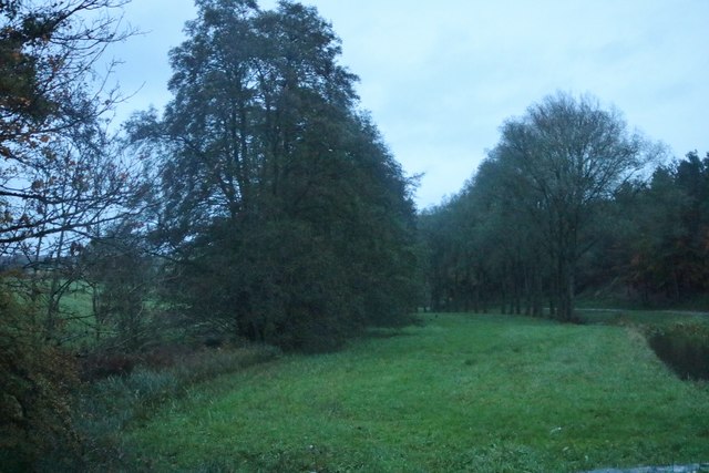
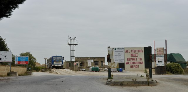
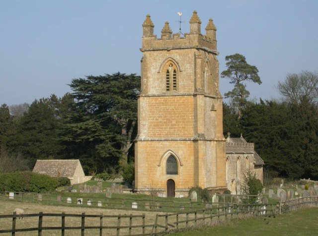
Devonport Wood Images

Images are sourced within 2km of 51.942174/-1.8387397 or Grid Reference SP1127. Thanks to Geograph Open Source API. All images are credited.

Half Way House, Kineton The red phone box is in particularly good condition including all the lighting.
Half Way House, Kineton
The red phone box is in particularly good condition including all the lighting.
Field entrance in Temple Guiting
Unsuitable for Motors Unsuitable for Motors the track from Critchford Lane heading to Sheephouse Barn
Unsuitable for Motors
Unsuitable for Motors the track from Critchford Lane heading to Sheephouse Barn
Half Way House, Keneton
Old Milestone by the B4077, Swell parish Stone post (plate lost) by the B4077, in parish of Swell (Cotswold District), roadside, by the road, on South side of road. Stow iron plate, erected by the Stow to Stump Cross turnpike trust in the 19th century. 

Inscription once read:-
(Tewkesbury)
(15)
(Stow on the Wold)
(5) 

Milestone Society National ID: GL_TWSW15
Old Milestone by the B4077, Swell parish
Stone post (plate lost) by the B4077, in parish of Swell (Cotswold District), roadside, by the road, on South side of road. Stow iron plate, erected by the Stow to Stump Cross turnpike trust in the 19th century. Inscription once read:- (Tewkesbury) (15) (Stow on the Wold) (5) Milestone Society National ID: GL_TWSW15
Houses in Barton
Houses in Barton
Avenue of trees by the River Windrush
Poppy flowers Poppy flowers in a crop of oilseed rape beyond the bright yellow flowers with the seed pods setting.
Poppy flowers
Poppy flowers in a crop of oilseed rape beyond the bright yellow flowers with the seed pods setting.
Poppy flowers Poppy flowers in a crop of oilseed rape beyond the bright yellow flowers with the seed pods setting.
Poppy flowers
Poppy flowers in a crop of oilseed rape beyond the bright yellow flowers with the seed pods setting.
Temple Guiting church
The Half Way House, Kineton The Half Way House pub in the Cotswold village of Kineton.
The Half Way House, Kineton
The Half Way House pub in the Cotswold village of Kineton.
River Windrush ford With a pedestrian bridge provided. The road takes a right-angled bend through the ford.
River Windrush ford
With a pedestrian bridge provided. The road takes a right-angled bend through the ford.
Ford in Kineton over the river Windrush in Spring View looks north-westwards from the spot where the road emerges from the ford on the east bank. The river Windrush can clearly be seen emerging on the right flowing downstream to the left. A car awaits to cross the ford on the far bank.
Ford in Kineton over the river Windrush in Spring
View looks north-westwards from the spot where the road emerges from the ford on the east bank. The river Windrush can clearly be seen emerging on the right flowing downstream to the left. A car awaits to cross the ford on the far bank.
Cottage at Kineton A Cotswold cottage in the village of Kineton. This cottage even has a victorian post box and the parish notice board mounted on the northern wall.
Cottage at Kineton
A Cotswold cottage in the village of Kineton. This cottage even has a victorian post box and the parish notice board mounted on the northern wall.
Road junction in Kineton The minor road at this road junction is from Roel Gate.
Road junction in Kineton
The minor road at this road junction is from Roel Gate.
Roadside building in Kineton A single storey building on the roadside in the village of Kineton.
Roadside building in Kineton
A single storey building on the roadside in the village of Kineton.
The Half Way House, Kineton
Clapper Bridge and ford, Kineton This old clapper bridge crosses the River Windrush, one of a number of Thames tributaries, below the village of Kineton.  Along side the bridge is a ford, one of two in the village, the ford appears deep and the bottom is quite rough and I would not recommend traversing it in a car.
Clapper Bridge and ford, Kineton
This old clapper bridge crosses the River Windrush, one of a number of Thames tributaries, below the village of Kineton. Along side the bridge is a ford, one of two in the village, the ford appears deep and the bottom is quite rough and I would not recommend traversing it in a car.
Show me another place!

Devonport Wood is located at Grid Ref: SP1127 (Lat: 51.942174, Lng: -1.8387397)

Administrative County: Gloucestershire

District: Cotswold

Police Authority: Gloucestershire

What 3 Words

///quench.front.reflector. Near Westfield, Gloucestershire

Nearby Locations

Devonport Wood

Related Wikis

Lark Wood

Lark Wood (grid reference SP104262) is a 1.11-hectare (2.7-acre) biological Site of Special Scientific Interest in Gloucestershire, notified in 1974. The...

Barton Bushes

Barton Bushes (grid reference SP110259) is a 5.7-hectare (14-acre) biological Site of Special Scientific Interest in Gloucestershire, notified in 1996...

Huntsman's Quarry

Huntsman's Quarry (grid reference SP125259) is a 1.6-hectare (4.0-acre) geological Site of Special Scientific Interest in Gloucestershire, notified in...

Temple Guiting

Temple Guiting is a village and civil parish in the Cotswolds, in Gloucestershire, England. The civil parish includes the smaller settlements of Barton...

Nearby Amenities

Located within 500m of 51.942174,-1.8387397
Ele: 265
Lat/Long: 51.9387373/-1.8432872
Bembro
Landuse: residential
Source: OS 1:25k
Lat/Long: 51.9415305/-1.8439775
Cotswold Farm Park
Addr City: Cheltenham
Addr Housename: Cotswold Farm
Addr Housenumber: Guilting Power
Addr Postcode: GL54 5UG
Operator: Cotswold Farm Park Ltd
Tourism: attraction
Website: https://www.cotswoldfarmpark.co.uk/
Lat/Long: 51.9383684/-1.8370845
Cafe
Cotswold Farm Park Cafe
Opening Hours: 10:00-17:00
Website: https://www.cotswoldfarmpark.co.uk/
Lat/Long: 51.938385/-1.8370236
Cotswold Farm Park
Power: pole
Transformer: distribution
Voltage Primary: 11000
Lat/Long: 51.9380089/-1.837513
Bembro Farm
Power: pole
Transformer: distribution
Voltage Primary: 11000
Lat/Long: 51.9416731/-1.8447697
Power: pole
Lat/Long: 51.9409853/-1.8456247
The data included in this document is from www.openstreetmap.org. The data is made available under ODbL.

Have you been to Devonport Wood?

Leave your review of Devonport Wood below (or comments, questions and feedback).