Garnes Barn Covert
Wood, Forest in Gloucestershire Cotswold
England
Garnes Barn Covert
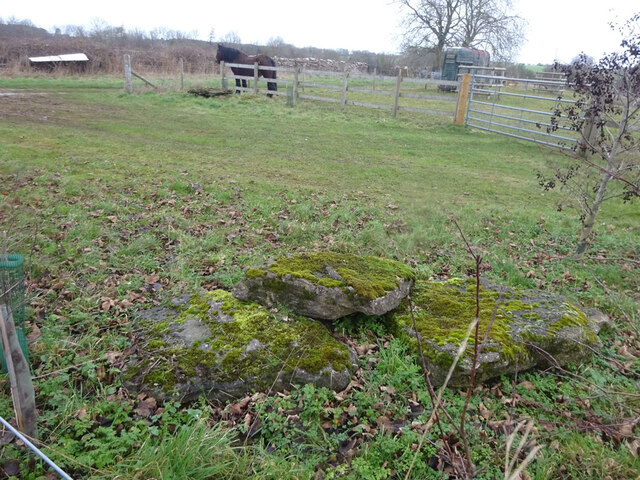
Garnes Barn Covert is a picturesque woodland located in the county of Gloucestershire, England. Situated within the larger Forest of Dean, this woodland is renowned for its natural beauty and tranquil atmosphere.
Covering an area of approximately 50 acres, Garnes Barn Covert is predominantly made up of native broadleaf trees such as oak, beech, and birch. The woodland is characterized by its dense canopy, which provides shelter and habitat for a wide variety of flora and fauna. Bluebells, primroses, and wild garlic carpet the forest floor during the spring months, adding a burst of color to the landscape.
The woodland is crisscrossed by a network of well-maintained footpaths, allowing visitors to explore its enchanting beauty at their own pace. These paths wind through the woods, taking visitors past ancient trees, babbling brooks, and moss-covered rocks. The peaceful ambiance of Garnes Barn Covert makes it a popular spot for nature walks, birdwatching, and photography.
The woodland also boasts a diverse wildlife population. Visitors may spot various bird species, including woodpeckers, nuthatches, and tawny owls. Additionally, Garnes Barn Covert is home to mammals such as foxes, badgers, and deer, which can occasionally be seen grazing or foraging in the undergrowth.
Garnes Barn Covert is a tranquil haven for nature enthusiasts and offers a unique opportunity to immerse oneself in the beauty of Gloucestershire's woodlands. Its natural charm, diverse wildlife, and well-kept footpaths make it a must-visit destination for anyone seeking solace in the great outdoors.
If you have any feedback on the listing, please let us know in the comments section below.
Garnes Barn Covert Images
Images are sourced within 2km of 51.7811/-1.8436477 or Grid Reference SP1009. Thanks to Geograph Open Source API. All images are credited.
![A circular walk around Bibury and Ablington [7] A stile and then a gate take the footpath to the crossing of the track.
The walk starts at Arlington Corner and follows a footpath to Ablington, where the River Coln is crossed, and then a byway northeast to Saltway Barn. Another byway, the historic Salt Way, is then followed southeast before a right turn onto a bridleway which runs south past Hale Barn to Bibury. The River Coln is recrossed at Bibury Mill and a footpath is then followed back to the starting point. Just over 5 miles.](https://s0.geograph.org.uk/geophotos/07/48/93/7489312_663e720a.jpg)
![A circular walk around Bibury and Ablington [8] The footpath cross this track, seen here looking northeast.
The walk starts at Arlington Corner and follows a footpath to Ablington, where the River Coln is crossed, and then a byway northeast to Saltway Barn. Another byway, the historic Salt Way, is then followed southeast before a right turn onto a bridleway which runs south past Hale Barn to Bibury. The River Coln is recrossed at Bibury Mill and a footpath is then followed back to the starting point. Just over 5 miles.](https://s2.geograph.org.uk/geophotos/07/48/93/7489314_97bec6f5.jpg)
![A circular walk around Bibury and Ablington [10] Difficult to see from ground level, this is Rawbarrow or Ablington Camp, a slight univallate hillfort situated on the summit of a ridge which also forms the southern valley side of the River Coln. A roughly oval enclosure of approximately 11 acres (4.4ha) the earthworks are best preserved on the eastern side as a bank of up to 30 feet (9 metres) wide and 6 feet (1.7 metres) high. A Scheduled Ancient Monument with details at: <span class="nowrap"><a title="https://historicengland.org.uk/listing/the-list/list-entry/1003356" rel="nofollow ugc noopener" href="https://historicengland.org.uk/listing/the-list/list-entry/1003356">Link</a><img style="margin-left:2px;" alt="External link" title="External link - shift click to open in new window" src="https://s1.geograph.org.uk/img/external.png" width="10" height="10"/></span>](https://s0.geograph.org.uk/geophotos/07/48/93/7489316_90b88654.jpg)
![A circular walk around Bibury and Ablington [11] Difficult to see from ground level, this is Rawbarrow or Ablington Camp, a slight univallate hillfort situated on the summit of a ridge which also forms the southern valley side of the River Coln. A roughly oval enclosure of approximately 11 acres (4.4ha) the earthworks are best preserved on the eastern side as a bank of up to 30 feet (9 metres) wide and 6 feet (1.7 metres) high. A Scheduled Ancient Monument with details at: <span class="nowrap"><a title="https://historicengland.org.uk/listing/the-list/list-entry/1003356" rel="nofollow ugc noopener" href="https://historicengland.org.uk/listing/the-list/list-entry/1003356">Link</a><img style="margin-left:2px;" alt="External link" title="External link - shift click to open in new window" src="https://s1.geograph.org.uk/img/external.png" width="10" height="10"/></span>](https://s1.geograph.org.uk/geophotos/07/48/93/7489317_3149e33e.jpg)
![A circular walk around Bibury and Ablington [12] The footpath from Arlington Corner meet the minor road at Ablington.
The walk starts at Arlington Corner and follows a footpath to Ablington, where the River Coln is crossed, and then a byway northeast to Saltway Barn. Another byway, the historic Salt Way, is then followed southeast before a right turn onto a bridleway which runs south past Hale Barn to Bibury. The River Coln is recrossed at Bibury Mill and a footpath is then followed back to the starting point. Just over 5 miles.](https://s2.geograph.org.uk/geophotos/07/48/93/7489318_31443d2d.jpg)
![A circular walk around Bibury and Ablington [13] After passing through Ablington Village, the walk now follows a restricted byway which leads northeast to Saltway Barn.
The walk starts at Arlington Corner and follows a footpath to Ablington, where the River Coln is crossed, and then a byway northeast to Saltway Barn. Another byway, the historic Salt Way, is then followed southeast before a right turn onto a bridleway which runs south past Hale Barn to Bibury. The River Coln is recrossed at Bibury Mill and a footpath is then followed back to the starting point. Just over 5 miles.](https://s2.geograph.org.uk/geophotos/07/48/93/7489326_08bc7578.jpg)
![A circular walk around Bibury and Ablington [14] The track, a restricted byway, runs along the field edge on its way to Saltway Barn.
The walk starts at Arlington Corner and follows a footpath to Ablington, where the River Coln is crossed, and then a byway northeast to Saltway Barn. Another byway, the historic Salt Way, is then followed southeast before a right turn onto a bridleway which runs south past Hale Barn to Bibury. The River Coln is recrossed at Bibury Mill and a footpath is then followed back to the starting point. Just over 5 miles.](https://s0.geograph.org.uk/geophotos/07/48/93/7489328_a152267d.jpg)
![A circular walk around Bibury and Ablington [15] The track continues northeast towards Saltway Barn. Gore Hill Covert is seen in the distance.
The walk starts at Arlington Corner and follows a footpath to Ablington, where the River Coln is crossed, and then a byway northeast to Saltway Barn. Another byway, the historic Salt Way, is then followed southeast before a right turn onto a bridleway which runs south past Hale Barn to Bibury. The River Coln is recrossed at Bibury Mill and a footpath is then followed back to the starting point. Just over 5 miles.](https://s1.geograph.org.uk/geophotos/07/48/93/7489329_d99739a6.jpg)
![A circular walk around Bibury and Ablington [16] Gore Hill Covert is seen alongside the track.
The walk starts at Arlington Corner and follows a footpath to Ablington, where the River Coln is crossed, and then a byway northeast to Saltway Barn. Another byway, the historic Salt Way, is then followed southeast before a right turn onto a bridleway which runs south past Hale Barn to Bibury. The River Coln is recrossed at Bibury Mill and a footpath is then followed back to the starting point. Just over 5 miles.](https://s3.geograph.org.uk/geophotos/07/49/06/7490635_0dfffd14.jpg)
![A circular walk around Bibury and Ablington [17] The track continues towards the northeast.
The walk starts at Arlington Corner and follows a footpath to Ablington, where the River Coln is crossed, and then a byway northeast to Saltway Barn. Another byway, the historic Salt Way, is then followed southeast before a right turn onto a bridleway which runs south past Hale Barn to Bibury. The River Coln is recrossed at Bibury Mill and a footpath is then followed back to the starting point. Just over 5 miles.](https://s1.geograph.org.uk/geophotos/07/49/06/7490641_f19a61aa.jpg)
![A circular walk around Bibury and Ablington [18] A view from the track along a muddy field edge, looking southeast towards Bibury.
The walk starts at Arlington Corner and follows a footpath to Ablington, where the River Coln is crossed, and then a byway northeast to Saltway Barn. Another byway, the historic Salt Way, is then followed southeast before a right turn onto a bridleway which runs south past Hale Barn to Bibury. The River Coln is recrossed at Bibury Mill and a footpath is then followed back to the starting point. Just over 5 miles.](https://s2.geograph.org.uk/geophotos/07/49/06/7490650_3c4d45f2.jpg)
![A circular walk around Bibury and Ablington [19] The track runs dead straight towards Saltway Barn. The track is slightly off the line of the Right of Way, a restricted byway.
The walk starts at Arlington Corner and follows a footpath to Ablington, where the River Coln is crossed, and then a byway northeast to Saltway Barn. Another byway, the historic Salt Way, is then followed southeast before a right turn onto a bridleway which runs south past Hale Barn to Bibury. The River Coln is recrossed at Bibury Mill and a footpath is then followed back to the starting point. Just over 5 miles.](https://s3.geograph.org.uk/geophotos/07/49/06/7490655_7bc615c8.jpg)
![A circular walk around Bibury and Ablington [20] A view across the fields to the curiously named The Hanger Piece, the home of an engineering company. Some of the buildings remain from RAF Bibury. RAF Bibury was built in 1939 for use as a relief landing ground. In the Battle of Britain the airfield had very few buildings and a grass runway and was used to base detachments of fighter aircraft. The site was not used for flying after 1944 and was home to a maintenance unit until it closed in 1945.
The walk starts at Arlington Corner and follows a footpath to Ablington, where the River Coln is crossed, and then a byway northeast to Saltway Barn. Another byway, the historic Salt Way, is then followed southeast before a right turn onto a bridleway which runs south past Hale Barn to Bibury. The River Coln is recrossed at Bibury Mill and a footpath is then followed back to the starting point. Just over 5 miles.](https://s2.geograph.org.uk/geophotos/07/49/06/7490662_ca4bff5e.jpg)
![A circular walk around Bibury and Ablington [21] A view from the track along a muddy field edge, looking southeast towards Bibury.
The walk starts at Arlington Corner and follows a footpath to Ablington, where the River Coln is crossed, and then a byway northeast to Saltway Barn. Another byway, the historic Salt Way, is then followed southeast before a right turn onto a bridleway which runs south past Hale Barn to Bibury. The River Coln is recrossed at Bibury Mill and a footpath is then followed back to the starting point. Just over 5 miles.](https://s2.geograph.org.uk/geophotos/07/49/06/7490666_d7882ae7.jpg)
![A circular walk around Bibury and Ablington [22] Still slightly off the line of the Right of Way, the track continues towards Saltway Barn. This area is part of the former RAF Bibury. RAF Bibury was built in 1939 for use as a relief landing ground. In the Battle of Britain the airfield had very few buildings and a grass runway and was used to base detachments of fighter aircraft. The site was not used for flying after 1944 and was home to a maintenance unit until it closed in 1945.
The walk starts at Arlington Corner and follows a footpath to Ablington, where the River Coln is crossed, and then a byway northeast to Saltway Barn. Another byway, the historic Salt Way, is then followed southeast before a right turn onto a bridleway which runs south past Hale Barn to Bibury. The River Coln is recrossed at Bibury Mill and a footpath is then followed back to the starting point. Just over 5 miles.](https://s0.geograph.org.uk/geophotos/07/49/06/7490668_00fa3e1e.jpg)
![A circular walk around Bibury and Ablington [23] Still slightly off the line of the Right of Way, the track continues towards Saltway Barn, the roof of which can be seen in the distance. This area is part of the former RAF Bibury which was built in 1939 for use as a relief landing ground. In the Battle of Britain the airfield had very few buildings and a grass runway and was used to base detachments of fighter aircraft. The site was not used for flying after 1944 and was home to a maintenance unit until it closed in 1945.
The walk starts at Arlington Corner and follows a footpath to Ablington, where the River Coln is crossed, and then a byway northeast to Saltway Barn. Another byway, the historic Salt Way, is then followed southeast before a right turn onto a bridleway which runs south past Hale Barn to Bibury. The River Coln is recrossed at Bibury Mill and a footpath is then followed back to the starting point. Just over 5 miles.](https://s1.geograph.org.uk/geophotos/07/49/06/7490669_fb7c6b89.jpg)
![A circular walk around Bibury and Ablington [24] Near Saltway Barn is this area of pavement, part of the hard standing of the former RAF Bibury which was built in 1939 for use as a relief landing ground. In the Battle of Britain the airfield had very few buildings and a grass runway and was used to base detachments of fighter aircraft. The site was not used for flying after 1944 and was home to a maintenance unit until it closed in 1945.
The walk starts at Arlington Corner and follows a footpath to Ablington, where the River Coln is crossed, and then a byway northeast to Saltway Barn. Another byway, the historic Salt Way, is then followed southeast before a right turn onto a bridleway which runs south past Hale Barn to Bibury. The River Coln is recrossed at Bibury Mill and a footpath is then followed back to the starting point. Just over 5 miles.](https://s2.geograph.org.uk/geophotos/07/49/06/7490670_fe2ff8d6.jpg)
Garnes Barn Covert is located at Grid Ref: SP1009 (Lat: 51.7811, Lng: -1.8436477)
Administrative County: Gloucestershire
District: Cotswold
Police Authority: Gloucestershire
What 3 Words
///introduce.extensive.pack. Near Northleach, Gloucestershire
Nearby Locations
Related Wikis

RAF Bibury
Royal Air Force Bibury or more simply RAF Bibury is a former Royal Air Force satellite station located north east of Cirencester, Gloucestershire, England...

Ablington Manor
Ablington Manor is a Grade I listed country house in Potlicker's Lane, Ablington within the parish of Bibury, Gloucestershire, England. The estate was...

Ablington, Gloucestershire
Ablington is a village in the county of Gloucestershire, England. It is located in the Coln Valley and is part of the Bibury civil parish, 6 miles (9...

Winson, Gloucestershire
Winson is a village in the Cotswold district of the English county of Gloucestershire. == Location == Winson lies next to the River Coln, north west of...

Winson Meadows
Winson Meadows (grid reference SP093081) is a 7.93-hectare (19.6-acre) biological Site of Special Scientific Interest in Gloucestershire, notified in 1974...

Calcot, Gloucestershire
Calcot is a settlement in the English county of Gloucestershire. Calcot forms part of the civil parish of Coln St Dennis, within the Cotswold local government...
Church of St Andrew, Coln Rogers
The Anglican Church of St Andrew at Coln Rogers in the Cotswold District of Gloucestershire, England was built in the 11th century. It is a grade I listed...

Coln St. Dennis
Coln St. Dennis is a village and civil parish on the River Coln in Gloucestershire about 3 miles (4.8 km) southwest of Northleach and about 7 miles (11...
Nearby Amenities
Located within 500m of 51.7811,-1.8436477Have you been to Garnes Barn Covert?
Leave your review of Garnes Barn Covert below (or comments, questions and feedback).