Barebottom Plantation

Wood, Forest in Northumberland

England

Barebottom Plantation

Rural art
Rural art Credit: Leanmeanmo

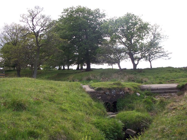
Barebottom Plantation is a picturesque woodland located in the heart of Northumberland, England. Stretching over a vast area of lush greenery, it is a haven for nature enthusiasts and a popular destination for outdoor activities. The plantation is renowned for its dense forest cover, comprising a variety of trees, including oak, beech, and birch, which create a vibrant tapestry of colors throughout the seasons.

The plantation offers a plethora of recreational opportunities for visitors. Hiking trails wind their way through the woodland, allowing exploration of its diverse flora and fauna. The tranquil atmosphere provides a perfect setting for birdwatching, with a multitude of species calling the plantation home. Nature lovers can also spot deer, foxes, rabbits, and other small mammals that thrive in the area.

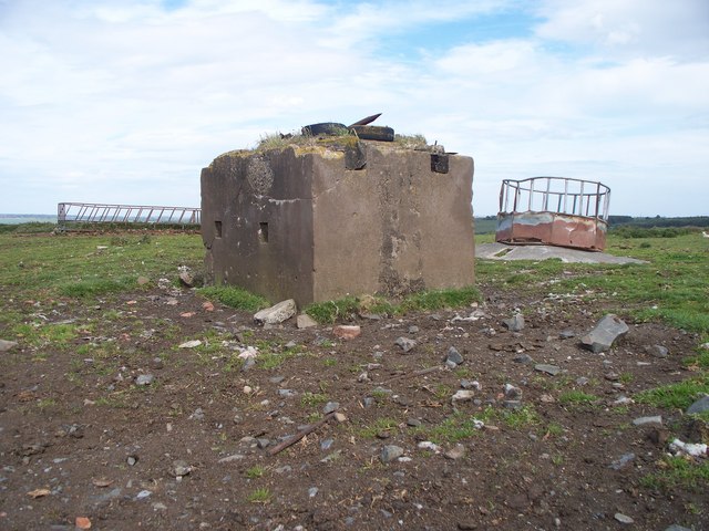
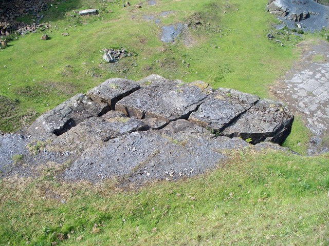
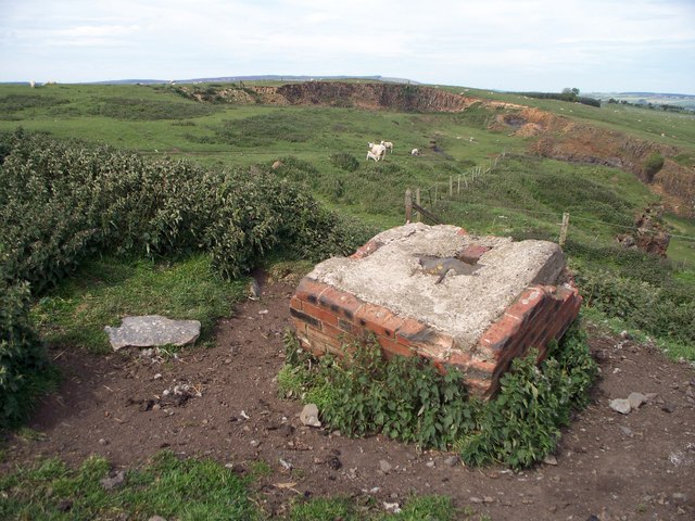
Barebottom Plantation is not only a natural paradise but also steeped in history. It was once a site of timber production during the 19th century, contributing to the region's economic development. Today, remnants of the old sawmill and logging operations can still be seen, adding an intriguing historical dimension to the plantation.

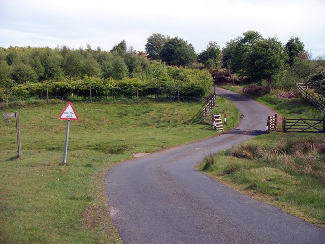
The plantation is well-maintained, with clearly marked trails and informative signposts to guide visitors. It offers picnic areas and benches, inviting individuals and families to relax and enjoy the serene ambiance. Additionally, the woodland is easily accessible, with ample parking facilities and nearby amenities.

Barebottom Plantation is a sanctuary of tranquility and natural beauty, providing a welcome escape from the bustle of everyday life. Whether one seeks a peaceful stroll, an immersive wildlife experience, or a glimpse into the region's past, this woodland gem in Northumberland offers a perfect retreat.

If you have any feedback on the listing, please let us know in the comments section below.

Barebottom Plantation Images

Images are sourced within 2km of 55.260917/-1.8487784 or Grid Reference NZ0996. Thanks to Geograph Open Source API. All images are credited.

Rural art
Rural art
Junction of country lanes The Whinstone gravel patch to the right of picture is where the contractors gain access to a proposed windfarm development.
Junction of country lanes
The Whinstone gravel patch to the right of picture is where the contractors gain access to a proposed windfarm development.
South west to Coat Yards
Where the stream runs A tributary of The Maglin burn runs under the road. The additions at either side of the culvert prevent water lying on the road during wet weather by providing a run off into the burn.
Where the stream runs
A tributary of The Maglin burn runs under the road. The additions at either side of the culvert prevent water lying on the road during wet weather by providing a run off into the burn.
Unfenced road crosses cattle grid Looking south towards Wingates. The footpath sign points the route to Wingates across country
Unfenced road crosses cattle grid
Looking south towards Wingates. The footpath sign points the route to Wingates across country
Industrial relic On Wards Hill, which was once a hive of industrial activity, but now is home to well bred sheep and cattle. Cattle feeders are seen standing behind the concrete block. The block has steel rope running through it. The round cattle feeder stands on a concrete base that once served a far different purpose.
Industrial relic
On Wards Hill, which was once a hive of industrial activity, but now is home to well bred sheep and cattle. Cattle feeders are seen standing behind the concrete block. The block has steel rope running through it. The round cattle feeder stands on a concrete base that once served a far different purpose.
Broken but still up Evidence can be seen on this rock outcrop that an attempt was made to break it from the upper level of the Quarry. The rock won the fight.
Broken but still up
Evidence can be seen on this rock outcrop that an attempt was made to break it from the upper level of the Quarry. The rock won the fight.
Remains of an industrial past It is remarkable how nature has taken over, with a little help from man.

Just peeking over the top of the quarry edge can be seen the range of Simonside hills.
Remains of an industrial past
It is remarkable how nature has taken over, with a little help from man. Just peeking over the top of the quarry edge can be seen the range of Simonside hills.
Trees beside the road, near Gusset The Lee can be seen in the distance.
Trees beside the road, near Gusset
The Lee can be seen in the distance.
New broad-leaf plantation  Wingates Wind Farm beyond.
New broad-leaf plantation
Wingates Wind Farm beyond.
Pasture near The Chirm
Ford at Low Hesleyhurst This ford on the Maglin Burn is found at Low Hesleyhurst.
Ford at Low Hesleyhurst
This ford on the Maglin Burn is found at Low Hesleyhurst.
Ford at Windylaw Woods This cattle ford is found beside Windylaw Woods.
Ford at Windylaw Woods
This cattle ford is found beside Windylaw Woods.
Ford on Rothbury to Longhorsley back road The second of three fords on the Rothbury to Longhorsley back road.
Ford on Rothbury to Longhorsley back road
The second of three fords on the Rothbury to Longhorsley back road.
Disused quarry Near Wardshill Cottage.
Wingates wind farm on the horizon.
Disused quarry
Near Wardshill Cottage. Wingates wind farm on the horizon.
Wardshill Cottage Wards Hill Colliery was hereabouts producing household and steam coal into the 1970s with four men underground and three on the surface.
Wardshill Cottage
Wards Hill Colliery was hereabouts producing household and steam coal into the 1970s with four men underground and three on the surface.
Derelict lime kiln With local limestone quarries and coal mines producing the raw materials this is an obvious place for lime kilns.
Derelict lime kiln
With local limestone quarries and coal mines producing the raw materials this is an obvious place for lime kilns.
Embleton Terrace In a remote rural setting a terrace of cottages is a surprising find.
With several quarries, coal mines and lime kilns they were probably built for the workers in these industries.
Embleton Terrace
In a remote rural setting a terrace of cottages is a surprising find. With several quarries, coal mines and lime kilns they were probably built for the workers in these industries.
Show me another place!

Barebottom Plantation is located at Grid Ref: NZ0996 (Lat: 55.260917, Lng: -1.8487784)

Unitary Authority: Northumberland

Police Authority: Northumbria

What 3 Words

///nametag.dressy.tiredness. Near Longhorsley, Northumberland

Related Wikis

Hesleyhurst

Hesleyhurst is a civil parish in the county of Northumberland in England. At the 2011 Census the population was only minimal. It is served by a joint parish...

Brinkburn Mill

Brinkburn Mill is a water mill located near Rothbury, in Northumberland. It once formed part of the precincts of Brinkburn Priory and was constructed in...

Brinkburn Priory

Brinkburn Priory is a former monastery built, starting in the 12th century, on a bend of the River Coquet, about 4 miles (6 km) east of Rothbury, Northumberland...

Brinkburn

Brinkburn is a civil parish in Northumberland, England. It is divided by the River Coquet. The parish includes the hamlet of Pauperhaugh. == History... ==

Brinkburn railway station

Brinkburn was a weatherboard- and corrugated-iron-built railway station in Northumberland on the Rothbury Branch built to serve the Healy Coate Colliery...

Nunnykirk

Nunnykirk is a settlement and civil parish in the county of Northumberland, England. Nunnykirk is the location of Nunnykirk Hall, a former nunnery country...

Nunnykirk Hall

Nunnykirk Hall is a 19th-century country house and Grade I listed building in the civil parish of Nunnykirk, near the village of Netherwitton in the English...

Cragend Silo

Cragend Silo is a Grade II* listed building located at Cragend Farm near the town of Rothbury in Northumberland, England. It was designed and built by...

Nearby Amenities

Located within 500m of 55.260917,-1.8487784
Power: pole
Lat/Long: 55.2583722/-1.8430674
Power: pole
Lat/Long: 55.2593548/-1.8425654
Power: pole
Lat/Long: 55.2603194/-1.8420717
Power: pole
Lat/Long: 55.2611403/-1.8416592
Power: pole
Lat/Long: 55.2619613/-1.8412224
The data included in this document is from www.openstreetmap.org. The data is made available under ODbL.

Have you been to Barebottom Plantation?

Leave your review of Barebottom Plantation below (or comments, questions and feedback).