Cadmoor Copse
Wood, Forest in Gloucestershire Cotswold
England
Cadmoor Copse
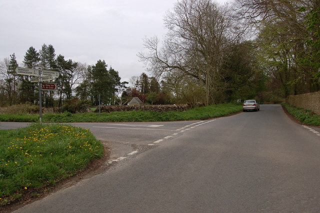
Cadmoor Copse is a picturesque woodland located in Gloucestershire, England. Spanning over an area of approximately 100 acres, this enchanting forest offers a serene and peaceful retreat for nature lovers and outdoor enthusiasts alike.
The copse is predominantly composed of deciduous trees, including oak, beech, and birch, which create a vibrant tapestry of colors during the autumn season. The forest floor is adorned with a rich carpet of ferns, bluebells, and wildflowers, adding to the beauty and diversity of the ecosystem.
Several walking trails wind through the copse, providing visitors with the opportunity to explore the woodland's hidden treasures. The paths are well-maintained and offer varying levels of difficulty, catering to both casual strollers and avid hikers. Along the way, visitors can admire the towering trees, listen to the soothing sounds of birdsong, and perhaps even spot some wildlife, such as deer or foxes.
For those seeking a tranquil spot to relax and enjoy a picnic, Cadmoor Copse offers plenty of idyllic spots. Clearings with benches provide the perfect setting to unwind and soak in the beauty of the surrounding nature. The copse also features a small stream that meanders through the forest, adding to the overall charm and tranquility of the area.
Cadmoor Copse is easily accessible, with ample parking available nearby. The copse is open to the public throughout the year, allowing visitors to experience its ever-changing beauty in every season. Whether one seeks a peaceful walk, a family outing, or a quiet spot for meditation, Cadmoor Copse in Gloucestershire is a delightful destination that offers a respite from the hustle and bustle of everyday life.
If you have any feedback on the listing, please let us know in the comments section below.
Cadmoor Copse Images
Images are sourced within 2km of 51.755454/-1.8710302 or Grid Reference SP0806. Thanks to Geograph Open Source API. All images are credited.

![A circular walk around Bibury and Ablington [2] The path runs along the field edge.
The walk starts at Arlington Corner and follows a footpath to Ablington, where the River Coln is crossed, and then a byway northeast to Saltway Barn. Another byway, the historic Salt Way, is then followed southeast before a right turn onto a bridleway which runs south past Hale Barn to Bibury. The River Coln is recrossed at Bibury Mill and a footpath is then followed back to the starting point. Just over 5 miles.](https://s0.geograph.org.uk/geophotos/07/48/92/7489292_d339398f.jpg)
![A circular walk around Bibury and Ablington [3] The footpath continues to follow the field edge.
The walk starts at Arlington Corner and follows a footpath to Ablington, where the River Coln is crossed, and then a byway northeast to Saltway Barn. Another byway, the historic Salt Way, is then followed southeast before a right turn onto a bridleway which runs south past Hale Barn to Bibury. The River Coln is recrossed at Bibury Mill and a footpath is then followed back to the starting point. Just over 5 miles.](https://s3.geograph.org.uk/geophotos/07/48/92/7489295_c417b5a7.jpg)
![A circular walk around Bibury and Ablington [4] The path passes through a kissing gate at the side of this large electric gate.
The walk starts at Arlington Corner and follows a footpath to Ablington, where the River Coln is crossed, and then a byway northeast to Saltway Barn. Another byway, the historic Salt Way, is then followed southeast before a right turn onto a bridleway which runs south past Hale Barn to Bibury. The River Coln is recrossed at Bibury Mill and a footpath is then followed back to the starting point. Just over 5 miles.](https://s3.geograph.org.uk/geophotos/07/48/92/7489299_5eae3bf9.jpg)
![A circular walk around Bibury and Ablington [5] Black sheep and lambs alongside the path.
The walk starts at Arlington Corner and follows a footpath to Ablington, where the River Coln is crossed, and then a byway northeast to Saltway Barn. Another byway, the historic Salt Way, is then followed southeast before a right turn onto a bridleway which runs south past Hale Barn to Bibury. The River Coln is recrossed at Bibury Mill and a footpath is then followed back to the starting point. Just over 5 miles.](https://s2.geograph.org.uk/geophotos/07/48/93/7489302_4165ff1b.jpg)
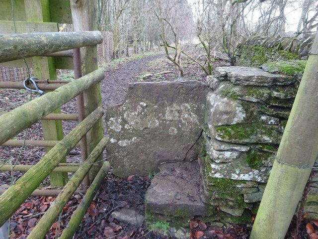
![A circular walk around Bibury and Ablington [6] The path passes through this small copse.
The walk starts at Arlington Corner and follows a footpath to Ablington, where the River Coln is crossed, and then a byway northeast to Saltway Barn. Another byway, the historic Salt Way, is then followed southeast before a right turn onto a bridleway which runs south past Hale Barn to Bibury. The River Coln is recrossed at Bibury Mill and a footpath is then followed back to the starting point. Just over 5 miles.](https://s0.geograph.org.uk/geophotos/07/48/93/7489304_63fe2f3e.jpg)
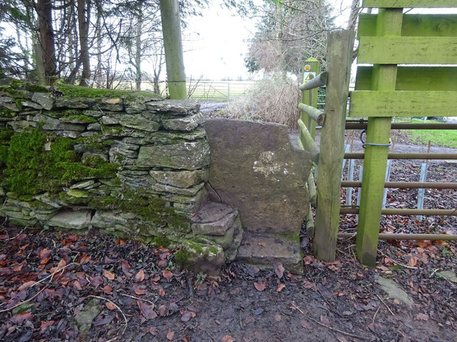
![A circular walk around Bibury and Ablington [7] A stile and then a gate take the footpath to the crossing of the track.
The walk starts at Arlington Corner and follows a footpath to Ablington, where the River Coln is crossed, and then a byway northeast to Saltway Barn. Another byway, the historic Salt Way, is then followed southeast before a right turn onto a bridleway which runs south past Hale Barn to Bibury. The River Coln is recrossed at Bibury Mill and a footpath is then followed back to the starting point. Just over 5 miles.](https://s0.geograph.org.uk/geophotos/07/48/93/7489312_663e720a.jpg)
![A circular walk around Bibury and Ablington [8] The footpath cross this track, seen here looking northeast.
The walk starts at Arlington Corner and follows a footpath to Ablington, where the River Coln is crossed, and then a byway northeast to Saltway Barn. Another byway, the historic Salt Way, is then followed southeast before a right turn onto a bridleway which runs south past Hale Barn to Bibury. The River Coln is recrossed at Bibury Mill and a footpath is then followed back to the starting point. Just over 5 miles.](https://s2.geograph.org.uk/geophotos/07/48/93/7489314_97bec6f5.jpg)
![A circular walk around Bibury and Ablington [9] The footpath cross this track, seen here looking southwest.
The walk starts at Arlington Corner and follows a footpath to Ablington, where the River Coln is crossed, and then a byway northeast to Saltway Barn. Another byway, the historic Salt Way, is then followed southeast before a right turn onto a bridleway which runs south past Hale Barn to Bibury. The River Coln is recrossed at Bibury Mill and a footpath is then followed back to the starting point. Just over 5 miles.](https://s3.geograph.org.uk/geophotos/07/48/93/7489315_d86821e5.jpg)
![A circular walk around Bibury and Ablington [10] Difficult to see from ground level, this is Rawbarrow or Ablington Camp, a slight univallate hillfort situated on the summit of a ridge which also forms the southern valley side of the River Coln. A roughly oval enclosure of approximately 11 acres (4.4ha) the earthworks are best preserved on the eastern side as a bank of up to 30 feet (9 metres) wide and 6 feet (1.7 metres) high. A Scheduled Ancient Monument with details at: <span class="nowrap"><a title="https://historicengland.org.uk/listing/the-list/list-entry/1003356" rel="nofollow ugc noopener" href="https://historicengland.org.uk/listing/the-list/list-entry/1003356">Link</a><img style="margin-left:2px;" alt="External link" title="External link - shift click to open in new window" src="https://s1.geograph.org.uk/img/external.png" width="10" height="10"/></span>](https://s0.geograph.org.uk/geophotos/07/48/93/7489316_90b88654.jpg)
![A circular walk around Bibury and Ablington [11] Difficult to see from ground level, this is Rawbarrow or Ablington Camp, a slight univallate hillfort situated on the summit of a ridge which also forms the southern valley side of the River Coln. A roughly oval enclosure of approximately 11 acres (4.4ha) the earthworks are best preserved on the eastern side as a bank of up to 30 feet (9 metres) wide and 6 feet (1.7 metres) high. A Scheduled Ancient Monument with details at: <span class="nowrap"><a title="https://historicengland.org.uk/listing/the-list/list-entry/1003356" rel="nofollow ugc noopener" href="https://historicengland.org.uk/listing/the-list/list-entry/1003356">Link</a><img style="margin-left:2px;" alt="External link" title="External link - shift click to open in new window" src="https://s1.geograph.org.uk/img/external.png" width="10" height="10"/></span>](https://s1.geograph.org.uk/geophotos/07/48/93/7489317_3149e33e.jpg)
![A circular walk around Bibury and Ablington [12] The footpath from Arlington Corner meet the minor road at Ablington.
The walk starts at Arlington Corner and follows a footpath to Ablington, where the River Coln is crossed, and then a byway northeast to Saltway Barn. Another byway, the historic Salt Way, is then followed southeast before a right turn onto a bridleway which runs south past Hale Barn to Bibury. The River Coln is recrossed at Bibury Mill and a footpath is then followed back to the starting point. Just over 5 miles.](https://s2.geograph.org.uk/geophotos/07/48/93/7489318_31443d2d.jpg)
![Ablington houses [1] Bridge House was formerly two houses, now one. Built in the mid or late 18th century with 20th century rear alterations. Constructed of limestone rubble stone with ashlar chimneys under a stone slate roof. Listed, grade II, with details at: <span class="nowrap"><a title="https://historicengland.org.uk/listing/the-list/list-entry/1341831" rel="nofollow ugc noopener" href="https://historicengland.org.uk/listing/the-list/list-entry/1341831">Link</a><img style="margin-left:2px;" alt="External link" title="External link - shift click to open in new window" src="https://s1.geograph.org.uk/img/external.png" width="10" height="10"/></span>
The hamlet of Ablington is located in Gloucestershire astride the River Coln some 6¼ miles northeast of Cirencester and about 1 mile upstream from Bibury. The name &#039;Ablington&#039; is derived from the &#039;estate called after Eadbald&#039; (personal name Ēadbald + ing + tūn) and has been recorded as Eadbaldingtun, Ablinton and Ablyngton.](https://s1.geograph.org.uk/geophotos/07/50/22/7502217_56aa5a1d.jpg)
![Ablington features [1] This late 18th century bridge of two round arches carries the road over the River Coln. Constructed of coursed limestone rubble stone with dressed copings and piers. Listed, grade II, with details at: <span class="nowrap"><a title="https://historicengland.org.uk/listing/the-list/list-entry/1088387" rel="nofollow ugc noopener" href="https://historicengland.org.uk/listing/the-list/list-entry/1088387">Link</a><img style="margin-left:2px;" alt="External link" title="External link - shift click to open in new window" src="https://s1.geograph.org.uk/img/external.png" width="10" height="10"/></span>
The hamlet of Ablington is located in Gloucestershire astride the River Coln some 6¼ miles northeast of Cirencester and about 1 mile upstream from Bibury. The name &#039;Ablington&#039; is derived from the &#039;estate called after Eadbald&#039; (personal name Ēadbald + ing + tūn) and has been recorded as Eadbaldingtun, Ablinton and Ablyngton.](https://s2.geograph.org.uk/geophotos/07/50/22/7502218_93cce947.jpg)
![Ablington features [2] Looking downstream from the bridge at <a href="https://www.geograph.org.uk/photo/7502218">SP1007 : Ablington features [1]</a> is seen this second bridge which carries a gravel driveway to Ablington Manor over the River Coln. Built in the early 19th century with two segmental arches with keystones and constructed of coursed and dressed limestone. Listed, grade II, with details at: <span class="nowrap"><a title="https://historicengland.org.uk/listing/the-list/list-entry/1088392" rel="nofollow ugc noopener" href="https://historicengland.org.uk/listing/the-list/list-entry/1088392">Link</a><img style="margin-left:2px;" alt="External link" title="External link - shift click to open in new window" src="https://s1.geograph.org.uk/img/external.png" width="10" height="10"/></span>
The hamlet of Ablington is located in Gloucestershire astride the River Coln some 6¼ miles northeast of Cirencester and about 1 mile upstream from Bibury. The name &#039;Ablington&#039; is derived from the &#039;estate called after Eadbald&#039; (personal name Ēadbald + ing + tūn) and has been recorded as Eadbaldingtun, Ablinton and Ablyngton.](https://s0.geograph.org.uk/geophotos/07/50/22/7502220_2c90699b.jpg)
Cadmoor Copse is located at Grid Ref: SP0806 (Lat: 51.755454, Lng: -1.8710302)
Administrative County: Gloucestershire
District: Cotswold
Police Authority: Gloucestershire
What 3 Words
///repeats.blemishes.agreed. Near Cirencester, Gloucestershire
Nearby Locations
Related Wikis


Nearby Amenities
Located within 500m of 51.755454,-1.8710302Have you been to Cadmoor Copse?
Leave your review of Cadmoor Copse below (or comments, questions and feedback).