Parley Wood

Wood, Forest in Dorset

England

Parley Wood

Golf Links Road, Ferndown A great many humps and chicanes 'traffic calming' in this road.
Golf Links Road, Ferndown Credit: Robin Webster

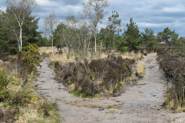
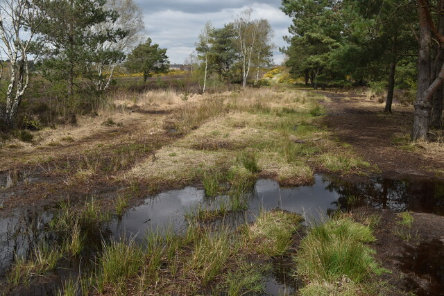
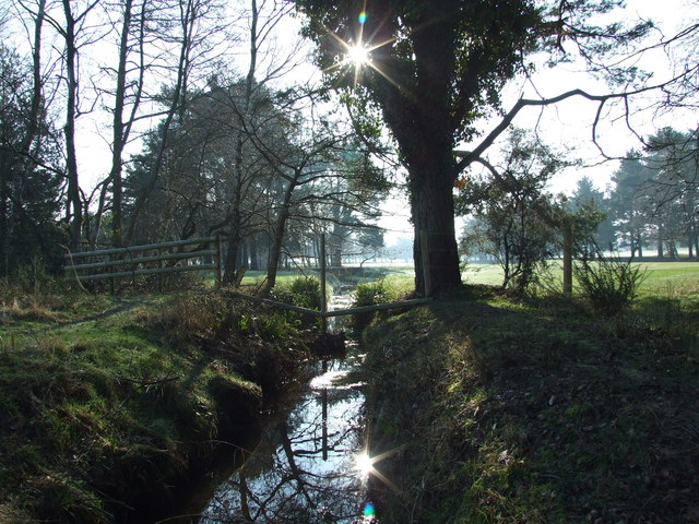
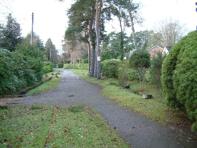
Parley Wood is a beautiful woodland located in the county of Dorset, England. Covering an area of approximately 100 hectares, the wood is situated near the village of Parley and is a popular destination for nature enthusiasts and outdoor lovers.

The wood is predominantly made up of deciduous trees such as oak, beech, and ash, creating a diverse and vibrant ecosystem. The canopy formed by the trees provides shade and shelter, while the undergrowth is home to a variety of plant species, including bluebells and wild garlic, which create a stunning carpet of color during the spring months.

Parley Wood is also known for its rich wildlife. The dense vegetation and quiet surroundings attract a wide range of bird species, including woodpeckers, owls, and various songbirds. Additionally, the wood is inhabited by small mammals such as squirrels, rabbits, and badgers, which can often be spotted during a walk through the forest.

The wood offers several walking trails and paths, allowing visitors to explore its beauty at their own pace. These trails lead through enchanting woodland areas, across babbling brooks, and up gentle slopes, offering breathtaking views of the surrounding countryside.

Parley Wood is a tranquil oasis where visitors can escape the hustle and bustle of daily life and immerse themselves in nature's wonders. Whether it's a leisurely stroll, a picnic, or wildlife spotting, this woodland provides a delightful experience for all who venture into its serene surroundings.

If you have any feedback on the listing, please let us know in the comments section below.

Parley Wood Images

Images are sourced within 2km of 50.785774/-1.8771864 or Grid Reference SZ0898. Thanks to Geograph Open Source API. All images are credited.

Golf Links Road, Ferndown A great many humps and chicanes 'traffic calming' in this road.
Golf Links Road, Ferndown
A great many humps and chicanes 'traffic calming' in this road.
Heathland track climbing towards Trickett’s Cross
Fork in the path beside Ferndown Golf Course
Very waterlogged path northeast of golf course Parley Common manages to be sandy and waterlogged at the same time!
Very waterlogged path northeast of golf course
Parley Common manages to be sandy and waterlogged at the same time!
Ringwood Road, Ferndown
Stream On Parley Common
Stream On Parley Common Looking towards Ferndown Golf Course.
Stream On Parley Common
Looking towards Ferndown Golf Course.
Ferndown Shopping Centre Inside the car park.
Ferndown Shopping Centre
Inside the car park.
Ringwood Rd This row of shops is on the A348 Ringwood Rd the main road into the centre of Bournemouth and Poole from Ferndown. The traffic lights are at the junction with Spinney Lane.
Ringwood Rd
This row of shops is on the A348 Ringwood Rd the main road into the centre of Bournemouth and Poole from Ferndown. The traffic lights are at the junction with Spinney Lane.
In which I Poole my resources (1) St Mary Ferndown
In which I Poole my resources (1)
St Mary Ferndown
A348 approaches junction with A347
Ferndown, residential area This is a public footpath which leads towards ferndown centre.
Ferndown, residential area
This is a public footpath which leads towards ferndown centre.
Ferndown Fire Station Ferndown Fire Station, Ringwood Road, Ferndown, Dorset.
Ferndown Fire Station
Ferndown Fire Station, Ringwood Road, Ferndown, Dorset.
Ferndown: parish church of St. Mary Built in 1933.
Ferndown: parish church of St. Mary
Built in 1933.
Ferndown: postbox № BH22 134, Carroll Avenue Carroll Avenue is a private road (which is nevertheless a public footpath) comprising very desirable properties. Here, we look towards its cut-off end at Golf Links Road. The postbox is emptied at 5:15pm on weekdays and at 12:30pm on Saturdays.
Ferndown: postbox № BH22 134, Carroll Avenue
Carroll Avenue is a private road (which is nevertheless a public footpath) comprising very desirable properties. Here, we look towards its cut-off end at Golf Links Road. The postbox is emptied at 5:15pm on weekdays and at 12:30pm on Saturdays.
Ferndown, The White Heather Pub on Ringwood Road, in the town centre. Internally, open-plan, with L-shaped bar, pool tables & TV. Cask ale on offer at my visit: Ringwood Fortyniner. For some customer comments, see <span class="nowrap"><a title="http://www.beerintheevening.com/pubs/s/29/2923/White_Heather/Ferndown" rel="nofollow ugc noopener" href="http://www.beerintheevening.com/pubs/s/29/2923/White_Heather/Ferndown">Link</a><img style="margin-left:2px;" alt="External link" title="External link - shift click to open in new window" src="https://s1.geograph.org.uk/img/external.png" width="10" height="10"/></span>
Ferndown, The White Heather
Pub on Ringwood Road, in the town centre. Internally, open-plan, with L-shaped bar, pool tables & TV. Cask ale on offer at my visit: Ringwood Fortyniner. For some customer comments, see LinkExternal link
Ferndown, Amberwood House Nursing & residential home on Ringwood Road. <span class="nowrap"><a title="http://www.coltencare.co.uk/carehomes/amberwood/index.asp" rel="nofollow ugc noopener" href="http://www.coltencare.co.uk/carehomes/amberwood/index.asp">Link</a><img style="margin-left:2px;" alt="External link" title="External link - shift click to open in new window" src="https://s1.geograph.org.uk/img/external.png" width="10" height="10"/></span>
Ferndown, Amberwood House
Nursing & residential home on Ringwood Road. LinkExternal link
Ferndown, St. Mary's Church Anglican parish church, at the junction of Ringwood & Church Roads. <span class="nowrap"><a title="http://stmarys-ferndown.org.uk/website/index.php" rel="nofollow ugc noopener" href="http://stmarys-ferndown.org.uk/website/index.php">Link</a><img style="margin-left:2px;" alt="External link" title="External link - shift click to open in new window" src="https://s1.geograph.org.uk/img/external.png" width="10" height="10"/></span>
Ferndown, St. Mary's Church
Anglican parish church, at the junction of Ringwood & Church Roads. LinkExternal link
Show me another place!

Parley Wood is located at Grid Ref: SZ0898 (Lat: 50.785774, Lng: -1.8771864)

Unitary Authority: Dorset

Police Authority: Dorset

What 3 Words

///bossy.slice.dating. Near Ferndown, Dorset

Related Wikis

Parley Common

Parley Common is a Site of Special Scientific Interest (SSSI) on the edge of Ferndown in Dorset, England. The majority land owner is the Canford Estate...

West Parley

West Parley is a village and civil parish in south-east Dorset, England, situated on the River Stour between Bournemouth and Ferndown and off of the B3073...

Plowman's Railroad

Plowman's Railroad operates the collection of 7+1⁄4 in (184 mm) gauge American outline steam and diesel locomotives from the former Dobwalls Adventure...

Dudsbury Camp

Dudsbury Camp (or Dudsbury Rings) is one of a series of Iron Age earthworks in Dorset, starting from Hambledon Hill, and including Hod Hill, Spetisbury...

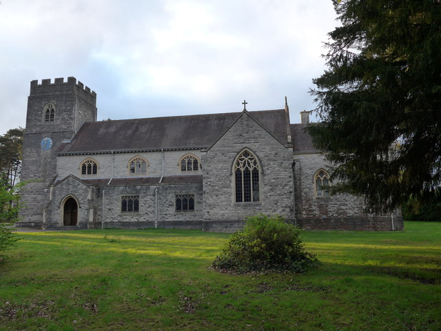
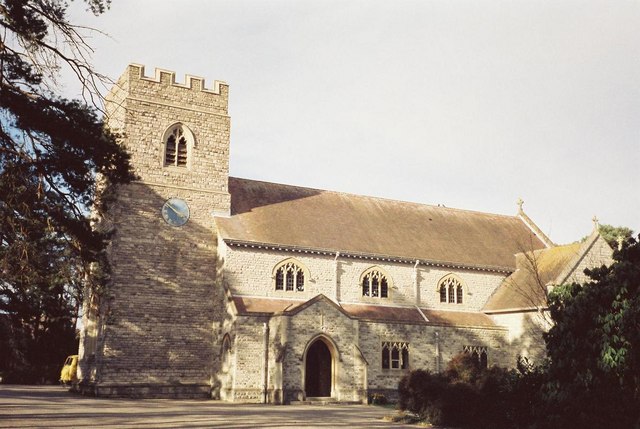
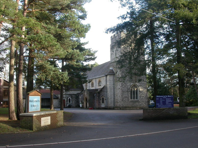
St Mary's Church, Ferndown

St Mary's Church is a Church of England parish church in the town of Ferndown, Dorset. == History == Building of the nave began in 1933, on land given...

Northbourne, Bournemouth

Northbourne is a suburb of Bournemouth, Dorset in England. It is in the north of the town and borders Ensbury Park. == History == Northbourne stands on...

Longham United Reformed Church

Longham United Reformed Church is a Grade II listed United Reformed church near Longham near Ferndown in Dorset, England. == History == The church was...

Ferndown Common

Ferndown Common is a Site of Special Scientific Interest (SSSI) on the edge of Ferndown in Dorset, England. It is currently owned by the Wimborne Estate...

Nearby Amenities

Located within 500m of 50.785774,-1.8771864
Turning Circle
Lat/Long: 50.7838327/-1.8796507
Turning Circle
Lat/Long: 50.7866449/-1.8817383
Power: tower
Source: Bing
Lat/Long: 50.7865262/-1.8722357
Power: tower
Source: Bing
Lat/Long: 50.7842078/-1.873093
Power: tower
Source: Bing
Lat/Long: 50.7819718/-1.8739278
Man Made: tower
Tower Type: communication
Lat/Long: 50.7867739/-1.8810917
Man Made: tower
Tower Type: communication
Lat/Long: 50.7870163/-1.8812433
Power: pole
Lat/Long: 50.7859384/-1.8728916
Power: pole
Lat/Long: 50.7847898/-1.8733578
Power: pole
Lat/Long: 50.784074/-1.8736276
Power: pole
Lat/Long: 50.7834924/-1.8731046
Power: pole
Lat/Long: 50.7825715/-1.8730751
Barrier: kissing_gate
Lat/Long: 50.7820984/-1.8787498
Bus Stop
Brierley Avenue
Bearing: S
Bench: no
Bin: no
Bus: yes
Lit: no
Naptan AtcoCode: 1200POA11947
Naptan Indicator: S-bound
Naptan StopType: bus
Public Transport: platform
Shelter: no
Tactile Paving: no
Lat/Long: 50.784471/-1.8812074
Bus Stop
Winnards Close
Bearing: SE
Bench: no
Bin: no
Bus: yes
Lit: no
Naptan AtcoCode: 1200POA10726
Naptan Indicator: SE-bound
Naptan StopType: bus
Public Transport: platform
Shelter: no
Tactile Paving: no
Lat/Long: 50.7876808/-1.8815587
Bus Stop
Winnards Close
Bearing: NW
Bench: no
Bin: no
Bus: yes
Lit: no
Naptan AtcoCode: 1200POA10725
Naptan Indicator: NW-bound
Naptan StopType: bus
Public Transport: platform
Shelter: no
Tactile Paving: no
Lat/Long: 50.7877592/-1.8818216
Bus Stop
Brierley Avenue
Bearing: N
Bench: no
Bin: no
Bus: yes
Lit: no
Naptan AtcoCode: 1200DOA25032
Naptan Indicator: N-bound
Naptan StopType: bus
Public Transport: platform
Shelter: no
Tactile Paving: no
Lat/Long: 50.7847894/-1.8812941
Bus Stop
Church Lane
Bus: yes
Naptan AtcoCode: 1200DOA90799
Naptan Bearing: W
Naptan BusStopType: CUS
Naptan CommonName: Church Lane
Naptan Indicator: W-bound
Naptan NaptanCode: dordpdgj
Naptan Street: B3073
Naptan Verified: no
Public Transport: platform
Lat/Long: 50.7814361/-1.8763889
Bus Stop
Church Lane
Bus: yes
Naptan AtcoCode: 1200DOA90798
Naptan Bearing: E
Naptan BusStopType: CUS
Naptan CommonName: Church Lane
Naptan Indicator: E-bound
Naptan NaptanCode: dordpdgd
Naptan Street: B3073
Naptan Verified: no
Public Transport: platform
Lat/Long: 50.7815353/-1.87622
Bicycle Rental
Oakland Walk
Bicycle Rental: dropoff_point
Brand: Beryl
Brand Wikidata: Q106575365
Capacity: 8
Email: support@beryl.cc
Fee: yes
Name Signed: no
Network: Beryl - Bournemouth Poole Christchurch
Official Name: Oakland Walk
Operator: Beryl
Operator Type: business
Operator Wikidata: Q106575369
Payment App: yes
Payment App Android: cc.beryl.basis
Payment App Ios: 1386768364
Payment Cash: no
Payment Credit Cards: no
Payment Cryptocurrencies: no
Payment Debit Cards: no
Payment Electronic Purses: no
Phone: +44 20 3003 5044
Ref Gbfs: beryl_bcp:3985
Rental: city_bike
Website: https://beryl.cc/scheme/bournemouth-christchurch-and-poole
Lat/Long: 50.784976/-1.881018
Bench
Backrest: yes
Colour: brown
Material: wood
Seats: 4
Lat/Long: 50.7865179/-1.8811812
Waste Basket
Colour: black
Material: plastic
Waste: trash
Lat/Long: 50.7865296/-1.8811385
Crossing
Crossing: uncontrolled
Crossing Island: yes
Tactile Paving: yes
Lat/Long: 50.7868673/-1.8810236
Operator: SSE
Power: substation
Ref: Mags Barrow
Ref GB Uprn: 10024895286
Lat/Long: 50.7877793/-1.8830637
The data included in this document is from www.openstreetmap.org. The data is made available under ODbL.

Have you been to Parley Wood?

Leave your review of Parley Wood below (or comments, questions and feedback).