Broadway Coppice

Wood, Forest in Worcestershire Wychavon

England

Broadway Coppice

Colletts Fields, Broadway From Leamington Road, the road named Colletts Fields leads to Orchard Avenue and Colletts Gardens.
Colletts Fields, Broadway Credit: Jaggery

Broadway Coppice is a picturesque woodland located in Worcestershire, England. Nestled in the heart of the Cotswolds, this enchanting forest spans an area of approximately 100 acres. It is a beloved destination for nature enthusiasts, hikers, and those seeking tranquility amidst the lush greenery.

As its name suggests, Broadway Coppice consists mainly of coppiced trees, which are regularly cut back to encourage new growth. This management practice has created a diverse ecosystem that supports a wide variety of plant and animal species. Visitors can expect to encounter a rich tapestry of native flora, including oak, ash, and beech trees, alongside vibrant carpets of bluebells and wild garlic during the spring months.

The woodland is crisscrossed by well-maintained footpaths, making it easy for visitors to explore its many hidden treasures. Along these paths, one might stumble upon charming babbling brooks, small ponds, and even the occasional ancient stone wall. Birdwatchers will delight in the opportunity to spot a range of avian species, such as woodpeckers, nuthatches, and tawny owls, while lucky visitors may even catch a glimpse of deer or foxes.

Broadway Coppice offers a tranquil escape from the hustle and bustle of everyday life, providing a peaceful haven where visitors can reconnect with nature. Whether it's a leisurely stroll, a family picnic, or a more adventurous hike, this woodland gem in Worcestershire offers a serene and captivating experience for all who visit.

If you have any feedback on the listing, please let us know in the comments section below.

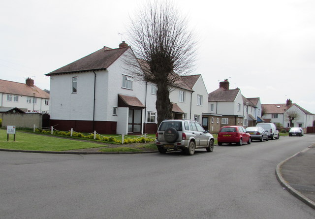
Broadway Coppice Images

Images are sourced within 2km of 52.028402/-1.8739649 or Grid Reference SP0836. Thanks to Geograph Open Source API. All images are credited.

Colletts Fields, Broadway From Leamington Road, the road named Colletts Fields leads to Orchard Avenue and Colletts Gardens.
Colletts Fields, Broadway
From Leamington Road, the road named Colletts Fields leads to Orchard Avenue and Colletts Gardens.
Wells Gardens, Broadway The road named Wells Gardens extends for 120 metres from Leamington Road to Orchard Avenue.
Wells Gardens, Broadway
The road named Wells Gardens extends for 120 metres from Leamington Road to Orchard Avenue.
Sheldon Avenue, Broadway Dead end road extending for 80 metres from Sandscroft Avenue, on the east side of Leamington Road.
Sheldon Avenue, Broadway
Dead end road extending for 80 metres from Sandscroft Avenue, on the east side of Leamington Road.
Long row of lockup garages behind the Sheldon Avenue turning circle, Broadway At the southeast end of Sheldon Avenue.
Long row of lockup garages behind the Sheldon Avenue turning circle, Broadway
At the southeast end of Sheldon Avenue.
Broadway Youth Club banner and Aria Dance Company banner on a Broadway gate Facing Leamington Road. Broadway Youth Club meets in Broadway Youth Centre, adjacent to Broadway First School in Lime Tree Avenue. The Youth Centre is also the venue of Aria Dance Company (for children ages 5-14).
Broadway Youth Club banner and Aria Dance Company banner on a Broadway gate
Facing Leamington Road. Broadway Youth Club meets in Broadway Youth Centre, adjacent to Broadway First School in Lime Tree Avenue. The Youth Centre is also the venue of Aria Dance Company (for children ages 5-14).
Broadway First School, Broadway Primary school on the north side of Lime Tree Avenue, viewed from the corner of Leamington Road.
Broadway First School, Broadway
Primary school on the north side of Lime Tree Avenue, viewed from the corner of Leamington Road.
Lime Tree Avenue, Broadway On the east side of Leamington Road. Broadway First School <a title="https://www.geograph.org.uk/photo/5212990" href="https://www.geograph.org.uk/photo/5212990">Link</a> is on the left.
Lime Tree Avenue, Broadway
On the east side of Leamington Road. Broadway First School Link is on the left.
Broadway First School name signs, Broadway Located on the left here. <a title="https://www.geograph.org.uk/photo/5212990" href="https://www.geograph.org.uk/photo/5212990">Link</a>
Broadway First School name signs, Broadway
Located on the left here. Link
Western entrance to Broadway First School, Broadway On the north side of Lime Tree Avenue, on the left here. <a title="https://www.geograph.org.uk/photo/5212990" href="https://www.geograph.org.uk/photo/5212990">Link</a>
Though overpainted, the word BOYS remains visible above the door. 
Relics of a bygone era, GIRLS and INFANTS are over the other two entrances in 2016.
Western entrance to Broadway First School, Broadway
On the north side of Lime Tree Avenue, on the left here. Link Though overpainted, the word BOYS remains visible above the door. Relics of a bygone era, GIRLS and INFANTS are over the other two entrances in 2016.
Zigzag markings on Lime Tree Avenue, Broadway The yellow zigzags are part of the Keep Clear (no stopping or parking) Zone outside Broadway First School.
Zigzag markings on Lime Tree Avenue, Broadway
The yellow zigzags are part of the Keep Clear (no stopping or parking) Zone outside Broadway First School.
Eastern end of Lime Tree Avenue, Broadway Lime Tree Avenue is on the east side of Leamington Road. Broadway First School is nearby. <a title="https://www.geograph.org.uk/photo/5212990" href="https://www.geograph.org.uk/photo/5212990">Link</a>
Eastern end of Lime Tree Avenue, Broadway
Lime Tree Avenue is on the east side of Leamington Road. Broadway First School is nearby. Link
South along Lime Tree Avenue, Broadway Viewed from the edge of Broadway First School. <a title="https://www.geograph.org.uk/photo/5212990" href="https://www.geograph.org.uk/photo/5212990">Link</a>
South along Lime Tree Avenue, Broadway
Viewed from the edge of Broadway First School. Link
High Street, Broadway Heading east along High Street at Broadway.
High Street, Broadway
Heading east along High Street at Broadway.
Milestone House The milestone was defaced during the Second World War and shows 90 miles to London.
Milestone House
The milestone was defaced during the Second World War and shows 90 miles to London.
Coneygree Lane
Coneygree Lane
Paths towards Lime Tree Avenue, Broadway From the east side of Leamington Road.
Paths towards Lime Tree Avenue, Broadway
From the east side of Leamington Road.
Broadway High Street, Eastern End Very quiet for a High Street, a glance at the map shows that this was once part of the main thoroughfare through Broadway. Building a by pass has meant that this end of the street is now just another residential road, albeit a very wide and smart one.
Broadway High Street, Eastern End
Very quiet for a High Street, a glance at the map shows that this was once part of the main thoroughfare through Broadway. Building a by pass has meant that this end of the street is now just another residential road, albeit a very wide and smart one.
Eastern part of Broadway High Street
Show me another place!

Broadway Coppice is located at Grid Ref: SP0836 (Lat: 52.028402, Lng: -1.8739649)

Administrative County: Worcestershire

District: Wychavon

Police Authority: West Mercia

What 3 Words

///conspire.dislikes.unless. Near Broadway, Worcestershire

Related Wikis

Buckland, Gloucestershire

Buckland is a village and civil parish in the borough of Tewkesbury, Gloucestershire, England. The parish, which also includes the village of Laverton...

Broadway War Memorial

The Broadway War Memorial is located on the village green in the village of Broadway in Worcestershire. The memorial marks the deaths of local individuals...
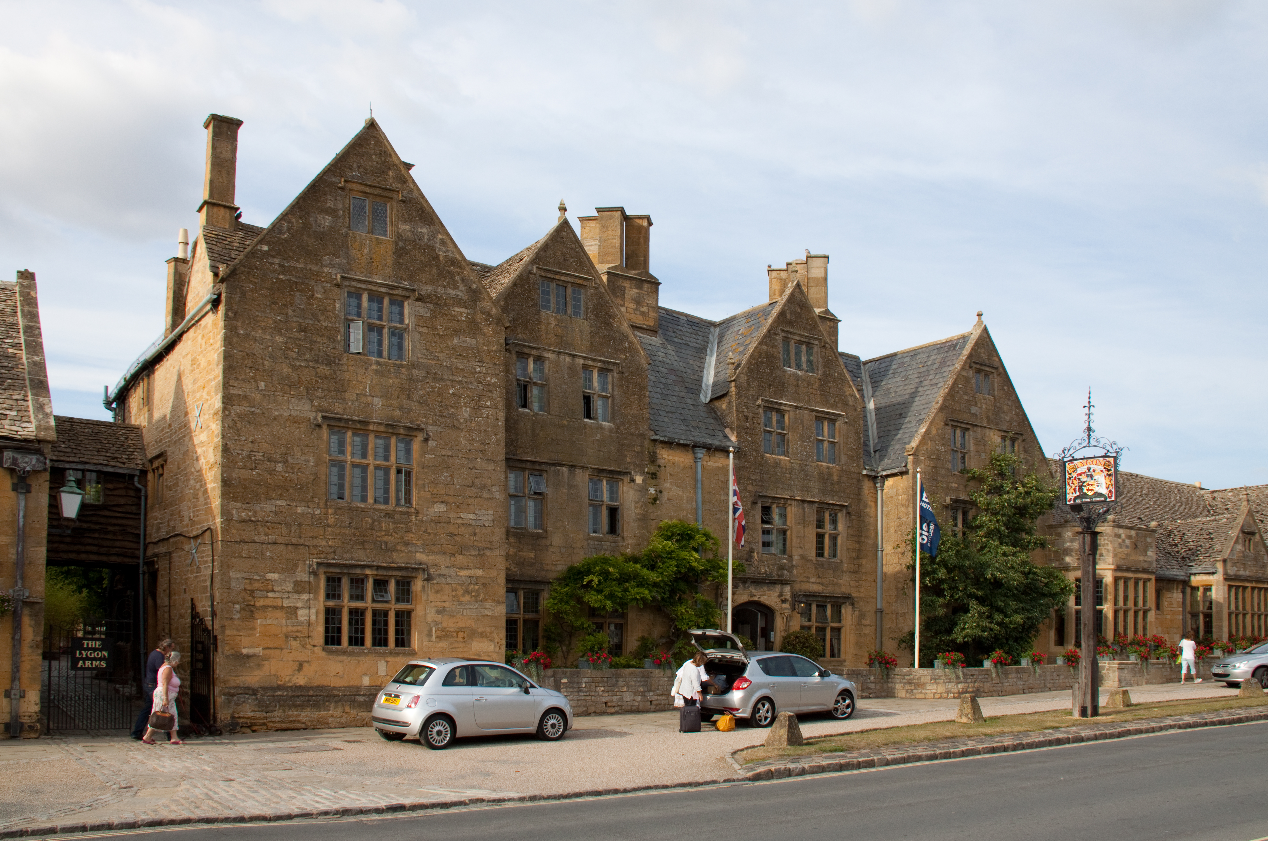
Lygon Arms

The Lygon Arms ( LIG-ən) is a Grade II* listed hotel in Broadway, Worcestershire, originally a coaching inn. The current building dates from the seventeenth...

Broadway, Worcestershire

Broadway is a large village and civil parish in the Cotswolds, England, with a population of 2,540 at the 2011 census. It is in the far southeast of Worcestershire...

Broadway railway station

Broadway railway station is a railway station on the heritage Gloucestershire Warwickshire Railway in the village of Broadway in Worcestershire, England...

Laverton, Gloucestershire

Laverton is a village in Tewkesbury Borough in Gloucestershire, England. It lies less than a mile south of the village of Buckland, and is in the civil...

Childswickham

Childswickham is a village in Worcestershire, England, situated within the flat open landscape of the Vale of Evesham, between the Bredon and Cotswold...

Laverton Halt railway station

Laverton Halt railway station was a halt on the Honeybourne Line from Honeybourne to Cheltenham which served the hamlet of Laverton in Gloucestershire...

Nearby Amenities

Located within 500m of 52.028402,-1.8739649
Burhill
Ele: 172
Natural: peak
Lat/Long: 52.0254407/-1.8762781
Barrier: stile
Lat/Long: 52.0324602/-1.8728127
Barrier: stile
Lat/Long: 52.0308123/-1.8732767
Barrier: stile
Lat/Long: 52.0319515/-1.8706009
Barrier: kissing_gate
Foot: yes
Lat/Long: 52.0319892/-1.8695982
Barrier: stile
Lat/Long: 52.0319027/-1.870034
Barrier: kissing_gate
Lat/Long: 52.0281093/-1.8735954
Barrier: kissing_gate
Lat/Long: 52.032012/-1.8697955
Material: wood
Power: pole
Lat/Long: 52.0241944/-1.8739247
Material: wood
Power: pole
Lat/Long: 52.0246875/-1.8750545
Material: wood
Power: pole
Lat/Long: 52.024352/-1.8762461
Bury End West
Location Transition: yes
Material: wood
Power: pole
Transformer: distribution
Voltage Primary: 11000
Lat/Long: 52.0312478/-1.869214
The data included in this document is from www.openstreetmap.org. The data is made available under ODbL.

Have you been to Broadway Coppice?

Leave your review of Broadway Coppice below (or comments, questions and feedback).