Cwm

Settlement in Flintshire

Wales

Cwm

Approaching the summit of Moel Hiraddug near Dyserth This path leads all the way to the summit from the south.
Approaching the summit of Moel Hiraddug near Dyserth Credit: Colin Park

Cwm is a small village located in Flintshire, Wales. Situated in the northeastern part of the county, Cwm is bordered by the towns of Holywell and Bagillt. With a population of just over 1,000 residents, it is a close-knit community that offers a peaceful and picturesque setting.

The village of Cwm is surrounded by stunning countryside and rolling hills, making it an attractive destination for outdoor enthusiasts. It is particularly popular among hikers and cyclists who enjoy exploring the scenic trails and paths in the area. The nearby River Dee also provides opportunities for fishing and boating.

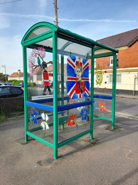
Despite its small size, Cwm offers a range of amenities to its residents and visitors. There is a local convenience store, a post office, and a few pubs where locals gather to socialize. The village also has a primary school, providing education for children in the area.

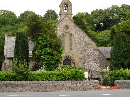
Cwm has a rich history, with evidence of human settlement dating back to the Bronze Age. The village has a number of historic buildings, including the Grade II listed Cwm Methodist Church, which dates back to the 19th century.

The village is well-connected to the surrounding areas, with good transport links by road. It is located just a short distance from the A548, which provides easy access to larger towns and cities in the region.

Overall, Cwm is a charming village that offers a tranquil lifestyle and beautiful surroundings, ideal for those seeking a peaceful retreat in Flintshire.

If you have any feedback on the listing, please let us know in the comments section below.
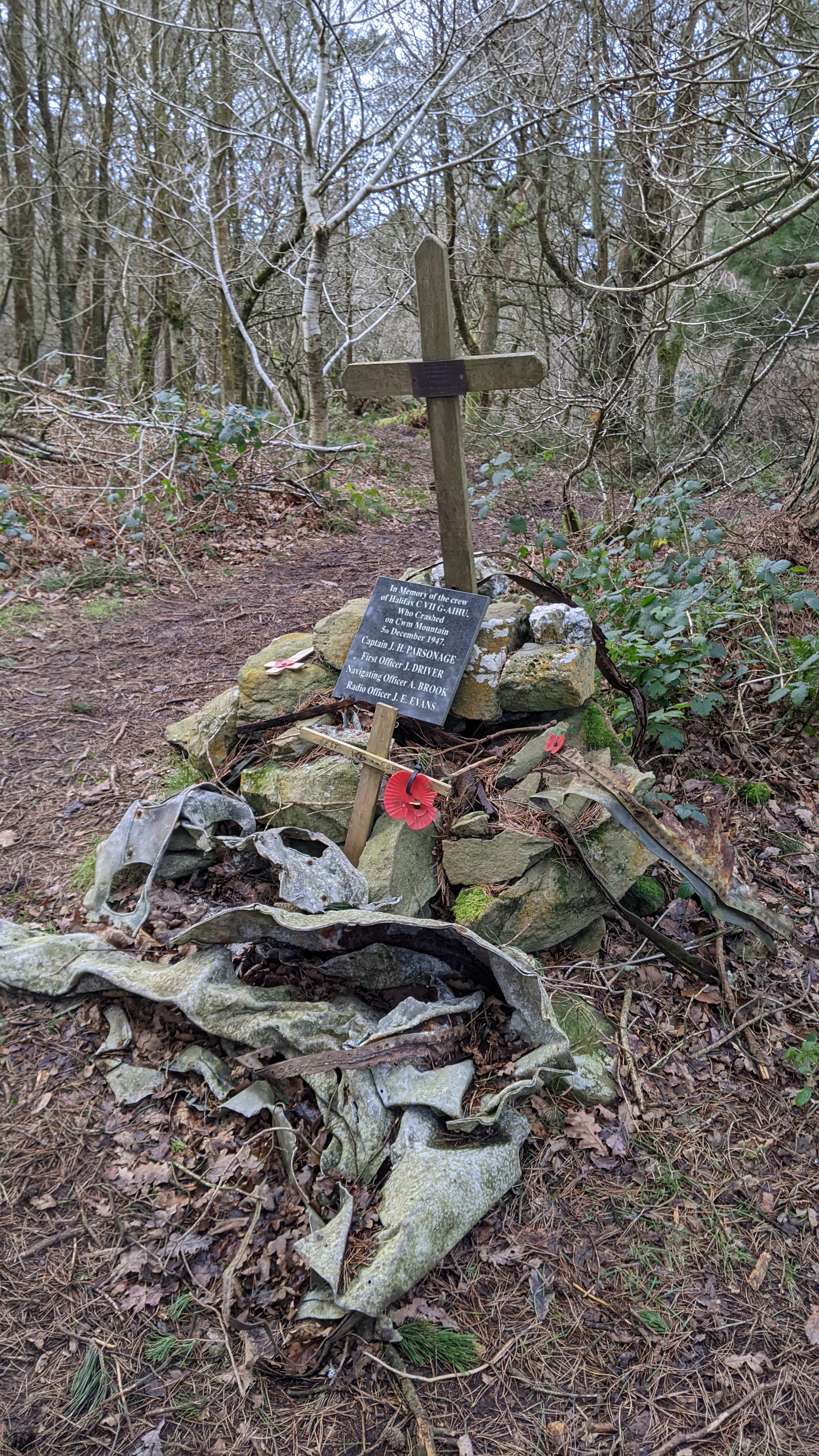
Cwm Images

Images are sourced within 2km of 53.285168/-3.4070043 or Grid Reference SJ0677. Thanks to Geograph Open Source API. All images are credited.

Approaching the summit of Moel Hiraddug near Dyserth This path leads all the way to the summit from the south.
Approaching the summit of Moel Hiraddug near Dyserth
This path leads all the way to the summit from the south.
On the summit of  Moel Hiraddug with view towards Mynydd y Cwm
On the summit of Moel Hiraddug with view towards Mynydd y Cwm
Dyserth from Moel Hiraddug
Vale of Clwyd from Moel Hiraddug
The village church at Cwm near Dyserth
Plas yn Cwm near Rhuallt
On the Offa's Dyke Path north of Tyddyn-y-cyll with view to Gop Hill
Dyserth Falls Sign
Dyserth Falls Sign
Afon Ffyddion Waterfall The massive wall in the view contains steps to reach the top of the waterfall but was thought originally to house a waterwheel
Afon Ffyddion Waterfall
The massive wall in the view contains steps to reach the top of the waterfall but was thought originally to house a waterwheel
Old Boundary Marker on the B5151 at Bodrhyddan Parish Boundary Marker against a stone wall on the south side of the A5151 opposite Bodrhyddan Home Farm. Inscribed R P for Rhuddlan Parish and on the boundary of Rhuddlan and Dyserth parishes.

Milestone Society National ID: DEN_RHUDYS02pb
Old Boundary Marker on the B5151 at Bodrhyddan
Parish Boundary Marker against a stone wall on the south side of the A5151 opposite Bodrhyddan Home Farm. Inscribed R P for Rhuddlan Parish and on the boundary of Rhuddlan and Dyserth parishes. Milestone Society National ID: DEN_RHUDYS02pb
Parish boundary stone on the A5151, Dyserth Marked R.P. for Rhuddlan Parish.
Parish boundary stone on the A5151, Dyserth
Marked R.P. for Rhuddlan Parish.
OS Benchmark Recorded on Benchmark Database as 'Dyserth, United Reformed Church'.
OS Benchmark
Recorded on Benchmark Database as 'Dyserth, United Reformed Church'.
Coronation Decor Attractive artwork celebrating the Coronation of His Majesty King Charles III.
 Seen on my Coronation tour.
Coronation Decor
Attractive artwork celebrating the Coronation of His Majesty King Charles III. Seen on my Coronation tour.
Dyserth Waterfall and Gardens
Postbox at Dyserth LL18 121. Royal Mail list this box as 'Hiraddug Road'.
Postbox at Dyserth
LL18 121. Royal Mail list this box as 'Hiraddug Road'.
Dyserth & District Field Club - anniversary bench This bench commemorates the 90th anniversary of the Dyserth & district Field Club, founded in 1911 by a group of about 40 people, the first chairman being the vicar Rev J. Evans Jones. The object of the club is to 'encourage the appreciation and understanding of all Aspects of the countryside'. According to its website <span class="nowrap"><a title="http://www.dyserth.com/html/dyserth_field_club.html" rel="nofollow ugc noopener" href="http://www.dyserth.com/html/dyserth_field_club.html">Link</a><img style="margin-left:2px;" alt="External link" title="External link - shift click to open in new window" src="https://s1.geograph.org.uk/img/external.png" width="10" height="10"/></span> it has a current membership of about 170 and organises a varied programme of lectures and excursions.
Dyserth & District Field Club - anniversary bench
This bench commemorates the 90th anniversary of the Dyserth & district Field Club, founded in 1911 by a group of about 40 people, the first chairman being the vicar Rev J. Evans Jones. The object of the club is to 'encourage the appreciation and understanding of all Aspects of the countryside'. According to its website LinkExternal link it has a current membership of about 170 and organises a varied programme of lectures and excursions.
Offa's Dyke path heading south beside Marian Mill
Rhes o goed pinwydd / A row of pine trees These pine trees mark the southern boundary of Rhyl Rugby Club's grounds.
Rhes o goed pinwydd / A row of pine trees
These pine trees mark the southern boundary of Rhyl Rugby Club's grounds.
Show me another place!

Cwm is located at Grid Ref: SJ0677 (Lat: 53.285168, Lng: -3.4070043)

Unitary Authority: Denbighshire

Police Authority: North Wales

Also known as: Y Cwm

What 3 Words

///bashful.handbook.factored. Near Cwm, Denbighshire

Related Wikis

Cwm, Denbighshire

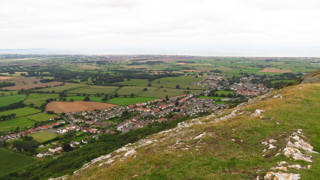
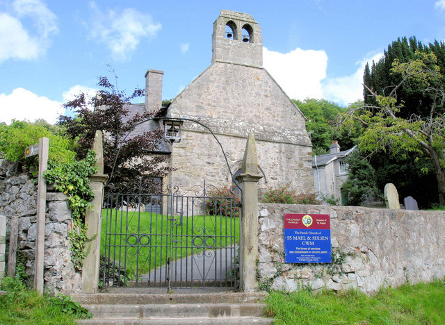
Cwm is a village and community in Denbighshire, below the hill Mynydd y Cwm. The church in Cwm is dedicated to two 6th-century saints, St Mael and St Sulien...

Moel Hiraddug

Moel Hiraddug, also known as Y Foel, is a hill fort and hill in the Clwydian Range of north-east Wales. The northern part of the hill has been eaten away...

Mynydd y Cwm

Mynydd y Cwm is a hill in the Clwydian Range in Denbighshire, North Wales. It reaches a height of 304.8 metres (1,000 feet). It has recently been promoted...
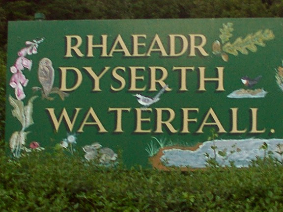
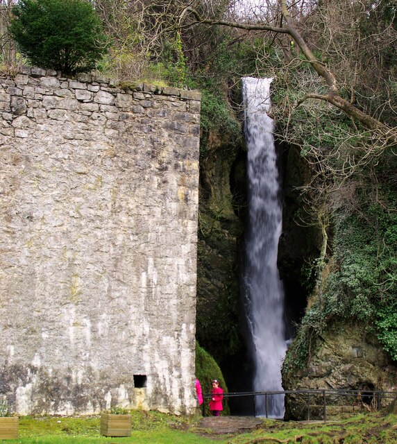
Dyserth

Dyserth (Welsh: Diserth) is a village, community and electoral ward in Denbighshire, Wales. Its population at the 2011 United Kingdom census was 2,269...

Nearby Amenities

Located within 500m of 53.285168,-3.4070043
Cwm
Place: village
Population: 378
Wikidata: Q16896555
Lat/Long: 53.2847015/-3.4058688
Power: pole
Lat/Long: 53.2886284/-3.4110499
Power: pole
Lat/Long: 53.2874964/-3.4099743
Power: pole
Lat/Long: 53.2867893/-3.4092448
Power: pole
Lat/Long: 53.2863719/-3.4088071
Power: pole
Lat/Long: 53.2860812/-3.4078318
Power: pole
Lat/Long: 53.2869932/-3.4094552
Power: pole
Lat/Long: 53.2870515/-3.4087305
Power: pole
Lat/Long: 53.2875313/-3.4077278
Power: pole
Lat/Long: 53.2886512/-3.4048666
Power: pole
Lat/Long: 53.2879549/-3.4069101
Power: pole
Lat/Long: 53.2881682/-3.4061942
Power: pole
Lat/Long: 53.2880007/-3.4105416
Power: pole
Lat/Long: 53.2852432/-3.4081335
Power: pole
Lat/Long: 53.2844028/-3.4070115
Power: pole
Lat/Long: 53.2833108/-3.4062546
Power: pole
Lat/Long: 53.2827612/-3.4059521
Power: pole
Lat/Long: 53.2821248/-3.4055804
Power: pole
Lat/Long: 53.2815288/-3.4052576
Power: pole
Lat/Long: 53.2810085/-3.4049366
Power: pole
Lat/Long: 53.2838829/-3.4065753
Power: pole
Lat/Long: 53.2849208/-3.4074222
Power: pole
Lat/Long: 53.2887872/-3.4038643
Power: pole
Lat/Long: 53.2849983/-3.4021739
Power: pole
Lat/Long: 53.2846725/-3.4008093
Power: pole
Lat/Long: 53.2844459/-3.3998279
Power: pole
Lat/Long: 53.2853145/-3.4032703
Power: pole
Lat/Long: 53.2852345/-3.411249
Power: pole
Lat/Long: 53.2853032/-3.4103804
Power: pole
Lat/Long: 53.2853694/-3.4097332
Power: pole
Lat/Long: 53.2854241/-3.4091691
Power: pole
Lat/Long: 53.2851327/-3.4116322
Power: pole
Lat/Long: 53.2849501/-3.4048557
Entrance: yes
Lat/Long: 53.2858422/-3.4021009
Post Box
Collection Times: Mo-Fr 11:00; Sa 10:15
Operator: Royal Mail
Post Box Type: wall
Ref: LL18 48
Royal Cypher: VR
Royal Cypher Wikidata: Q33102356
Lat/Long: 53.2855972/-3.4020345
Ffynnon Fael y Sulien
Archaeological Site: holy_well
Historic: archaeological_site
Historic Civilization: medieval_christianity
Lat/Long: 53.2855538/-3.4019474
Vicarage Spring
Natural: spring
Lat/Long: 53.2856398/-3.4018512
Ffynnon Bwbach
Natural: spring
Lat/Long: 53.2849181/-3.4020152
Rhyd y Bwbach
Ford: yes
Lat/Long: 53.2840523/-3.4034381
Power: pole
Lat/Long: 53.2849164/-3.4064685
Barrier: stile
Lat/Long: 53.2846393/-3.3996455
Barrier: bollard
Lat/Long: 53.2852026/-3.4059105
Barrier: bollard
Lat/Long: 53.2851965/-3.4059414
Barrier: bollard
Lat/Long: 53.2852087/-3.4058805
Barrier: bollard
Lat/Long: 53.2852136/-3.4058547
Barrier: bollard
Lat/Long: 53.2851911/-3.405969
Barrier: stile
Lat/Long: 53.2861321/-3.4034601
Bod Hamer
Place: neighbourhood
Lat/Long: 53.2852934/-3.4048928
Power: pole
Lat/Long: 53.2888035/-3.4047068
Direction: 165
Generator Method: photovoltaic
Generator Output Electricity: yes
Generator Solar Modules: 12
Generator Source: solar
Generator Type: solar_photovoltaic_panel
Location: roof
Power: generator
Lat/Long: 53.285096/-3.4066047
Public Bookcase
Booth: K6
Disused Amenity: telephone
Man Made: telephone_box
Public Bookcase Type: phone_box
Lat/Long: 53.285314/-3.4059015
Post Box
Collection Times: Mo-Fr 10:00; Sa 09:00
Operator: Royal Mail
Post Box Type: wall
Ref: LL18 129
Royal Cypher: GR
Royal Cypher Wikidata: Q33102273
Lat/Long: 53.2851453/-3.4070077
Bus Stop
Bus: yes
Naptan AtcoCode: 5110WDB48444
Naptan NaptanCode: dbgjmja
Public Transport: platform
Lat/Long: 53.2851319/-3.4069981
The data included in this document is from www.openstreetmap.org. The data is made available under ODbL.

Have you been to Cwm?

Leave your review of Cwm below (or comments, questions and feedback).