Stanway Ash Wood

Wood, Forest in Gloucestershire Tewkesbury

England

Stanway Ash Wood

It could be 1935 Donnington Brewery has 18 tied houses in the Cotswolds and brews my favourite beer. The car is a pre-war Morris Cowley 2 seat tourer.
It could be 1935 Credit: Stuart Logan

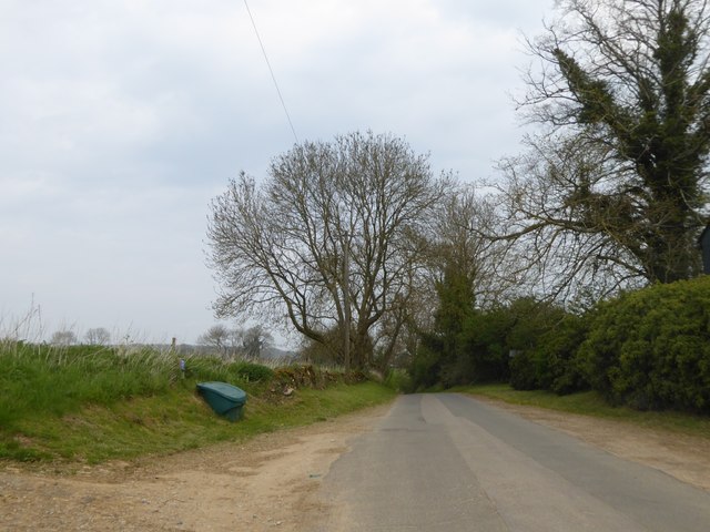
Stanway Ash Wood is a picturesque woodland located in the county of Gloucestershire, England. Covering an area of approximately 20 hectares, this woodland is part of the larger Stanway Estate and is a haven for nature enthusiasts and outdoor lovers.

The wood is primarily composed of ash trees, which give it its name, but it also features an array of other tree species such as oak, beech, and birch. This diverse mix of trees creates a rich and varied habitat, supporting a wide range of flora and fauna.

Walking through Stanway Ash Wood, visitors can enjoy a tranquil and peaceful environment. The woodland is crisscrossed by a network of well-maintained footpaths, allowing easy access to explore its hidden wonders. The paths are surrounded by a lush carpet of ferns, bluebells, and wildflowers, creating a vibrant and colorful scene during the spring and summer months.

Birdwatchers will delight in the variety of avian species that call Stanway Ash Wood home. From the melodious songs of the blackbird and the chirping of the goldfinch to the occasional sighting of the elusive tawny owl, there is always something to marvel at for bird enthusiasts.

Moreover, the wood is home to a diverse range of wildlife, including small mammals like squirrels, rabbits, and foxes. It is not uncommon to spot deer grazing in the open glades or catch a glimpse of a badger scurrying through the undergrowth.

Overall, Stanway Ash Wood offers a peaceful retreat for nature lovers, with its stunning scenery, diverse flora and fauna, and well-maintained footpaths. It is a place where visitors can immerse themselves in the beauty of the natural world and enjoy the tranquility of the Gloucestershire countryside.

If you have any feedback on the listing, please let us know in the comments section below.

Stanway Ash Wood Images

Images are sourced within 2km of 51.988803/-1.8790999 or Grid Reference SP0832. Thanks to Geograph Open Source API. All images are credited.

It could be 1935 Donnington Brewery has 18 tied houses in the Cotswolds and brews my favourite beer. The car is a pre-war Morris Cowley 2 seat tourer.
It could be 1935
Donnington Brewery has 18 tied houses in the Cotswolds and brews my favourite beer. The car is a pre-war Morris Cowley 2 seat tourer.
St Barnabas Church and graveyard A Grade II listed church that is not as old as one might think; 1864 to be exact.
St Barnabas Church and graveyard
A Grade II listed church that is not as old as one might think; 1864 to be exact.
Houses at Stanway Corner Energetic walkers can climb straight ahead which leads to a footpath; the road curves to the right and climbs gently up the ridge
Houses at Stanway Corner
Energetic walkers can climb straight ahead which leads to a footpath; the road curves to the right and climbs gently up the ridge
Small lay-by in The Slade woodland The B4077 climbs the side of the slope east of Stanway, through woodland.  This small lay-by offers access to a woodland track
Small lay-by in The Slade woodland
The B4077 climbs the side of the slope east of Stanway, through woodland. This small lay-by offers access to a woodland track
Former quarry in Coscombe Grove Now almost filled with debris and plant material, but not yet completely colonised by trees
Former quarry in Coscombe Grove
Now almost filled with debris and plant material, but not yet completely colonised by trees
B4077 in Coscombe Grove
Sheep in the Cotswolds West of Cutsdean, the level top of the ridge is used for grazing sheep, a field has been ploughed and in the distance is Carey's Covert which is the boundary of Guiting Quarry
Sheep in the Cotswolds
West of Cutsdean, the level top of the ridge is used for grazing sheep, a field has been ploughed and in the distance is Carey's Covert which is the boundary of Guiting Quarry
Minor road north to Taddington Along the flat top of the ridge between Stanway and Cutsdean
Minor road north to Taddington
Along the flat top of the ridge between Stanway and Cutsdean
Advert for a business in Taddington Board for an architectural reclamation business in this rural settlement
Advert for a business in Taddington
Board for an architectural reclamation business in this rural settlement
Farm pull-off in Taddington The road here drops into a shallow valley marked on the map as "Village Earthworks" <a href="https://www.geograph.org.uk/photo/1947397">SP0831 : Lost village</a> clearly shows boundaries of the lost village of Taddington in that valley
Farm pull-off in Taddington
The road here drops into a shallow valley marked on the map as "Village Earthworks" SP0831 : Lost village clearly shows boundaries of the lost village of Taddington in that valley
Sign for the Winchcombe Way
Shallow valley, site of the medieval village of Taddington Passing places on the narrow road
Shallow valley, site of the medieval village of Taddington
Passing places on the narrow road
A large ploughed field near Taddington Looking from the minor road north of Taddington.  The field (about 600 metres by 300 metres) stretches from the road to Stanway Ash Plantation
A large ploughed field near Taddington
Looking from the minor road north of Taddington. The field (about 600 metres by 300 metres) stretches from the road to Stanway Ash Plantation
Two fields and Stanway Ash Plantation Farmland on the ridge north of Taddington. The large fields stretch from the road to the woodland
Two fields and Stanway Ash Plantation
Farmland on the ridge north of Taddington. The large fields stretch from the road to the woodland
Old wall separating two fields near Stanway Ash Plantation The wall remains, but does not appear to be maintained as a useful barrier
Old wall separating two fields near Stanway Ash Plantation
The wall remains, but does not appear to be maintained as a useful barrier
The northern end of Stanway Ash Plantation
Footpath through Stanway Ash Plantation A link from the road to a network of paths on Shenberrow Hill; what a shame that the wall has been broken
Footpath through Stanway Ash Plantation
A link from the road to a network of paths on Shenberrow Hill; what a shame that the wall has been broken
Valley north-west of Snowshill Manor
Show me another place!

Stanway Ash Wood is located at Grid Ref: SP0832 (Lat: 51.988803, Lng: -1.8790999)

Administrative County: Gloucestershire

District: Tewkesbury

Police Authority: Gloucestershire

What 3 Words

///flute.dusty.lifestyle. Near Broadway, Worcestershire

Nearby Locations

Stanway Ash Wood

Related Wikis

Jackdaw Quarry

Jackdaw Quarry (grid reference SP077309) is a 4.78-hectare (11.8-acre) geological Site of Special Scientific Interest in Gloucestershire, notified in 1985...
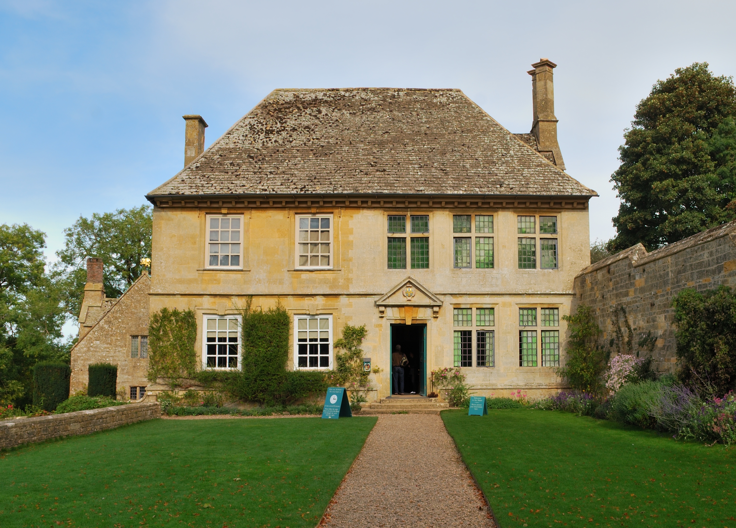
Snowshill Manor

Snowshill Manor is a National Trust property located in the village of Snowshill, Gloucestershire, United Kingdom. It is a sixteenth-century country house...

Cutsdean Quarry

Cutsdean Quarry (grid reference SP105315) is a 0.83-hectare (2.1-acre) nature reserve in Gloucestershire, England. The site is listed in the 'Cotswold...

Stanway House

Stanway House is a Jacobean manor house near the village of Stanway in Gloucestershire, England. The manor of Stanway was owned by Tewkesbury Abbey for...

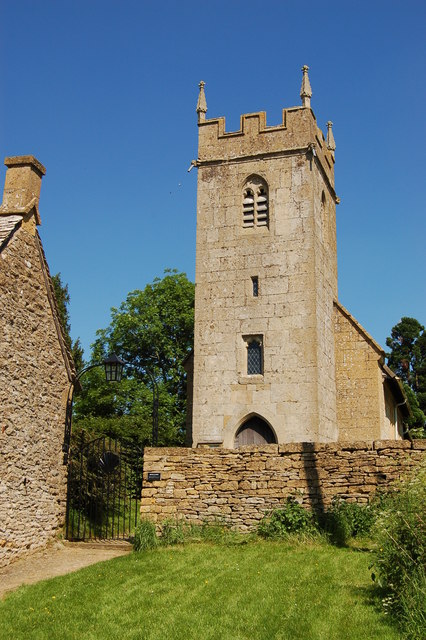
Stanton, Gloucestershire

Stanton is a village and civil parish in Tewkesbury Borough, Gloucestershire, England. The village is a spring line settlement at the foot of the Cotswold...

Snowshill

Snowshill (locally SNOH-zəl, SNOZ-əl) is a small Cotswolds village and civil parish in Gloucestershire, England, located near Broadway, Worcestershire...

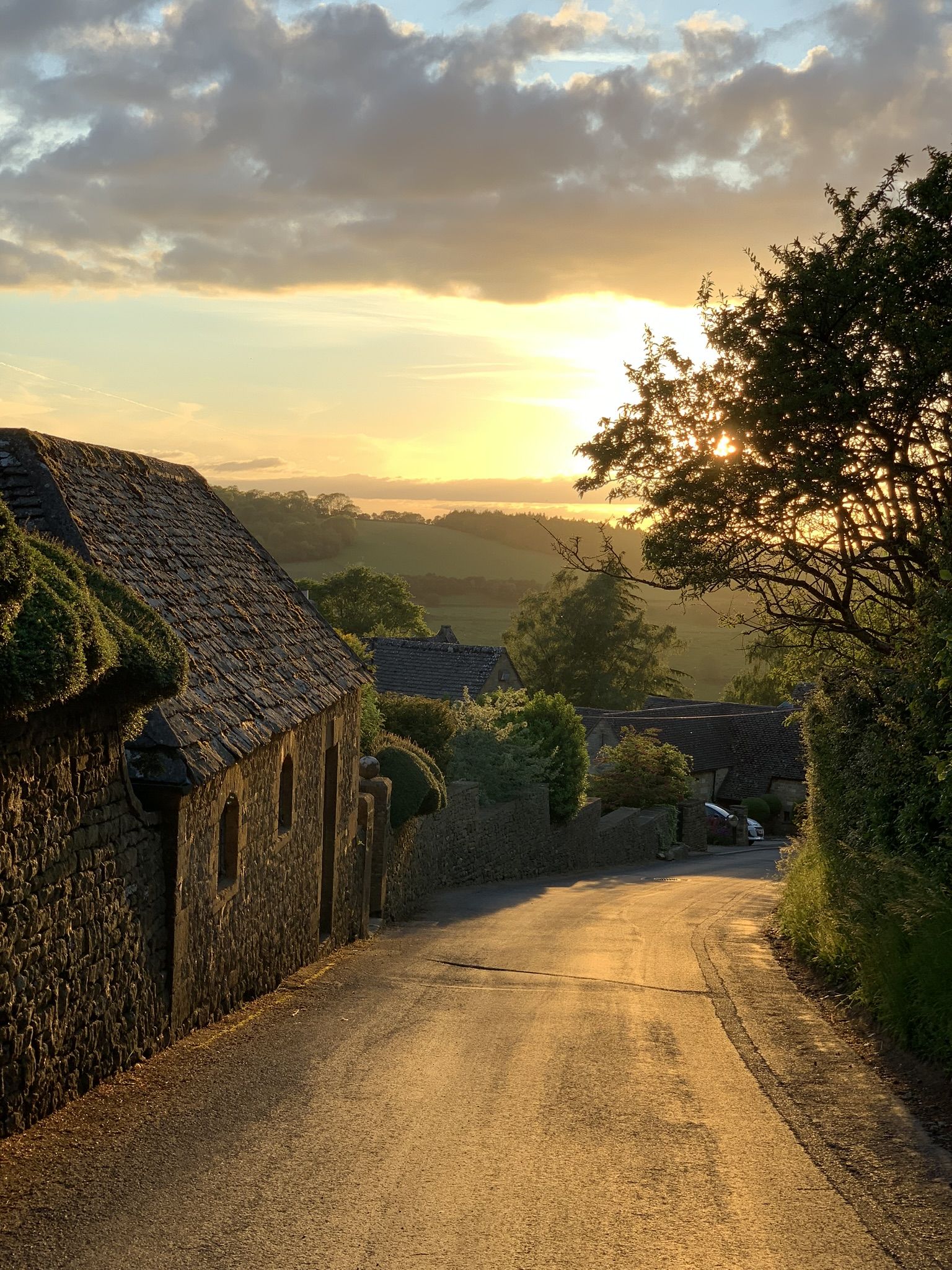
Stanway, Gloucestershire

Stanway is a small village and civil parish in the county of Gloucestershire, England, and about 1 mile south of Stanton: both villages are on the Cotswold...

Cutsdean

Cutsdean is a rural village in the Cotswolds and smaller than average sized parish, a few miles east north-east of Cheltenham, Gloucestershire and the...

Nearby Amenities

Located within 500m of 51.988803,-1.8790999
The data included in this document is from www.openstreetmap.org. The data is made available under ODbL.

Have you been to Stanway Ash Wood?

Leave your review of Stanway Ash Wood below (or comments, questions and feedback).