Cowlease Grove
Wood, Forest in Gloucestershire Cotswold
England
Cowlease Grove
![A walk around the Fosse Way [28] The Far Peak entrance, seen from the minor road that is the Salt Way. Far Peak offers a climbing gym and a campsite amongst other facilities.
The Salt Way is an old British trackway, which runs from Droitwich through Worcestershire, and into Gloucestershire near Ashton-under‑Hill. It then runs past Hawling, Salperton, and Hazleton to cross the Fosse Way between Northleach and Stowell Park. It then proceeds by Crickley Barrow to Coln St. Aldwyns, where it crosses Ikenild Street and leaves Gloucestershire at Lechlade on its way to the coast of Hampshire.
Starting at Fossebridge, where the Fosse Way descends precipitously to cross the River Coln, the walk gently ascends on a road and then a bridleway to meet a minor road which is part of the Salt Way. After using the Salt Way to cross the Fosse Way the route descends on footpaths and minor roads via Oxpens Farm and Stowell Mill to return to Fossebridge.](https://s3.geograph.org.uk/geophotos/06/99/66/6996687_297b4257.jpg)
Cowlease Grove is a picturesque woodland area located in Gloucestershire, England. Situated near the village of Cowlease, the grove is renowned for its natural beauty and diverse ecosystem. Covering an area of approximately 50 acres, Cowlease Grove is predominantly made up of mature oak, beech, and birch trees, creating a dense and enchanting forest.
The grove is a popular destination for nature enthusiasts and hikers, offering a range of well-marked trails that wind through the woodland. These trails provide visitors with the opportunity to explore the grove's varied terrain, which includes gentle slopes, open glades, and small streams. Additionally, the grove is home to an abundance of wildlife, including deer, squirrels, and various bird species, making it a haven for birdwatchers and wildlife photographers.
Cowlease Grove is also of historical significance, with evidence of human activity dating back thousands of years. Archaeological remains, including Iron Age hill forts and Roman settlements, have been discovered in the vicinity of the grove, adding to its cultural and historical value.
The grove offers a peaceful and tranquil escape from the hustle and bustle of urban life, attracting visitors who seek solace in nature. It is a popular spot for picnics, family outings, and nature walks. With its stunning natural scenery and rich biodiversity, Cowlease Grove is a cherished natural gem in the heart of Gloucestershire.
If you have any feedback on the listing, please let us know in the comments section below.
Cowlease Grove Images
Images are sourced within 2km of 51.829684/-1.8796415 or Grid Reference SP0814. Thanks to Geograph Open Source API. All images are credited.
![A walk around the Fosse Way [29] The campsite at Far Peak. Seen from the minor road that is the Salt Way.
The Salt Way is an old British trackway, which runs from Droitwich through Worcestershire, and into Gloucestershire near Ashton-under‑Hill. It then runs past Hawling, Salperton, and Hazleton to cross the Fosse Way between Northleach and Stowell Park. It then proceeds by Crickley Barrow to Coln St. Aldwyns, where it crosses Ikenild Street and leaves Gloucestershire at Lechlade on its way to the coast of Hampshire.
Starting at Fossebridge, where the Fosse Way descends precipitously to cross the River Coln, the walk gently ascends on a road and then a bridleway to meet a minor road which is part of the Salt Way. After using the Salt Way to cross the Fosse Way the route descends on footpaths and minor roads via Oxpens Farm and Stowell Mill to return to Fossebridge.](https://s0.geograph.org.uk/geophotos/06/99/66/6996688_4f85b31f.jpg)
![A walk around the Fosse Way [30] The entrance to Northfields from the minor road that is the Salt Way. The sign on the tree states: 'This is not the campsite'.
The Salt Way is an old British trackway, which runs from Droitwich through Worcestershire, and into Gloucestershire near Ashton-under‑Hill. It then runs past Hawling, Salperton, and Hazleton to cross the Fosse Way between Northleach and Stowell Park. It then proceeds by Crickley Barrow to Coln St. Aldwyns, where it crosses Ikenild Street and leaves Gloucestershire at Lechlade on its way to the coast of Hampshire.
Starting at Fossebridge, where the Fosse Way descends precipitously to cross the River Coln, the walk gently ascends on a road and then a bridleway to meet a minor road which is part of the Salt Way. After using the Salt Way to cross the Fosse Way the route descends on footpaths and minor roads via Oxpens Farm and Stowell Mill to return to Fossebridge.](https://s1.geograph.org.uk/geophotos/06/99/66/6996689_7f745463.jpg)
![A walk around the Fosse Way [31] This former filling station on Fosse Way, (A429 road) is now a lawn mower servicing centre.
The Fosse Way was a Roman road built during the first and second centuries that linked Exeter in the southwest and Lincoln to the northeast.
Starting at Fossebridge, where the Fosse Way descends precipitously to cross the River Coln, the walk gently ascends on a road and then a bridleway to meet a minor road which is part of the Salt Way. After using the Salt Way to cross the Fosse Way the route descends on footpaths and minor roads via Oxpens Farm and Stowell Mill to return to Fossebridge.](https://s2.geograph.org.uk/geophotos/06/99/66/6996690_b0ca5c15.jpg)
![A walk around the Fosse Way [32] The Fosse Way (A429 road) looking northeast. Minor roads, part of the Salt Way, turn off to both left and right.
The Fosse Way was a Roman road built during the first and second centuries that linked Exeter in the southwest and Lincoln to the northeast.
The Salt Way is an old British trackway, which runs from Droitwich through Worcestershire, and into Gloucestershire near Ashton-under‑Hill. It then runs past Hawling, Salperton, and Hazleton to cross the Fosse Way between Northleach and Stowell Park. It then proceeds by Crickley Barrow to Coln St. Aldwyns, where it crosses Ikenild Street and leaves Gloucestershire at Lechlade on its way to the coast of Hampshire.
Starting at Fossebridge, where the Fosse Way descends precipitously to cross the River Coln, the walk gently ascends on a road and then a bridleway to meet a minor road which is part of the Salt Way. After using the Salt Way to cross the Fosse Way the route descends on footpaths and minor roads via Oxpens Farm and Stowell Mill to return to Fossebridge.](https://s1.geograph.org.uk/geophotos/06/99/66/6996693_85c467e5.jpg)
![A walk around the Fosse Way [33] Another minor road crosses the Salt Way. This is the minor road heading southwest towards Yarnworth.
The Salt Way is an old British trackway, which runs from Droitwich through Worcestershire, and into Gloucestershire near Ashton-under‑Hill. It then runs past Hawling, Salperton, and Hazleton to cross the Fosse Way between Northleach and Stowell Park. It then proceeds by Crickley Barrow to Coln St. Aldwyns, where it crosses Ikenild Street and leaves Gloucestershire at Lechlade on its way to the coast of Hampshire.
Starting at Fossebridge, where the Fosse Way descends precipitously to cross the River Coln, the walk gently ascends on a road and then a bridleway to meet a minor road which is part of the Salt Way. After using the Salt Way to cross the Fosse Way the route descends on footpaths and minor roads via Oxpens Farm and Stowell Mill to return to Fossebridge.](https://s2.geograph.org.uk/geophotos/06/99/66/6996698_a48181d0.jpg)
![A walk around the Fosse Way [34] Another minor road crosses the Salt Way. This is the minor road heading northeast towards Northleach.
The Salt Way is an old British trackway, which runs from Droitwich through Worcestershire, and into Gloucestershire near Ashton-under‑Hill. It then runs past Hawling, Salperton, and Hazleton to cross the Fosse Way between Northleach and Stowell Park. It then proceeds by Crickley Barrow to Coln St. Aldwyns, where it crosses Ikenild Street and leaves Gloucestershire at Lechlade on its way to the coast of Hampshire.
Starting at Fossebridge, where the Fosse Way descends precipitously to cross the River Coln, the walk gently ascends on a road and then a bridleway to meet a minor road which is part of the Salt Way. After using the Salt Way to cross the Fosse Way the route descends on footpaths and minor roads via Oxpens Farm and Stowell Mill to return to Fossebridge.](https://s3.geograph.org.uk/geophotos/06/99/66/6996699_14a4ffd6.jpg)
![A walk around the Fosse Way [35] Here another minor road crosses the Salt Way. This is the Salt Way heading southeast towards the Fosse Way and Bibury.
The Salt Way is an old British trackway, which runs from Droitwich through Worcestershire, and into Gloucestershire near Ashton-under‑Hill. It then runs past Hawling, Salperton, and Hazleton to cross the Fosse Way between Northleach and Stowell Park. It then proceeds by Crickley Barrow to Coln St. Aldwyns, where it crosses Ikenild Street and leaves Gloucestershire at Lechlade on its way to the coast of Hampshire.
Starting at Fossebridge, where the Fosse Way descends precipitously to cross the River Coln, the walk gently ascends on a road and then a bridleway to meet a minor road which is part of the Salt Way. After using the Salt Way to cross the Fosse Way the route descends on footpaths and minor roads via Oxpens Farm and Stowell Mill to return to Fossebridge.](https://s1.geograph.org.uk/geophotos/06/99/67/6996701_15b2f391.jpg)
![A walk around the Fosse Way [36] Here another minor road crosses the Salt Way. This is the Salt Way heading northwest towards Andoversford.
The Salt Way is an old British trackway, which runs from Droitwich through Worcestershire, and into Gloucestershire near Ashton-under‑Hill. It then runs past Hawling, Salperton, and Hazleton to cross the Fosse Way between Northleach and Stowell Park. It then proceeds by Crickley Barrow to Coln St. Aldwyns, where it crosses Ikenild Street and leaves Gloucestershire at Lechlade on its way to the coast of Hampshire.
Starting at Fossebridge, where the Fosse Way descends precipitously to cross the River Coln, the walk gently ascends on a road and then a bridleway to meet a minor road which is part of the Salt Way. After using the Salt Way to cross the Fosse Way the route descends on footpaths and minor roads via Oxpens Farm and Stowell Mill to return to Fossebridge.](https://s3.geograph.org.uk/geophotos/06/99/67/6996703_fa9179c9.jpg)
![A walk around the Fosse Way [37] A large covered reservoir is seen from the minor road that is the Salt Way.
The Salt Way is an old British trackway, which runs from Droitwich through Worcestershire, and into Gloucestershire near Ashton-under‑Hill. It then runs past Hawling, Salperton, and Hazleton to cross the Fosse Way between Northleach and Stowell Park. It then proceeds by Crickley Barrow to Coln St. Aldwyns, where it crosses Ikenild Street and leaves Gloucestershire at Lechlade on its way to the coast of Hampshire.
Starting at Fossebridge, where the Fosse Way descends precipitously to cross the River Coln, the walk gently ascends on a road and then a bridleway to meet a minor road which is part of the Salt Way. After using the Salt Way to cross the Fosse Way the route descends on footpaths and minor roads via Oxpens Farm and Stowell Mill to return to Fossebridge.](https://s0.geograph.org.uk/geophotos/06/99/67/6996704_b8072565.jpg)
![A walk around the Fosse Way [38] Problems with a lorry on the minor road.
Starting at Fossebridge, where the Fosse Way descends precipitously to cross the River Coln, the walk gently ascends on a road and then a bridleway to meet a minor road which is part of the Salt Way. After using the Salt Way to cross the Fosse Way the route descends on footpaths and minor roads via Oxpens Farm and Stowell Mill to return to Fossebridge.](https://s1.geograph.org.uk/geophotos/06/99/67/6996705_d1ce9739.jpg)
![A walk around the Fosse Way [39] A pylon on the bridleway.
Starting at Fossebridge, where the Fosse Way descends precipitously to cross the River Coln, the walk gently ascends on a road and then a bridleway to meet a minor road which is part of the Salt Way. After using the Salt Way to cross the Fosse Way the route descends on footpaths and minor roads via Oxpens Farm and Stowell Mill to return to Fossebridge.](https://s2.geograph.org.uk/geophotos/06/99/67/6996706_ff897873.jpg)
![A walk around the Fosse Way [40] From the bridleway this path runs through the crop towards Oxpens Farm.
Starting at Fossebridge, where the Fosse Way descends precipitously to cross the River Coln, the walk gently ascends on a road and then a bridleway to meet a minor road which is part of the Salt Way. After using the Salt Way to cross the Fosse Way the route descends on footpaths and minor roads via Oxpens Farm and Stowell Mill to return to Fossebridge.](https://s3.geograph.org.uk/geophotos/06/99/67/6996707_177b6924.jpg)
![A walk around the Fosse Way [41] The path through the crop heads towards the gap in the trees on the skyline.
Starting at Fossebridge, where the Fosse Way descends precipitously to cross the River Coln, the walk gently ascends on a road and then a bridleway to meet a minor road which is part of the Salt Way. After using the Salt Way to cross the Fosse Way the route descends on footpaths and minor roads via Oxpens Farm and Stowell Mill to return to Fossebridge.](https://s2.geograph.org.uk/geophotos/06/99/67/6996726_9a1adfd1.jpg)
![A walk around the Fosse Way [42] An 'island' of trees in the fields of crops. Seen from the path.
Starting at Fossebridge, where the Fosse Way descends precipitously to cross the River Coln, the walk gently ascends on a road and then a bridleway to meet a minor road which is part of the Salt Way. After using the Salt Way to cross the Fosse Way the route descends on footpaths and minor roads via Oxpens Farm and Stowell Mill to return to Fossebridge.](https://s3.geograph.org.uk/geophotos/06/99/67/6996727_f9a88998.jpg)
![A walk around the Fosse Way [43] The path near the gap in the trees.
Starting at Fossebridge, where the Fosse Way descends precipitously to cross the River Coln, the walk gently ascends on a road and then a bridleway to meet a minor road which is part of the Salt Way. After using the Salt Way to cross the Fosse Way the route descends on footpaths and minor roads via Oxpens Farm and Stowell Mill to return to Fossebridge.](https://s1.geograph.org.uk/geophotos/06/99/67/6996729_0a7cab98.jpg)
![A walk around the Fosse Way [44] The two paths (seen at <a href="https://www.geograph.org.uk/photo/6996707">SP0914 : A walk around the Fosse Way [40]</a> and at <a href="https://www.geograph.org.uk/photo/6996726">SP0914 : A walk around the Fosse Way [41]</a>) have merged and crest the slight ridge before starting to descent towards Oxpen Farm. The path is now part of the long distance Monarch&#039;s Way.
Starting at Fossebridge, where the Fosse Way descends precipitously to cross the River Coln, the walk gently ascends on a road and then a bridleway to meet a minor road which is part of the Salt Way. After using the Salt Way to cross the Fosse Way the route descends on footpaths and minor roads via Oxpens Farm and Stowell Mill to return to Fossebridge.](https://s3.geograph.org.uk/geophotos/06/99/67/6996731_7572dab5.jpg)
![A walk around the Fosse Way [45] A crop of linseed alongside the path.
Starting at Fossebridge, where the Fosse Way descends precipitously to cross the River Coln, the walk gently ascends on a road and then a bridleway to meet a minor road which is part of the Salt Way. After using the Salt Way to cross the Fosse Way the route descends on footpaths and minor roads via Oxpens Farm and Stowell Mill to return to Fossebridge.](https://s1.geograph.org.uk/geophotos/06/99/67/6996733_77a555d7.jpg)
Cowlease Grove is located at Grid Ref: SP0814 (Lat: 51.829684, Lng: -1.8796415)
Administrative County: Gloucestershire
District: Cotswold
Police Authority: Gloucestershire
What 3 Words
///wager.decades.post. Near Northleach, Gloucestershire
Nearby Locations
Related Wikis
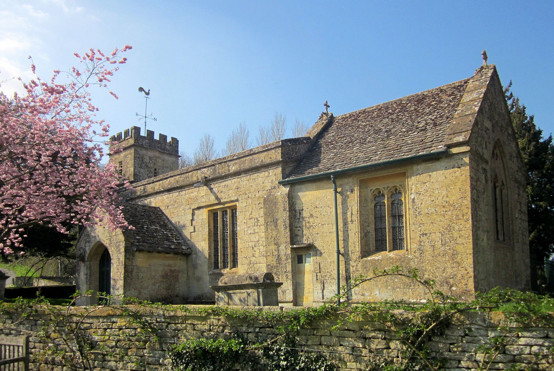
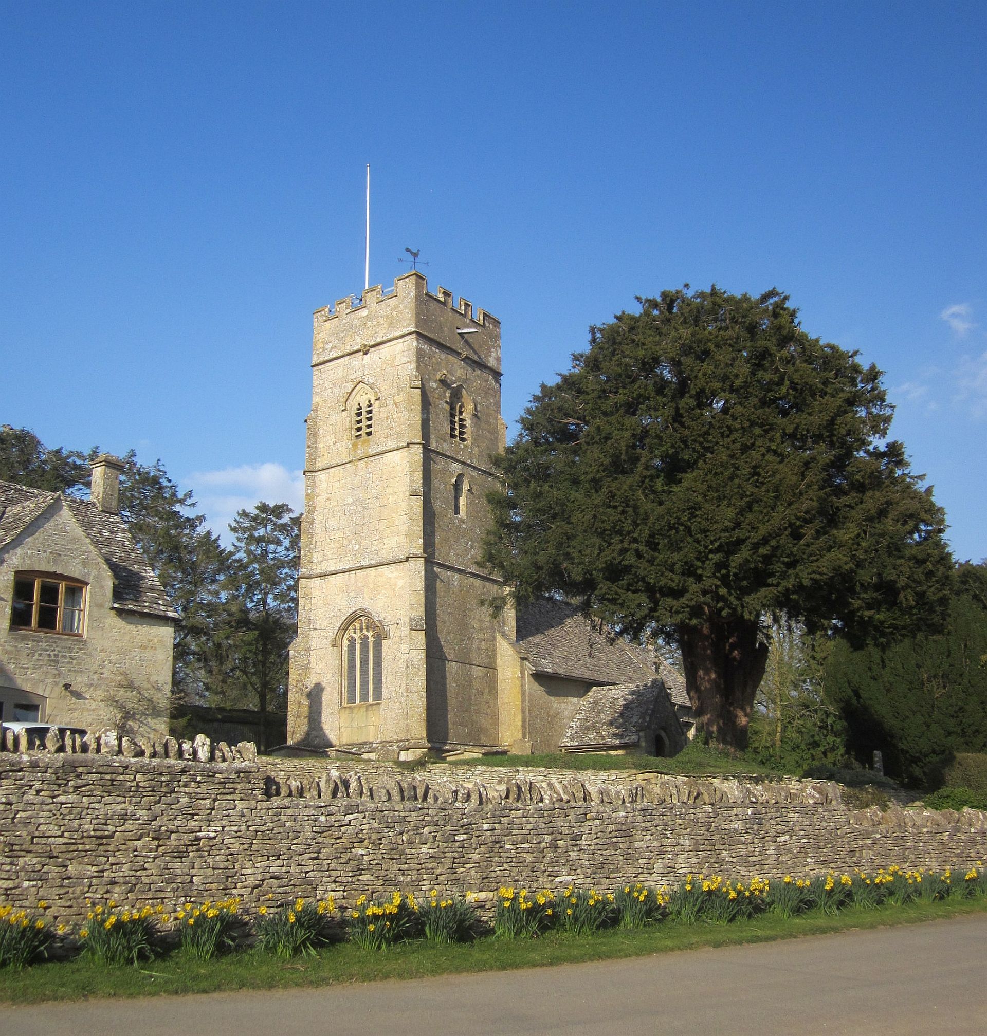
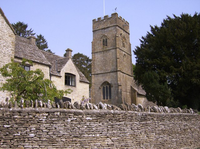
St Michael's Church, Yanworth
The Church of St. Michael is the parish church of Yanworth, Gloucestershire, England. The church is a Grade II* listed building dating from the late-12th...
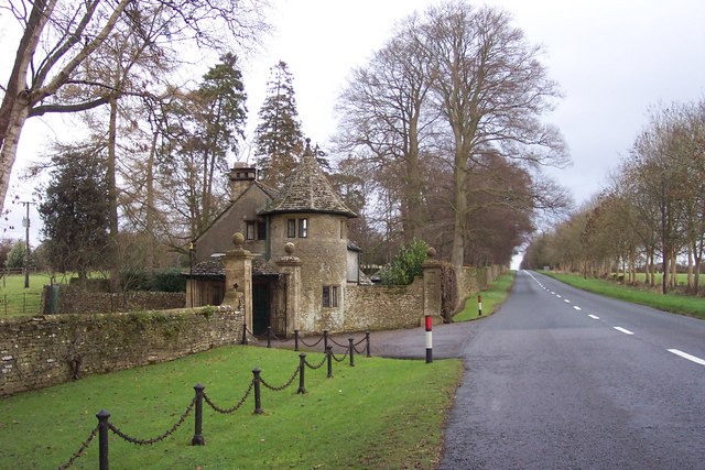
Stowell Park
Stowell Park Estate is a 6,000-acre (24 km2) historic agricultural and sporting estate in the Cotswold Hills, Gloucestershire, England. The estate includes...
Yanworth
Yanworth is a small rural parish located in the county of Gloucestershire, England 14 miles south east of Cheltenham and 88 miles North West of London...
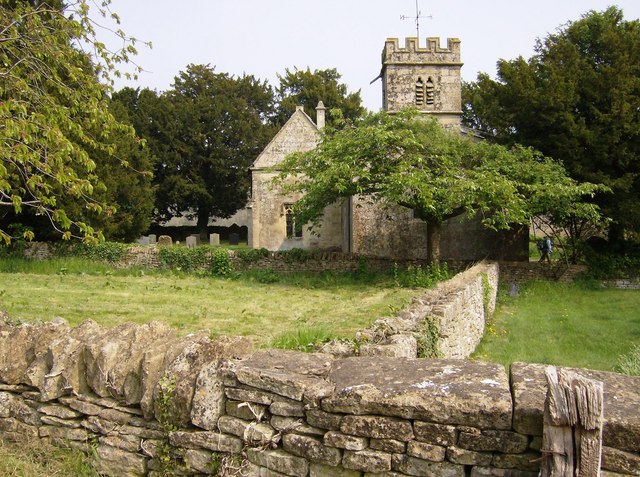
Church of St Leonard, Stowell Park
The Anglican Church of St Leonard at Stowell Park, in the Cotswold District of Gloucestershire, England was built in the 12th century. It is a grade I...
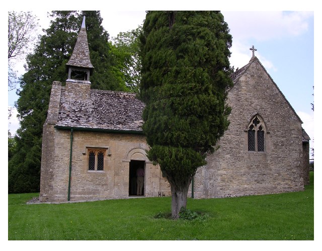
Church of St George, Hampnett
The Anglican Church of St George at Hampnett in the Cotswold District of Gloucestershire, England was built in 12th century. It is a grade I listed building...
Hampnett
Hampnett is a small village and civil parish in Gloucestershire, England, just west of the Fosse Way. It is situated west of the junction of the A40 and...

Compton Abdale
Compton Abdale is a small village in Gloucestershire, England on the Roman "White Way" which ran North from Cirencester ("Corinium.") The village lies...

RAF Northleach
Royal Air Force Northleach or more simply RAF Northleach is a former Royal Air Force satellite airfield near the Cotswold town of Northleach, Gloucestershire...
Related Videos

Early Morning Walk During Heavy Rainfall in the Village of Compton Abdale
So, today we are out and about walking in the Cotswold village and parish of Compton Abdale which is located in Gloucestershire ...

A Breezy & Solitary Walk in the Cotswold Village of Yanworth
So, today we are out and about walking in the Cotswold village and parish of Yanworth, which is located in the county of ...

4K Cotswold Way (UK) Hiking - 3rd Stop Winchcombe
I will take you to some of the most iconic hiking trails in the UK, across many charming towns and rural scenery. There will be no ...

Cotswolds Wool Church Walking Tour | Northleach - English Countryside
14th-15th Century Historic Cotswolds wool CHURCH Northleach Postcode: GL54 Northleach is certainly one of the best kept ...
Nearby Amenities
Located within 500m of 51.829684,-1.8796415Have you been to Cowlease Grove?
Leave your review of Cowlease Grove below (or comments, questions and feedback).