Argoed

Settlement in Montgomeryshire

Wales

Argoed

Fork to Pen-y-cwm Looking uphill towards the Kerry Ridgeway.
Fork to Pen-y-cwm Credit: Jonathan Billinger

Argoed is a small village located in the county of Montgomeryshire, Wales. Situated in the picturesque countryside, the village is surrounded by rolling hills and lush green fields. It is part of the community of Llanbrynmair and lies approximately 9 miles west of the town of Newtown.

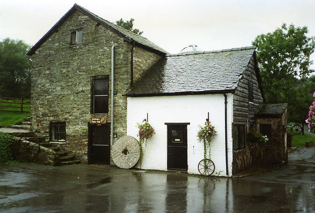
With a population of around 250 residents, Argoed maintains a close-knit community atmosphere. The village is known for its peaceful and tranquil environment, making it an ideal place for those seeking a calm and rural lifestyle. The majority of the houses in Argoed are traditional stone cottages, adding to the village's charm and character.

Despite its small size, Argoed offers several amenities for its residents. These include a local pub, a village hall, and a post office. There is also a primary school in the nearby village of Llanbrynmair, providing education for the village's younger population.

The village is well-positioned for outdoor enthusiasts, with numerous walking and cycling routes in the surrounding countryside. The nearby Hafren Forest offers beautiful woodland trails and stunning views. Additionally, the River Severn flows close to the village, providing opportunities for fishing and other water-based activities.

Argoed is also conveniently located for those who require access to larger towns and cities. Newtown, the nearest town, offers a wider range of amenities including supermarkets, shops, and leisure facilities. The village is well-connected by road, with the A470 running nearby, providing easy access to other parts of Montgomeryshire and beyond.

If you have any feedback on the listing, please let us know in the comments section below.
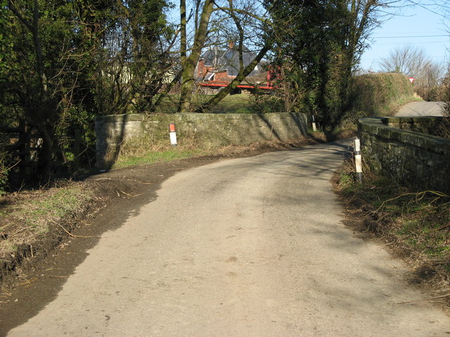
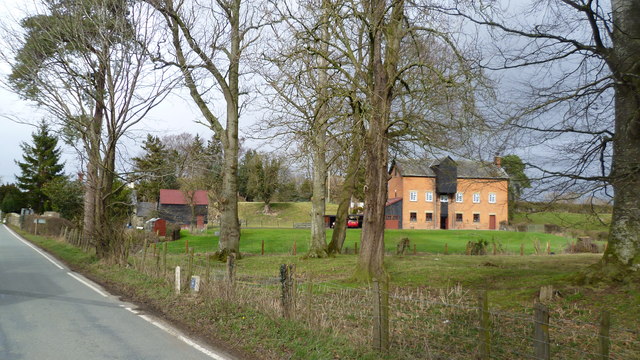
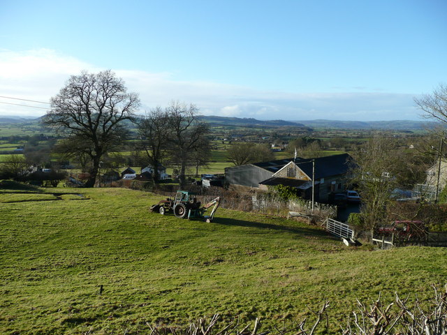
Argoed Images

Images are sourced within 2km of 52.50272/-3.1063239 or Grid Reference SO2590. Thanks to Geograph Open Source API. All images are credited.

Fork to Pen-y-cwm Looking uphill towards the Kerry Ridgeway.
Fork to Pen-y-cwm
Looking uphill towards the Kerry Ridgeway.
Cwmlladron dingle The wooded upper valley is like a notch in the side of the Shadwell Hill massif.
Cwmlladron dingle
The wooded upper valley is like a notch in the side of the Shadwell Hill massif.
Welsh borders The edge of Wales and Shropshire is typified by rolling hills with wooded valleys of dingles notched into the landscape.
Welsh borders
The edge of Wales and Shropshire is typified by rolling hills with wooded valleys of dingles notched into the landscape.
On ODP near Nut Wood Down in the deep valley.
On ODP near Nut Wood
Down in the deep valley.
On ODP below Nut Wood Nice steep pull.
On ODP below Nut Wood
Nice steep pull.
On ODP beside Nut Wood Kissing gate replacing old stiles.
On ODP beside Nut Wood
Kissing gate replacing old stiles.
Pond beside ODP A little man made pond I suspect.
Pond beside ODP
A little man made pond I suspect.
Gate on ODP where the Kerry Ridgeway crosses too The lane carries the Kerry Ridgeway I believe.
Gate on ODP where the Kerry Ridgeway crosses too
The lane carries the Kerry Ridgeway I believe.
On Offa's Dyke Path below Crowsnest Cottage Great ODP view towards lovely Corndon Hill.
On Offa's Dyke Path below Crowsnest Cottage
Great ODP view towards lovely Corndon Hill.
Upper Castlewright farm from Offa's Dyke Path Nice upland farm here.
Upper Castlewright farm from Offa's Dyke Path
Nice upland farm here.
Dog and Duck Cottage Viewed from the Welsh side of the border.
Dog and Duck Cottage
Viewed from the Welsh side of the border.
Welsh Sheep In The Meadow With Corndon Hill on the horizon.
Welsh Sheep In The Meadow
With Corndon Hill on the horizon.
Ordnance Survey Rivet This OS rivet can be found on the cattle grid. It marks a point 414.979m above mean sea level.
Ordnance Survey Rivet
This OS rivet can be found on the cattle grid. It marks a point 414.979m above mean sea level.
Ordnance Survey Cut Mark This OS cut mark can be found on the Pump House NE side of the road. It marks a point 410.126m above mean sea level.
Ordnance Survey Cut Mark
This OS cut mark can be found on the Pump House NE side of the road. It marks a point 410.126m above mean sea level.
Unk in the Valley - Mainstone, Shropshire Another photo from my March 1980 north - south walk on the Offa's Dyke Path. Here a look back north from Edenhope Hill to the River Unk and Nut Wood. The River Unk, 9.7 miles/15.6 kilometres in length, rises at a point east of the Lower Short Ditch <a href="https://www.geograph.org.uk/gridref/SO2288">SO2288</a> a Bronze Age cross dyke. It then runs southwards past Mainstone <a href="https://www.geograph.org.uk/gridref/SO2787">SO2787</a> to join the River Clun at the village of Clun <a href="https://www.geograph.org.uk/gridref/SO2981">SO2981</a>. Time photo taken not available. Source: Wikipedia. <a href="https://www.geograph.org.uk/photo/5758871">SO2688 : Offa's Dyke above the Unk valley</a>
Unk in the Valley - Mainstone, Shropshire
Another photo from my March 1980 north - south walk on the Offa's Dyke Path. Here a look back north from Edenhope Hill to the River Unk and Nut Wood. The River Unk, 9.7 miles/15.6 kilometres in length, rises at a point east of the Lower Short Ditch SO2288 a Bronze Age cross dyke. It then runs southwards past Mainstone SO2787 to join the River Clun at the village of Clun SO2981. Time photo taken not available. Source: Wikipedia. SO2688 : Offa's Dyke above the Unk valley
Dog and Duck, Kerry Ridgeway
Road on Edenhope Hill
Unenclosed pasture, Edenhope Hill
Show me another place!

Argoed is located at Grid Ref: SO2590 (Lat: 52.50272, Lng: -3.1063239)

Unitary Authority: Powys

Police Authority: Dyfed Powys

What 3 Words

///misty.blanking.rules. Near Mainstone, Shropshire

Related Wikis

Bacheldre

Bacheldre (Welsh: Bachelldref or Bachelldre) is a small settlement in Powys, Wales. It is near the A489 road and is 5 kilometres (3 mi) southeast of the...

Pentreheyling

Pentreheyling is a hamlet in Shropshire, England. It lies just west of Brompton on the A489 between Church Stoke and Newtown. The hamlet is notable for...

Brompton, Shropshire

Brompton (Welsh: Brontyn) is a hamlet in Shropshire, England. It lies on the A489 between Church Stoke and Newtown (both in Powys) at its junction with...

Mainstone

Mainstone is a small village and civil parish in southwest Shropshire, England, near the border with Powys, Wales. The village lies approximately 1 mile...

City, Powys

City is a hamlet in Powys, Wales. == Geography == City is 0.75 miles (1.21 km) from the small village of Sarn (which is situated on the A489 road) and...

The Lack, Brompton

The Lack is a Grade II* listed building, formerly in the historic parish of Churchstoke but now in the parish of Chirbury with Brompton in Shropshire....

Brompton and Rhiston

Brompton and Rhiston was a civil parish in Shropshire, England. In 1987 it merged with Chirbury civil parish to form the present-day civil parish of Chirbury...

Old Church Stoke

Old Church Stoke is a village in the community of Churchstoke in Powys, Wales. Until 1974 it was in the county of Montgomeryshire. The name, as a distinct...

Nearby Amenities

Located within 500m of 52.50272,-3.1063239
Ford: yes
Lat/Long: 52.504611/-3.1096431
The data included in this document is from www.openstreetmap.org. The data is made available under ODbL.

Have you been to Argoed?

Leave your review of Argoed below (or comments, questions and feedback).