Stephen Bank Wood

Wood, Forest in Yorkshire Harrogate

England

Stephen Bank Wood

Low Moor, Langbar Low Moor, close to where it gives way to improved land at about 250m above sea level in lower Wharfedale.
Low Moor, Langbar Credit: Gordon Hatton

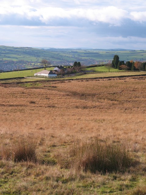
Stephen Bank Wood is a small woodland area located in Yorkshire, England. Situated near the village of Stephen Bank, it covers an area of approximately 50 hectares. The wood is characterized by its dense forest and diverse range of flora and fauna.

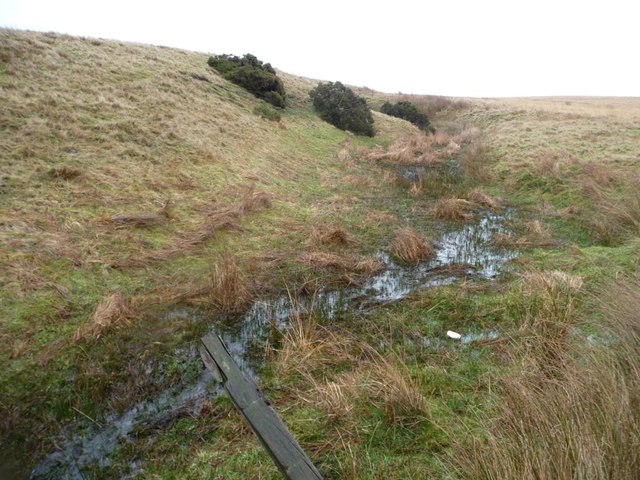
The woodland is primarily composed of deciduous trees such as oak, beech, and birch, which form a lush canopy overhead. These trees provide a habitat for a variety of wildlife, including birds, squirrels, and deer. The forest floor is covered in a rich carpet of mosses, ferns, and wildflowers, creating a picturesque and tranquil environment.

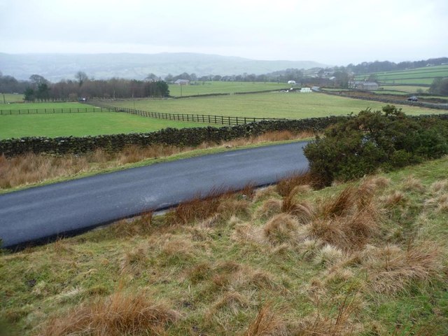
Stephen Bank Wood is a popular destination for nature enthusiasts and hikers, offering a network of well-maintained footpaths that wind through the woodland. These paths allow visitors to explore the different sections of the wood and discover its hidden gems. The wood also features a small picnic area, providing a perfect spot for visitors to relax and enjoy the natural surroundings.

The wood is owned and managed by the local council, who work to preserve its natural beauty and protect its ecosystem. They regularly carry out maintenance and conservation efforts to ensure the longevity of the woodland and its inhabitants.

Overall, Stephen Bank Wood is a charming and idyllic woodland area in Yorkshire, offering a peaceful retreat for nature lovers and a chance to immerse oneself in the beauty of the natural world.

If you have any feedback on the listing, please let us know in the comments section below.

Stephen Bank Wood Images

Images are sourced within 2km of 53.952702/-1.8768415 or Grid Reference SE0850. Thanks to Geograph Open Source API. All images are credited.

Low Moor, Langbar Low Moor, close to where it gives way to improved land at about 250m above sea level in lower Wharfedale.
Low Moor, Langbar
Low Moor, close to where it gives way to improved land at about 250m above sea level in lower Wharfedale.
Footpath on Low Moor A rather muddy soggy excuse for a footpath follows the stunted wall on Low Moor, heading towards Chapel House
Footpath on Low Moor
A rather muddy soggy excuse for a footpath follows the stunted wall on Low Moor, heading towards Chapel House
Moor End Farm Farmhouse on the edge of Langbar Moor
Moor End Farm
Farmhouse on the edge of Langbar Moor
Track leading onto Langbar Moor Rough track leaving the lane beside Moor End Farm
Track leading onto Langbar Moor
Rough track leaving the lane beside Moor End Farm
Lane to Nesfield at Low Moor
Moor End Farm
Moor End Farm
Gully of a moorland stream coming from Delves Tarn On the east side of Hardings Lane, near Moor End Farm.
Gully of a moorland stream coming from Delves Tarn
On the east side of Hardings Lane, near Moor End Farm.
Moorland stream coming from Delves Tarn About to pass under Hardings Lane.
Moorland stream coming from Delves Tarn
About to pass under Hardings Lane.
Moor End Farm, Langbar Farming at the edge of moorland, about 240 metres above sea level.
Moor End Farm, Langbar
Farming at the edge of moorland, about 240 metres above sea level.
Fencing in a land of drystone walls Field boundaries on the west side of Hardings Lane at Moor End, Langbar.
Fencing in a land of drystone walls
Field boundaries on the west side of Hardings Lane at Moor End, Langbar.
Bijou shippon near the head of Dean Beck A small, but perfectly formed, example of typical field building architecture in Wharfedale
Bijou shippon near the head of Dean Beck
A small, but perfectly formed, example of typical field building architecture in Wharfedale
Lane off Bolton Road, Addingham Also hosting a public footpath.
Lane off Bolton Road, Addingham
Also hosting a public footpath.
Bolton Road, Addingham (2) At its junction with The Acres (right).
Bolton Road, Addingham (2)
At its junction with The Acres (right).
Harcourt Drive, Addingham Off Bolton Road.
Harcourt Drive, Addingham
Off Bolton Road.
Bolton Road, Addingham (3) At its junction with Bark Lane, on the northern edge of the village.
Bolton Road, Addingham (3)
At its junction with Bark Lane, on the northern edge of the village.
North west end of Bark Lane, Addingham Where it meets Bolton Road.
North west end of Bark Lane, Addingham
Where it meets Bolton Road.
Beamsley, Bowers Hill The rivet benchmark is cut into the lowest stone in the wall on the east side of the lane.
Beamsley, Bowers Hill
The rivet benchmark is cut into the lowest stone in the wall on the east side of the lane.
Beamsley, Bowers Hill There is a rivet benchmark cut into the lowest course of stone in the wall on the east side of the lane.
Beamsley, Bowers Hill
There is a rivet benchmark cut into the lowest course of stone in the wall on the east side of the lane.
Show me another place!

Stephen Bank Wood is located at Grid Ref: SE0850 (Lat: 53.952702, Lng: -1.8768415)

Division: West Riding

Administrative County: North Yorkshire

District: Harrogate

Police Authority: North Yorkshire

What 3 Words

///clarifies.asleep.gratitude. Near Addingham, West Yorkshire

Related Wikis

Addingham railway station

Addingham railway station was on the Midland Railway route from Skipton to Ilkley. It served the village of Addingham in West Yorkshire, England. ��2...

St Peter's Church, Addingham

St Peter's Church is a Church of England parish church in Addingham, West Yorkshire. It is a Grade I listed building, with the main structure dating to...

Farfield Friends Meeting House

Farfield Friends Meeting House is a Quaker meeting house no longer regularly in use by a Quaker meeting and now owned by the Historic Chapels Trust. It...

Nesfield

Nesfield is a small village, 2 miles (3.2 km) north-west of Ilkley on the north bank of the River Wharfe, in the civil parish of Nesfield with Langbar...

Nearby Amenities

Located within 500m of 53.952702,-1.8768415
Barrier: stile
Lat/Long: 53.95172/-1.877055
Barrier: stile
Lat/Long: 53.9528828/-1.8778267
Barrier: stile
Lat/Long: 53.9497405/-1.8767706
Barrier: stile
Lat/Long: 53.9550043/-1.8805152
Turning Circle
Source: Bing
Lat/Long: 53.9484099/-1.878037
lime kiln
Archaeological Site: lime_kiln
Historic: archaeological_site
Output: lime
Source: OS sheet 169,publ 1853
Lat/Long: 53.949486/-1.8746862
Generator Method: photovoltaic
Generator Output Electricity: yes
Generator Source: solar
Generator Type: solar_photovoltaic_panel
Power: generator
Lat/Long: 53.954796/-1.8833545
The data included in this document is from www.openstreetmap.org. The data is made available under ODbL.

Have you been to Stephen Bank Wood?

Leave your review of Stephen Bank Wood below (or comments, questions and feedback).