Cutsdean

Settlement in Gloucestershire Cotswold

England

Cutsdean

Campden Lane heading towards Stumps Cross The track gives more than just farm access, and links Stumps Cross with Lynes Barn.
Campden Lane heading towards Stumps Cross Credit: Bill Boaden

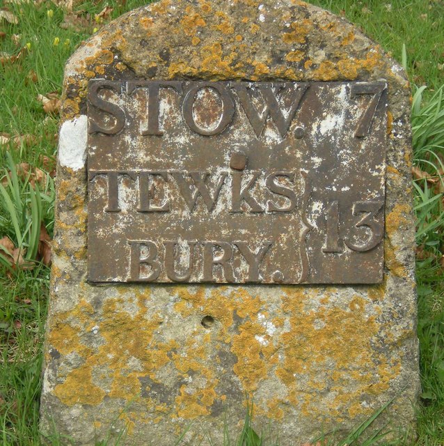
Cutsdean is a small village located in the county of Gloucestershire, England. Situated on the western edge of the Cotswolds, it is surrounded by picturesque rolling hills and charming countryside. The village is part of the larger civil parish of Guiting Power and lies approximately 5 miles northeast of the town of Stow-on-the-Wold.

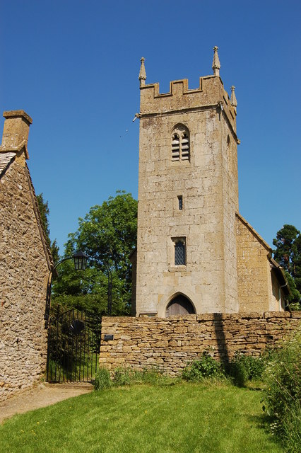
With its quaint and idyllic setting, Cutsdean offers a peaceful and tranquil atmosphere. The village is characterized by traditional stone houses and cottages, which add to its rural charm. Although small in size, Cutsdean is known for its strong sense of community and friendly residents.

Despite its remote location, Cutsdean benefits from good transport links. The nearby A429 road provides convenient access to larger towns and cities in the area, while the closest railway station can be found in Moreton-in-Marsh, approximately 8 miles away.

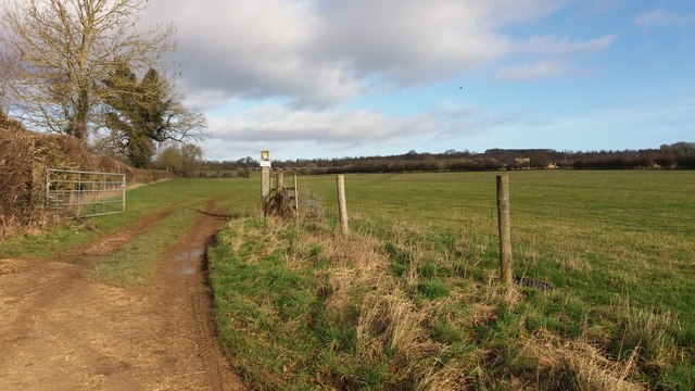
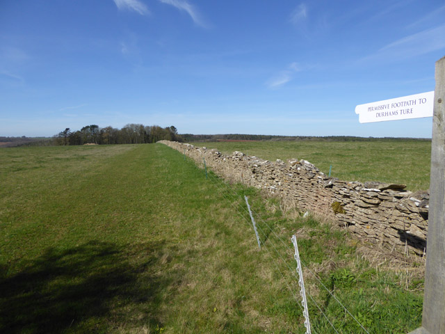
The surrounding countryside offers ample opportunities for outdoor activities and exploration. The Cotswold Way, a long-distance footpath, passes near Cutsdean, attracting walkers and hikers who enjoy the stunning views and diverse wildlife. Additionally, the village is within reach of popular tourist attractions such as Sudeley Castle and the historic market town of Chipping Campden.

In terms of amenities, Cutsdean has limited services, with the nearest shops and facilities located in neighboring towns. However, for those seeking a peaceful retreat in a quintessentially English village, Cutsdean provides a charming and picturesque setting.

If you have any feedback on the listing, please let us know in the comments section below.

Cutsdean Images

Images are sourced within 2km of 51.970865/-1.872274 or Grid Reference SP0830. Thanks to Geograph Open Source API. All images are credited.

Campden Lane heading towards Stumps Cross The track gives more than just farm access, and links Stumps Cross with Lynes Barn.
Campden Lane heading towards Stumps Cross
The track gives more than just farm access, and links Stumps Cross with Lynes Barn.
From Campden Lane looking towards the top of the hill An unnamed hill with a rounded top, it rises to 951 feet above sea level. There are several higher places in the Cotswolds, but they aren't a lot higher.
From Campden Lane looking towards the top of the hill
An unnamed hill with a rounded top, it rises to 951 feet above sea level. There are several higher places in the Cotswolds, but they aren't a lot higher.
Wheat field above Coscombe Corner Looking down the slope in the direction of Stumps Cross.
Wheat field above Coscombe Corner
Looking down the slope in the direction of Stumps Cross.
Crossroads near Mawkin Farm
On Cotswold Way - Campden Lane leading towards Stumps Cross
Harrowing the hill A rich brown soil.
Harrowing the hill
A rich brown soil.
Rich brown fields It is noticeable that the soil is so much darker than the rock it is derived from - note the quarry on the left.
Rich brown fields
It is noticeable that the soil is so much darker than the rock it is derived from - note the quarry on the left.
Quarry entrance 3gates Cotswold Stone operate here.
Quarry entrance
3gates Cotswold Stone operate here.
Poppy field near Ford
Farmland near Temple Guiting Farmland between Temple Guiting and Ford.
Farmland near Temple Guiting
Farmland between Temple Guiting and Ford.
Traveller step inside - Ford, Gloucestershire This is the Plough Inn at Ford in the Cotswolds, between Cutsdean and Temple Guiting. The invitation to passers-by reads "Ye weary travellers that pass by With dust and scorching sunbeams dry Or be benumb'd with snow and frost  With having these bleak cotswolds crost Step in and quaff my nut brown ale Bright as rubys mild and stale Twill make your laging trotters dance As nimble as the suns of france Then ye will own ye men of sense That neare was better spent sixpence". Some years ago I did take the invitation but it certainly was not sixpence a pint. Time photo taken not available.
<a href="https://www.geograph.org.uk/photo/3190392">SP0829 : The Plough Inn</a>
Traveller step inside - Ford, Gloucestershire
This is the Plough Inn at Ford in the Cotswolds, between Cutsdean and Temple Guiting. The invitation to passers-by reads "Ye weary travellers that pass by With dust and scorching sunbeams dry Or be benumb'd with snow and frost With having these bleak cotswolds crost Step in and quaff my nut brown ale Bright as rubys mild and stale Twill make your laging trotters dance As nimble as the suns of france Then ye will own ye men of sense That neare was better spent sixpence". Some years ago I did take the invitation but it certainly was not sixpence a pint. Time photo taken not available. SP0829 : The Plough Inn
Old Milestone by the B4077, Ford village, Temple Guiting Metal plate attached to stone post by the B4077, in parish of TEMPLE GUITING (COTSWOLD District), Ford, village centre, on banking near bend, on North side of road. Stow iron plate, erected by the Stow to Stump Cross turnpike trust in the 19th century. 

Inscription reads:-
STOW 7.
TEWKS
BURY.
13.

Grade II listed.  
List Entry Number: 1089517 <span class="nowrap"><a title="https://historicengland.org.uk/listing/the-list/list-entry/1089517" rel="nofollow ugc noopener" href="https://historicengland.org.uk/listing/the-list/list-entry/1089517">Link</a><img style="margin-left:2px;" alt="External link" title="External link - shift click to open in new window" src="https://s1.geograph.org.uk/img/external.png" width="10" height="10"/></span>

Milestone Society National ID: GL_TWSW13.
Old Milestone by the B4077, Ford village, Temple Guiting
Metal plate attached to stone post by the B4077, in parish of TEMPLE GUITING (COTSWOLD District), Ford, village centre, on banking near bend, on North side of road. Stow iron plate, erected by the Stow to Stump Cross turnpike trust in the 19th century. Inscription reads:- STOW 7. TEWKS BURY. 13. Grade II listed. List Entry Number: 1089517 LinkExternal link Milestone Society National ID: GL_TWSW13.
Diamond Way Diamond Way heading out of Temple Guiting towards Ford
Diamond Way
Diamond Way heading out of Temple Guiting towards Ford
Diamond Way From Ford the Diamond Way heading alongside the gallops to Jackdaws Castle
Diamond Way
From Ford the Diamond Way heading alongside the gallops to Jackdaws Castle
Diamond Way Diamond Way cuts across the gallops near Jackdaw Castle
Diamond Way
Diamond Way cuts across the gallops near Jackdaw Castle
Permissive footpath to Durhams Ture Maps do not tell us what Durhams Ture is, but label the wood ahead as The Durhams.
Permissive footpath to Durhams Ture
Maps do not tell us what Durhams Ture is, but label the wood ahead as The Durhams.
Cutsdean Trig Point An OS roadside triangulation pillar.
Cutsdean Trig Point
An OS roadside triangulation pillar.
Diamond Way Diamond Way alongside a gallop by Jackdaw's Castle
Diamond Way
Diamond Way alongside a gallop by Jackdaw's Castle
Show me another place!

Cutsdean is located at Grid Ref: SP0830 (Lat: 51.970865, Lng: -1.872274)

Administrative County: Gloucestershire

District: Cotswold

Police Authority: Gloucestershire

What 3 Words

///televise.repelled.vegetable. Near Winchcombe, Gloucestershire

Nearby Locations

Carey's Covert Cutsdean

Related Wikis

Cutsdean

Cutsdean is a rural village in the Cotswolds and smaller than average sized parish, a few miles east north-east of Cheltenham, Gloucestershire and the...

Ford, Gloucestershire

Ford is a hamlet in Gloucestershire, England. Ford lies on the B4077 road where it crosses the upper reaches of the River Windrush between Tewkesbury and...

Jackdaw Quarry

Jackdaw Quarry (grid reference SP077309) is a 4.78-hectare (11.8-acre) geological Site of Special Scientific Interest in Gloucestershire, notified in 1985...
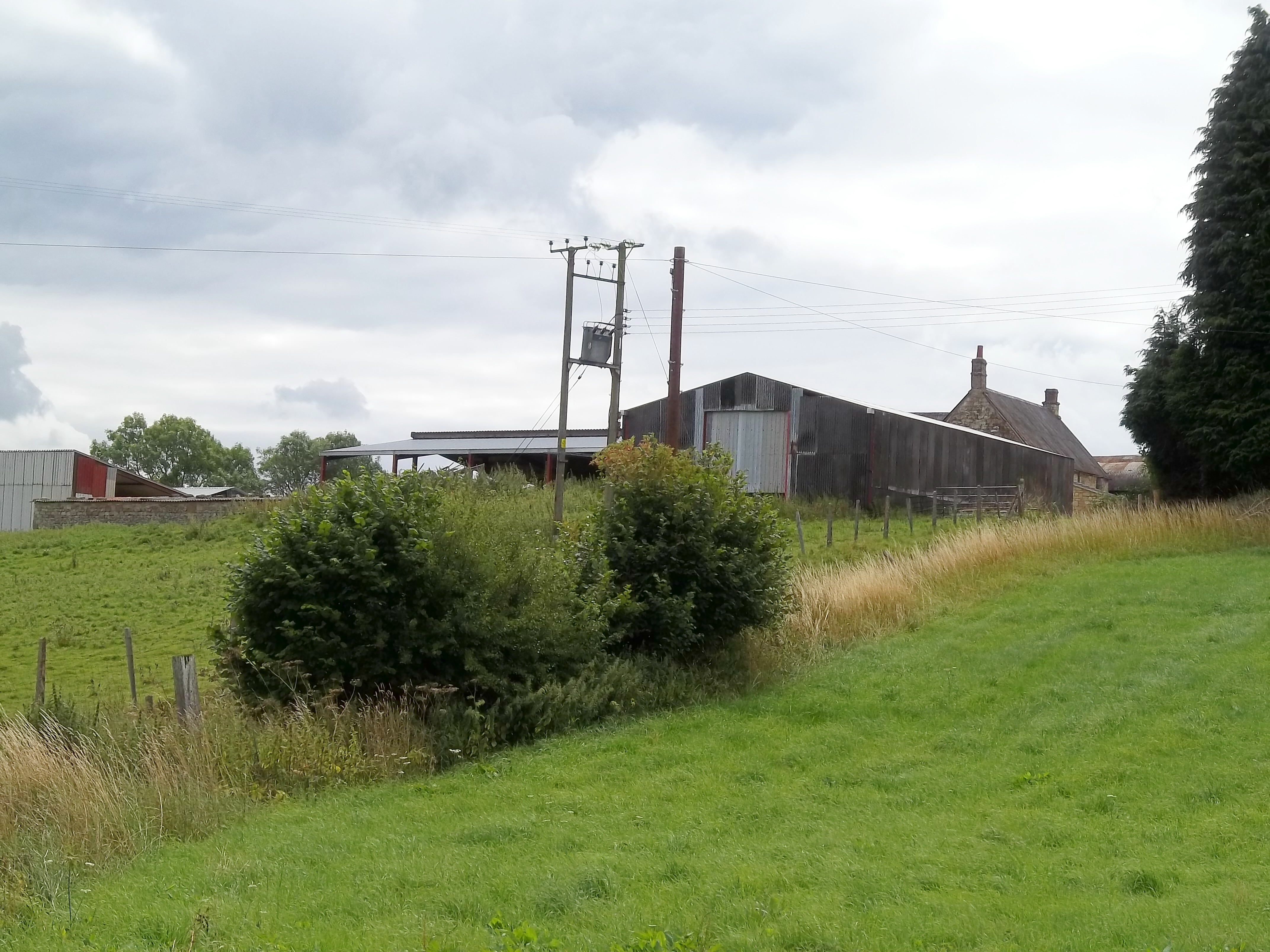
Cutsdean Quarry

Cutsdean Quarry (grid reference SP105315) is a 0.83-hectare (2.1-acre) nature reserve in Gloucestershire, England. The site is listed in the 'Cotswold...

Manor Farmhouse, Temple Guiting

Temple Guiting Manor is an early 16th-century house at Temple Guiting, Gloucestershire, England. It is a Grade I listed building, and is in private ownership...

Temple Guiting

Temple Guiting is a village and civil parish in the Cotswolds, in Gloucestershire, England. The civil parish includes the smaller settlements of Barton...

Pinnock and Hyde

Pinnock and Hyde was a township and civil parish in the Cotswolds in Gloucestershire, England. It lies 4 miles (6.4 km) east of the town of Winchcombe...

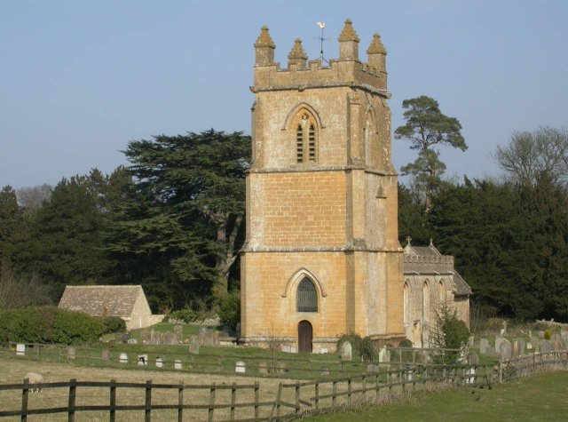
Church of St Mary, Temple Guiting

The Anglican Church of St Mary at Temple Guiting in the Cotswold District of Gloucestershire, England was built in the 12th century. It is a grade I listed...

Related Videos

Early Morning Walk in the Hillside village of Snowshill

Out and about Walking in Snowshill Snowshill is a small Cotswold village nestled on a hillside located not too far from Broadway.

A Chilly Morning Walk In a Beautiful Cotswold Village

Out and about Walking in Snowshill So, for today's walk we return on a very chilly & frosty morning to the beautiful Cotswold ...

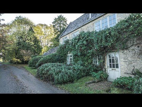
A Bright & Early Morning Walk in a Cotswold Village

So, today we are out and about walking in the rural Cotswold village of Cutsdean, which is located in the South West county of ...

Snowshill, Cotswolds, Medieval English Village Walking Tour, English Countryside 4K

Welcome to our walking tour of Snowshill in the Cotswolds! Join us on this fascinating journey through the historic streets and ...

Nearby Amenities

Located within 500m of 51.970865,-1.872274
Bus Stop
Church
Bus: yes
Naptan AtcoCode: 1600GL1559
Naptan Bearing: E
Naptan CommonName: Church
Naptan Indicator: Opp
Naptan NaptanCode: glogdatd
Naptan Street: Main Street
Naptan Verified: no
Public Transport: platform
Source: naptan_import
Lat/Long: 51.9701025/-1.8741272
Bus Stop
Church
Bus: yes
Naptan AtcoCode: 1600GL1560
Naptan Bearing: W
Naptan CommonName: Church
Naptan NaptanCode: glogdatj
Naptan Street: Main Street
Naptan Verified: no
Public Transport: platform
Source: naptan_import
Lat/Long: 51.9700485/-1.8740546
Barrier: stile
Lat/Long: 51.9744001/-1.8731957
Barrier: kissing_gate
Source: survey
Lat/Long: 51.9701963/-1.8731313
Barrier: kissing_gate
Source: survey
Lat/Long: 51.968278/-1.8716589
Barrier: kissing_gate
Source: survey
Lat/Long: 51.966587/-1.8722686
Post Box
Collection Times: Mo-Fr 16:00; Sa 09:00
Note: ref no obscured by sticker
Post Box Type: wall
Ref: GL54 217
Royal Cypher: GR
Royal Cypher Wikidata: Q33102273
Source: GPS Survey
Lat/Long: 51.9712312/-1.87362
Barrier: kissing_gate
Source: survey
Lat/Long: 51.9729205/-1.8731677
Barrier: stile
Source: survey
Lat/Long: 51.9743107/-1.8730453
Bus Stop
Town Close
Bus: yes
Naptan AtcoCode: 1600GLC663
Naptan Bearing: E
Naptan CommonName: Town Close
Naptan NaptanCode: glogdgad
Naptan Street: Main Street
Naptan Verified: no
Public Transport: platform
Source: naptan_import
Lat/Long: 51.9709659/-1.8722829
Source: survey
Lat/Long: 51.9668235/-1.8721414
Barrier: stile
Lat/Long: 51.9711296/-1.8737917
Telephone
Booth: K6
Covered: booth
Listed Status: Grade II
Operator: BT
Operator Wikidata: Q593786
Phone: +44 1386 584282
Lat/Long: 51.9712891/-1.8729981
Advertising: board
Lat/Long: 51.9712408/-1.873554
Power: pole
Lat/Long: 51.9724595/-1.8742928
Power: pole
Lat/Long: 51.9753172/-1.8727465
Power: pole
Lat/Long: 51.9745538/-1.8731609
Power: pole
Lat/Long: 51.9738318/-1.8735525
Power: pole
Lat/Long: 51.9733567/-1.87381
Cutsdean
Power: pole
Transformer: distribution
Voltage Primary: 11000
Lat/Long: 51.9713756/-1.8722798
Power: pole
Lat/Long: 51.9717746/-1.872894
Power: pole
Lat/Long: 51.9719977/-1.874152
Power: pole
Lat/Long: 51.9719762/-1.8745449
Power: pole
Lat/Long: 51.9715036/-1.8748024
Power: pole
Lat/Long: 51.9710599/-1.8750425
Power: pole
Lat/Long: 51.970394/-1.8754596
Power: pole
Lat/Long: 51.969947/-1.8751605
Cutsdean Church
Power: pole
Transformer: distribution
Voltage Primary: 11000
Lat/Long: 51.969928/-1.8743156
Power: pole
Lat/Long: 51.9697223/-1.8753214
Power: pole
Lat/Long: 51.969229/-1.8756701
Power: pole
Lat/Long: 51.9686118/-1.8761449
Power: pole
Lat/Long: 51.9678905/-1.8761127
The data included in this document is from www.openstreetmap.org. The data is made available under ODbL.

Have you been to Cutsdean?

Leave your review of Cutsdean below (or comments, questions and feedback).