Cutnall Green
Settlement in Worcestershire Wychavon
England
Cutnall Green

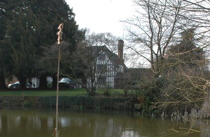
Cutnall Green is a picturesque village located in the county of Worcestershire, England. Situated approximately 10 miles south of the city of Worcester, it is nestled in the heart of the county's countryside. With a population of around 500 residents, it offers a tranquil and tight-knit community atmosphere.
The village is known for its traditional English charm, featuring a collection of beautiful period cottages and well-maintained gardens. It benefits from its rural setting, surrounded by rolling hills, farmland, and scenic landscapes. The nearby Cutnall Brook, which meanders through the village, adds to its idyllic appeal.
A focal point of Cutnall Green is its historic parish church, St. Mary Magdalene. Dating back to the 12th century, the church boasts stunning architectural features and is a testament to the village's rich heritage. It serves as a gathering place for religious services and community events.
Despite its small size, Cutnall Green offers several amenities to its residents and visitors. These include a village hall, a primary school, and a pub, which serves as a social hub for locals. The surrounding countryside provides ample opportunities for outdoor activities such as walking, cycling, and horse riding.
Cutnall Green benefits from its close proximity to larger towns and cities. It is easily accessible via the nearby M5 motorway and benefits from good transport links. This allows residents to enjoy the tranquility of village life while still having access to the amenities and services of larger areas.
Overall, Cutnall Green is a charming and peaceful village that provides a delightful escape from the hustle and bustle of modern life, making it an attractive place for residents and visitors alike.
If you have any feedback on the listing, please let us know in the comments section below.
Cutnall Green Images
Images are sourced within 2km of 52.315779/-2.184808 or Grid Reference SO8768. Thanks to Geograph Open Source API. All images are credited.


Cutnall Green is located at Grid Ref: SO8768 (Lat: 52.315779, Lng: -2.184808)
Administrative County: Worcestershire
District: Wychavon
Police Authority: West Mercia
What 3 Words
///bordering.coasted.cubed. Near Hartlebury, Worcestershire
Nearby Locations
Related Wikis

Elmley Lovett
Elmley Lovett in Worcestershire, England is a civil parish whose residents' homes are quite loosely clustered east of its Hartlebury Trading Estate, as...

Cutnall Green Halt railway station
Cutnall Green Halt was a railway station in Worcestershire, England, serving the nearby village of Hampton Lovett on the Oxford, Worcester and Wolverhampton...

Snead's Green
Snead's Green, sometimes written Sneads Green, is an area of Droitwich Spa, Worcestershire, England.Francis Moule, of Snead's Green House, sold the manorial...

Rushock
Rushock is a village and civil parish in the Wyre Forest District of Worcestershire, England. At the 2001 census it had a population of 138. The grave...

Elmbridge, Worcestershire
Elmbridge is a small community, mainly clustered in a village and forms a civil parish in Worcestershire, England. == Geography == It occupies the top...

Hartlebury railway station
Hartlebury railway station serves the village of Hartlebury in Worcestershire, England. All trains serving the station are operated by West Midlands Trains...

Hampton Lovett
Hampton Lovett is a village and civil parish in the Wychavon district of the county of Worcestershire, England. It is just north of Droitwich. The church...
Badge Court
Badge Court is an estate in Worcestershire, England. Originally known as Batchcott, the home's most famous occupant was Helena Wintour, daughter of Gunpowder...
Nearby Amenities
Located within 500m of 52.315779,-2.184808Have you been to Cutnall Green?
Leave your review of Cutnall Green below (or comments, questions and feedback).