Cutlers Green

Settlement in Essex Uttlesford

England

Cutlers Green

Thaxted Windmill Down a little footpath leading from the village.  The mill dates to 1810.
Thaxted Windmill Credit: Ben Keating

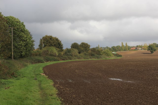
Cutlers Green is a small village located in the county of Essex, in southeastern England. Situated approximately 6 miles northeast of the town of Chelmsford, Cutlers Green falls within the administrative district of Uttlesford. The village is surrounded by picturesque countryside, characterized by rolling hills, green fields, and quaint rural landscapes.

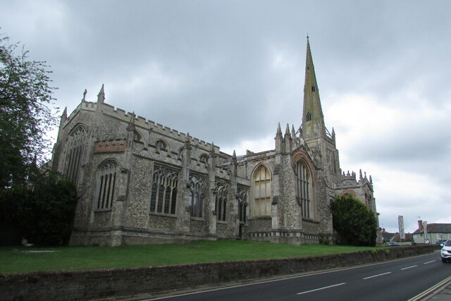
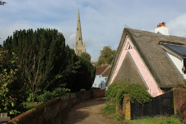
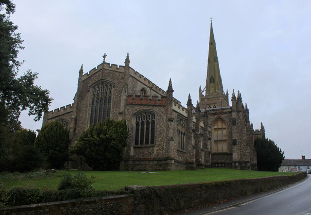
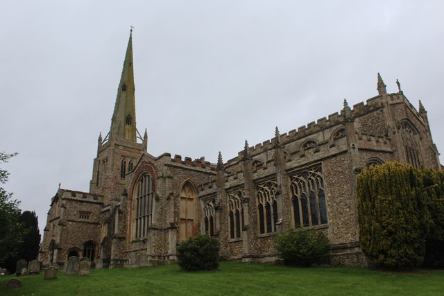
Despite its small size, Cutlers Green has a rich history dating back several centuries. The village is named after the Cutler family, who were prominent landowners in the area during the medieval period. Historical buildings and landmarks, such as St. John the Baptist Church, add to the charm and character of the village.

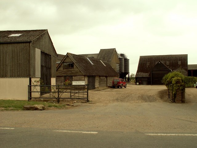
The community of Cutlers Green is close-knit and friendly, with a population of around 200 residents. The village is primarily residential, consisting of a mix of traditional cottages, farmhouses, and more modern dwellings. The peaceful and idyllic setting of Cutlers Green makes it an attractive place for those seeking a quieter way of life, away from the hustle and bustle of larger towns and cities.

Although Cutlers Green does not have its own amenities, residents can find essential services and facilities in nearby towns such as Chelmsford and Stansted. The village benefits from excellent transport links, with easy access to major roads and motorways, making it convenient for commuters.

In summary, Cutlers Green is a charming and historic village nestled in the beautiful Essex countryside. With its tranquil atmosphere and close-knit community, it offers a peaceful retreat for those looking to escape the pressures of urban living.

If you have any feedback on the listing, please let us know in the comments section below.

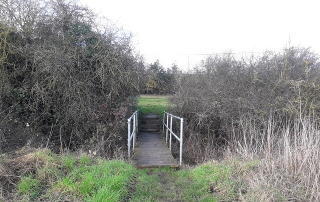
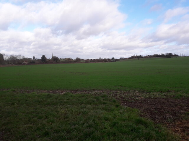
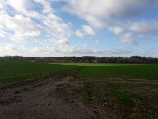
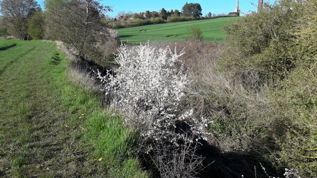
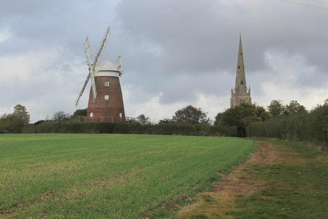
Cutlers Green Images

Images are sourced within 2km of 51.951848/0.321035 or Grid Reference TL5930. Thanks to Geograph Open Source API. All images are credited.

Thaxted Windmill Down a little footpath leading from the village.  The mill dates to 1810.
Thaxted Windmill
Down a little footpath leading from the village. The mill dates to 1810.
A footpath west out of Thaxted Taken from Watling Lane.
A footpath west out of Thaxted
Taken from Watling Lane.
Margaret Gardens A public garden in Thaxted - pretty green despite weeks of drought this summer.
Margaret Gardens
A public garden in Thaxted - pretty green despite weeks of drought this summer.
Thaxted Church One of the largest churches in Essex.
Thaxted Church
One of the largest churches in Essex.
Small bridge to Broxted Road (B1051) near Thaxted
Footpath near Thaxted
Footpath through a field near Thaxted Photo is taken from Dunmow Road (B184) near Thaxted
Footpath through a field near Thaxted
Photo is taken from Dunmow Road (B184) near Thaxted
Spring walk April 2023 Sadly those lovely white flowers would soon be gone
Spring walk April 2023
Sadly those lovely white flowers would soon be gone
John Webb's Windmill, Thaxted A Grade II* Listed red brick tower mill built in 1804 for Mr John Webb. It has four patent sails and winding by fantail. However the latter is missing and the mill was closed for restoration although we had been expecting it to be open for National Mills Open Days.
John Webb's Windmill, Thaxted
A Grade II* Listed red brick tower mill built in 1804 for Mr John Webb. It has four patent sails and winding by fantail. However the latter is missing and the mill was closed for restoration although we had been expecting it to be open for National Mills Open Days.
Public Convenience at Margaret Street Car Park in Thaxted Tidy and well maintained facilities in this ancient town
Public Convenience at Margaret Street Car Park in Thaxted
Tidy and well maintained facilities in this ancient town
Harcamlow Way beside Broxted Road The road is concealed by the hedgerow, the long distance footpath following a well placed grass strip beside the ploughed field
Harcamlow Way beside Broxted Road
The road is concealed by the hedgerow, the long distance footpath following a well placed grass strip beside the ploughed field
Harcamlow Way approaching Thaxted from the South Two prominent landmarks herald the proximity of the fine old town of Thaxted. John Webb's windmill, a restored brick tower mill dating from 1810 and the soaring 181 ft. spire of the town's English Perpendicular church.
Harcamlow Way approaching Thaxted from the South
Two prominent landmarks herald the proximity of the fine old town of Thaxted. John Webb's windmill, a restored brick tower mill dating from 1810 and the soaring 181 ft. spire of the town's English Perpendicular church.
John Webb's Windmill Referred to on some maps as Thaxted Mill.
Restored brick tower windmill dating from 1810, currently closed to the public at the time we passed by on the Harcamlow Way.
John Webb's Windmill
Referred to on some maps as Thaxted Mill. Restored brick tower windmill dating from 1810, currently closed to the public at the time we passed by on the Harcamlow Way.
John Webb's Windmill from Below Referred to on some maps as Thaxted Mill.
Restored brick tower windmill dating from 1810, currently closed to the public at the time we passed by on the Harcamlow Way.
John Webb's Windmill from Below
Referred to on some maps as Thaxted Mill. Restored brick tower windmill dating from 1810, currently closed to the public at the time we passed by on the Harcamlow Way.
Harcamlow Way entering Thaxted A 141 mile long figure-of-eight walk, mainly on tracks and green lanes passing many places of historic interest, crossing low hills, woods and arable land via Standon and Manuden to meet the cross-over point at Newport. It continues through Saffron Walden and over the low Bartlow Hills to Horseheath and the Fleam Dyke, to enter Cambridge, the return route passing through Melbourn and Chrishall to Newport, continuing via Debden, Thaxted, Takeley and Hatfield Forest. The waymarked Five Parishes Millennium Boundary Walk (15 miles) is a circular route using part of the Harcamlow Way at Tilty. The waymarked Wimpole Way (11 miles and on OS mapping) Way goes across farmland and through the villages of Caldecote and Kingston to the eighteenth-century Wimpole Hall and Park and is part of the Harcamlow Way. With the Clopton Way it links the Greensand Ridge Walk with Cambridge.
Harcamlow Way entering Thaxted
A 141 mile long figure-of-eight walk, mainly on tracks and green lanes passing many places of historic interest, crossing low hills, woods and arable land via Standon and Manuden to meet the cross-over point at Newport. It continues through Saffron Walden and over the low Bartlow Hills to Horseheath and the Fleam Dyke, to enter Cambridge, the return route passing through Melbourn and Chrishall to Newport, continuing via Debden, Thaxted, Takeley and Hatfield Forest. The waymarked Five Parishes Millennium Boundary Walk (15 miles) is a circular route using part of the Harcamlow Way at Tilty. The waymarked Wimpole Way (11 miles and on OS mapping) Way goes across farmland and through the villages of Caldecote and Kingston to the eighteenth-century Wimpole Hall and Park and is part of the Harcamlow Way. With the Clopton Way it links the Greensand Ridge Walk with Cambridge.
St. John the Baptist with Our Lady and St. Laurence Church, Thaxted This really is a fine church with a 181 foot spire dominating the town of Thaxted on a slight hill.
English Perpendicular church built between 1340 and 1510, - one of the largest in Essex, and a testament to the wealth of the town during the Middle Ages.
Grade I Listed Building.
St. John the Baptist with Our Lady and St. Laurence Church, Thaxted
This really is a fine church with a 181 foot spire dominating the town of Thaxted on a slight hill. English Perpendicular church built between 1340 and 1510, - one of the largest in Essex, and a testament to the wealth of the town during the Middle Ages. Grade I Listed Building.
English Perpendicular Church in Thaxted This really is a fine church with a 181 foot spire dominating the town of Thaxted on a slight hill.
English Perpendicular church built between 1340 and 1510, - one of the largest in Essex, and a testament to the wealth of the town during the Middle Ages.
Grade I Listed Building.
English Perpendicular Church in Thaxted
This really is a fine church with a 181 foot spire dominating the town of Thaxted on a slight hill. English Perpendicular church built between 1340 and 1510, - one of the largest in Essex, and a testament to the wealth of the town during the Middle Ages. Grade I Listed Building.
Show me another place!

Cutlers Green is located at Grid Ref: TL5930 (Lat: 51.951848, Lng: 0.321035)

Administrative County: Essex

District: Uttlesford

Police Authority: Essex

What 3 Words

///campsites.surface.engage. Near Thaxted, Essex

Nearby Locations

Cutlers Green

Related Wikis

Cutlers Green

Cutlers Green is a hamlet in the civil parish of Thaxted, and the Uttlesford district of Essex, England. The hamlet is 1 mile (1.6 km) west from the town...

Cutlers Green Halt railway station

Cutlers Green Halt railway station was a station serving the hamlet of Cutlers Green, Essex. It was located 4 miles 52 chains (7.48 km) from Elsenham station...

Thaxted railway station

Thaxted railway station served the village of Thaxted, Essex. It was located 5 miles 47 chains (8.99 km) from Elsenham station. It closed in 1952. ��2...

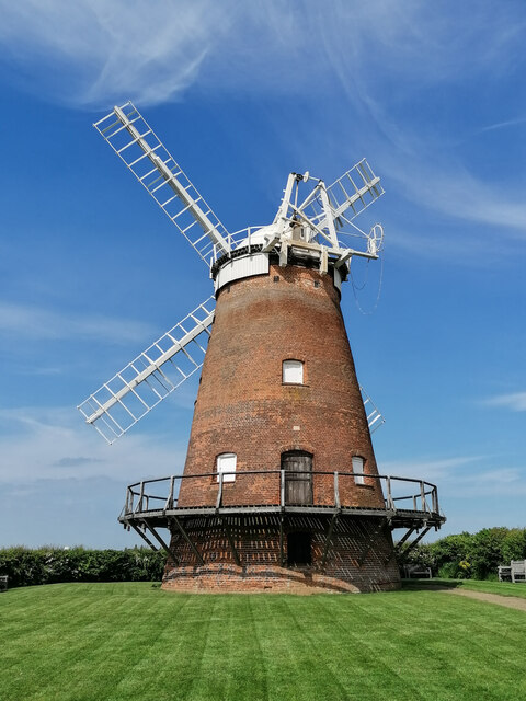
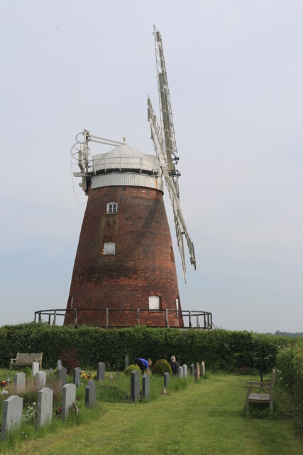
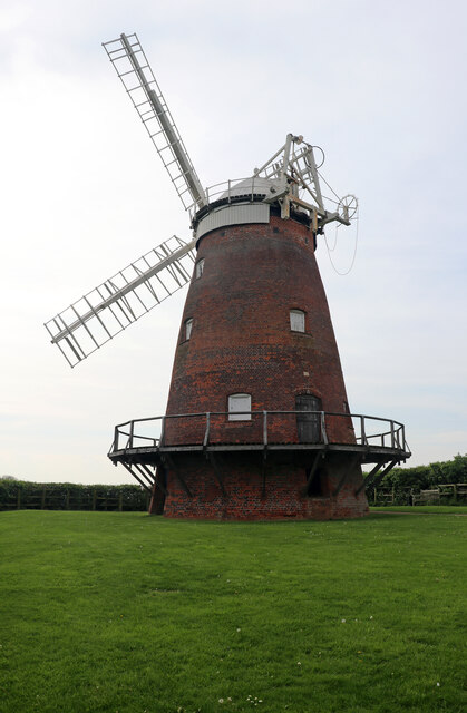
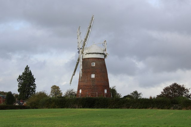
John Webb's Mill, Thaxted

John Webb’s or Lowe’s Mill is a Grade II* listed tower mill at Thaxted, Essex, England, which had been restored to working order, but is currently out...

Nearby Amenities

Located within 500m of 51.951848,0.321035
Loves Farm Road
Naptan AtcoCode: 1500IM1095
Naptan Bearing: W
Naptan BusStopType: CUS
Naptan CommonName: Cutlers Green
Naptan Indicator: W-bound
Naptan Landmark: Cutlers Green
Naptan NaptanCode: esxdgatj
Naptan Street: Thaxted Road
Naptan Verified: no
Public Transport: platform
Source: naptan_import
Lat/Long: 51.9526658/0.320994
Bus Stop
Loves Farm Road
Bus: yes
Naptan AtcoCode: 1500IM1095AA
Naptan Bearing: E
Naptan BusStopType: CUS
Naptan CommonName: Cutlers Green
Naptan Indicator: E-bound
Naptan Landmark: Cutlers Green
Naptan NaptanCode: esxgpgat
Naptan Street: Thaxted Road
Naptan Verified: no
Public Transport: platform
Source: naptan_import
Lat/Long: 51.9527291/0.3210663
Cutlers Green
Place: hamlet
Wikidata: Q5196895
Lat/Long: 51.9525964/0.3195642
The data included in this document is from www.openstreetmap.org. The data is made available under ODbL.

Have you been to Cutlers Green?

Leave your review of Cutlers Green below (or comments, questions and feedback).