Burford's Grove
Wood, Forest in Gloucestershire Cotswold
England
Burford's Grove
![A walk around the Fosse Way [1] The minor road runs from the Fosse Way (A429) towards Coln St Dennis.
Starting at Fossebridge, where the Fosse Way descends precipitously to cross the River Coln, the walk gently ascends on a road and then a bridleway to meet a minor road which is part of the Salt Way. After using the Salt Way to cross the Fosse Way the route descends on footpaths and minor roads via Oxpens Farm and Stowell Mill to return to Fossebridge.](https://s2.geograph.org.uk/geophotos/06/99/49/6994958_d768d550.jpg)
Burford's Grove is a picturesque woodland located in Gloucestershire, England. Spanning over a vast area, this enchanting forest is renowned for its natural beauty and diverse flora and fauna. It is situated near the charming town of Burford, which is famous for its medieval architecture and rich history.
The woodland is predominantly composed of ancient oak trees, some of which are believed to be over 500 years old. These majestic trees create a dense canopy that provides shelter and shade to a wide range of wildlife. The forest floor is adorned with a carpet of vibrant wildflowers, adding a splash of color to the landscape.
Burford's Grove is a haven for nature enthusiasts and hikers, offering numerous walking trails that wind through the forest. These paths allow visitors to immerse themselves in the serene surroundings, with the sound of birdsong filling the air. The forest is also home to several species of deer, squirrels, and a variety of birds, making it a popular spot for wildlife watching and photography.
In addition to its natural beauty, Burford's Grove holds historical significance. It is believed that the woodland once served as a hunting ground for ancient kings and nobles. The remnants of old hunting lodges and pathways can still be found within the forest, adding a sense of intrigue and nostalgia.
Overall, Burford's Grove is a captivating woodland that offers a peaceful retreat from the hustle and bustle of everyday life. Its stunning scenery, rich biodiversity, and historical charm make it a must-visit destination for nature lovers and history enthusiasts alike.
If you have any feedback on the listing, please let us know in the comments section below.
Burford's Grove Images
Images are sourced within 2km of 51.814103/-1.8888943 or Grid Reference SP0712. Thanks to Geograph Open Source API. All images are credited.
![A walk around the Fosse Way [2] The minor road runs from the Fosse Way (A429) towards Coln St Dennis. The telephone box in the distance is a K6 and there is a closer view at <a href="https://www.geograph.org.uk/photo/6994971">SP0811 : A walk around the Fosse Way [3]</a>.
Starting at Fossebridge, where the Fosse Way descends precipitously to cross the River Coln, the walk gently ascends on a road and then a bridleway to meet a minor road which is part of the Salt Way. After using the Salt Way to cross the Fosse Way the route descends on footpaths and minor roads via Oxpens Farm and Stowell Mill to return to Fossebridge.](https://s3.geograph.org.uk/geophotos/06/99/49/6994959_e9b82b35.jpg)
![A walk around the Fosse Way [3] A K6 telephone box, designed in 1935 by Sir Giles Gilbert Scott. The box is seen in context at <a href="https://www.geograph.org.uk/photo/6994959">SP0811 : A walk around the Fosse Way [2]</a>.
Starting at Fossebridge, where the Fosse Way descends precipitously to cross the River Coln, the walk gently ascends on a road and then a bridleway to meet a minor road which is part of the Salt Way. After using the Salt Way to cross the Fosse Way the route descends on footpaths and minor roads via Oxpens Farm and Stowell Mill to return to Fossebridge.](https://s3.geograph.org.uk/geophotos/06/99/49/6994971_072b3497.jpg)
![A walk around the Fosse Way [4] The entrance driveway to The Manor, Coln St Dennis.
Starting at Fossebridge, where the Fosse Way descends precipitously to cross the River Coln, the walk gently ascends on a road and then a bridleway to meet a minor road which is part of the Salt Way. After using the Salt Way to cross the Fosse Way the route descends on footpaths and minor roads via Oxpens Farm and Stowell Mill to return to Fossebridge.](https://s2.geograph.org.uk/geophotos/06/99/49/6994982_71a491c9.jpg)
![A walk around the Fosse Way [5] The driveway to Manor Farm, a public bridleway, leaves the minor road.
Starting at Fossebridge, where the Fosse Way descends precipitously to cross the River Coln, the walk gently ascends on a road and then a bridleway to meet a minor road which is part of the Salt Way. After using the Salt Way to cross the Fosse Way the route descends on footpaths and minor roads via Oxpens Farm and Stowell Mill to return to Fossebridge.](https://s2.geograph.org.uk/geophotos/06/99/59/6995946_00b78739.jpg)
![A walk around the Fosse Way [6] The track leading to Manor Farm is also a public bridleway.
Starting at Fossebridge, where the Fosse Way descends precipitously to cross the River Coln, the walk gently ascends on a road and then a bridleway to meet a minor road which is part of the Salt Way. After using the Salt Way to cross the Fosse Way the route descends on footpaths and minor roads via Oxpens Farm and Stowell Mill to return to Fossebridge.](https://s3.geograph.org.uk/geophotos/06/99/59/6995947_3d389408.jpg)
![A walk around the Fosse Way [7] The track, a public bridleway, curves around the garden of Manor Farmhouse.
Starting at Fossebridge, where the Fosse Way descends precipitously to cross the River Coln, the walk gently ascends on a road and then a bridleway to meet a minor road which is part of the Salt Way. After using the Salt Way to cross the Fosse Way the route descends on footpaths and minor roads via Oxpens Farm and Stowell Mill to return to Fossebridge.](https://s0.geograph.org.uk/geophotos/06/99/59/6995948_97014c9f.jpg)
![A walk around the Fosse Way [8] Manor Farmhouse, seen from the bridleway.
Starting at Fossebridge, where the Fosse Way descends precipitously to cross the River Coln, the walk gently ascends on a road and then a bridleway to meet a minor road which is part of the Salt Way. After using the Salt Way to cross the Fosse Way the route descends on footpaths and minor roads via Oxpens Farm and Stowell Mill to return to Fossebridge.](https://s1.geograph.org.uk/geophotos/06/99/59/6995949_3ff41a59.jpg)
![A walk around the Fosse Way [9] Barn conversions at Manor Farm. Seen from the bridleway.
Starting at Fossebridge, where the Fosse Way descends precipitously to cross the River Coln, the walk gently ascends on a road and then a bridleway to meet a minor road which is part of the Salt Way. After using the Salt Way to cross the Fosse Way the route descends on footpaths and minor roads via Oxpens Farm and Stowell Mill to return to Fossebridge.](https://s2.geograph.org.uk/geophotos/06/99/59/6995950_963a7809.jpg)
![A walk around the Fosse Way [10] Manor Farmhouse, seen from the bridleway.
Starting at Fossebridge, where the Fosse Way descends precipitously to cross the River Coln, the walk gently ascends on a road and then a bridleway to meet a minor road which is part of the Salt Way. After using the Salt Way to cross the Fosse Way the route descends on footpaths and minor roads via Oxpens Farm and Stowell Mill to return to Fossebridge.](https://s3.geograph.org.uk/geophotos/06/99/59/6995951_cfbc0467.jpg)
![A walk around the Fosse Way [11] Beyond Manor Farm the track, a public bridleway, is degraded.
Starting at Fossebridge, where the Fosse Way descends precipitously to cross the River Coln, the walk gently ascends on a road and then a bridleway to meet a minor road which is part of the Salt Way. After using the Salt Way to cross the Fosse Way the route descends on footpaths and minor roads via Oxpens Farm and Stowell Mill to return to Fossebridge.](https://s0.geograph.org.uk/geophotos/06/99/59/6995952_b8217fe8.jpg)
![A walk around the Fosse Way [12] A view from the bridleway across the fields to Greenhill Covert.
Starting at Fossebridge, where the Fosse Way descends precipitously to cross the River Coln, the walk gently ascends on a road and then a bridleway to meet a minor road which is part of the Salt Way. After using the Salt Way to cross the Fosse Way the route descends on footpaths and minor roads via Oxpens Farm and Stowell Mill to return to Fossebridge.](https://s1.geograph.org.uk/geophotos/06/99/59/6995953_2206fe48.jpg)
![A walk around the Fosse Way [13] The bridleway continues through the green tunnel to the right, open fields to the left.
Starting at Fossebridge, where the Fosse Way descends precipitously to cross the River Coln, the walk gently ascends on a road and then a bridleway to meet a minor road which is part of the Salt Way. After using the Salt Way to cross the Fosse Way the route descends on footpaths and minor roads via Oxpens Farm and Stowell Mill to return to Fossebridge.](https://s3.geograph.org.uk/geophotos/06/99/59/6995955_5b576cae.jpg)
![A walk around the Fosse Way [14] The track, a bridleway, ascends gently as it heads northeast.
Starting at Fossebridge, where the Fosse Way descends precipitously to cross the River Coln, the walk gently ascends on a road and then a bridleway to meet a minor road which is part of the Salt Way. After using the Salt Way to cross the Fosse Way the route descends on footpaths and minor roads via Oxpens Farm and Stowell Mill to return to Fossebridge.](https://s0.geograph.org.uk/geophotos/06/99/59/6995960_7c495eff.jpg)
![A walk around the Fosse Way [15] On the edge of Fox Covert, this shed is slowly being reclaimed by the undergrowth. Seen from the bridleway.
Starting at Fossebridge, where the Fosse Way descends precipitously to cross the River Coln, the walk gently ascends on a road and then a bridleway to meet a minor road which is part of the Salt Way. After using the Salt Way to cross the Fosse Way the route descends on footpaths and minor roads via Oxpens Farm and Stowell Mill to return to Fossebridge.](https://s2.geograph.org.uk/geophotos/06/99/59/6995962_2ad354f2.jpg)
![A walk around the Fosse Way [16] A strange structure at the side of the bridleway. Sown as a tank on OS maps.
Starting at Fossebridge, where the Fosse Way descends precipitously to cross the River Coln, the walk gently ascends on a road and then a bridleway to meet a minor road which is part of the Salt Way. After using the Salt Way to cross the Fosse Way the route descends on footpaths and minor roads via Oxpens Farm and Stowell Mill to return to Fossebridge.](https://s2.geograph.org.uk/geophotos/06/99/59/6995966_c3cb0644.jpg)
![A walk around the Fosse Way [17] A rough track runs along the edge of Fox Covert. Seen from the bridleway.
Starting at Fossebridge, where the Fosse Way descends precipitously to cross the River Coln, the walk gently ascends on a road and then a bridleway to meet a minor road which is part of the Salt Way. After using the Salt Way to cross the Fosse Way the route descends on footpaths and minor roads via Oxpens Farm and Stowell Mill to return to Fossebridge.](https://s0.geograph.org.uk/geophotos/06/99/59/6995968_190f210a.jpg)
![A walk around the Fosse Way [18] The bridleway now traverses open fields full of ripening crops.
Starting at Fossebridge, where the Fosse Way descends precipitously to cross the River Coln, the walk gently ascends on a road and then a bridleway to meet a minor road which is part of the Salt Way. After using the Salt Way to cross the Fosse Way the route descends on footpaths and minor roads via Oxpens Farm and Stowell Mill to return to Fossebridge.](https://s1.geograph.org.uk/geophotos/06/99/59/6995969_a0ce1894.jpg)
Burford's Grove is located at Grid Ref: SP0712 (Lat: 51.814103, Lng: -1.8888943)
Administrative County: Gloucestershire
District: Cotswold
Police Authority: Gloucestershire
What 3 Words
///grad.badminton.sings. Near Northleach, Gloucestershire
Nearby Locations
Related Wikis
Yanworth
Yanworth is a small rural parish located in the county of Gloucestershire, England 14 miles south east of Cheltenham and 88 miles North West of London...
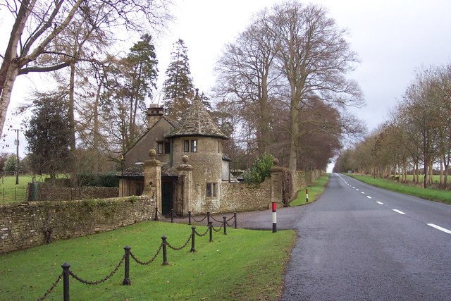
Stowell Park
Stowell Park Estate is a 6,000-acre (24 km2) historic agricultural and sporting estate in the Cotswold Hills, Gloucestershire, England. The estate includes...
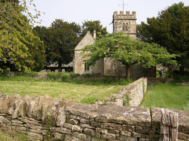
Church of St Leonard, Stowell Park
The Anglican Church of St Leonard at Stowell Park, in the Cotswold District of Gloucestershire, England was built in the 12th century. It is a grade I...
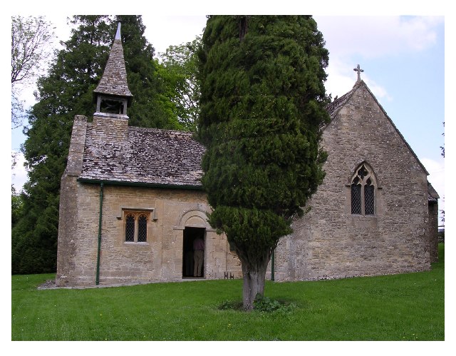
St Michael's Church, Yanworth
The Church of St. Michael is the parish church of Yanworth, Gloucestershire, England. The church is a Grade II* listed building dating from the late-12th...

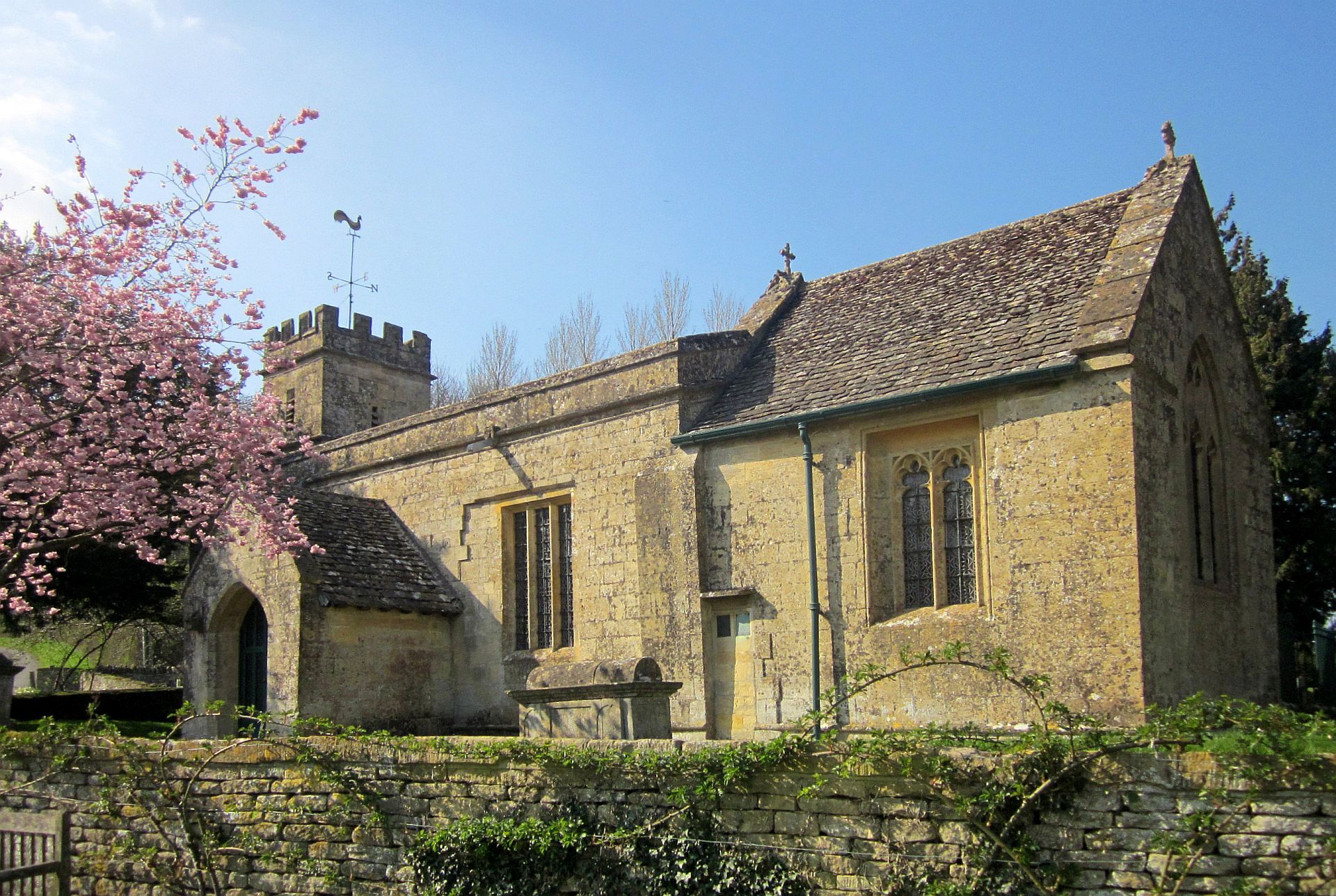
Church of St James, Coln St. Dennis
The Anglican Church of St James at Coln St. Dennis in the Cotswold District of Gloucestershire, England was built in the 12th century. It is a grade I...
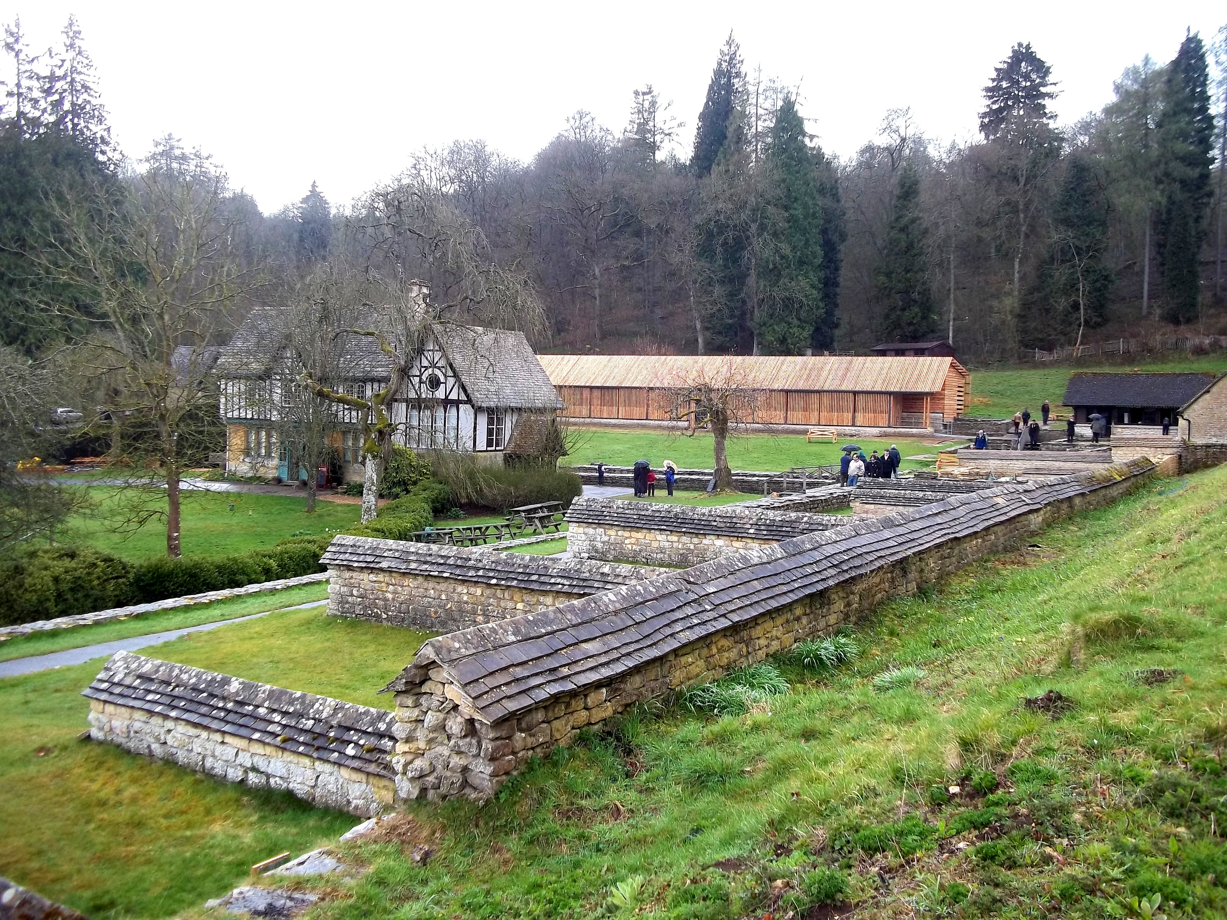
Chedworth Roman Villa
Chedworth Roman Villa is located near Chedworth, Gloucestershire, England and is a scheduled monument. It is one of the largest and most elaborate Roman...

Stony Furlong Railway Cutting
Stony Furlong Railway Cutting (grid reference SP063106) is a 2.7-hectare (6.7-acre) geological Site of Special Scientific Interest in Gloucestershire,...
Chedworth Halt railway station
Chedworth Halt railway station was on the Midland and South Western Junction Railway in Gloucestershire. The station opened on 1 October 1892, 14 months...
Nearby Amenities
Located within 500m of 51.814103,-1.8888943Have you been to Burford's Grove?
Leave your review of Burford's Grove below (or comments, questions and feedback).