Pond Wood

Wood, Forest in Durham

England

Pond Wood

The Lodge of St. John's Hall South of the Weardale village of Wolsingham a 'dead end' road gives an approach to several isolated buildings. The grandest of them is St. John's Hall, presently (April 2011) unoccupied and deteriorating <a title="https://www.geograph.org.uk/photo/1781360" href="https://www.geograph.org.uk/photo/1781360">Link</a>. This bungalow is the lodge for the hall; it's also unoccupied and is deteriorating as well.
The Lodge of St. John's Hall Credit: Trevor Littlewood

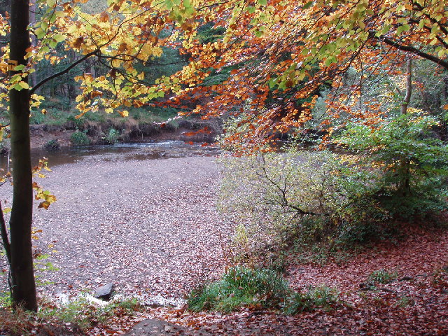
Pond Wood, located in Durham, is a picturesque forest area that covers a significant portion of land. It is a serene and tranquil place that attracts nature enthusiasts, hikers, and wildlife observers alike. The wood is abundant in diverse tree species, including oak, beech, and birch, which create a dense canopy that provides shade and shelter to various flora and fauna.

The wood is known for its enchanting pond, which is the centerpiece of the area. The pond is surrounded by lush vegetation and serves as a habitat for numerous aquatic creatures, such as ducks, frogs, and fish. It also attracts a variety of bird species, making it a popular spot for birdwatchers.

Walking through Pond Wood, visitors can enjoy the peaceful ambiance and take in the natural beauty that surrounds them. The forest trails are well-maintained and offer different routes catering to different levels of difficulty. Along the way, one might encounter wildflowers, ferns, and even occasional sightings of deer or squirrels.

Pond Wood is also home to a rich biodiversity. Various insects, including butterflies and dragonflies, can be spotted, adding to the vibrant ecosystem of the area. The wood provides an ideal habitat for small mammals, such as rabbits and hedgehogs, which thrive in its secluded and sheltered environment.

Overall, Pond Wood in Durham offers a delightful escape into nature, providing visitors with a chance to immerse themselves in the tranquility of the forest, observe wildlife, and appreciate the wonders of the natural world.

If you have any feedback on the listing, please let us know in the comments section below.

Pond Wood Images

Images are sourced within 2km of 54.698686/-1.890579 or Grid Reference NZ0733. Thanks to Geograph Open Source API. All images are credited.

The Lodge of St. John's Hall South of the Weardale village of Wolsingham a 'dead end' road gives an approach to several isolated buildings. The grandest of them is St. John's Hall, presently (April 2011) unoccupied and deteriorating <a title="https://www.geograph.org.uk/photo/1781360" href="https://www.geograph.org.uk/photo/1781360">Link</a>. This bungalow is the lodge for the hall; it's also unoccupied and is deteriorating as well.
The Lodge of St. John's Hall
South of the Weardale village of Wolsingham a 'dead end' road gives an approach to several isolated buildings. The grandest of them is St. John's Hall, presently (April 2011) unoccupied and deteriorating Link. This bungalow is the lodge for the hall; it's also unoccupied and is deteriorating as well.
West Moor Plantation West Moor Plantation lies adjacent to moorland and to the north-east of Hamsterley Forest.
West Moor Plantation
West Moor Plantation lies adjacent to moorland and to the north-east of Hamsterley Forest.
Black Allotment Track near leading past Black Allotment and Harthope.
Black Allotment
Track near leading past Black Allotment and Harthope.
Harthope Track above Ashes Allotment.
Harthope
Track above Ashes Allotment.
Ruddy Carr Ruddy Carr seen from near Harthope.
Ruddy Carr
Ruddy Carr seen from near Harthope.
Wear Lane Quarry Communications mast above Wolsingham.
Wear Lane Quarry
Communications mast above Wolsingham.
View West up the Dale Looking up Weardale from the road to the South of Wolsingham.
View West up the Dale
Looking up Weardale from the road to the South of Wolsingham.
Road Junction Junction of the road running South from Wolsingham with the minor road which leads to Doctor's Gate.
Road Junction
Junction of the road running South from Wolsingham with the minor road which leads to Doctor's Gate.
View West from the Hamsterley road Wiserley Barn Plantation on the left.
View West from the Hamsterley road
Wiserley Barn Plantation on the left.
Valley of the Harthope Beck Looking across the little valley from the Hmasterley road.
Valley of the Harthope Beck
Looking across the little valley from the Hmasterley road.
Wiserley Barn Plantation Looking across from the Hamsterley road to the plantation and Dryderdale beyond.
Wiserley Barn Plantation
Looking across from the Hamsterley road to the plantation and Dryderdale beyond.
Roadside trees at Knitsley Cottage An isolated house beside Dryderdale Plantation.
Roadside trees at Knitsley Cottage
An isolated house beside Dryderdale Plantation.
Dryderdale Plantation There has evidently been a lot of clear felling going on recently.
Dryderdale Plantation
There has evidently been a lot of clear felling going on recently.
View East from Cabin Hill Looking over the open moor towards Dryderdale.
View East from Cabin Hill
Looking over the open moor towards Dryderdale.
Looking towards Doctor's Gate View across the open moor from Cabin Hill.
Looking towards Doctor's Gate
View across the open moor from Cabin Hill.
Looking West from near Blackburn Lodge View from the road North of the Lodge. St John's Hall in the distance.
Looking West from near Blackburn Lodge
View from the road North of the Lodge. St John's Hall in the distance.
Distant view of Blackburn Lodge Viewed from the South across the moorland.
Distant view of Blackburn Lodge
Viewed from the South across the moorland.
View West from the top of the bank Good views from up here. Makes the long slog up from Blackburn Lodge worthwhile.
View West from the top of the bank
Good views from up here. Makes the long slog up from Blackburn Lodge worthwhile.
Show me another place!

Pond Wood is located at Grid Ref: NZ0733 (Lat: 54.698686, Lng: -1.890579)

Unitary Authority: County Durham

Police Authority: Durham

What 3 Words

///earplugs.submits.refuses. Near Wolsingham, Co. Durham

Related Wikis

Weardale

Weardale is a dale, or valley, on the east side of the Pennines in County Durham, England. Large parts of Weardale fall within the North Pennines Area...

Wear Valley

Wear Valley was, from 1974 to 2009, a local government district in County Durham, England. Its council and district capital was Crook. The district covered...

Low Redford Meadows

Low Redford Meadows is a Site of Special Scientific Interest in the Teesdale district of County Durham, England. It consists of two separate areas of meadows...

Frog Wood Bog

Frog Wood Bog is a Site of Special Scientific Interest in the Teesdale district of County Durham, England. It lies alongside Bedburn Beck, approximately...

Wolsingham

Wolsingham is a market town in Weardale, County Durham, England. It is situated by the River Wear, between Crook and Stanhope. == History == Wolsingham...

Bedburn

Bedburn is a village in County Durham, in England. It is in the civil parish of South Bedburn, near Hamsterley, and Hamsterley Forest. The Bedburn Beck...

South Bedburn

South Bedburn is a civil parish in County Durham, England. The population of the civil parish at the 2011 census was 171. == References == == External... ==

Hamsterley Forest

Hamsterley Forest is a commercial forest in County Durham owned and managed by Forestry England. It is the largest forest in County Durham and covers...

Nearby Amenities

Located within 500m of 54.698686,-1.890579
Power: pole
Lat/Long: 54.7021675/-1.891762
Power: pole
Lat/Long: 54.700685/-1.8939936
Power: pole
Lat/Long: 54.7013143/-1.8935484
Power: pole
Lat/Long: 54.7018963/-1.893146
Power: pole
Lat/Long: 54.7026921/-1.8925868
The data included in this document is from www.openstreetmap.org. The data is made available under ODbL.

Have you been to Pond Wood?

Leave your review of Pond Wood below (or comments, questions and feedback).