Cunnister

Settlement in Shetland

Scotland

Cunnister

Hill of Bixsetter, east of Sellafirth
Hill of Bixsetter, east of Sellafirth Credit: Mike Pennington

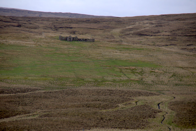
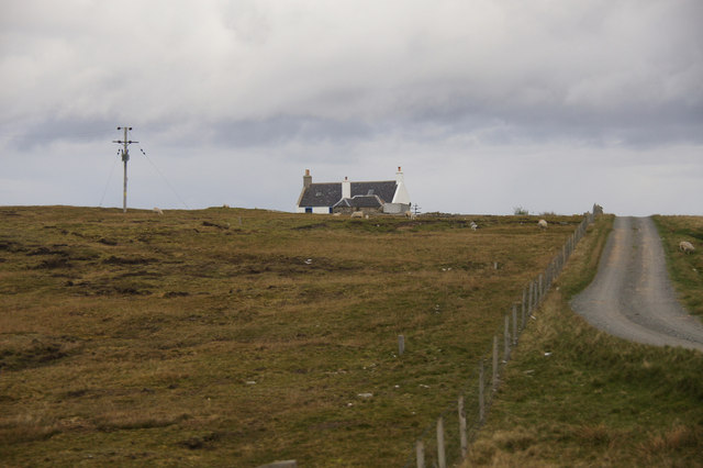
Cunnister is a small picturesque village located on the west coast of the Shetland Islands, Scotland. The village is situated on the mainland of Shetland, overlooking the North Atlantic Ocean. It is approximately 8 miles northwest of Lerwick, the largest town in the Shetland Islands.

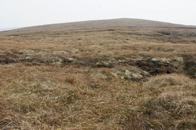
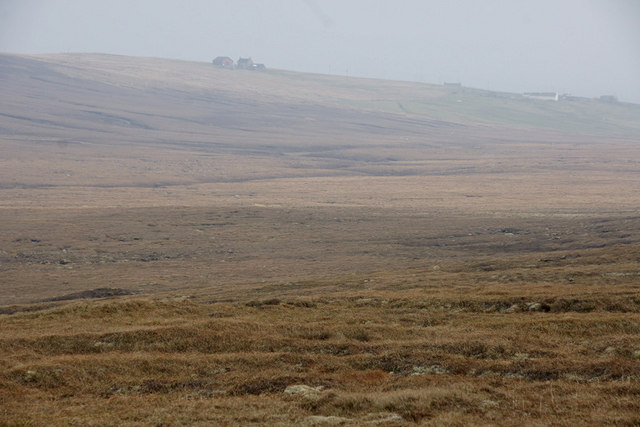
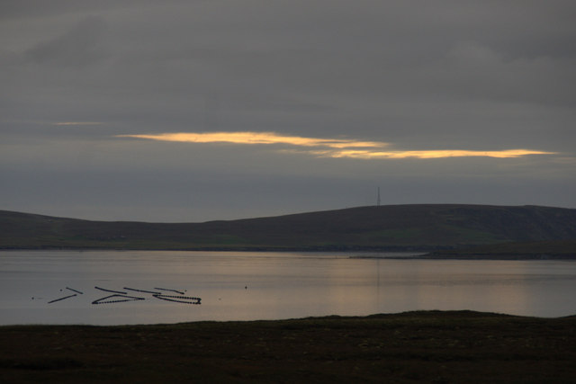
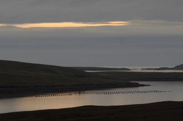
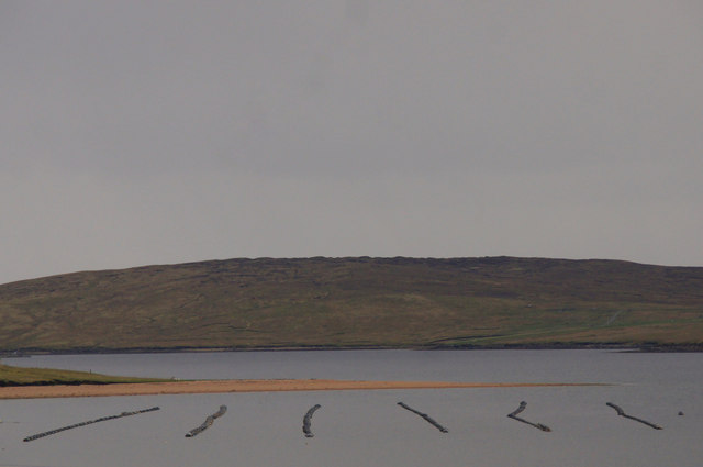
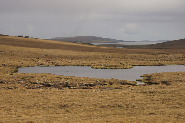
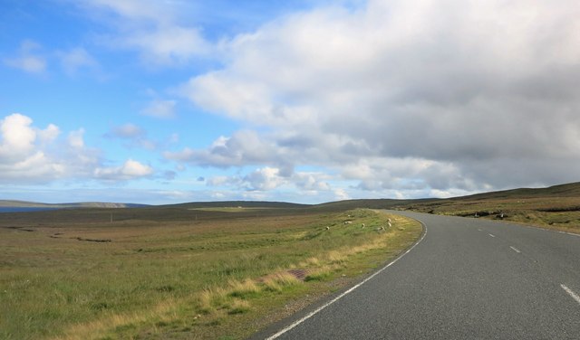
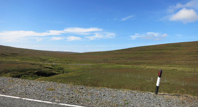
Cunnister is known for its stunning natural beauty and rugged coastline. The village is surrounded by rolling hills and offers breathtaking views of the sea and nearby islands. The area is a haven for wildlife enthusiasts, with numerous species of birds, seals, and otters commonly spotted along the shores.

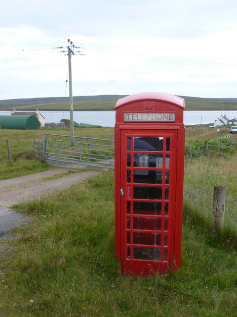
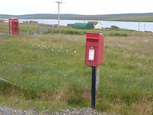
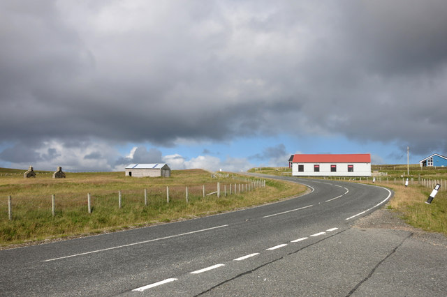
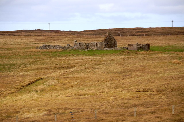
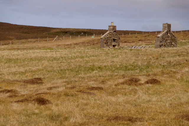
The village itself is a traditional Shetland settlement, with a small number of houses scattered along the coast. The local community is tight-knit, and the residents often engage in fishing, agriculture, and other traditional occupations. The village has a strong sense of community spirit and hosts various events and activities throughout the year.

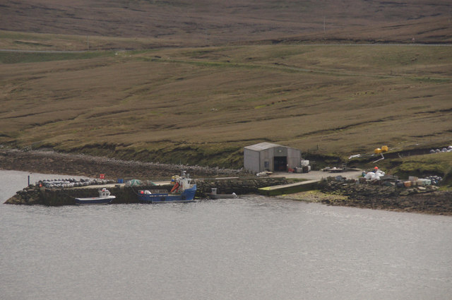
Cunnister is a popular destination for visitors seeking tranquility and a glimpse into the unique Shetland way of life. It offers opportunities for hiking, bird watching, and exploring the rugged coastline. The village is also home to a small harbor, which serves as a base for local fishermen and provides a picturesque setting.

Overall, Cunnister is a charming and peaceful village that encapsulates the natural beauty and rich cultural heritage of the Shetland Islands. It is a place where visitors can immerse themselves in the stunning surroundings and experience the warmth and friendliness of the local community.

If you have any feedback on the listing, please let us know in the comments section below.

Cunnister Images

Images are sourced within 2km of 60.650132/-1.037467 or Grid Reference HU5296. Thanks to Geograph Open Source API. All images are credited.

Hill of Bixsetter, east of Sellafirth
Black Park, North Sandwick Looking towards North Sandwick.
Black Park, North Sandwick
Looking towards North Sandwick.
Sellafirth: telephone box A traditional red phone box, still in working order although as is often the case these days it no longer accepts coins, just off the main road.
Sellafirth: telephone box
A traditional red phone box, still in working order although as is often the case these days it no longer accepts coins, just off the main road.
Sellafirth: postbox № ZE2 87 This postbox stands at a junction of the A968 and is emptied at 9:45 each weekday and Saturday morning. In the background is <a href="https://www.geograph.org.uk/photo/2647764">HU5297 : Sellafirth: telephone box</a>, just down the side road, despite the 1:50,000 and 1:25,000 maps suggesting it is on the corner with the postbox.
Sellafirth: postbox № ZE2 87
This postbox stands at a junction of the A968 and is emptied at 9:45 each weekday and Saturday morning. In the background is HU5297 : Sellafirth: telephone box, just down the side road, despite the 1:50,000 and 1:25,000 maps suggesting it is on the corner with the postbox.
Setter, North Sandwick Ruined crofthouse across the valley from the extant houses.
Setter, North Sandwick
Ruined crofthouse across the valley from the extant houses.
Basta Voe from Colvister Looking east towards the sun poking through clouds (more than two hours after sunrise despite the appearance). There are mussel lines in Basta Voe. In the background is the north end of Hascosay on the far right, with Fetlar beyond that.
Basta Voe from Colvister
Looking east towards the sun poking through clouds (more than two hours after sunrise despite the appearance). There are mussel lines in Basta Voe. In the background is the north end of Hascosay on the far right, with Fetlar beyond that.
Basta Voe from south of Colvister Mussel lines in the voe in the foreground, and Burra Ness and some of the islands noth of Fetlar in the distance.
Basta Voe from south of Colvister
Mussel lines in the voe in the foreground, and Burra Ness and some of the islands noth of Fetlar in the distance.
Colvister beside Basta Voe
Basta Voe pier
Basta Voe pier
North Ayre of Cunnister Mussel ropes in Basta Voe in the foreground.
North Ayre of Cunnister
Mussel ropes in Basta Voe in the foreground.
Un-named lochan west of Hill of Gutcher Looking down towards North Sandwick and Fetlar in the distance.
Un-named lochan west of Hill of Gutcher
Looking down towards North Sandwick and Fetlar in the distance.
A968  at Sellafirth
A968 at Sellafirth
The Main Road at Colvister The A968 about to cross the South Burn of Colvister.
The Main Road at Colvister
The A968 about to cross the South Burn of Colvister.
Old road below the Hill Of Dalsetter The main road has been rebuilt all along here, but several sections of the old alignment still run nearby now used as farm tracks or access to premises.
This is where the old and new roads cross a small stream, the Burn of Colvister.
Old road below the Hill Of Dalsetter
The main road has been rebuilt all along here, but several sections of the old alignment still run nearby now used as farm tracks or access to premises. This is where the old and new roads cross a small stream, the Burn of Colvister.
The Burn of Colvister A small stream flowing into Basta Voe. It drains the Loch of Colvister which is just over the horizon.
The Burn of Colvister
A small stream flowing into Basta Voe. It drains the Loch of Colvister which is just over the horizon.
East end of Sand Water, between Sellafirth and Gutcher
Ruined croft house at Leogie, Sellafirth
Ruined croft house at Sellafirth
Show me another place!

Cunnister is located at Grid Ref: HU5296 (Lat: 60.650132, Lng: -1.037467)

Unitary Authority: Shetland Islands

Police Authority: Highlands and Islands

What 3 Words

///preheated.engraving.wreck. Near Gutcher, Shetland Islands

Related Wikis

Basta, Shetland

Basta is a hamlet on the island of Yell in the Shetland islands of Scotland. It is on the shores of Basta Voe and is in the parish of Yell. == References... ==

North Isles

The North Isles are the northern islands of the Shetland Islands, Scotland. The main islands in the group are Yell, Unst and Fetlar. Sometimes the islands...

Burra Ness Broch

Burra Ness Broch is an iron-age broch located on the east coast of the island of Yell, Shetland, Scotland. == Location == Burra Ness Broch (grid reference...

Gutcher

Gutcher is a settlement on the northeast coast of Yell in the Shetland islands. From here, rollon/roll off ferry services to Belmont on Unst and Hamars...

Linga, Bluemull Sound

Linga is a very small uninhabited island in the Bluemull Sound, Shetland, Scotland. It is one of many islands in Shetland called Linga. It has an area...

Yell, Shetland

Yell (Scots: Yell) is one of the North Isles of Shetland, Scotland. In the 2011 census it had a usually resident population of 966. It is the second largest...

Bluemull Sound

Bluemull Sound is the strait between Unst and Yell in Shetland's North Isles. A ferry service crosses it regularly. Cullivoe is on the Yell side, and the...

Hascosay

Hascosay (Scots: Hascosay; Old Norse "Hafskotsey") is a small island lying between Yell and Fetlar in the Shetland Islands, Scotland. == Geography and... ==

Nearby Amenities

Located within 500m of 60.650132,-1.037467
Cunnister
Place: hamlet
Lat/Long: 60.6512886/-1.0380774
Power: pole
Lat/Long: 60.6542341/-1.0404688
Power: pole
Lat/Long: 60.6536544/-1.0398117
Power: pole
Lat/Long: 60.6530773/-1.0391546
Power: pole
Lat/Long: 60.6524779/-1.0384679
Power: pole
Lat/Long: 60.6521295/-1.0374648
Power: pole
Lat/Long: 60.6518482/-1.0377357
Power: pole
Lat/Long: 60.6509832/-1.0364133
Power: pole
Lat/Long: 60.6512869/-1.0370678
Power: pole
Lat/Long: 60.6504968/-1.0360244
Power: pole
Lat/Long: 60.6500202/-1.0356247
Power: pole
Lat/Long: 60.6493648/-1.035201
Power: pole
Lat/Long: 60.6487088/-1.0347665
Power: pole
Lat/Long: 60.6480449/-1.0343266
Power: pole
Lat/Long: 60.6473664/-1.033876
Power: pole
Lat/Long: 60.6468576/-1.0329882
Power: pole
Lat/Long: 60.6506098/-1.0388516
Power: pole
Lat/Long: 60.6511896/-1.038299
Passing Place
Lat/Long: 60.6516336/-1.0397118
Power: pole
Lat/Long: 60.6528854/-1.0396589
Barrier: cattle_grid
Lat/Long: 60.6534019/-1.0403916
Passing Place
Lat/Long: 60.6481524/-1.0354954
Power: pole
Lat/Long: 60.6502612/-1.0391237
The data included in this document is from www.openstreetmap.org. The data is made available under ODbL.

Have you been to Cunnister?

Leave your review of Cunnister below (or comments, questions and feedback).