Weirhead Plantation
Wood, Forest in Northumberland
England
Weirhead Plantation

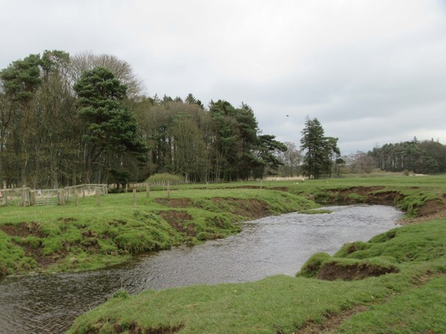
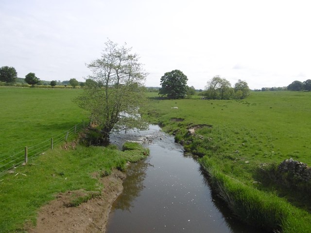
Weirhead Plantation is a picturesque woodland located in the county of Northumberland, England. Covering an area of approximately 200 acres, it is nestled in the heart of the region's stunning countryside. The plantation is well-known for its diverse range of native trees, making it a haven for wildlife and a popular destination for nature enthusiasts.
The woodland is predominantly made up of broadleaf trees, including oak, birch, and beech. These towering trees provide a dense canopy, creating a serene and peaceful atmosphere for visitors. Walking along the well-maintained trails, one can admire the vibrant colors of the changing seasons, from the lush greens of spring and summer to the fiery hues of autumn.
Weirhead Plantation is home to an array of wildlife, including deer, badgers, and a variety of bird species. Birdwatchers can spot woodpeckers, owls, and even the occasional buzzard soaring above the treetops. The plantation's diverse ecosystem also supports a rich variety of plant life, with bluebells, wild garlic, and ferns carpeting the forest floor.
For outdoor enthusiasts, Weirhead Plantation offers a range of recreational activities. Visitors can enjoy walking or cycling along the well-marked trails, immersing themselves in the natural beauty of the surroundings. The plantation also features picnic areas, where families and friends can relax and enjoy a meal amidst the tranquil woodland setting.
In conclusion, Weirhead Plantation in Northumberland is a stunning woodland paradise, boasting a diverse range of native trees and abundant wildlife. Whether seeking solace in nature or seeking adventure, this woodland offers something for everyone.
If you have any feedback on the listing, please let us know in the comments section below.
Weirhead Plantation Images
Images are sourced within 2km of 55.164332/-1.9061687 or Grid Reference NZ0685. Thanks to Geograph Open Source API. All images are credited.


Weirhead Plantation is located at Grid Ref: NZ0685 (Lat: 55.164332, Lng: -1.9061687)
Unitary Authority: Northumberland
Police Authority: Northumbria
What 3 Words
///stuck.nylon.edgy. Near Rothley, Northumberland
Nearby Locations
Related Wikis

Middleton North railway station
Middleton North was a stone-built railway station on the Wansbeck Railway between Morpeth and Reedsmouth, which served the villages of Middleton and Hartburn...

West Grange Hall
West Grange Hall is an English country house and estate in the village of Scots Gap, Northumberland, built between 1863 and 1896 and originally part of...

Scots Gap
Scots Gap is a small village in Northumberland, United Kingdom. == Population == Scots Gap has approximately 70 private residential dwellings, the oldest...
Scotsgap railway station
Scotsgap was a stone-built railway station in Northumberland on the Wansbeck Railway, which served the villages of Scots' Gap and Cambo. It was located...
Hartburn, Northumberland
Hartburn is a village in Northumberland, in England. It is situated about 6 miles (10 km) to the west of Morpeth. The population at the 2011 census was...
Hartburn War Memorial
Hartburn War Memorial is a First World War Memorial in the village of Hartburn, Northumberland, in the north-east of England. The memorial, designed by...

Rothley, Northumberland
Rothley is a small settlement and civil parish in Northumberland, England about 2 miles (3 km) north east of Cambo and about 6 miles (10 km) west of Morpeth...

Huckhoe Settlement
Huckhoe Settlement is an archaeological site in Northumberland, England, near the village of Bolam and about 7 miles (11 km) west of Morpeth. The site...
Nearby Amenities
Located within 500m of 55.164332,-1.9061687Have you been to Weirhead Plantation?
Leave your review of Weirhead Plantation below (or comments, questions and feedback).