East Strip
Wood, Forest in Northumberland
England
East Strip
East Strip is a small, picturesque village located in the county of Northumberland in England. Nestled within a dense forest, it is known for its natural beauty and tranquil ambiance. The village is situated on the eastern side of the strip of land that separates two larger towns in the region.
The main feature of East Strip is its lush woodland, which surrounds the village on all sides. The forest is home to a diverse range of flora and fauna, making it a haven for nature lovers and wildlife enthusiasts. The dense canopy of trees provides a serene environment, with the sound of birdsong and rustling leaves creating a calming atmosphere.
The village itself consists of a tight-knit community of residents who take pride in preserving the natural beauty of their surroundings. The houses in East Strip are predominantly traditional, with charming stone cottages and thatched roofs dotting the landscape. The small, well-maintained gardens and flower-filled window boxes add a touch of color to the village.
Despite its rural setting, East Strip is well-connected to nearby towns and cities. The village benefits from good road links, allowing residents to easily access amenities and services. The nearest town, located to the west, offers a range of shops, schools, and healthcare facilities.
For those seeking outdoor activities, East Strip provides ample opportunities for hiking, cycling, and exploring the forest trails. The area is also popular for birdwatching, with several species of birds calling the forest their home.
In summary, East Strip is a charming village nestled in the woodlands of Northumberland. With its natural beauty, close-knit community, and easy access to amenities, it offers a peaceful and idyllic living environment for its residents.
If you have any feedback on the listing, please let us know in the comments section below.
East Strip Images
Images are sourced within 2km of 55.195587/-1.9090801 or Grid Reference NZ0589. Thanks to Geograph Open Source API. All images are credited.


East Strip is located at Grid Ref: NZ0589 (Lat: 55.195587, Lng: -1.9090801)
Unitary Authority: Northumberland
Police Authority: Northumbria
What 3 Words
///erupt.apricot.twinge. Near Rothley, Northumberland
Nearby Locations
Related Wikis

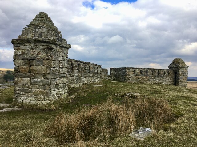
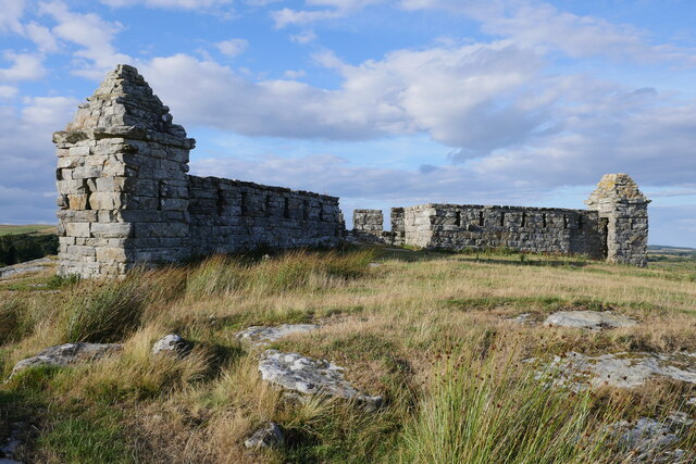
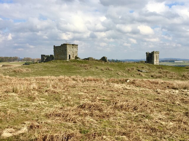
Rothley Castle
Rothley Castle is an 18th-century gothic folly built to resemble a medieval castle, situated at Rothley, Northumberland. It is a Grade II* listed building...
Rothley, Northumberland
Rothley is a small settlement and civil parish in Northumberland, England about 2 miles (3 km) north east of Cambo and about 6 miles (10 km) west of Morpeth...

Longwitton railway station
Longwitton station was a weather board and corrugated iron built railway station in Northumberland on the Rothbury Branch. Originally known as Rothley...

West Grange Hall
West Grange Hall is an English country house and estate in the village of Scots Gap, Northumberland, built between 1863 and 1896 and originally part of...

Scots Gap
Scots Gap is a small village in Northumberland, United Kingdom. == Population == Scots Gap has approximately 70 private residential dwellings, the oldest...
Scotsgap railway station
Scotsgap was a stone-built railway station in Northumberland on the Wansbeck Railway, which served the villages of Scots' Gap and Cambo. It was located...

Ewesley railway station
Ewesley station was a weather board and corrugated iron built railway station in Northumberland on the Rothbury Branch built to serve the local farming...

Middleton North railway station
Middleton North was a stone-built railway station on the Wansbeck Railway between Morpeth and Reedsmouth, which served the villages of Middleton and Hartburn...
Have you been to East Strip?
Leave your review of East Strip below (or comments, questions and feedback).