Butcher's Coppice

Wood, Forest in Dorset

England

Butcher's Coppice

Kinson: Middle Road Middle Road is part of an estate of bungalows, the roads forming the shape of a three-pronged fork without the handle. As its name suggests, Middle Road is the middle 'prong'.

The sign is a modern one, dating from around 2014-15, by which time the council had replaced the coloured logo, which had been prone to fading after a while, to simple wording BOURNEMOUTH BOROUGH COUNCIL in smaller type.

This is photo no.269 of a series of 453 in my coronavirus lockdown walking project:
See <a title="https://www.geograph.org.uk/article/My-2020-Coronavirus-Lockdown-walking-project" href="https://www.geograph.org.uk/article/My-2020-Coronavirus-Lockdown-walking-project">Link</a> for the complete set of photos.
Kinson: Middle Road Credit: Chris Downer

Butcher's Coppice is a picturesque woodland located in Dorset, England. Covering an area of approximately 125 acres, it is nestled within the beautiful landscape of the county. The coppice is known for its diverse range of tree species, including oak, beech, hazel, and ash, which create a rich and vibrant habitat.

The woodland has a long history dating back to the medieval period when it was primarily used for timber production and charcoal burning. Today, it is managed by the local council and serves as a recreational area for the public to enjoy. It offers a tranquil escape from the hustle and bustle of urban life, providing a peaceful haven for nature lovers and outdoor enthusiasts.

Visitors to Butcher's Coppice can explore the network of well-maintained footpaths and trails that wind through the forest, allowing them to discover its natural beauty at their own pace. The woodland is home to a variety of wildlife, including deer, badgers, foxes, and a wide range of bird species, making it a popular spot for birdwatching.

In addition to its natural attractions, Butcher's Coppice also features several amenities for visitors. These include picnic areas, children's play areas, and a café where visitors can relax and enjoy refreshments. The coppice also hosts educational events and workshops, providing visitors with the opportunity to learn more about the local flora and fauna.

Overall, Butcher's Coppice offers a delightful blend of natural beauty, recreational opportunities, and educational experiences, making it a must-visit destination for anyone seeking a peaceful retreat in the heart of Dorset.

If you have any feedback on the listing, please let us know in the comments section below.

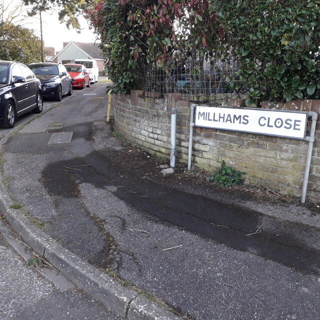
Butcher's Coppice Images

Images are sourced within 2km of 50.764805/-1.9207288 or Grid Reference SZ0596. Thanks to Geograph Open Source API. All images are credited.

Kinson: Middle Road Middle Road is part of an estate of bungalows, the roads forming the shape of a three-pronged fork without the handle. As its name suggests, Middle Road is the middle 'prong'.

The sign is a modern one, dating from around 2014-15, by which time the council had replaced the coloured logo, which had been prone to fading after a while, to simple wording BOURNEMOUTH BOROUGH COUNCIL in smaller type.

This is photo no.269 of a series of 453 in my coronavirus lockdown walking project:
See <a title="https://www.geograph.org.uk/article/My-2020-Coronavirus-Lockdown-walking-project" href="https://www.geograph.org.uk/article/My-2020-Coronavirus-Lockdown-walking-project">Link</a> for the complete set of photos.
Kinson: Middle Road
Middle Road is part of an estate of bungalows, the roads forming the shape of a three-pronged fork without the handle. As its name suggests, Middle Road is the middle 'prong'. The sign is a modern one, dating from around 2014-15, by which time the council had replaced the coloured logo, which had been prone to fading after a while, to simple wording BOURNEMOUTH BOROUGH COUNCIL in smaller type. This is photo no.269 of a series of 453 in my coronavirus lockdown walking project: See Link for the complete set of photos.
Bear Cross: Milford Drive Part of the 1950s bungalow development around Bear Cross, we look along Milford Drive past the sign that greets traffic emerging from Exbury Drive, towards its eastern end at Anstey Road. The latter is the boundary of the West Howe council estate, as can be glimpsed by the council semis in the background.

The sign is a modern one, from 2010-15 when this more modern, abstract emblem rather than the traditional town coat of arms as the working logo of the council.

This is photo no.271 of a series of 453 in my coronavirus lockdown walking project:
See <a title="https://www.geograph.org.uk/article/My-2020-Coronavirus-Lockdown-walking-project" href="https://www.geograph.org.uk/article/My-2020-Coronavirus-Lockdown-walking-project">Link</a> for the complete set of photos.
Bear Cross: Milford Drive
Part of the 1950s bungalow development around Bear Cross, we look along Milford Drive past the sign that greets traffic emerging from Exbury Drive, towards its eastern end at Anstey Road. The latter is the boundary of the West Howe council estate, as can be glimpsed by the council semis in the background. The sign is a modern one, from 2010-15 when this more modern, abstract emblem rather than the traditional town coat of arms as the working logo of the council. This is photo no.271 of a series of 453 in my coronavirus lockdown walking project: See Link for the complete set of photos.
Kinson: Millhams Close A cul-de-sac of bungalows off what was once a reasonably major side road, Millhams Road.

The sign is the standard Bournemouth nameplate from the 1980s, affixed with tubular steel which protrudes at each side. The vacant post just to the left almost certainly once had a No Through Road sign affixed to it, such as at <a href="https://www.geograph.org.uk/photo/6458895">SZ0794 : Ensbury Park: Dawn Close</a>.

This is photo no.272 of a series of 453 in my coronavirus lockdown walking project:
See <a title="https://www.geograph.org.uk/article/My-2020-Coronavirus-Lockdown-walking-project" href="https://www.geograph.org.uk/article/My-2020-Coronavirus-Lockdown-walking-project">Link</a> for the complete set of photos.
Kinson: Millhams Close
A cul-de-sac of bungalows off what was once a reasonably major side road, Millhams Road. The sign is the standard Bournemouth nameplate from the 1980s, affixed with tubular steel which protrudes at each side. The vacant post just to the left almost certainly once had a No Through Road sign affixed to it, such as at SZ0794 : Ensbury Park: Dawn Close. This is photo no.272 of a series of 453 in my coronavirus lockdown walking project: See Link for the complete set of photos.
Kinson: Millhams Drive A cul-de-sac off Millhams Road, younger than and diagonally opposite <a href="https://www.geograph.org.uk/photo/7075244">SZ0696 : Kinson: Millhams Close</a>.

The sign is of a design that became prevalent in Bournemouth around 1990 and was in use for most of that decade. Many are starting to look a bit shabby now, with peeling white or fading blue, and this is a very good example of the white deterioration.

This is photo no.273 of a series of 453 in my coronavirus lockdown walking project:
See <a title="https://www.geograph.org.uk/article/My-2020-Coronavirus-Lockdown-walking-project" href="https://www.geograph.org.uk/article/My-2020-Coronavirus-Lockdown-walking-project">Link</a> for the complete set of photos.
Kinson: Millhams Drive
A cul-de-sac off Millhams Road, younger than and diagonally opposite SZ0696 : Kinson: Millhams Close. The sign is of a design that became prevalent in Bournemouth around 1990 and was in use for most of that decade. Many are starting to look a bit shabby now, with peeling white or fading blue, and this is a very good example of the white deterioration. This is photo no.273 of a series of 453 in my coronavirus lockdown walking project: See Link for the complete set of photos.
Kinson: Millhams Road Looking across the village green at the heart of Kinson, long since a 'village' and very much a suburb of Bournemouth. Millhams Road was a through road coming out by Longham Bridge until roughly the late 1980s, when it was closed to traffic between the parish church and the council tip. That middle stretch is still usable by pedestrians and cyclists and forms part of the Millhams Mead Local Nature Reserve.

The public toilet block is visible at the far end of the green.

The road sign is a standard one from around 2000-2006, perhaps a little earlier, featuring the borough coat of arms.

This is photo no.274 of a series of 453 in my coronavirus lockdown walking project:
See <a title="https://www.geograph.org.uk/article/My-2020-Coronavirus-Lockdown-walking-project" href="https://www.geograph.org.uk/article/My-2020-Coronavirus-Lockdown-walking-project">Link</a> for the complete set of photos.
Kinson: Millhams Road
Looking across the village green at the heart of Kinson, long since a 'village' and very much a suburb of Bournemouth. Millhams Road was a through road coming out by Longham Bridge until roughly the late 1980s, when it was closed to traffic between the parish church and the council tip. That middle stretch is still usable by pedestrians and cyclists and forms part of the Millhams Mead Local Nature Reserve. The public toilet block is visible at the far end of the green. The road sign is a standard one from around 2000-2006, perhaps a little earlier, featuring the borough coat of arms. This is photo no.274 of a series of 453 in my coronavirus lockdown walking project: See Link for the complete set of photos.
East Howe: Minstead Road Minstead is a New Forest village, as is Marchwood, whose namesake road comes off Minstead Road – but these are the only two roads so named in the area.

The sign is from around 2000, and it morphed into another design, in blue rather than green and far more widely seen, including BOURNEMOUTH BOROUGH COUNCIL in smaller letters at the top, and the borough coat of arms on the left.

This is photo no.275 of a series of 453 in my coronavirus lockdown walking project:
See <a title="https://www.geograph.org.uk/article/My-2020-Coronavirus-Lockdown-walking-project" href="https://www.geograph.org.uk/article/My-2020-Coronavirus-Lockdown-walking-project">Link</a> for the complete set of photos.
East Howe: Minstead Road
Minstead is a New Forest village, as is Marchwood, whose namesake road comes off Minstead Road – but these are the only two roads so named in the area. The sign is from around 2000, and it morphed into another design, in blue rather than green and far more widely seen, including BOURNEMOUTH BOROUGH COUNCIL in smaller letters at the top, and the borough coat of arms on the left. This is photo no.275 of a series of 453 in my coronavirus lockdown walking project: See Link for the complete set of photos.
West Howe: Montgomery Avenue One of the main thoroughfares within the large 1950s West Howe council estate, linking its heart, Cunningham Crescent, with its eastern edge, here on the main Kinson Road. There are a few blocks of council flats here at this end – and at the other – while in between is half a mile or so of standard, very recognisable semi-detached council houses.

The sign is an early version of a standard Bournemouth design from around 2000, the early version recognisable by a slightly more emboldened typeface, the wording initially aligned to the left but the centralised layout was used by the time of this one.


This is photo no.276 of a series of 453 in my coronavirus lockdown walking project:
See <a title="https://www.geograph.org.uk/article/My-2020-Coronavirus-Lockdown-walking-project" href="https://www.geograph.org.uk/article/My-2020-Coronavirus-Lockdown-walking-project">Link</a> for the complete set of photos.
West Howe: Montgomery Avenue
One of the main thoroughfares within the large 1950s West Howe council estate, linking its heart, Cunningham Crescent, with its eastern edge, here on the main Kinson Road. There are a few blocks of council flats here at this end – and at the other – while in between is half a mile or so of standard, very recognisable semi-detached council houses. The sign is an early version of a standard Bournemouth design from around 2000, the early version recognisable by a slightly more emboldened typeface, the wording initially aligned to the left but the centralised layout was used by the time of this one. This is photo no.276 of a series of 453 in my coronavirus lockdown walking project: See Link for the complete set of photos.
Ensbury Park: Montrose Drive A cul-de-sac of bungalows off Priestley Road.

The sign tells us that the road isn't modern: it looks like an ordinary 1980s sign mounted on tubular steel (such as the one at <a href="https://www.geograph.org.uk/photo/6447362">SZ0795 : Ensbury Park: Barnes Close</a>), but careful scrutiny will tell us that the lettering and black border is embossed in the metalwork and not put on adhesively like the more modern variety. This makes it one of the older, perhaps 1960s, nameplates.

This is photo no.277 of a series of 451 in my coronavirus lockdown walking project:
See <a title="https://www.geograph.org.uk/article/My-2020-Coronavirus-Lockdown-walking-project" href="https://www.geograph.org.uk/article/My-2020-Coronavirus-Lockdown-walking-project">Link</a> for the complete set of photos.
Ensbury Park: Montrose Drive
A cul-de-sac of bungalows off Priestley Road. The sign tells us that the road isn't modern: it looks like an ordinary 1980s sign mounted on tubular steel (such as the one at SZ0795 : Ensbury Park: Barnes Close), but careful scrutiny will tell us that the lettering and black border is embossed in the metalwork and not put on adhesively like the more modern variety. This makes it one of the older, perhaps 1960s, nameplates. This is photo no.277 of a series of 451 in my coronavirus lockdown walking project: See Link for the complete set of photos.
West Howe: Moore Avenue Seen here ascending from Poole Lane, Moore Avenue is one of the chief roads into the large, 1950s West Howe council estate, as attested by the bus stop (there is a more substantial one opposite, out of picture, with bus shelter).

After the block of flats, more standard semi-detached council houses take over before more flats are found nearer the centre of the estate.

The road sign is a standard one from around 2000-2006, perhaps a little earlier, featuring the borough coat of arms.

This is photo no.279 of a series of 453 in my coronavirus lockdown walking project:
See <a title="https://www.geograph.org.uk/article/My-2020-Coronavirus-Lockdown-walking-project" href="https://www.geograph.org.uk/article/My-2020-Coronavirus-Lockdown-walking-project">Link</a> for the complete set of photos.
West Howe: Moore Avenue
Seen here ascending from Poole Lane, Moore Avenue is one of the chief roads into the large, 1950s West Howe council estate, as attested by the bus stop (there is a more substantial one opposite, out of picture, with bus shelter). After the block of flats, more standard semi-detached council houses take over before more flats are found nearer the centre of the estate. The road sign is a standard one from around 2000-2006, perhaps a little earlier, featuring the borough coat of arms. This is photo no.279 of a series of 453 in my coronavirus lockdown walking project: See Link for the complete set of photos.
West Howe: Moorside Close A small cul-de-sac off Moorside Road, hence the name, Moorside Close actually takes the course of one of the original tracks when this was all fields, before the large 1950s West Howe council estate was built: Behind us to the right is Ericksen Road, while at the top of the hill ahead is a path onto the eastern leg of Tedder Road, which continues diagonally into Mount Road – and that whole route is recognisable, when looking at older maps, as an original track or lane.

The sign is the standard Bournemouth nameplate from the 1980s, affixed with tubular steel which protrudes at each side.

This is photo no.281 of a series of 453 in my coronavirus lockdown walking project:
See <a title="https://www.geograph.org.uk/article/My-2020-Coronavirus-Lockdown-walking-project" href="https://www.geograph.org.uk/article/My-2020-Coronavirus-Lockdown-walking-project">Link</a> for the complete set of photos.
West Howe: Moorside Close
A small cul-de-sac off Moorside Road, hence the name, Moorside Close actually takes the course of one of the original tracks when this was all fields, before the large 1950s West Howe council estate was built: Behind us to the right is Ericksen Road, while at the top of the hill ahead is a path onto the eastern leg of Tedder Road, which continues diagonally into Mount Road – and that whole route is recognisable, when looking at older maps, as an original track or lane. The sign is the standard Bournemouth nameplate from the 1980s, affixed with tubular steel which protrudes at each side. This is photo no.281 of a series of 453 in my coronavirus lockdown walking project: See Link for the complete set of photos.
West Howe: Moorside Gardens Modern infill development of a few houses, off Moorside Road. Because the houses are tucked around the back of the two adjoining gardens, we can't see any of them from here at the end of the road.

The sign is a modern one, from 2010-15 when this more modern, abstract emblem rather than the traditional town coat of arms as the working logo of the council. It is unusual in being a short version with the road name on two lines.

This is photo no.282 of a series of 453 in my coronavirus lockdown walking project:
See <a title="https://www.geograph.org.uk/article/My-2020-Coronavirus-Lockdown-walking-project" href="https://www.geograph.org.uk/article/My-2020-Coronavirus-Lockdown-walking-project">Link</a> for the complete set of photos.
West Howe: Moorside Gardens
Modern infill development of a few houses, off Moorside Road. Because the houses are tucked around the back of the two adjoining gardens, we can't see any of them from here at the end of the road. The sign is a modern one, from 2010-15 when this more modern, abstract emblem rather than the traditional town coat of arms as the working logo of the council. It is unusual in being a short version with the road name on two lines. This is photo no.282 of a series of 453 in my coronavirus lockdown walking project: See Link for the complete set of photos.
West Howe: Moorside Road Looking at some of the semi-detached houses on this road which marks the southeastern edge of the large 1950s West Howe council estate.

The sign dates from around 1999/2000 and is one of the first to include the borough logo. It morphed from this version, one size regardless of the name length, to a similar design but with centred text, to the commonplace version with blue edges and with slightly less emboldened typeface.

This is photo no.283 of a series of 453 in my coronavirus lockdown walking project:
See <a title="https://www.geograph.org.uk/article/My-2020-Coronavirus-Lockdown-walking-project" href="https://www.geograph.org.uk/article/My-2020-Coronavirus-Lockdown-walking-project">Link</a> for the complete set of photos.
West Howe: Moorside Road
Looking at some of the semi-detached houses on this road which marks the southeastern edge of the large 1950s West Howe council estate. The sign dates from around 1999/2000 and is one of the first to include the borough logo. It morphed from this version, one size regardless of the name length, to a similar design but with centred text, to the commonplace version with blue edges and with slightly less emboldened typeface. This is photo no.283 of a series of 453 in my coronavirus lockdown walking project: See Link for the complete set of photos.
West Howe: Mount Road When the large 1950s West Howe council estate was built, Mount Road utilised an original farm track or lane: overlaying older with present-day maps, the course is very obvious.

The sign is an early version of a standard Bournemouth design from around 2000, the early version recognisable by a slightly more emboldened typeface, aligned to the left when on two lines or, never on the newer versions, written on a single line as here.

This is photo no.286 of a series of 453 in my coronavirus lockdown walking project:
See Link for the complete set of photos.
West Howe: Mount Road
When the large 1950s West Howe council estate was built, Mount Road utilised an original farm track or lane: overlaying older with present-day maps, the course is very obvious. The sign is an early version of a standard Bournemouth design from around 2000, the early version recognisable by a slightly more emboldened typeface, aligned to the left when on two lines or, never on the newer versions, written on a single line as here. This is photo no.286 of a series of 453 in my coronavirus lockdown walking project: See Link for the complete set of photos.
Car sales on Wimborne Road
Kinson Conservative Club
Wimborne Road (A341)
Post Office and shop on Wimborne Road
The Acorn public house
Show me another place!

Butcher's Coppice is located at Grid Ref: SZ0596 (Lat: 50.764805, Lng: -1.9207288)

Unitary Authority: Bournemouth, Christchurch and Poole

Police Authority: Dorset

What 3 Words

///covers.firepower.envy. Near Canford Heath, Dorset

Related Wikis

LeAF Studio

LeAF Studio is a co-educational studio school located in the West Howe area of Bournemouth in the English county of Dorset. The school specialises in education...

Oak Academy

Oak Academy (formerly Oakmead College of Technology) is a co-educational secondary school located in the northern outskirts of Bournemouth in the English...

Bear Cross

Bear Cross is a suburb on the north-western edge of Bournemouth, Dorset, taking its name from the crossroads made by the main road (A348) between Poole...
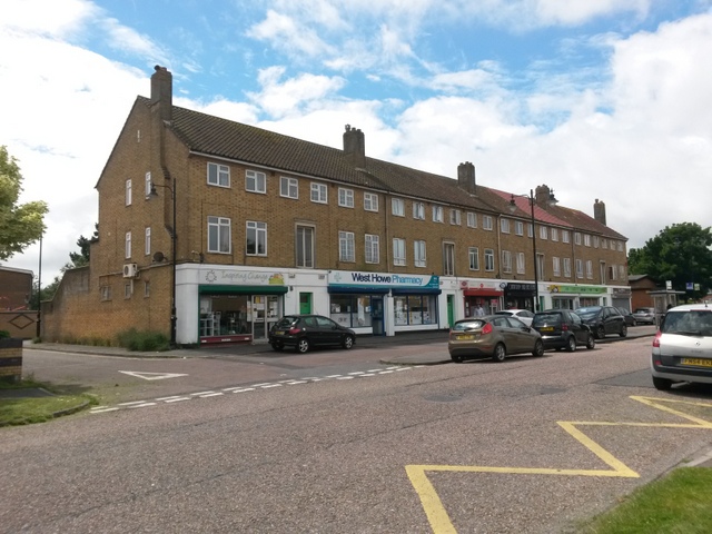
West Howe

West Howe is a suburb of Bournemouth, Dorset, England, located in the north-west provinces of the borough. Largely consisting of affordable housing owned...

Nearby Amenities

Located within 500m of 50.764805,-1.9207288
Traffic Signals
Crossing: traffic_signals
Crossing Ref: puffin
Tactile Paving: yes
Lat/Long: 50.7680172/-1.9200173
West Howe
Is In: Bournemouth
Place: suburb
Wikidata: Q23475239
Lat/Long: 50.7627915/-1.9231484
Source: www.npemap.org.uk
Uk Postcode Centroid: BH11
Lat/Long: 50.762965/-1.918595
Post Box
Collection Times: Mo-Fr 17:30; Sa 12:15
Operator: Royal Mail
Operator Wikidata: Q638098
Post Box Type: pillar
Ref: BH11 162
Ref GB Uprn: 10015309652
Royal Cypher: EIIR
Royal Cypher Wikidata: Q33102113
Lat/Long: 50.7671378/-1.9179268
Post Box
Operator: Royal Mail
Operator Wikidata: Q638098
Post Box Type: pillar
Ref: BH11 241
Ref GB Uprn: 10015323258
Lat/Long: 50.763416/-1.914196
Post Box
Collection Times: Mo-Fr 17:30; Sa 12:00
Operator: Royal Mail
Operator Wikidata: Q638098
Post Box Type: pillar
Ref: BH11 207
Royal Cypher: GR
Royal Cypher Wikidata: Q33102273
Lat/Long: 50.7616704/-1.9251636
Post Box
Collection Times: Mo-Fr 17:30; Sa 12:15
Operator: Royal Mail
Operator Wikidata: Q638098
Post Box Type: pillar
Ref: BH11 78
Ref GB Uprn: 10015450640
Royal Cypher: EIIR
Royal Cypher Wikidata: Q33102113
Lat/Long: 50.7673738/-1.9230388
Turning Circle
Lat/Long: 50.7688351/-1.9187988
Turning Circle
Lat/Long: 50.7641017/-1.9277257
Barrier: cycle_barrier
Motor Vehicle: no
Lat/Long: 50.765141/-1.9238403
Turning Circle
Lat/Long: 50.7681984/-1.9233513
Power: tower
Source: Bing
Lat/Long: 50.7669788/-1.9262203
Crossing
Crossing: traffic_signals
Crossing Ref: puffin
Tactile Paving: yes
Lat/Long: 50.7680471/-1.9201914
Traffic Signals
Button Operated: yes
Crossing: traffic_signals
Crossing Ref: pelican
Tactile Paving: yes
Lat/Long: 50.7613213/-1.924906
Bear Cross
Description: This is not East Howe it is West Howe!rnEast Howe is east of Kinson road.
Place: suburb
Lat/Long: 50.7651185/-1.9171756
School
Leaf Academy
Lat/Long: 50.7626999/-1.9205559
Pub
Shoulder of Mutton
Addr Housenumber: 1010
Addr Postcode: BH11 9LA
Addr Street: Ringwood Road
Fhrs Id: 342704
Source Addr: FHRS Open Data
Lat/Long: 50.7623755/-1.9251052
Leisure: firepit
Lat/Long: 50.7647302/-1.9196111
Leisure: firepit
Lat/Long: 50.7645041/-1.9194306
Leisure: firepit
Lat/Long: 50.7643094/-1.9191475
Leisure: firepit
Lat/Long: 50.764184/-1.9187511
Leisure: firepit
Lat/Long: 50.7639848/-1.9181813
Leisure: firepit
Lat/Long: 50.7637542/-1.9183582
Leisure: firepit
Lat/Long: 50.7635214/-1.9185175
Turning Circle
Lat/Long: 50.7636733/-1.9161219
Generator Method: photovoltaic
Generator Output Electricity: yes
Generator Source: solar
Generator Type: solar_photovoltaic_panel
Location: roof
Power: generator
Lat/Long: 50.760511/-1.9192948
Generator Method: photovoltaic
Generator Output Electricity: yes
Generator Source: solar
Generator Type: solar_photovoltaic_panel
Location: roof
Power: generator
Lat/Long: 50.760477/-1.9194504
Generator Method: photovoltaic
Generator Output Electricity: yes
Generator Source: solar
Generator Type: solar_photovoltaic_panel
Location: roof
Power: generator
Lat/Long: 50.7604635/-1.9204428
Generator Method: photovoltaic
Generator Output Electricity: yes
Generator Source: solar
Generator Type: solar_photovoltaic_panel
Location: roof
Power: generator
Lat/Long: 50.7604092/-1.9203248
Generator Method: photovoltaic
Generator Output Electricity: yes
Generator Source: solar
Generator Type: solar_photovoltaic_panel
Location: roof
Power: generator
Lat/Long: 50.7603735/-1.9202202
Generator Method: photovoltaic
Generator Output Electricity: yes
Generator Source: solar
Generator Type: solar_photovoltaic_panel
Location: roof
Power: generator
Lat/Long: 50.7608367/-1.9199037
Generator Method: photovoltaic
Generator Output Electricity: yes
Generator Source: solar
Generator Type: solar_photovoltaic_panel
Location: roof
Power: generator
Lat/Long: 50.7608469/-1.9196274
Generator Method: photovoltaic
Generator Output Electricity: yes
Generator Source: solar
Generator Type: solar_photovoltaic_panel
Location: roof
Power: generator
Lat/Long: 50.7608096/-1.9190749
Generator Method: photovoltaic
Generator Output Electricity: yes
Generator Source: solar
Generator Type: solar_photovoltaic_panel
Location: roof
Power: generator
Lat/Long: 50.7607909/-1.9189971
Generator Method: photovoltaic
Generator Output Electricity: yes
Generator Source: solar
Generator Type: solar_photovoltaic_panel
Location: roof
Power: generator
Lat/Long: 50.7607366/-1.9186001
Generator Method: photovoltaic
Generator Output Electricity: yes
Generator Source: solar
Generator Type: solar_photovoltaic_panel
Location: roof
Power: generator
Lat/Long: 50.7606993/-1.918356
Generator Method: photovoltaic
Generator Output Electricity: yes
Generator Source: solar
Generator Type: solar_photovoltaic_panel
Location: roof
Power: generator
Lat/Long: 50.7606535/-1.91801
Generator Method: photovoltaic
Generator Output Electricity: yes
Generator Source: solar
Generator Type: solar_photovoltaic_panel
Location: roof
Power: generator
Lat/Long: 50.7610641/-1.9179054
Generator Method: photovoltaic
Generator Output Electricity: yes
Generator Source: solar
Generator Type: solar_photovoltaic_panel
Location: roof
Power: generator
Lat/Long: 50.7611404/-1.9182756
Generator Method: photovoltaic
Generator Output Electricity: yes
Generator Source: solar
Generator Type: solar_photovoltaic_panel
Location: roof
Power: generator
Lat/Long: 50.7612049/-1.9187691
Generator Method: photovoltaic
Generator Output Electricity: yes
Generator Source: solar
Generator Type: solar_photovoltaic_panel
Location: roof
Power: generator
Lat/Long: 50.7612829/-1.919335
Generator Method: photovoltaic
Generator Output Electricity: yes
Generator Source: solar
Generator Type: solar_photovoltaic_panel
Location: roof
Power: generator
Lat/Long: 50.7612931/-1.9194745
Generator Method: photovoltaic
Generator Output Electricity: yes
Generator Source: solar
Generator Type: solar_photovoltaic_panel
Location: roof
Power: generator
Lat/Long: 50.7643219/-1.9145994
Generator Method: photovoltaic
Generator Output Electricity: yes
Generator Source: solar
Generator Type: solar_photovoltaic_panel
Location: roof
Power: generator
Lat/Long: 50.7640963/-1.9141542
Generator Method: photovoltaic
Generator Output Electricity: yes
Generator Source: solar
Generator Type: solar_photovoltaic_panel
Location: roof
Power: generator
Lat/Long: 50.7640539/-1.9140791
Generator Method: photovoltaic
Generator Output Electricity: yes
Generator Source: solar
Generator Type: solar_photovoltaic_panel
Location: roof
Power: generator
Lat/Long: 50.7653378/-1.9148164
Generator Method: photovoltaic
Generator Output Electricity: yes
Generator Source: solar
Generator Type: solar_photovoltaic_panel
Location: roof
Power: generator
Lat/Long: 50.7653547/-1.9145589
Generator Method: photovoltaic
Generator Output Electricity: yes
Generator Source: solar
Generator Type: solar_photovoltaic_panel
Location: roof
Power: generator
Lat/Long: 50.7653829/-1.9147762
Generator Method: photovoltaic
Generator Output Electricity: yes
Generator Source: solar
Generator Type: solar_photovoltaic_panel
Location: roof
Power: generator
Lat/Long: 50.7654329/-1.9147386
Generator Method: photovoltaic
Generator Output Electricity: yes
Generator Source: solar
Generator Type: solar_photovoltaic_panel
Location: roof
Power: generator
Lat/Long: 50.7651836/-1.9150028
Generator Method: photovoltaic
Generator Output Electricity: yes
Generator Source: solar
Generator Type: solar_photovoltaic_panel
Location: roof
Power: generator
Lat/Long: 50.7651454/-1.9149344
Generator Method: photovoltaic
Generator Output Electricity: yes
Generator Source: solar
Generator Type: solar_photovoltaic_panel
Location: roof
Power: generator
Lat/Long: 50.7651089/-1.914862
Generator Method: photovoltaic
Generator Output Electricity: yes
Generator Source: solar
Generator Type: solar_photovoltaic_panel
Location: roof
Power: generator
Lat/Long: 50.7654618/-1.9146783
Generator Method: photovoltaic
Generator Output Electricity: yes
Generator Source: solar
Generator Type: solar_photovoltaic_panel
Location: roof
Power: generator
Lat/Long: 50.7655374/-1.9146447
Generator Method: photovoltaic
Generator Output Electricity: yes
Generator Source: solar
Generator Type: solar_photovoltaic_panel
Location: roof
Power: generator
Lat/Long: 50.7655883/-1.9145803
Generator Method: photovoltaic
Generator Output Electricity: yes
Generator Source: solar
Generator Type: solar_photovoltaic_panel
Location: roof
Power: generator
Lat/Long: 50.7656274/-1.9142852
Generator Method: photovoltaic
Generator Output Electricity: yes
Generator Source: solar
Generator Type: solar_photovoltaic_panel
Location: roof
Power: generator
Lat/Long: 50.7656732/-1.914355
Generator Method: photovoltaic
Generator Output Electricity: yes
Generator Source: solar
Generator Type: solar_photovoltaic_panel
Location: roof
Power: generator
Lat/Long: 50.7656986/-1.9144193
Generator Method: photovoltaic
Generator Output Electricity: yes
Generator Source: solar
Generator Type: solar_photovoltaic_panel
Location: roof
Power: generator
Lat/Long: 50.7657427/-1.914481
Generator Method: photovoltaic
Generator Output Electricity: yes
Generator Source: solar
Generator Type: solar_photovoltaic_panel
Location: roof
Power: generator
Lat/Long: 50.7657749/-1.9145561
Generator Method: photovoltaic
Generator Output Electricity: yes
Generator Source: solar
Generator Type: solar_photovoltaic_panel
Location: roof
Power: generator
Lat/Long: 50.765539/-1.9152978
Generator Method: photovoltaic
Generator Output Electricity: yes
Generator Source: solar
Generator Type: solar_photovoltaic_panel
Location: roof
Power: generator
Lat/Long: 50.765729/-1.91509
Generator Method: photovoltaic
Generator Output Electricity: yes
Generator Source: solar
Generator Type: solar_photovoltaic_panel
Location: roof
Power: generator
Lat/Long: 50.7669275/-1.9147171
Generator Method: photovoltaic
Generator Output Electricity: yes
Generator Source: solar
Generator Type: solar_photovoltaic_panel
Location: roof
Power: generator
Lat/Long: 50.7653559/-1.9162111
Generator Method: photovoltaic
Generator Output Electricity: yes
Generator Source: solar
Generator Type: solar_photovoltaic_panel
Location: roof
Power: generator
Lat/Long: 50.765115/-1.9162728
Generator Method: photovoltaic
Generator Output Electricity: yes
Generator Source: solar
Generator Type: solar_photovoltaic_panel
Location: roof
Power: generator
Lat/Long: 50.7651235/-1.9163425
Generator Method: photovoltaic
Generator Output Electricity: yes
Generator Source: solar
Generator Type: solar_photovoltaic_panel
Location: roof
Power: generator
Lat/Long: 50.7632732/-1.9257324
Generator Method: photovoltaic
Generator Output Electricity: yes
Generator Source: solar
Generator Type: solar_photovoltaic_panel
Location: roof
Power: generator
Lat/Long: 50.7685467/-1.9227082
Generator Method: photovoltaic
Generator Output Electricity: yes
Generator Source: solar
Generator Type: solar_photovoltaic_panel
Location: roof
Power: generator
Lat/Long: 50.7649172/-1.9190564
Generator Method: photovoltaic
Generator Output Electricity: yes
Generator Source: solar
Generator Type: solar_photovoltaic_panel
Location: roof
Power: generator
Lat/Long: 50.7648705/-1.9188847
Crossing
Kerb: lowered
Lat/Long: 50.7678198/-1.9200652
Kerb: raised
Lat/Long: 50.7659826/-1.9218617
Kerb: raised
Lat/Long: 50.7658356/-1.9220032
Crossing
Crossing: unmarked
Crossing Markings: no
Traffic Calming: table
Lat/Long: 50.7634304/-1.9143229
Bus Stop
Fulwood Avenue
Bench: no
Bin: no
Bus: yes
Lit: no
Public Transport: platform
Shelter: no
Tactile Paving: no
Lat/Long: 50.7681909/-1.9247237
Bus Stop
Dalewood Avenue
Bench: no
Bin: no
Bus: yes
Lit: no
Public Transport: platform
Shelter: no
Tactile Paving: no
Lat/Long: 50.7650796/-1.9255042
Bus Stop
Bearwood Estate, Knighton Heath Road
Bench: no
Bin: no
Bus: yes
Lit: no
Public Transport: platform
Shelter: no
Tactile Paving: no
Lat/Long: 50.7627452/-1.9264229
Bus Stop
Poole Lane Roundabout
Bench: no
Bin: no
Bus: yes
Naptan AtcoCode: 1290BOA56557
Naptan Bearing: S
Naptan CommonName: Oakmead Gardens
Naptan Indicator: S-bound
Naptan NaptanCode: bougpdm
Naptan PlusbusZoneRef: BOMO
Naptan Street: Ringwood Road
Naptan Verified: no
Public Transport: platform
Shelter: no
Tactile Paving: no
Lat/Long: 50.7614057/-1.9248095
Bus Stop
Oakmead School
Bench: no
Bin: no
Bus: yes
Lit: no
Naptan AtcoCode: 1290BOA56559
Naptan NaptanCode: bougmwj
Public Transport: platform
Shelter: no
Tactile Paving: no
Lat/Long: 50.76354/-1.9243643
Bus Stop
Oakmead School
Bench: yes
Bin: no
Bus: yes
Public Transport: platform
Shelter: no
Lat/Long: 50.7633551/-1.9241658
Bus Stop
Holloway Avenue
Bench: no
Bin: no
Bus: yes
Lit: no
Public Transport: platform
Shelter: no
Tactile Paving: no
Lat/Long: 50.7665114/-1.9217974
Bus Stop
Holloway Avenue
Bench: no
Bin: no
Bus: yes
Lit: yes
Naptan AtcoCode: 1290WDY38456
Naptan NaptanCode: bouadpj
Public Transport: platform
Shelter: yes
Tactile Paving: no
Lat/Long: 50.7665411/-1.9212985
Bus Stop
Bear Cross Roundabout
Bench: yes
Bin: no
Bus: yes
Lit: yes
Naptan AtcoCode: 1290WDY38454
Naptan NaptanCode: bouadtp
Public Transport: platform
Shelter: yes
Tactile Paving: no
Lat/Long: 50.7687974/-1.9196543
Bus Stop
Bear Cross Roundabout
Bench: no
Bin: no
Bus: yes
Lit: no
Public Transport: platform
Shelter: no
Tactile Paving: no
Lat/Long: 50.7688974/-1.9198608
Bus Stop
Elmrise School
Bus: yes
Naptan AtcoCode: 1290BOB20062
Naptan Bearing: SE
Naptan CommonName: Elm Academy
Naptan Indicator: SE-bound
Naptan NaptanCode: bouagmp
Naptan PlusbusZoneRef: BOMO
Naptan Street: Holloway Avenue
Naptan Verified: no
Public Transport: platform
Lat/Long: 50.7635103/-1.9143529
Bus Stop
Cornerstone Church
Bus: yes
Naptan AtcoCode: 1290BOB20061
Naptan Bearing: E
Naptan CommonName: Cornerstone Church
Naptan Indicator: E-bound
Naptan NaptanCode: bouagjm
Naptan PlusbusZoneRef: BOMO
Naptan Street: Holloway Avenue
Naptan Verified: no
Public Transport: platform
Lat/Long: 50.7641084/-1.9157839
Bus Stop
West Howe Baptist Church
Bus: yes
Naptan AtcoCode: 1290BOA05702
Naptan Bearing: N
Naptan CommonName: Cornerstone Church
Naptan Indicator: N-bound
Naptan NaptanCode: bougtag
Naptan PlusbusZoneRef: BOMO
Naptan Verified: no
Public Transport: platform
Lat/Long: 50.764597/-1.9163659
Bus Stop
Anchor Road
Bus: yes
Naptan AtcoCode: 1290BOA05703
Naptan Bearing: N
Naptan CommonName: Anchor Road
Naptan Indicator: N-bound
Naptan NaptanCode: bougtaj
Naptan PlusbusZoneRef: BOMO
Naptan Street: Anstey Road
Naptan Verified: no
Public Transport: platform
Lat/Long: 50.7657217/-1.9155908
Bus Stop
Anchor Road
Bus: yes
Naptan AtcoCode: 1290BOA05704
Naptan Bearing: S
Naptan CommonName: Anchor Road
Naptan Indicator: S-bound
Naptan NaptanCode: bougtam
Naptan PlusbusZoneRef: BOMO
Naptan Street: Anstey Road
Naptan Verified: no
Public Transport: platform
Lat/Long: 50.7657031/-1.9154526
Bus Stop
Cornerstone Church
Bus: yes
Naptan AtcoCode: 1290BOB20060
Naptan Bearing: W
Naptan CommonName: Cornerstone Church
Naptan Indicator: W-bound
Naptan NaptanCode: bouagda
Naptan PlusbusZoneRef: BOMO
Naptan Street: Holloway Avenue
Naptan Verified: no
Public Transport: platform
Lat/Long: 50.7642475/-1.9172511
Bus Stop
Milford Drive
Bus: yes
Naptan AtcoCode: 1290BOB20057
Naptan Bearing: NE
Naptan CommonName: Milford Drive
Naptan Indicator: NE-bound
Naptan NaptanCode: bouadpm
Naptan PlusbusZoneRef: BOMO
Naptan Street: Anchor Road
Naptan Verified: no
Public Transport: platform
Lat/Long: 50.765871/-1.9208157
Bus Stop
Milford Drive
Bus: yes
Naptan AtcoCode: 1290BOB20056
Naptan Bearing: SW
Naptan CommonName: Milford Drive
Naptan Indicator: SW-bound
Naptan NaptanCode: bouadpt
Naptan PlusbusZoneRef: BOMO
Naptan Street: Anchor Road
Naptan Verified: no
Public Transport: platform
Lat/Long: 50.765871/-1.9206601
Bus Stop
Bear Cross, Anchor Road Parade
Bus: yes
Naptan AtcoCode: 1290BOB20055
Naptan Bearing: E
Naptan CommonName: Anchor Road Parade
Naptan Indicator: E-bound
Naptan NaptanCode: bouadwm
Naptan PlusbusZoneRef: BOMO
Naptan Street: Anchor Road
Naptan Verified: no
Public Transport: platform
Lat/Long: 50.767576/-1.9185922
Bus Stop
Bear Cross, Anchor Road Parade
Bench: no
Bin: no
Bus: yes
Lit: yes
Naptan AtcoCode: 1290BOB20054
Naptan Bearing: W
Naptan CommonName: Anchor Road Parade
Naptan Indicator: W-bound
Naptan NaptanCode: bouagap
Naptan PlusbusZoneRef: BOMO
Naptan Street: Anchor Road
Naptan Verified: no
Public Transport: platform
Shelter: no
Tactile Paving: no
Lat/Long: 50.7672859/-1.9179484
Bus Stop
Anchor Road
Bus: yes
Naptan AtcoCode: 1290BOB20052
Naptan Bearing: E
Naptan CommonName: Exbury Drive
Naptan Indicator: E-bound
Naptan NaptanCode: bouagmg
Naptan PlusbusZoneRef: BOMO
Naptan Street: Anchor Road
Naptan Verified: no
Public Transport: platform
Lat/Long: 50.7666921/-1.9150141
Bus Stop
Anchor Road
Bus: yes
Naptan AtcoCode: 1290BOB20053
Naptan Bearing: W
Naptan CommonName: Exbury Drive
Naptan Indicator: W-bound
Naptan NaptanCode: bouagjw
Naptan PlusbusZoneRef: BOMO
Naptan Street: Anchor Road
Naptan Verified: no
Public Transport: platform
Lat/Long: 50.7666921/-1.915293
Bicycle Rental
Fulwood Avenue
Bicycle Rental: dropoff_point
Capacity: 5
Email: support@beryl.cc
Fee: yes
Name Signed: no
Network: Beryl - Bournemouth Poole Christchurch
Official Name: Fulwood Avenue
Operator: Beryl
Operator Wikidata: Q106575369
Payment App: yes
Payment App Android: cc.beryl.basis
Payment App Ios: 1386768364
Payment Cash: no
Payment Credit Cards: no
Payment Cryptocurrencies: no
Payment Debit Cards: no
Payment Electronic Purses: no
Phone: +44 20 3003 5044
Ref Gbfs: beryl_bcp:406
Rental: city_bike
Website: https://beryl.cc/scheme/bournemouth-christchurch-and-poole
Lat/Long: 50.7670937/-1.921512
Give Way
Direction: backward
Lat/Long: 50.7658091/-1.9249477
Give Way
Direction: backward
Lat/Long: 50.7647573/-1.9255042
Give Way
Direction: forward
Lat/Long: 50.7645172/-1.925698
Tesco Bear Cross Express
Addr Housenumber: 46-50
Addr Postcode: BH11 9HS
Addr Street: Anchor Road
Brand: Tesco Express
Brand Wikidata: Q98456772
Fhrs Id: 495378
Not Brand Wikidata: Q98456772
Opening Hours: Mo-Su 07:00-23:00
Shop: convenience
Website: https://www.tesco.com/store-locator/dorset/46-50-anchor-road
Lat/Long: 50.7670382/-1.9175196
The data included in this document is from www.openstreetmap.org. The data is made available under ODbL.

Have you been to Butcher's Coppice?

Leave your review of Butcher's Coppice below (or comments, questions and feedback).