Low Brown Bank Wood

Wood, Forest in Yorkshire Craven

England

Low Brown Bank Wood

Sheep dip below Howgill Lane The facility is variously referred to on maps as 'sheep dip' or 'sheep wash'; the water presumably comes from the stream causing the boggy surface in the foreground.
Sheep dip below Howgill Lane Credit: Stephen Craven

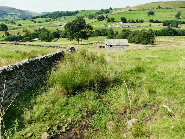
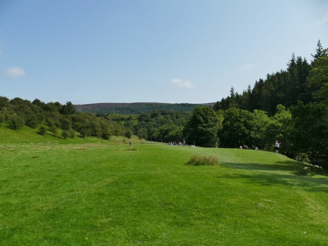
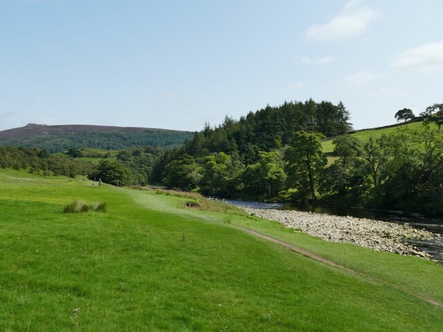
Low Brown Bank Wood is a picturesque woodland located in Yorkshire, England. Covering an area of approximately 100 acres, it is known for its natural beauty and diverse range of flora and fauna.

The wood is characterized by its dense canopy of towering trees, including oak, beech, and ash. This provides a sheltered habitat for a wide variety of wildlife, making it a popular destination for nature enthusiasts and birdwatchers. Visitors to the wood can expect to see a range of bird species, such as woodpeckers, owls, and thrushes, as well as small mammals like squirrels and hedgehogs.

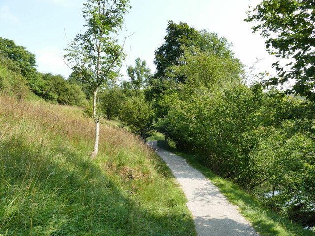
Tranquil walking trails wind their way through the wood, allowing visitors to explore its hidden corners and enjoy the peaceful surroundings. These paths are well-maintained, making it accessible to people of all ages and abilities.

Low Brown Bank Wood also boasts a rich history. It is believed to have been part of an ancient woodland that once covered much of the area. Remnants of this history can be seen in the form of old stone walls and moss-covered ruins. The wood is also home to a number of archaeological sites, including prehistoric burial mounds.

Overall, Low Brown Bank Wood offers a serene escape from the hustle and bustle of everyday life. Whether you are looking to immerse yourself in nature, go for a leisurely stroll, or learn about the region's history, this beautiful woodland has something to offer for everyone.

If you have any feedback on the listing, please let us know in the comments section below.

Low Brown Bank Wood Images

Images are sourced within 2km of 54.03117/-1.9147156 or Grid Reference SE0559. Thanks to Geograph Open Source API. All images are credited.

Sheep dip below Howgill Lane The facility is variously referred to on maps as 'sheep dip' or 'sheep wash'; the water presumably comes from the stream causing the boggy surface in the foreground.
Sheep dip below Howgill Lane
The facility is variously referred to on maps as 'sheep dip' or 'sheep wash'; the water presumably comes from the stream causing the boggy surface in the foreground.
Howgill Barn Now holiday accommodation.
Howgill Barn
Now holiday accommodation.
Howgill Lodge Holiday accommodation with adjacent caravan and camp site.
Howgill Lodge
Holiday accommodation with adjacent caravan and camp site.
Bridge on Stangs Lane The bridge takes the lane over Fir Beck.
Bridge on Stangs Lane
The bridge takes the lane over Fir Beck.
New planting below Knowles Lodge Alongside the public footpath.
New planting below Knowles Lodge
Alongside the public footpath.
Rapids on the Wharfe below Haugh Wood There wasn't much water in the river at this time, it would be more impressive after heavy rain.
Rapids on the Wharfe below Haugh Wood
There wasn't much water in the river at this time, it would be more impressive after heavy rain.
Entering Haugh Wood from the west The path is part of the Dales Way.
Entering Haugh Wood from the west
The path is part of the Dales Way.
Picnic site by the Wharfe A fairly flat field, a short walk from Appletreewick village or the nearby caravan site, made a suitable picnic site for several families.
Picnic site by the Wharfe
A fairly flat field, a short walk from Appletreewick village or the nearby caravan site, made a suitable picnic site for several families.
Gravel bank in the Wharfe Fairly low flow in the river exposed this gravel bank. The path forms part of the Dales Way.
Gravel bank in the Wharfe
Fairly low flow in the river exposed this gravel bank. The path forms part of the Dales Way.
The River Wharfe near Barden Bridge
Barn at Haugh Mill Farm
Old tractor at Haugh Mill Farm
Former chapel near Howgill This former Primitive Methodist chapel was erected in 1836. It closed in the 1990s and was converted into a house: <span class="nowrap"><a title="https://www.myprimitivemethodists.org.uk/content/chapels/yorkshire/hi-hy/howgill_barden_pm_chapel_north_yorkshire" rel="nofollow ugc noopener" href="https://www.myprimitivemethodists.org.uk/content/chapels/yorkshire/hi-hy/howgill_barden_pm_chapel_north_yorkshire">Link</a><img style="margin-left:2px;" alt="External link" title="External link - shift click to open in new window" src="https://s1.geograph.org.uk/img/external.png" width="10" height="10"/></span>
Former chapel near Howgill
This former Primitive Methodist chapel was erected in 1836. It closed in the 1990s and was converted into a house: LinkExternal link
Meadow near Appletreewick
Rapids on the River Wharfe
View across the River Wharfe
View from the Dales Way towards Lower Fell Plantation
Countryside near Burnsall, Yorkshire Dales Looking across Wharfedale towards Low Farm campsite and Appletreewick.
Countryside near Burnsall, Yorkshire Dales
Looking across Wharfedale towards Low Farm campsite and Appletreewick.
Show me another place!

Low Brown Bank Wood is located at Grid Ref: SE0559 (Lat: 54.03117, Lng: -1.9147156)

Division: West Riding

Administrative County: North Yorkshire

District: Craven

Police Authority: North Yorkshire

What 3 Words

///vows.riverboat.minus. Near Grassington, North Yorkshire

Related Wikis

Appletreewick

Appletreewick is a village and civil parish in the Craven district of North Yorkshire, England, 6.5 miles (10.5 km) north-east of Skipton, 7 miles (11...

Skyreholme

Skyreholme is a hamlet in Wharfedale in the Yorkshire Dales, North Yorkshire, England. It lies 1-mile (1.6 km) east of Appletreewick, in the small side...

Parcevall Hall

Parcevall Hall -- also known as Parceval Hall -- and its gardens are located at Skyreholme near Appletreewick village, Wharfedale, North Yorkshire, England...

River Dibb

The River Dibb, also known as Barben Beck, is a small river located in North Yorkshire, England. It is a tributary of the River Wharfe. Grimwith Reservoir...

Simon's Seat

Simon's Seat is a peak in the Yorkshire Dales in northern England. It is a prominent outcrop of millstone grit on the eastern side of Wharfedale. Although...

Barden Tower

Barden Tower is a ruined building in the Parish of Barden, in Wharfedale, North Yorkshire, England. The tower was used as a hunting lodge in the 15th and...

Barden, Craven

Barden is a civil parish in the Craven district of North Yorkshire, England. It consists of the hamlet of Drebley and a few scattered houses in Wharfedale...

Hartlington

Hartlington is a small village and civil parish in the Craven district of North Yorkshire, England. At the 2011 Census, the population of the parish was...

Nearby Amenities

Located within 500m of 54.03117,-1.9147156
Drebley
Is In County: North Yorkshire
Is In Municipality: Craven
Place: hamlet
Wikidata: Q662753
Wikipedia: en:Barden, Craven
Lat/Long: 54.028542/-1.9205369
Herds Hill
Man Made: survey_point
Natural: peak
Source: OS 1:25k
Lat/Long: 54.0305305/-1.9211103
Brown Bank Hill
Natural: peak
Source: OS OpenData StreetView
Lat/Long: 54.0306212/-1.9187371
Ford: yes
Lat/Long: 54.0286059/-1.9127929
Haugh
Natural: peak
Source: OS 1:25k
Lat/Long: 54.0327172/-1.9120515
lime kiln
Archaeological Site: lime_kiln
Historic: archaeological_site
Mineral: limestone
Output: lime
Source: OS sheet 151,publ. 1853
Lat/Long: 54.0289078/-1.9118901
lime kiln
Archaeological Site: lime_kiln
Historic: archaeological_site
Mineral: limestone
Output: lime
Source: OS sheet 151,publ. 1853
Lat/Long: 54.0292417/-1.9086765
Information: guidepost
Tourism: information
Lat/Long: 54.0293255/-1.9197665
Information: guidepost
Tourism: information
Lat/Long: 54.029761/-1.9182456
Barrier: stile
Lat/Long: 54.0286497/-1.9133211
Information: guidepost
Tourism: information
Lat/Long: 54.0292392/-1.9154519
Power: pole
Lat/Long: 54.0282926/-1.9094533
Power: pole
Lat/Long: 54.0290712/-1.9088513
Power: pole
Lat/Long: 54.0298082/-1.9082821
Power: pole
Lat/Long: 54.0305659/-1.9077104
Power: pole
Lat/Long: 54.0314678/-1.9079811
Power: pole
Lat/Long: 54.0323339/-1.9082366
Power: pole
Lat/Long: 54.0332551/-1.9084996
Power: pole
Lat/Long: 54.0339281/-1.9086919
Power: pole
Lat/Long: 54.0295392/-1.9097746
Power: pole
Lat/Long: 54.0283996/-1.9205405
The data included in this document is from www.openstreetmap.org. The data is made available under ODbL.

Have you been to Low Brown Bank Wood?

Leave your review of Low Brown Bank Wood below (or comments, questions and feedback).