Windmill Hill Copse

Wood, Forest in Wiltshire

England

Windmill Hill Copse

2011 : Crossroads on the road to Bushton Left to Littlecott right to Corton Manor Farm, straight on to Wootton Bassett.
2011 : Crossroads on the road to Bushton Credit: Maurice Pullin

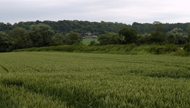
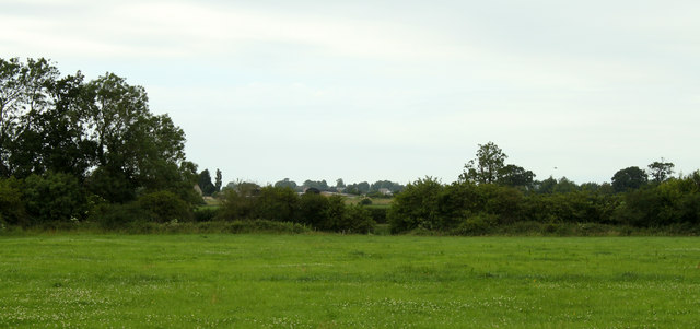
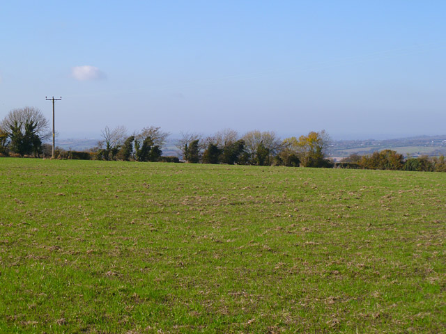
Windmill Hill Copse is a picturesque woodland located in Wiltshire, England. Covering an area of approximately 25 acres, it is nestled in the rolling countryside near the village of Avebury. The copse is known for its ancient trees, diverse wildlife, and historical significance.

The woodland is primarily composed of mixed deciduous trees, including oak, beech, ash, and birch. These majestic trees create a dense canopy, providing a shaded and tranquil environment for visitors. The forest floor is carpeted with a variety of wildflowers, ferns, and mosses, adding to the copse's natural beauty.

Windmill Hill Copse is home to a wide range of wildlife. Birds such as woodpeckers, nightingales, and tawny owls can be heard throughout the year, while deer, foxes, and badgers can occasionally be spotted among the trees. The copse also attracts a diverse array of insects, including butterflies and dragonflies.

The copse holds historical significance as well. It is situated near the ancient monument of Avebury, a UNESCO World Heritage Site famous for its stone circles and Neolithic henge. Windmill Hill, a nearby Bronze Age burial mound, is also of archaeological interest. These historical landmarks, combined with the copse's natural beauty, make it a popular destination for nature enthusiasts and history buffs alike.

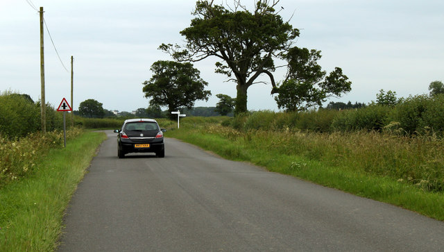
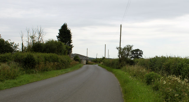
Windmill Hill Copse offers a network of footpaths and trails, allowing visitors to explore its enchanting scenery. Whether it be for a leisurely stroll, wildlife observation, or a peaceful picnic, this woodland provides a delightful escape into nature for all who visit.

If you have any feedback on the listing, please let us know in the comments section below.

Windmill Hill Copse Images

Images are sourced within 2km of 51.489762/-1.9228093 or Grid Reference SU0576. Thanks to Geograph Open Source API. All images are credited.

2011 : Crossroads on the road to Bushton Left to Littlecott right to Corton Manor Farm, straight on to Wootton Bassett.
2011 : Crossroads on the road to Bushton
Left to Littlecott right to Corton Manor Farm, straight on to Wootton Bassett.
2011 : Half a mile to Bushton Then on to Wootton Bassett.
2011 : Half a mile to Bushton
Then on to Wootton Bassett.
2011 : Minor road to  Clyffe Pypard Passing the Trotting Horse at Bushton.
2011 : Minor road to Clyffe Pypard
Passing the Trotting Horse at Bushton.
2011 : North Farm, Bushton, with honeysuckle Seen from the Bushton crossroads.
2011 : North Farm, Bushton, with honeysuckle
Seen from the Bushton crossroads.
2011 : The road to Hilmarton passes Marsh Farm Part of a useful rush hour route via the back roads between Wootton Bassett and the A3102.
2011 : The road to Hilmarton passes Marsh Farm
Part of a useful rush hour route via the back roads between Wootton Bassett and the A3102.
2011 : Wheat field near Marsh Farm Ripening well, will need rain soon or the yield will be down. May be too late already. No fun being a farmer, either too much rain or too little, too much sun or too little, but look on the bright side, if everything were perfect there would be nothing to moan about.

P.S. Shouldn't be rude about farmers, on the whole they are pleasant, helpful and fairly happy.
2011 : Wheat field near Marsh Farm
Ripening well, will need rain soon or the yield will be down. May be too late already. No fun being a farmer, either too much rain or too little, too much sun or too little, but look on the bright side, if everything were perfect there would be nothing to moan about. P.S. Shouldn't be rude about farmers, on the whole they are pleasant, helpful and fairly happy.
2011 : Pasture north of the road to Bushton
2011 : Track to the Medieval Village of Woodhill Has gained a wooden fence, a herd of cows and a drinking trough since <a href="https://www.geograph.org.uk/photo/899691">SU0577 : Track to Woodhill Park, near Bushton</a> in 2008.
2011 : Track to the Medieval Village of Woodhill
Has gained a wooden fence, a herd of cows and a drinking trough since SU0577 : Track to Woodhill Park, near Bushton in 2008.
2011 : Waiting for the next load Trailer parked in the corner of a pasture, looked well cared for, probably gone by now.
2011 : Waiting for the next load
Trailer parked in the corner of a pasture, looked well cared for, probably gone by now.
2011 : Mowing grass, Bushton Cut, drying and almost ready for collection. Probably for hay.
2011 : Mowing grass, Bushton
Cut, drying and almost ready for collection. Probably for hay.
2011 : The road to Tockenham Seen from Bushton Crossroads.
Bushton is a somewhat scattered village, more a collection of hamlets really. One bit is on this road, the first house is just in sight, some more, including the pub, on the other side of the crossroads on the road to Clyffe Pypard and yet more to the north east on the road to Wootton Bassett. At the crossroads? Just a few fields.
2011 : The road to Tockenham
Seen from Bushton Crossroads. Bushton is a somewhat scattered village, more a collection of hamlets really. One bit is on this road, the first house is just in sight, some more, including the pub, on the other side of the crossroads on the road to Clyffe Pypard and yet more to the north east on the road to Wootton Bassett. At the crossroads? Just a few fields.
2011 : The road to Hilmarton Seen from the Bushton crossroads.
2011 : The road to Hilmarton
Seen from the Bushton crossroads.
Farmland, Hilmarton A pastoral view from the start of the footpath to Highway from Clevancy.
Farmland, Hilmarton
A pastoral view from the start of the footpath to Highway from Clevancy.
Pasture, Hilmarton With the bridleway descending to Corton Farm from the scarp near Clevancy.
Pasture, Hilmarton
With the bridleway descending to Corton Farm from the scarp near Clevancy.
Bupton Hill Farm, Clyffe Pypard The track is a public footpath approaching the farm from the southwest.
Bupton Hill Farm, Clyffe Pypard
The track is a public footpath approaching the farm from the southwest.
Farmland, Clyffe Pypard A field just above the scarp near Nebo Farm.
Farmland, Clyffe Pypard
A field just above the scarp near Nebo Farm.
Farmland, Clyffe Pypard A flat arable field above the scarp that rises from the village.
Farmland, Clyffe Pypard
A flat arable field above the scarp that rises from the village.
Duck cottage, Clyffe Pypard
Show me another place!

Windmill Hill Copse is located at Grid Ref: SU0576 (Lat: 51.489762, Lng: -1.9228093)

Unitary Authority: Wiltshire

Police Authority: Wiltshire

What 3 Words

///yachting.proceeds.robe. Near Lyneham, Wiltshire

Related Wikis

Bushton, Wiltshire

Bushton is an English hamlet about 3 miles (4.8 km) south of Royal Wootton Bassett in Wiltshire. It belongs to the civil parish of Clyffe Pypard. ��2...

Clyffe Pypard

Clyffe Pypard is a village and civil parish about 3+1⁄2 miles (5.6 km) south of Royal Wootton Bassett in North Wiltshire, England.The parish includes the...

Church of St Peter, Clyffe Pypard

The Church of St Peter, Clyffe Pypard, Wiltshire is a parish church of the Diocese of Salisbury, England. It dates from the 13th and 15th centuries, and...

RAF Clyffe Pypard

Royal Air Force Clyffe Pypard or more simply RAF Clyffe Pypard is a former Royal Air Force satellite airfield in Wiltshire, England. == History == No....

Highway, Wiltshire

Highway is a hamlet and former civil parish, now in the parish of Hilmarton, in Wiltshire, England. The hamlet lies about 1+1⁄2 miles (2.4 km) southeast...

Tockenham

Tockenham is a village and civil parish in north Wiltshire, England. The village is about 1.2 miles (1.9 km) east of Lyneham and 3 miles (5 km) southwest...

Goatacre

Goatacre is a village in the English county of Wiltshire, about 4 miles (6 km) north of Calne and 1 mile (1.6 km) south of Lyneham on the A3102 road. It...

Lyneham, Wiltshire

Lyneham is a large village in north Wiltshire, England, within the civil parish of Lyneham and Bradenstoke, and situated 4 miles (6.4 km) southwest of...

Nearby Amenities

Located within 500m of 51.489762,-1.9228093
The data included in this document is from www.openstreetmap.org. The data is made available under ODbL.

Have you been to Windmill Hill Copse?

Leave your review of Windmill Hill Copse below (or comments, questions and feedback).