Halton Gill Wood
Wood, Forest in Yorkshire Craven
England
Halton Gill Wood

Halton Gill Wood is a picturesque woodland located in the region of Yorkshire, England. This enchanting forest is nestled within the idyllic village of Halton Gill, offering visitors a tranquil retreat from the bustling urban life. Covering an expansive area, the wood is known for its diverse range of flora and fauna, attracting nature enthusiasts and hikers alike.
The wood boasts a rich variety of tree species, including oak, beech, birch, and hazel, creating a vibrant and colorful canopy throughout the seasons. The forest floor is adorned with a carpet of bluebells in the spring, adding a touch of beauty to the already stunning landscape. Additionally, the wood is home to a plethora of wildlife, such as deer, foxes, badgers, and an array of bird species, making it a haven for wildlife enthusiasts and birdwatchers.
Numerous walking trails wind their way through the wood, offering visitors the opportunity to immerse themselves in the natural beauty of the area. These trails cater to all levels of fitness and can be enjoyed by families, individuals, and even avid hikers seeking a challenging trek. Along the paths, visitors may come across babbling brooks, charming bridges, and hidden clearings, further enhancing the wood's ethereal atmosphere.
Halton Gill Wood is a popular destination for those seeking solace in nature, as well as for those interested in exploring the rich biodiversity of Yorkshire. Its tranquil surroundings, diverse wildlife, and scenic trails make it a wonderful place to escape the hustle and bustle of everyday life and reconnect with the natural world.
If you have any feedback on the listing, please let us know in the comments section below.
Halton Gill Wood Images
Images are sourced within 2km of 53.980889/-1.9208106 or Grid Reference SE0553. Thanks to Geograph Open Source API. All images are credited.

![Bolton Abbey, the village and the priory [19] The medieval priory precinct wall, seen from the path. About 12 feet high of squared, coursed stone. Another part of the wall is seen at <a href="https://www.geograph.org.uk/photo/7020743">SE0754 : Bolton Abbey, the village and the priory [20]</a>. Listed, grade II, with details at: <span class="nowrap"><a title="https://historicengland.org.uk/listing/the-list/list-entry/1166722" rel="nofollow ugc noopener" href="https://historicengland.org.uk/listing/the-list/list-entry/1166722">Link</a><img style="margin-left:2px;" alt="External link" title="External link - shift click to open in new window" src="https://s1.geograph.org.uk/img/external.png" width="10" height="10"/></span>
There was never an abbey here, the monastic settlement was a priory, founded in 1154 by the Augustinian order. Part of the 33,000 acre Devonshire Estate, the village is some 5¼ miles northeast of Skipton. The picturesque ruins of the priory, on the bank of the River Wharfe, adjoin the village.](https://s0.geograph.org.uk/geophotos/07/02/07/7020740_794da7a5.jpg)
![Bolton Abbey, the village and the priory [20] The medieval priory precinct wall, seen from the path. About 12 feet high of squared, coursed stone. Another part of the wall is seen at <a href="https://www.geograph.org.uk/photo/7020740">SE0753 : Bolton Abbey, the village and the priory [19]</a>. Listed, grade II, with details at: <span class="nowrap"><a title="https://historicengland.org.uk/listing/the-list/list-entry/1166722" rel="nofollow ugc noopener" href="https://historicengland.org.uk/listing/the-list/list-entry/1166722">Link</a><img style="margin-left:2px;" alt="External link" title="External link - shift click to open in new window" src="https://s1.geograph.org.uk/img/external.png" width="10" height="10"/></span>
There was never an abbey here, the monastic settlement was a priory, founded in 1154 by the Augustinian order. Part of the 33,000 acre Devonshire Estate, the village is some 5¼ miles northeast of Skipton. The picturesque ruins of the priory, on the bank of the River Wharfe, adjoin the village.](https://s3.geograph.org.uk/geophotos/07/02/07/7020743_c872316c.jpg)
![Bolton Abbey, the village and the priory [21] Mill House is the former priory mill. The mill is set against the precinct wall, adjacent to the B6160 road. Built in the 16th century with 17th century and later alterations. Constructed of squared, coursed rubble stone under a stone slate roof. Listed, grade II, with details at: <span class="nowrap"><a title="https://historicengland.org.uk/listing/the-list/list-entry/1301245" rel="nofollow ugc noopener" href="https://historicengland.org.uk/listing/the-list/list-entry/1301245">Link</a><img style="margin-left:2px;" alt="External link" title="External link - shift click to open in new window" src="https://s1.geograph.org.uk/img/external.png" width="10" height="10"/></span>
There was never an abbey here, the monastic settlement was a priory, founded in 1154 by the Augustinian order. Part of the 33,000 acre Devonshire Estate, the village is some 5¼ miles northeast of Skipton. The picturesque ruins of the priory, on the bank of the River Wharfe, adjoin the village.](https://s1.geograph.org.uk/geophotos/07/02/13/7021313_bd7acee5.jpg)
![Bolton Abbey, the village and the priory [22] These arches are part of an 18th century aqueduct, seen here crossing the B6160 road. Built of squared, coursed rubble stone. Listed, grade II, with details at: <span class="nowrap"><a title="https://historicengland.org.uk/listing/the-list/list-entry/1131773" rel="nofollow ugc noopener" href="https://historicengland.org.uk/listing/the-list/list-entry/1131773">Link</a><img style="margin-left:2px;" alt="External link" title="External link - shift click to open in new window" src="https://s1.geograph.org.uk/img/external.png" width="10" height="10"/></span>
There was never an abbey here, the monastic settlement was a priory, founded in 1154 by the Augustinian order. Part of the 33,000 acre Devonshire Estate, the village is some 5¼ miles northeast of Skipton. The picturesque ruins of the priory, on the bank of the River Wharfe, adjoin the village.](https://s2.geograph.org.uk/geophotos/07/02/13/7021314_5492927f.jpg)
![Bolton Abbey, the village and the priory [23] This house, known as The Arches, is on the B6160 road, adjacent to the aqueduct <a href="https://www.geograph.org.uk/photo/7021314">SE0754 : Bolton Abbey, the village and the priory [22]</a>. Built in the late 18th or early 19th century, of squared, coursed stone under a stone slate roof. Listed, grade II, with details at: <span class="nowrap"><a title="https://historicengland.org.uk/listing/the-list/list-entry/1317019" rel="nofollow ugc noopener" href="https://historicengland.org.uk/listing/the-list/list-entry/1317019">Link</a><img style="margin-left:2px;" alt="External link" title="External link - shift click to open in new window" src="https://s1.geograph.org.uk/img/external.png" width="10" height="10"/></span>
There was never an abbey here, the monastic settlement was a priory, founded in 1154 by the Augustinian order. Part of the 33,000 acre Devonshire Estate, the village is some 5¼ miles northeast of Skipton. The picturesque ruins of the priory, on the bank of the River Wharfe, adjoin the village.](https://s0.geograph.org.uk/geophotos/07/02/13/7021316_21d7aab6.jpg)
![Bolton Abbey, the village and the priory [24] The Great Tythe Barn was the tithe barn to Bolton Priory. Built in, probably, the 16th century of rubble stone with ashlar dressings, under a stone slate roof. The openings, other than the two arched doorways, are 19th or 20th century as the building is now used for weddings and other functions. Listed, grade II*, with details at: <span class="nowrap"><a title="https://historicengland.org.uk/listing/the-list/list-entry/1131772" rel="nofollow ugc noopener" href="https://historicengland.org.uk/listing/the-list/list-entry/1131772">Link</a><img style="margin-left:2px;" alt="External link" title="External link - shift click to open in new window" src="https://s1.geograph.org.uk/img/external.png" width="10" height="10"/></span>
The extensive site of the priory is a Scheduled Ancient Monument with details at: <span class="nowrap"><a title="https://historicengland.org.uk/listing/the-list/list-entry/1015684" rel="nofollow ugc noopener" href="https://historicengland.org.uk/listing/the-list/list-entry/1015684">Link</a><img style="margin-left:2px;" alt="External link" title="External link - shift click to open in new window" src="https://s1.geograph.org.uk/img/external.png" width="10" height="10"/></span>
There was never an abbey here, the monastic settlement was a priory, founded in 1154 by the Augustinian order. Part of the 33,000 acre Devonshire Estate, the village is some 5¼ miles northeast of Skipton. The picturesque ruins of the priory, on the bank of the River Wharfe, adjoin the village.](https://s2.geograph.org.uk/geophotos/07/02/13/7021318_bea40c65.jpg)
![Bolton Abbey, the village and the priory [25] The Tea House, on The Green, is probably the remains of a barn belonging to the priory. Possibly originally built in the 16th century and converted to a residence in the 19th century. Constructed of squared, coursed stone under a stone slate roof. Listed, grade II, with details at: <span class="nowrap"><a title="https://historicengland.org.uk/listing/the-list/list-entry/1166807" rel="nofollow ugc noopener" href="https://historicengland.org.uk/listing/the-list/list-entry/1166807">Link</a><img style="margin-left:2px;" alt="External link" title="External link - shift click to open in new window" src="https://s1.geograph.org.uk/img/external.png" width="10" height="10"/></span>
There was never an abbey here, the monastic settlement was a priory, founded in 1154 by the Augustinian order. Part of the 33,000 acre Devonshire Estate, the village is some 5¼ miles northeast of Skipton. The picturesque ruins of the priory, on the bank of the River Wharfe, adjoin the village.](https://s0.geograph.org.uk/geophotos/07/02/13/7021320_5f49dd2f.jpg)
![Bolton Abbey, the village and the priory [26] Numbers 1 to 4 The Green are a row of 18th century cottages, altered and added to in the 19th century. Constructed of rubble stone with ashlar dressings under a stone slate roof. Listed, for group value, grade II, with details at: <span class="nowrap"><a title="https://historicengland.org.uk/listing/the-list/list-entry/1317039" rel="nofollow ugc noopener" href="https://historicengland.org.uk/listing/the-list/list-entry/1317039">Link</a><img style="margin-left:2px;" alt="External link" title="External link - shift click to open in new window" src="https://s1.geograph.org.uk/img/external.png" width="10" height="10"/></span>
There was never an abbey here, the monastic settlement was a priory, founded in 1154 by the Augustinian order. Part of the 33,000 acre Devonshire Estate, the village is some 5¼ miles northeast of Skipton. The picturesque ruins of the priory, on the bank of the River Wharfe, adjoin the village.](https://s2.geograph.org.uk/geophotos/07/02/13/7021322_74734bc1.jpg)
![Bolton Abbey, the village and the priory [27] The recently built village hall is adjacent to a large car park.
There was never an abbey here, the monastic settlement was a priory, founded in 1154 by the Augustinian order. Part of the 33,000 acre Devonshire Estate, the village is some 5¼ miles northeast of Skipton. The picturesque ruins of the priory, on the bank of the River Wharfe, adjoin the village.](https://s3.geograph.org.uk/geophotos/07/02/13/7021323_d1502678.jpg)
![Bolton Abbey, the village and the priory [28] This large car park is adjacent to the village hall <a href="https://www.geograph.org.uk/photo/7021323">SE0753 : Bolton Abbey, the village and the priory [27]</a>.
There was never an abbey here, the monastic settlement was a priory, founded in 1154 by the Augustinian order. Part of the 33,000 acre Devonshire Estate, the village is some 5¼ miles northeast of Skipton. The picturesque ruins of the priory, on the bank of the River Wharfe, adjoin the village.](https://s1.geograph.org.uk/geophotos/07/02/13/7021325_26dfc64d.jpg)
![Bolton Abbey, the village and the priory [29] An information board in the car park.
There was never an abbey here, the monastic settlement was a priory, founded in 1154 by the Augustinian order. Part of the 33,000 acre Devonshire Estate, the village is some 5¼ miles northeast of Skipton. The picturesque ruins of the priory, on the bank of the River Wharfe, adjoin the village.](https://s2.geograph.org.uk/geophotos/07/02/13/7021326_d2788056.jpg)
![Bolton Bridge [1] Originally a house, The Devonshire Arms Hotel is made up of several builds. There is a 17th century central range, with an 18th century range and a 19th century range on the left and a 19th century range to the right. There are 20th century extensions to the rear. Some ranges are of rubble stone, some of squared, coursed stone, all under stone slate roofs. Listed, grade II, with details at: <span class="nowrap"><a title="https://historicengland.org.uk/listing/the-list/list-entry/1131771" rel="nofollow ugc noopener" href="https://historicengland.org.uk/listing/the-list/list-entry/1131771">Link</a><img style="margin-left:2px;" alt="External link" title="External link - shift click to open in new window" src="https://s1.geograph.org.uk/img/external.png" width="10" height="10"/></span>
Bolton Bridge is a bridge carrying the A59 road across the River Wharfe. The original bridge replaced a ferry and was itself bypassed when the A59 was straightened and a new bridge constructed in the 1990s. The hamlet of the same name grew up around the river crossing.](https://s1.geograph.org.uk/geophotos/07/02/66/7026605_3767cf97.jpg)
![Bolton Bridge [2] A Victorian letter box in the wall of the Devonshire Arms Hotel <a href="https://www.geograph.org.uk/photo/7026605">SE0753 : Bolton Bridge [1]</a>.
Bolton Bridge is a bridge carrying the A59 road across the River Wharfe. The original bridge replaced a ferry and was itself bypassed when the A59 was straightened and a new bridge constructed in the 1990s. The hamlet of the same name grew up around the river crossing.](https://s3.geograph.org.uk/geophotos/07/02/66/7026607_4e608327.jpg)
![Bolton Bridge [3] Devonshire Cottages, alongside the B6160 road, are mid 18th century. Constructed of coursed rubble stone with freestone dressings under a stone slate roof. There is another view of the cottages at <a href="https://www.geograph.org.uk/photo/7027395">SE0653 : Bolton Bridge [4]</a>. Listed, grade II, with details at: <span class="nowrap"><a title="https://historicengland.org.uk/listing/the-list/list-entry/1166709" rel="nofollow ugc noopener" href="https://historicengland.org.uk/listing/the-list/list-entry/1166709">Link</a><img style="margin-left:2px;" alt="External link" title="External link - shift click to open in new window" src="https://s1.geograph.org.uk/img/external.png" width="10" height="10"/></span>
Bolton Bridge is a bridge carrying the A59 road across the River Wharfe. The original bridge replaced a ferry and was itself bypassed when the A59 was straightened and a new bridge constructed in the 1990s. The hamlet of the same name grew up around the river crossing.](https://s2.geograph.org.uk/geophotos/07/02/73/7027394_876fa8b5.jpg)
Halton Gill Wood is located at Grid Ref: SE0553 (Lat: 53.980889, Lng: -1.9208106)
Division: West Riding
Administrative County: North Yorkshire
District: Craven
Police Authority: North Yorkshire
What 3 Words
///directive.sweetened.ringside. Near Embsay, North Yorkshire
Nearby Locations
Related Wikis

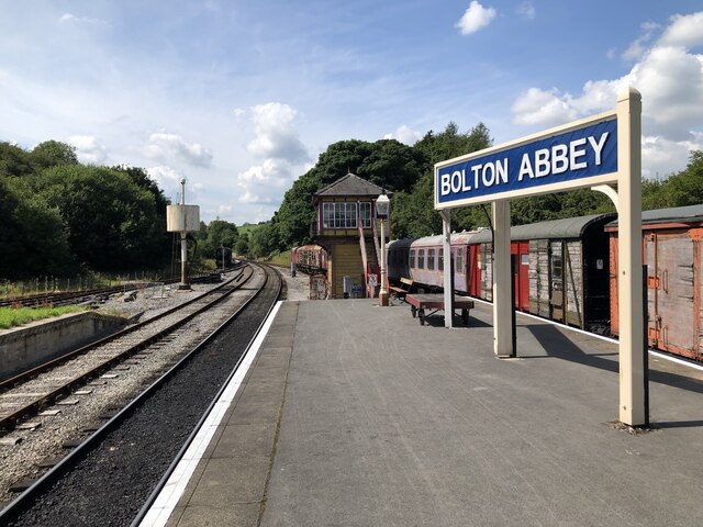
Bolton Abbey railway station
Bolton Abbey railway station is on the Embsay and Bolton Abbey Steam Railway. It serves Bolton Abbey, although it is closer to Bolton Bridge, in North...
Halton East
Halton East is a village and civil parish in North Yorkshire, England, 3.5 miles (5.6 km) east of Skipton. The population of the parish was estimated...

Bolton Abbey (village)
Bolton Abbey is a village and civil parish in the Craven district of North Yorkshire, England, 22 miles (35 km) north-west of Leeds. The village lies in...

Draughton, North Yorkshire
Draughton (pronounced Draftun) is a village and civil parish, population 240, in the Craven district of North Yorkshire, England. It is situated 3 miles...

Bolton Abbey
Bolton Abbey in Wharfedale, North Yorkshire, England, takes its name from the ruins of the 12th-century Augustinian monastery now known as Bolton Priory...
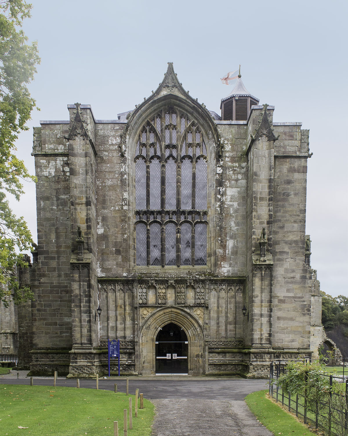
Bolton Priory
Bolton Priory, whose full title is The Priory Church of St Mary and St Cuthbert, Bolton Abbey, is a Grade I listed parish church of the Church of England...

Cavendish memorial fountain
The Cavendish memorial fountain is a drinking fountain erected in 1886 at Bolton Abbey, North Yorkshire, England as a memorial to Lord Frederick Cavendish...

Chelker Reservoir
Chelker Reservoir is a man-made lake in North Yorkshire, England. It lies in the parish of Draughton, immediately north of the A65 road, between Skipton...
Nearby Amenities
Located within 500m of 53.980889,-1.9208106Have you been to Halton Gill Wood?
Leave your review of Halton Gill Wood below (or comments, questions and feedback).