Adam's Brake

Wood, Forest in Wiltshire

England

Adam's Brake

Going east past Moonsleaze Farm
Going east past Moonsleaze Farm Credit: Rob Purvis

Adam's Brake is a picturesque woodland located in the county of Wiltshire, England. This enchanting forest covers an area of approximately 200 acres and is known for its diverse range of flora and fauna.

The woodland is named after Adam, a local landowner who lived in the area during the 19th century. Adam's Brake is characterized by its dense canopy of mature trees, including oak, beech, and chestnut. These towering trees provide a sheltered habitat for a wide variety of wildlife, making it a popular destination for nature enthusiasts and birdwatchers.

The forest floor is adorned with a rich carpet of bluebells and wildflowers during the spring months, creating a vibrant and colorful display. The diverse ecosystem of Adam's Brake supports a multitude of animal species, including deer, foxes, badgers, and numerous species of birds, such as woodpeckers and owls.

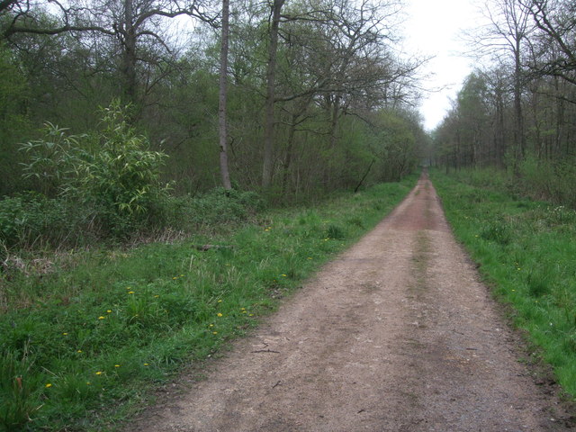
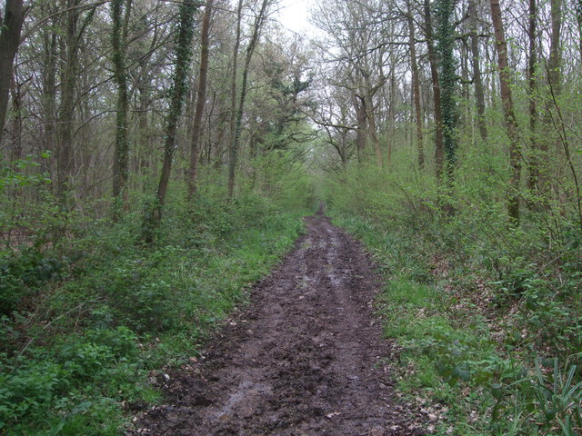
The woodland is crisscrossed with a network of well-maintained footpaths, allowing visitors to explore its natural beauty. There are also several picnic areas and benches strategically placed throughout the forest, providing the perfect spot for a peaceful outdoor lunch or a moment of tranquility.

Adam's Brake offers a serene and tranquil escape from the hustle and bustle of everyday life. Its untouched natural beauty and thriving wildlife make it a true gem in the heart of Wiltshire. Whether you are a nature lover, hiker, or simply seeking solace in nature, Adam's Brake is a must-visit destination.

If you have any feedback on the listing, please let us know in the comments section below.
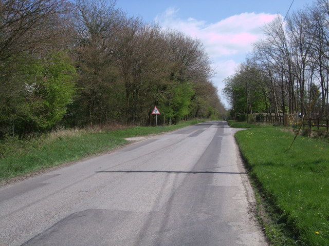
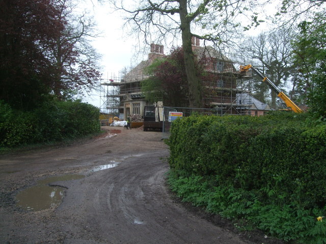
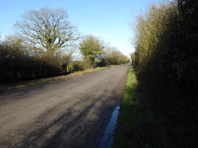
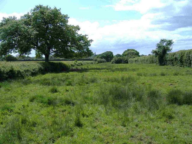
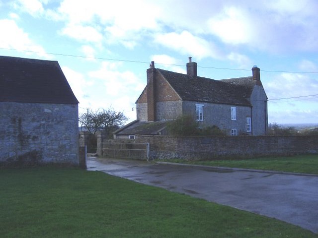
Adam's Brake Images

Images are sourced within 2km of 51.589083/-1.9252687 or Grid Reference SU0587. Thanks to Geograph Open Source API. All images are credited.

Going east past Moonsleaze Farm
Brockhurst Meadow Nature Reserve, near Purton A wildlife-rich meadow. The ancient ridge-and-furrow can clearly be seen running from left to right across the picture.
Brockhurst Meadow Nature Reserve, near Purton
A wildlife-rich meadow. The ancient ridge-and-furrow can clearly be seen running from left to right across the picture.
Road past Park Farm, Braydon The road past Park Farm, showing a farm trailer and an old metal roller. This organic farm is advertising free-range eggs for sale by the roadside. Two cyclists have just ridden by on this well-frequented cycle route, which is part of the Wiltshire Cycleway. <span class="nowrap"><a title="http://www.wiltshire.gov.uk/leisureandrecreation/walkingandcycling/wiltshirecycleway.htm" rel="nofollow ugc noopener" href="http://www.wiltshire.gov.uk/leisureandrecreation/walkingandcycling/wiltshirecycleway.htm">Link</a><img style="margin-left:2px;" alt="External link" title="External link - shift click to open in new window" src="https://s1.geograph.org.uk/img/external.png" width="10" height="10"/></span>
Road past Park Farm, Braydon
The road past Park Farm, showing a farm trailer and an old metal roller. This organic farm is advertising free-range eggs for sale by the roadside. Two cyclists have just ridden by on this well-frequented cycle route, which is part of the Wiltshire Cycleway. LinkExternal link
The Firs, Wood Lane, Braydon The Firs (on the left of the picture) is a pocket of woodland in the heart of what was once the Royal Forest of Braydon. It is a Wiltshire Wildlife Trust reserve, with a circular woodland walk within it.<span class="nowrap"><a title="http://www.wiltshirewildlife.org/Reserves/thefirs.htm" rel="nofollow ugc noopener" href="http://www.wiltshirewildlife.org/Reserves/thefirs.htm">Link</a><img style="margin-left:2px;" alt="External link" title="External link - shift click to open in new window" src="https://s1.geograph.org.uk/img/external.png" width="10" height="10"/></span>
The Firs, Wood Lane, Braydon
The Firs (on the left of the picture) is a pocket of woodland in the heart of what was once the Royal Forest of Braydon. It is a Wiltshire Wildlife Trust reserve, with a circular woodland walk within it.LinkExternal link
Four Oaks Park, Lydiard Plain Four Oaks Park is a residential site for travellers and gypsies. At present it still seems to be in the process of construction.
Four Oaks Park, Lydiard Plain
Four Oaks Park is a residential site for travellers and gypsies. At present it still seems to be in the process of construction.
Bridleway, Webb's Wood, looking towards Four Oaks Park The bridleway emerges from Webb's Wood at this point; Four Oaks Park travellers' residential site can be seen in the distance, see <a href="https://www.geograph.org.uk/photo/3938593">SU0586 : Four Oaks Park, Lydiard Plain</a>.
Bridleway, Webb's Wood, looking towards Four Oaks Park
The bridleway emerges from Webb's Wood at this point; Four Oaks Park travellers' residential site can be seen in the distance, see SU0586 : Four Oaks Park, Lydiard Plain.
Common Farm, near Purton Common Farm, seen here in the distance from the track from Battlelake Farm to Brockhurst Wood.
Common Farm, near Purton
Common Farm, seen here in the distance from the track from Battlelake Farm to Brockhurst Wood.
Track, Redlodge Plantation Strictly speaking private, but the bridleway running parallel to the north was so soggy that it was just about impassable. The reddish colour of this track seems to come from crushed-up bricks, not from red subsoil. The bamboo is taking a hold in parts of the wood near here.
Track, Redlodge Plantation
Strictly speaking private, but the bridleway running parallel to the north was so soggy that it was just about impassable. The reddish colour of this track seems to come from crushed-up bricks, not from red subsoil. The bamboo is taking a hold in parts of the wood near here.
Public footpath through Redlodge Plantation Another very soggy track through the woods.
Public footpath through Redlodge Plantation
Another very soggy track through the woods.
Red Lodge, Braydon Grade II Listed former hunting lodge, probably built in the 17th century, with 19th century additions, <span class="nowrap"><a title="http://www.britishlistedbuildings.co.uk/en-317719-red-lodge-braydon-" rel="nofollow ugc noopener" href="http://www.britishlistedbuildings.co.uk/en-317719-red-lodge-braydon-">Link</a><img style="margin-left:2px;" alt="External link" title="External link - shift click to open in new window" src="https://s1.geograph.org.uk/img/external.png" width="10" height="10"/></span> and now in the process of renovation. Originally known as Hatton's Lodge, it has now reverted to that name. <span class="nowrap"><a title="http://history.wiltshire.gov.uk/community/getcom.php?id=28" rel="nofollow ugc noopener" href="http://history.wiltshire.gov.uk/community/getcom.php?id=28">Link</a><img style="margin-left:2px;" alt="External link" title="External link - shift click to open in new window" src="https://s1.geograph.org.uk/img/external.png" width="10" height="10"/></span>
Red Lodge, Braydon
Grade II Listed former hunting lodge, probably built in the 17th century, with 19th century additions, LinkExternal link and now in the process of renovation. Originally known as Hatton's Lodge, it has now reverted to that name. LinkExternal link
Lane, Braydon Manor Country lane, looking in the direction of No Parish Bungalow.
Lane, Braydon Manor
Country lane, looking in the direction of No Parish Bungalow.
Country lane near Greenacres Farm Minor road approaching junction with B4696. Greenacres farm is on the right, strips of grazing land on the left.
Country lane near Greenacres Farm
Minor road approaching junction with B4696. Greenacres farm is on the right, strips of grazing land on the left.
Cows in the road
Cows in the road
Country lane near Minety
Minor road to Minety The Public Bridleway sign can be seen on the left side of the road (in the centre of the picture).
Minor road to Minety
The Public Bridleway sign can be seen on the left side of the road (in the centre of the picture).
Road towards Purton
Road towards Purton
Footpath near No Parish Farm Heading south towards Brinkworth.
Footpath near No Parish Farm
Heading south towards Brinkworth.
Maple Sale Copse Separated from the road by a narrow field which is part of a very long strip between the road and a parish boundary running parallel to the road. Was this common land?
Maple Sale Copse
Separated from the road by a narrow field which is part of a very long strip between the road and a parish boundary running parallel to the road. Was this common land?
Show me another place!

Adam's Brake is located at Grid Ref: SU0587 (Lat: 51.589083, Lng: -1.9252687)

Unitary Authority: Wiltshire

Police Authority: Wiltshire

What 3 Words

///unloads.tensions.device. Near Purton, Wiltshire

Related Wikis

Nearby Amenities

Located within 500m of 51.589083,-1.9252687
Power: tower
Lat/Long: 51.5855095/-1.9270056
Power: tower
Lat/Long: 51.5852228/-1.9228428
Braydon Road Crossroads
Junction: yes
Lat/Long: 51.5874779/-1.9196416
The data included in this document is from www.openstreetmap.org. The data is made available under ODbL.

Have you been to Adam's Brake?

Leave your review of Adam's Brake below (or comments, questions and feedback).