Àird a' Mhulaidh

Settlement in Inverness-shire

Scotland

Àird a' Mhulaidh

Hill of Lewis
Hill of Lewis Credit: Ralph Greig

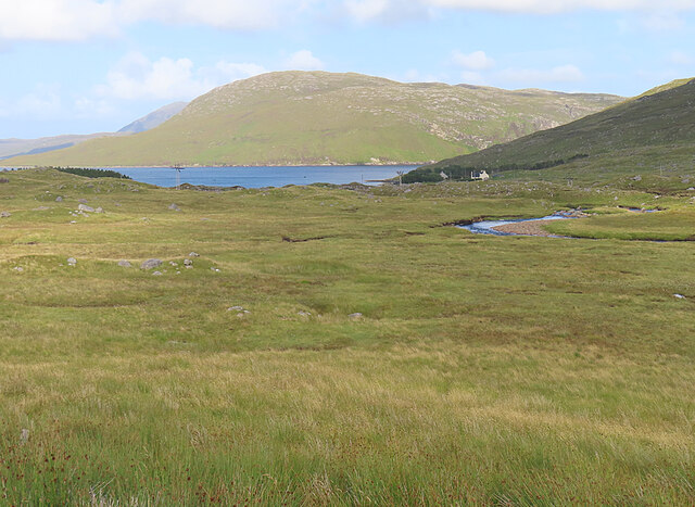
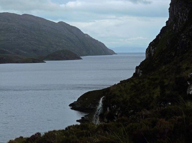
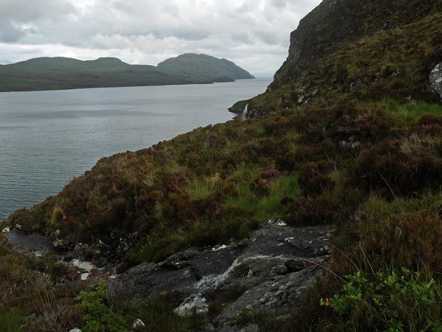
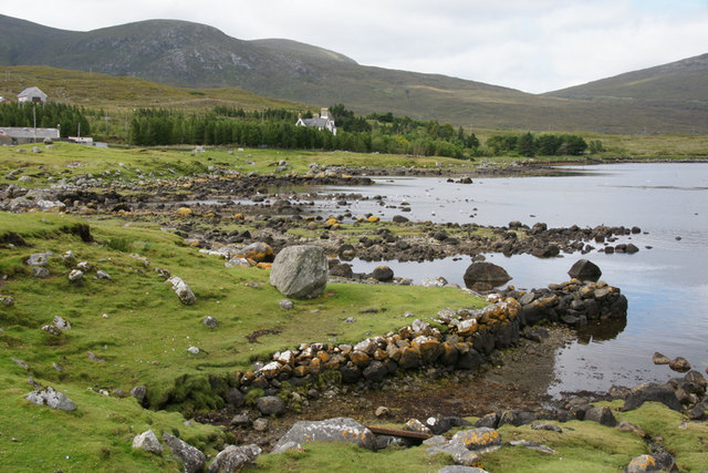
Àird a' Mhulaidh is a small village located in the county of Inverness-shire in the Highlands of Scotland. Situated on the northern banks of Loch Ness, it is approximately 15 miles southwest of the city of Inverness.

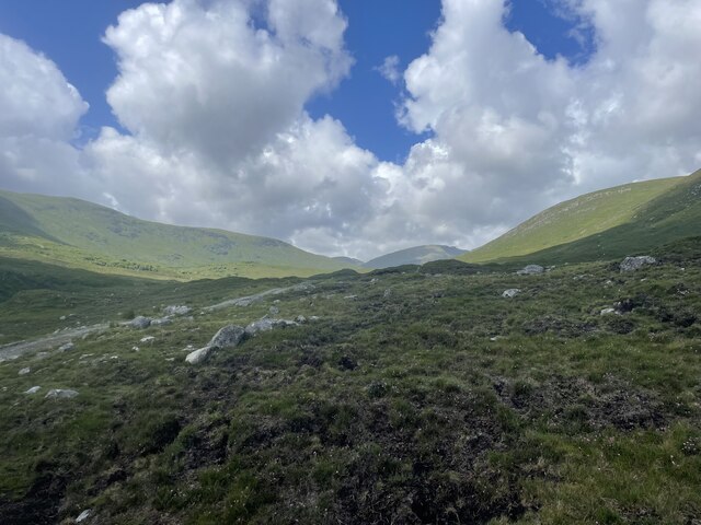
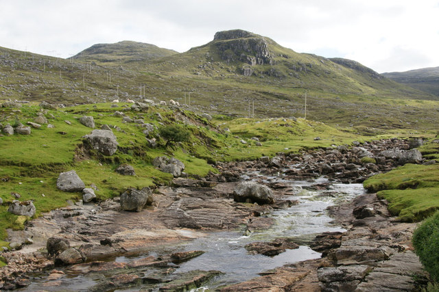
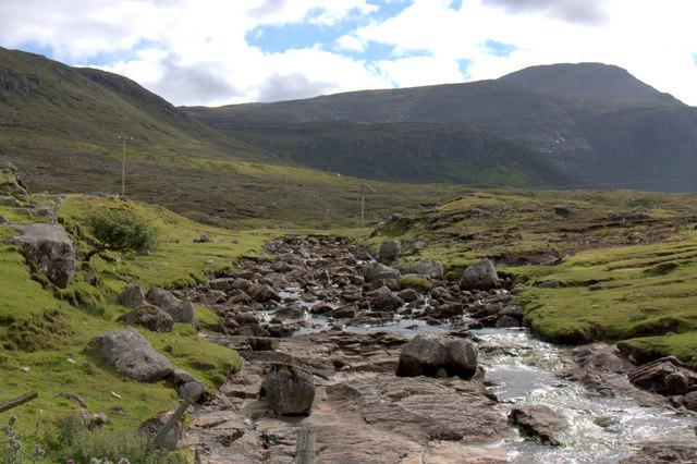
The village is known for its stunning natural beauty, surrounded by rolling hills and forests, offering breathtaking views of the loch. The area is a popular spot for outdoor enthusiasts, with numerous hiking and cycling trails that showcase the picturesque scenery.

Despite its small size, Àird a' Mhulaidh has a close-knit community that takes pride in its Gaelic heritage. The village is home to a number of traditional Gaelic-speaking families, and the language is still spoken by some residents.

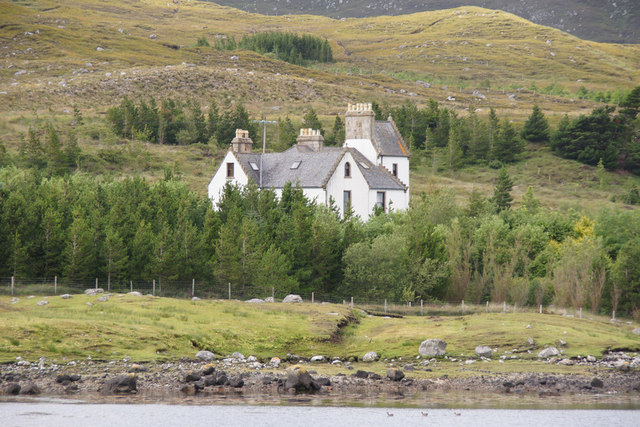
The main industry in Àird a' Mhulaidh is tourism, with visitors drawn to the area for its tranquility and its proximity to Loch Ness. The village offers a range of accommodation options, including cozy bed and breakfasts and self-catering cottages.

There are also a few local amenities in Àird a' Mhulaidh, including a small shop where residents and visitors can purchase basic groceries and supplies. For more extensive shopping needs, residents typically travel to the nearby city of Inverness.

Overall, Àird a' Mhulaidh is a charming village nestled in the Scottish Highlands, offering a peaceful and idyllic escape for those seeking a taste of rural Scotland.

If you have any feedback on the listing, please let us know in the comments section below.

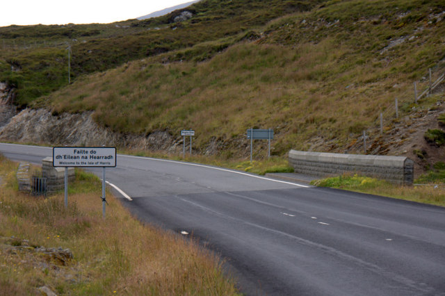
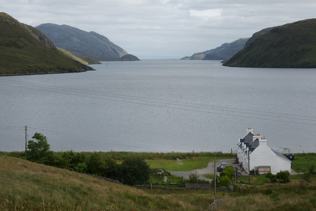
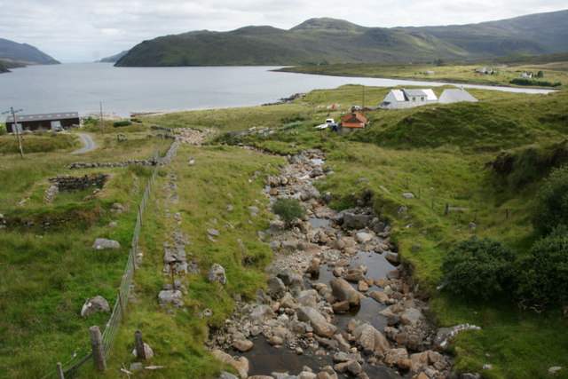
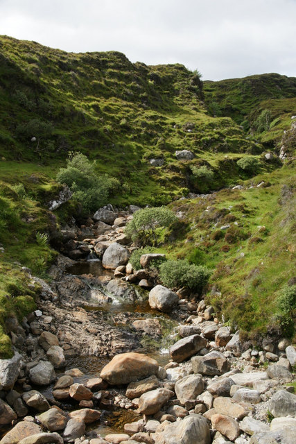
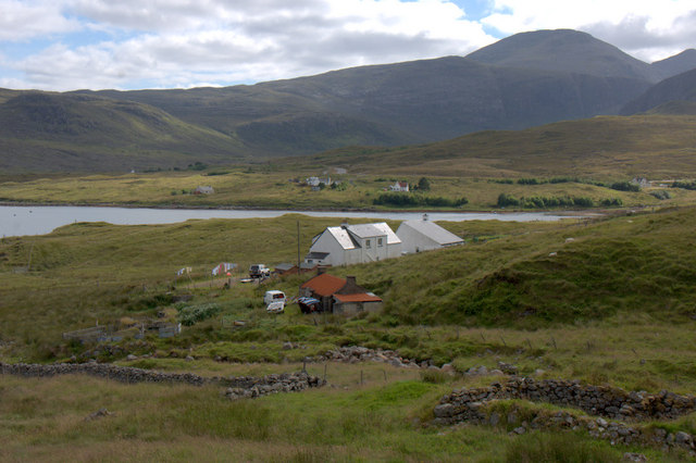
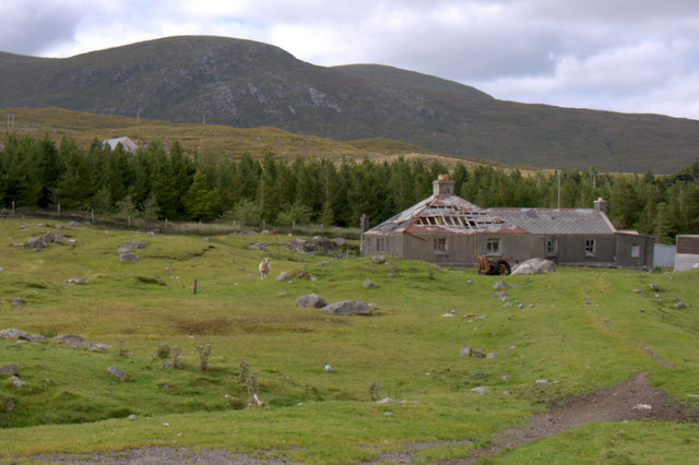
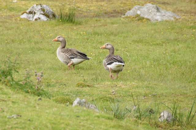
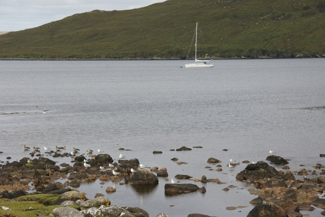
Àird a' Mhulaidh Images

Images are sourced within 2km of 57.995187/-6.7585836 or Grid Reference NB1810. Thanks to Geograph Open Source API. All images are credited.

Hill of Lewis
Hill of Lewis
Mountain trail
Mountain trail
Scaladale The river winds its waythrough wet grassland to Scaladale, on the sea shore at Bàgh Àird a' Mhulaidh.
Scaladale
The river winds its waythrough wet grassland to Scaladale, on the sea shore at Bàgh Àird a' Mhulaidh.
Waterfall below Creag na h-Iolaire, Harris Looking along Loch Seaforth/Loch Shiphoirt which forms the boundary between Harris and the Isle of Lewis.

Creag na h-Iolaire means Eagle's Rock.
Waterfall below Creag na h-Iolaire, Harris
Looking along Loch Seaforth/Loch Shiphoirt which forms the boundary between Harris and the Isle of Lewis. Creag na h-Iolaire means Eagle's Rock.
Unnamed burn below Creag na h-Iolaire, Harris Looking along Loch Seaforth/Loch Shiphoirt which forms the boundary between Harris and the Isle of Lewis.

Creag na h-Iolaire means Eagle's Rock.
Unnamed burn below Creag na h-Iolaire, Harris
Looking along Loch Seaforth/Loch Shiphoirt which forms the boundary between Harris and the Isle of Lewis. Creag na h-Iolaire means Eagle's Rock.
Welcome to the Isle of Harris The slightly random border between the Isle of Lewis (formerly in the county of Ross & Cromarty) and the Isle of Harris (formerly in Inverness-shire).
Welcome to the Isle of Harris
The slightly random border between the Isle of Lewis (formerly in the county of Ross & Cromarty) and the Isle of Harris (formerly in Inverness-shire).
View down Loch Seaforth (Loch Siophort) from Mulhagery
Abhainn a' Mhuil at Mulhagery On the left is Lewis and on the right is Harris.
Abhainn a' Mhuil at Mulhagery
On the left is Lewis and on the right is Harris.
Abhainn a' Mhuil at Mulhagery Looking upstream along the burn that forms the boundary between Harris and Lewis.
Abhainn a' Mhuil at Mulhagery
Looking upstream along the burn that forms the boundary between Harris and Lewis.
Houses at Mulhagery Looking towards An Cliseam.
Houses at Mulhagery
Looking towards An Cliseam.
Ruined house at Scaladale
Greylag Geese (Anser anser), Scaladale In the mid 20th century the Outer Hebrides were the last refuge of native geese in Britain, but numbers, from various sources, are much larger these days.
Greylag Geese (Anser anser), Scaladale
In the mid 20th century the Outer Hebrides were the last refuge of native geese in Britain, but numbers, from various sources, are much larger these days.
Yacht in Loch Seaforth (Siophort) off Scaladale
Abhainn Sgaladail at Scaladale Looking towards the crag of Caisteal Ard.
Abhainn Sgaladail at Scaladale
Looking towards the crag of Caisteal Ard.
Abhainn Sgaladail at Scaladale Looking towards An Cliseam.
Abhainn Sgaladail at Scaladale
Looking towards An Cliseam.
Bagh Aird a' Mhulaidh at Scaladale Looking towards Ardvourlie Castle.
Bagh Aird a' Mhulaidh at Scaladale
Looking towards Ardvourlie Castle.
Ardvourlie Castle from Scaladale
Pier at Scaladale The hill of Beinn a' Mhuil is in the background, with the valley to the left marking the border between Harris and Lewis.
Pier at Scaladale
The hill of Beinn a' Mhuil is in the background, with the valley to the left marking the border between Harris and Lewis.
Show me another place!

Àird a' Mhulaidh is located at Grid Ref: NB1810 (Lat: 57.995187, Lng: -6.7585836)

Unitary Authority: Na h-Eileanan an Iar

Police Authority: Highlands and Islands

Also known as: Ardvourlie

What 3 Words

///group.glee.insects. Near Tarbert, Na h-Eileanan Siar

Related Wikis

Ardvourlie Castle

Ardvourlie Castle is a 19th-century country house on Harris, one of the Western Isles off the north-west coast of Scotland. The house was built beside...

Seaforth Island

Seaforth Island (Scottish Gaelic: Eilean Shìphoirt/Shìophoirt or Mulag) is an uninhabited island in the Outer Hebrides of Scotland. Unlike many other...

Loch Seaforth

Loch Seaforth (Scottish Gaelic: Loch Shiphoirt or Shìophoirt) is a sea loch in the Outer Hebrides of Scotland. It consists of three distinct sections;...

Uisgneabhal Mor

Uisgnabhal Mor (729 m) is a mountain in Harris, in the Outer Hebrides of Scotland. A complex mountain of several ridges and summits, it lies in the centre...

Nearby Amenities

Located within 500m of 57.995187,-6.7585836
Barrier: cattle_grid
Source: Bing
Lat/Long: 57.9941632/-6.7622152
Aird a Mhulaidh
Name En: Ardvourlie
Name Gd: Aird a Mhulaidh
Naptan AtcoCode: 6010731516
Naptan Bearing: NE
Naptan BusStopType: CUS
Naptan CommonName: Ardvourlie
Naptan Indicator: Scaladale Centre
Naptan Landmark: Centre entrance
Naptan NaptanCode: 94723696
Naptan Street: Scaladale Centre
Naptan Verified: no
Source: naptan_import
Lat/Long: 57.9951214/-6.7615506
Power: pole
Lat/Long: 57.992937/-6.7641012
Power: pole
Lat/Long: 57.9972123/-6.7653445
Power: pole
Lat/Long: 57.9962089/-6.7652385
Power: pole
Lat/Long: 57.9952855/-6.7651981
Power: pole
Lat/Long: 57.9942862/-6.7650784
Power: pole
Lat/Long: 57.9932942/-6.7649311
Power: pole
Lat/Long: 57.9925204/-6.7630737
Power: pole
Lat/Long: 57.9919558/-6.761667
Power: pole
Lat/Long: 57.9914128/-6.7602726
Power: pole
Lat/Long: 57.9909363/-6.7590656
Aird a' Mhulaidh
Alt Name: Ardvourlie
Name En: Ardvourlie
Name Gd: Aird a' Mhulaidh
Place: hamlet
Source: Bing
Lat/Long: 57.9968734/-6.7589677
Turning Circle
Lat/Long: 57.9924744/-6.7543581
Barrier: cattle_grid
Source: Bing
Lat/Long: 57.992814/-6.7630883
Sgaladal
Alt Name Gd: Scaladal
Name En: Scaladale
Name Gd: Sgaladal
Place: hamlet
Lat/Long: 57.9922706/-6.755412
Material: wood
Power: pole
Lat/Long: 57.9913284/-6.7579009
Material: wood
Power: pole
Lat/Long: 57.9920061/-6.7584947
Material: wood
Power: pole
Lat/Long: 57.9926568/-6.7590189
Material: wood
Power: pole
Lat/Long: 57.9932384/-6.7601142
Material: wood
Power: pole
Lat/Long: 57.99466/-6.7606369
Material: wood
Power: pole
Lat/Long: 57.9948253/-6.7611839
Material: wood
Power: pole
Lat/Long: 57.9943267/-6.7596682
Material: wood
Power: pole
Lat/Long: 57.9917235/-6.7566674
Material: wood
Power: pole
Lat/Long: 57.9920602/-6.7556882
Material: wood
Power: pole
Lat/Long: 57.9921118/-6.7555977
Material: wood
Power: pole
Lat/Long: 57.9921051/-6.7548747
Passing Place
Lat/Long: 57.9970278/-6.7595027
Power: pole
Lat/Long: 57.9990712/-6.7580006
Material: wood
Power: pole
Lat/Long: 57.9983903/-6.7582688
Material: wood
Power: pole
Lat/Long: 57.9977037/-6.7585344
Material: wood
Power: pole
Lat/Long: 57.99703/-6.7588132
Operator: Scaladale Center
Tourism: hostel
Website: https://www.scaladale-centre.co.uk/hostel
Lat/Long: 57.995119/-6.761954
Bicycle Rental
Operator: Scaladale Center
Website: https://www.scaladale-centre.co.uk/bookings-checkout/mountain-biking
Lat/Long: 57.9950878/-6.7619607
Ford: yes
Lat/Long: 57.9965137/-6.7554188
Bagh Aird a Mhulaidh
Natural: bay
Lat/Long: 57.9951811/-6.7523003
Barrier: cattle_grid
Lat/Long: 57.9951077/-6.7616331
Generator Method: wind_turbine
Generator Source: wind
Generator Type: horizontal_axis
Power: generator
Lat/Long: 57.9965678/-6.7625563
Generator Method: wind_turbine
Generator Source: wind
Generator Type: horizontal_axis
Power: generator
Lat/Long: 57.9965109/-6.7631947
Power: pole
Lat/Long: 57.9949476/-6.7592084
Power: pole
Lat/Long: 57.9963421/-6.7590716
Barrier: cattle_grid
Lat/Long: 57.9941563/-6.761983
Power: pole
Lat/Long: 57.9943944/-6.7598736
Passing Place
Lat/Long: 57.9981537/-6.7596663
Passing Place
Lat/Long: 57.9926156/-6.7607782
Charging Station
Access: yes
Capacity: 2
Operator: ChargePlace Scotland
Operator Wikidata: Q105359316
Ref: 61291
Socket Type2 Output: 22 kW
Website: https://chargeplacescotland.org/cpmap/chargepoint/3035823/
Lat/Long: 57.9945648/-6.7621676
The data included in this document is from www.openstreetmap.org. The data is made available under ODbL.

Have you been to Àird a' Mhulaidh?

Leave your review of Àird a' Mhulaidh below (or comments, questions and feedback).