Horse Wood
Wood, Forest in Northumberland
England
Horse Wood

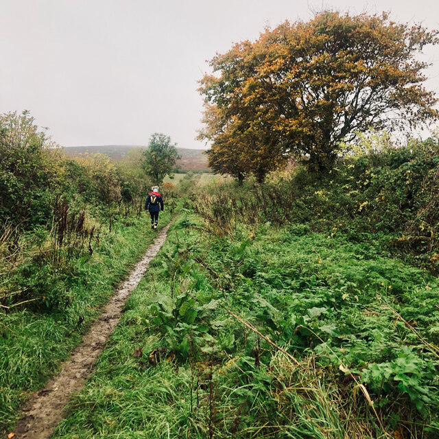
Horse Wood is a charming woodland located in the county of Northumberland, England. Situated in the heart of the picturesque Northumberland National Park, this enchanting forest covers an area of approximately 50 acres, offering visitors a tranquil and captivating natural environment.
Known for its diverse range of flora and fauna, Horse Wood is home to a variety of indigenous tree species, including oak, beech, and birch. The forest floor is adorned with an array of wildflowers, creating a vibrant tapestry of colors during the spring and summer months. It is not uncommon to spot woodland creatures such as deer, foxes, and rabbits roaming freely in their natural habitat.
The woodland features several well-marked walking trails, providing visitors with the opportunity to explore its beauty at their own pace. The paths wind through the dense forest, offering glimpses of scenic vistas and hidden clearings. Birdwatchers will be delighted by the numerous feathered inhabitants that call Horse Wood their home, with species such as woodpeckers and owls commonly spotted.
Horse Wood also holds historical significance, with remnants of a medieval hunting lodge still visible within its boundaries. The lodge, believed to have been built in the 12th century, adds an element of intrigue and mystique to the woodland.
With its idyllic setting and abundant natural beauty, Horse Wood is a popular destination for nature enthusiasts, hikers, and those seeking a peaceful retreat amidst the stunning Northumberland landscape. Whether one is looking to immerse themselves in the serenity of nature or explore the rich history of the region, Horse Wood offers a truly unforgettable experience.
If you have any feedback on the listing, please let us know in the comments section below.
Horse Wood Images
Images are sourced within 2km of 55.601941/-1.9218418 or Grid Reference NU0534. Thanks to Geograph Open Source API. All images are credited.


Horse Wood is located at Grid Ref: NU0534 (Lat: 55.601941, Lng: -1.9218418)
Unitary Authority: Northumberland
Police Authority: Northumbria
What 3 Words
///defrost.switch.umbrella. Near Doddington, Northumberland
Nearby Locations
Related Wikis

Holburn Lake and Moss
Holburn Lake and Moss is a nature reserve in Northumberland, England to the east of the village of Holburn. Nearby is St Cuthbert's Cave. == The lake... ==

Holburn
Holburn is a hamlet in the English county of Northumberland. Holburn is located between Lowick and Belford. == Governance == Holburn is in the parliamentary...
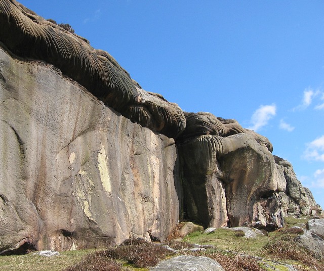
Colour Heugh and Bowden Doors
Colour Heugh and Bowden Doors are two crag rock formations in north Northumberland in North East England, designated as a Site of Special Scientific Interest...
Horton, Chatton
Horton is a pair of small settlements, West Horton and East Horton, divided by a stream - the Horton Burn - in Northumberland, England 3 miles (5 km) north...

Middleton, Northumberland
Middleton is a settlement and civil parish in Northumberland, England. The parish is situated on the North Sea coast, south of the island of Lindisfarne...

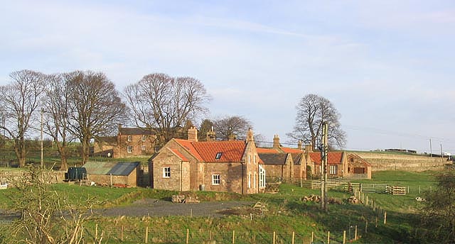
Middleton Hall, Middleton, Northumberland
Middleton Hall is a country house near the settlement of Middleton, Northumberland, in that parish, that dates from 1871. It is listed Grade II on the...

Fowberry Tower
Fowberry Tower is a Grade II* listed mansion house, situated on the banks of the River Till, near Chatton, Northumberland.The Manor of Fowberry was owned...

Buckton, Northumberland
Buckton is a small village in Northumberland, North East England, located just over 5 km north of Belford.Buckton consists of a farm and a few cottages...
Have you been to Horse Wood?
Leave your review of Horse Wood below (or comments, questions and feedback).