Culmington
Settlement in Shropshire
England
Culmington
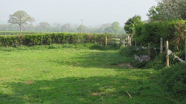
Culmington is a small village located in the picturesque county of Shropshire, England. Situated approximately 7 miles southeast of the town of Ludlow, Culmington is nestled in a rural landscape characterized by rolling hills, lush green fields, and charming countryside views.
The village itself is home to a tight-knit community, with a population of around 300 residents. The architecture of Culmington reflects its rich history, with many traditional cottages and buildings dating back to the 16th and 17th centuries. The centerpiece of the village is the St. Michael and All Angels Church, a beautiful medieval structure that stands as a testament to the area's long-standing religious heritage.
Despite its small size, Culmington offers a range of amenities for residents and visitors alike. The village has a vibrant local pub, The Crown Inn, where one can enjoy a pint of local ale and partake in traditional British pub fare. Additionally, there is a village hall that serves as a hub for community events and gatherings.
Surrounded by idyllic countryside, Culmington is a haven for outdoor enthusiasts. The area offers numerous walking and cycling routes, allowing visitors to explore the stunning natural beauty of Shropshire. Nearby attractions include the stunning Mortimer Forest, known for its ancient oak trees and scenic trails.
Culmington is a tranquil and charming village that provides a peaceful retreat from the hustle and bustle of modern life. With its rich history, stunning countryside, and welcoming community, it is a hidden gem within the beautiful county of Shropshire.
If you have any feedback on the listing, please let us know in the comments section below.
Culmington Images
Images are sourced within 2km of 52.434347/-2.75151 or Grid Reference SO4982. Thanks to Geograph Open Source API. All images are credited.


Culmington is located at Grid Ref: SO4982 (Lat: 52.434347, Lng: -2.75151)
Unitary Authority: Shropshire
Police Authority: West Mercia
What 3 Words
///bogus.imitate.juggle. Near Bromfield, Shropshire
Nearby Locations
Related Wikis

Culmington
Culmington is a village and civil parish in south Shropshire, England, about 3+1⁄2 miles (5.6 km) east of Craven Arms and 4+1⁄2 miles (7 km) north of Ludlow...

River Corve
The River Corve is a minor river in Shropshire, England. It is a tributary of the River Teme which it joins in the town of Ludlow, and which joins the...

Bache, Shropshire
Bache is a hamlet in Shropshire, England. == External links == Media related to Bache, Shropshire at Wikimedia Commons

Corfton
Corfton is a small village in Shropshire, England, located 4.5 miles (7.2 km) east of Craven Arms and 7.5 miles (12.1 km) north of Ludlow, the two nearest...
Nearby Amenities
Located within 500m of 52.434347,-2.75151Have you been to Culmington?
Leave your review of Culmington below (or comments, questions and feedback).