Lightoaks Wood

Wood, Forest in Staffordshire Staffordshire Moorlands

England

Lightoaks Wood

Old Milestone, Threapwood Head Cast iron post by the B5032, in parish of ALTON (STAFFORDSHIRE MOORLANDS District), by hedge, on North side of road. Cochrane iron casting, erected by the County Council in the 20th century.

Inscription reads:-
: ALTON 2½ / DENSTONE 4½ / ELLASTONE 6¼ / ASHBOURNE 11 : : ALTON / PARISH : : CHEADLE 2 :
Maker:- Cochrane & Co, Dudley. :

Milestone Society National ID: ST_ABCD11
Old Milestone, Threapwood Head Credit: Ivan Clare

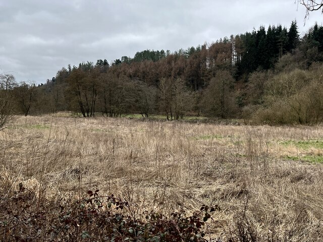
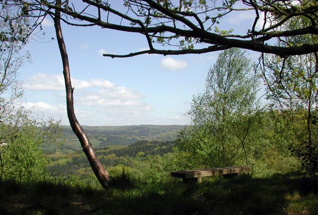
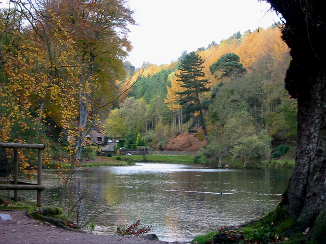
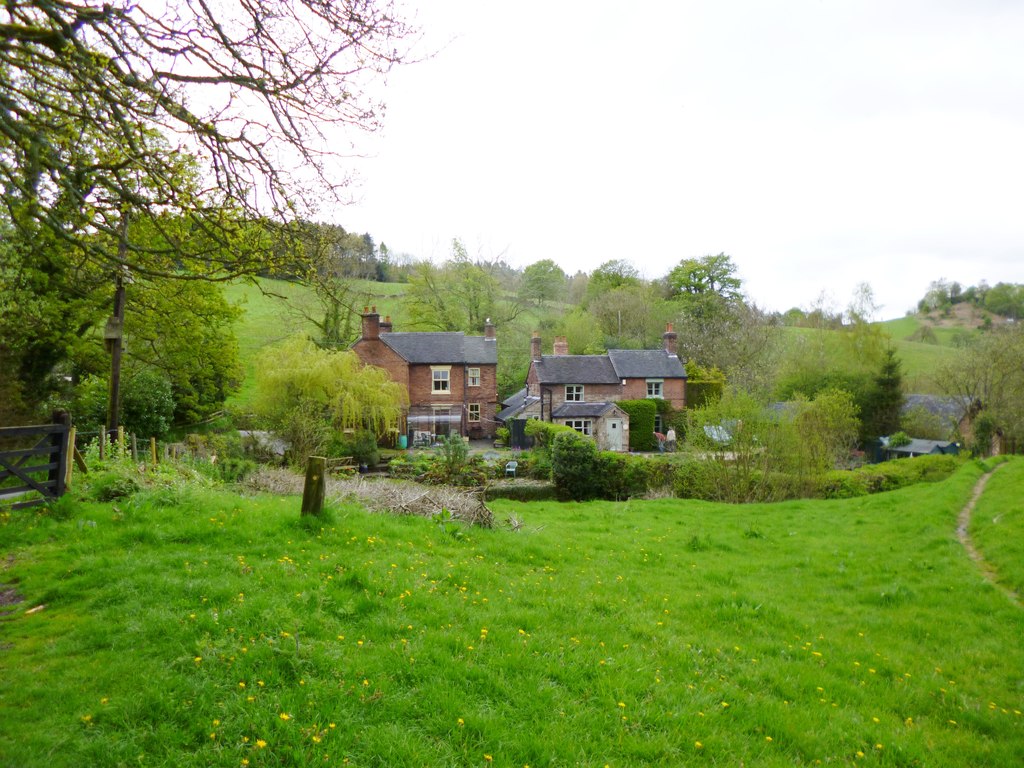
Lightoaks Wood is a picturesque woodland located in Staffordshire, England. Spanning approximately 100 acres, it is a popular destination for nature enthusiasts and locals seeking tranquility and natural beauty. The wood is situated near the village of Brewood, just west of Cannock Chase.

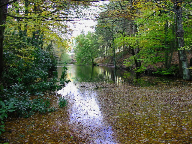
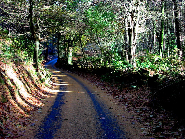
The wood is predominantly made up of broadleaf trees, including oak, birch, and beech, which create a rich and diverse ecosystem. The dense canopy allows for a shaded and cool environment, perfect for leisurely walks and picnics even during the warmer months. The forest floor is covered in a carpet of wildflowers, adding bursts of color to the green surroundings.

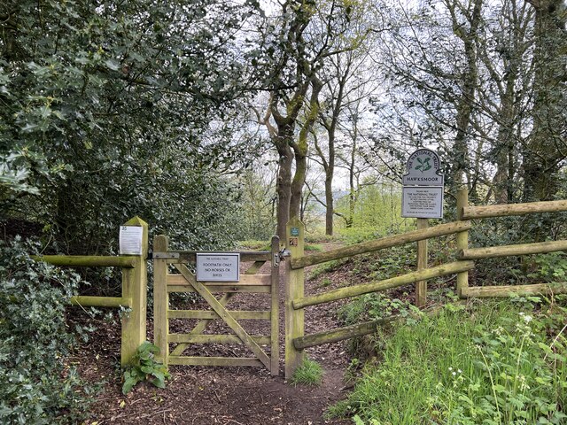
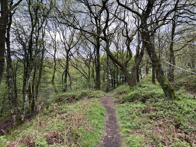
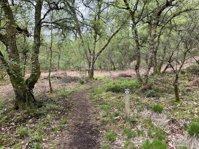
Visitors can explore numerous walking trails that wind through the woods, offering opportunities to spot local wildlife such as deer, squirrels, and a variety of bird species. The wood is also home to a small pond, which attracts water-loving creatures like ducks and frogs.

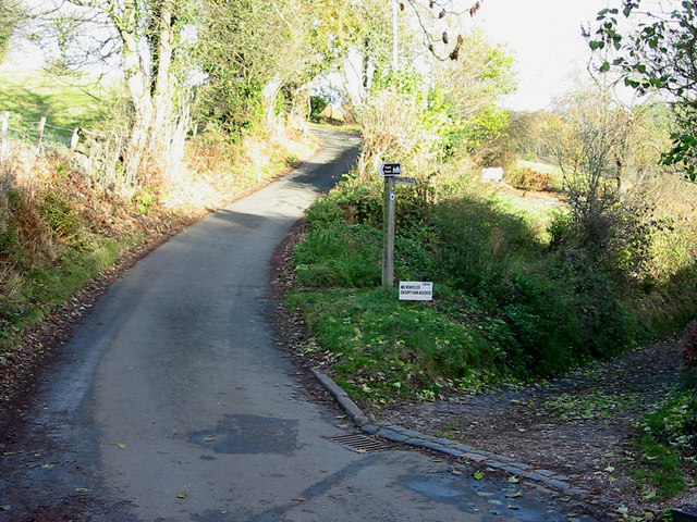
Lightoaks Wood is managed by the local council, ensuring the preservation of its natural beauty and providing amenities for visitors. The wood features well-maintained paths, benches, and information boards providing details about the local flora and fauna. It is accessible to all, including families with young children and individuals with limited mobility.

Overall, Lightoaks Wood offers a peaceful and rejuvenating escape from the hustle and bustle of everyday life. Its natural charm, diverse wildlife, and well-maintained facilities make it a must-visit destination for nature lovers in Staffordshire.

If you have any feedback on the listing, please let us know in the comments section below.

Lightoaks Wood Images

Images are sourced within 2km of 52.994785/-1.9338985 or Grid Reference SK0444. Thanks to Geograph Open Source API. All images are credited.

Old Milestone, Threapwood Head Cast iron post by the B5032, in parish of ALTON (STAFFORDSHIRE MOORLANDS District), by hedge, on North side of road. Cochrane iron casting, erected by the County Council in the 20th century.

Inscription reads:-
: ALTON 2½ / DENSTONE 4½ / ELLASTONE 6¼ / ASHBOURNE 11 : : ALTON / PARISH : : CHEADLE 2 :
Maker:- Cochrane & Co, Dudley. :

Milestone Society National ID: ST_ABCD11
Old Milestone, Threapwood Head
Cast iron post by the B5032, in parish of ALTON (STAFFORDSHIRE MOORLANDS District), by hedge, on North side of road. Cochrane iron casting, erected by the County Council in the 20th century. Inscription reads:- : ALTON 2½ / DENSTONE 4½ / ELLASTONE 6¼ / ASHBOURNE 11 : : ALTON / PARISH : : CHEADLE 2 : Maker:- Cochrane & Co, Dudley. : Milestone Society National ID: ST_ABCD11
Closed railway tunnel and former crossing keeper's cottage On the former Churnet Valley line in North Staffordshire.
Closed railway tunnel and former crossing keeper's cottage
On the former Churnet Valley line in North Staffordshire.
Churnet Valley flood plain
The Ramblers' Retreat A deservedly popular cafe and tea room in Dimmingsdale.
The Ramblers' Retreat
A deservedly popular cafe and tea room in Dimmingsdale.
Highshutt entrance to Hawksmoor NT Hawksmoor is an ancient steep-sided oak woodland
Highshutt entrance to Hawksmoor NT
Hawksmoor is an ancient steep-sided oak woodland
Path through Hawksmoor NT Hawksmoor is an ancient steep-sided oak woodland east of Cheadle in Staffordshire towards Oakamoor. It is managed by the National Trust. The habitat attracts specialised bird species such as Wood Warbler and Pied Flycatcher.
Path through Hawksmoor NT
Hawksmoor is an ancient steep-sided oak woodland east of Cheadle in Staffordshire towards Oakamoor. It is managed by the National Trust. The habitat attracts specialised bird species such as Wood Warbler and Pied Flycatcher.
Car parking for Hawksmoor NT 'Limited parking for approx. 6 cars' states the National Trust website, and this is it. However even more limited off-road parking is possible at Highshutt further west outside the entrance shown here <a title="https://www.geograph.org.uk/photo/7667028" href="https://www.geograph.org.uk/photo/7667028">Link</a>
Car parking for Hawksmoor NT
'Limited parking for approx. 6 cars' states the National Trust website, and this is it. However even more limited off-road parking is possible at Highshutt further west outside the entrance shown here Link
Path through Hawksmoor NT Hawksmoor is an ancient steep-sided oak woodland east of Cheadle in Staffordshire towards Oakamoor. It is managed by the National Trust. The habitat attracts specialised bird species such as Wood Warbler and Pied Flycatcher.
Path through Hawksmoor NT
Hawksmoor is an ancient steep-sided oak woodland east of Cheadle in Staffordshire towards Oakamoor. It is managed by the National Trust. The habitat attracts specialised bird species such as Wood Warbler and Pied Flycatcher.
View from Hawksmoor Reserve (NT)
Dimmingsdale Dimmingsdale in all its autumnal glory showing one of the holding ponds built to hold water used in the adjacent smelting mill, now a private residence.
Dimmingsdale
Dimmingsdale in all its autumnal glory showing one of the holding ponds built to hold water used in the adjacent smelting mill, now a private residence.
Dimmingsdale in Autumn Autumnal leaves cover one of several ponds in Dimmingsdale in the Staffordshire Moorlands.
Dimmingsdale in Autumn
Autumnal leaves cover one of several ponds in Dimmingsdale in the Staffordshire Moorlands.
Country Lane The Threapwood to Oakamoor road showing the western entrance to Dimmingsdale
Country Lane
The Threapwood to Oakamoor road showing the western entrance to Dimmingsdale
Autumn Lane A country lane near Oakamoor in the Staffordshire Moorlands covered in pine needles.
Autumn Lane
A country lane near Oakamoor in the Staffordshire Moorlands covered in pine needles.
Oldfurnace Cottages at Oldfurnace from the footpath to Newton.
Oldfurnace
Cottages at Oldfurnace from the footpath to Newton.
Newton Newly renovated cottages in the local pink stone. Newton is a cluster of cottages set back from the road down a gravelled track.
Newton
Newly renovated cottages in the local pink stone. Newton is a cluster of cottages set back from the road down a gravelled track.
Ridge above Bradley Elms A footpath follows the crest of this broad ridge from Newton to Great Gate, with views to the quarries to the west and Alton Towers to the northeast.
Ridge above Bradley Elms
A footpath follows the crest of this broad ridge from Newton to Great Gate, with views to the quarries to the west and Alton Towers to the northeast.
View from Alton Common Looking west with (I think) the Weaver Hills (<a href="https://www.geograph.org.uk/gridref/SK0946">SK0946</a>) in the distance, left.
View from Alton Common
Looking west with (I think) the Weaver Hills (SK0946) in the distance, left.
Stile, Alton Common Looking north towards Dimmingsdale Woods.
Stile, Alton Common
Looking north towards Dimmingsdale Woods.
Show me another place!

Lightoaks Wood is located at Grid Ref: SK0444 (Lat: 52.994785, Lng: -1.9338985)

Administrative County: Staffordshire

District: Staffordshire Moorlands

Police Authority: Staffordshire

What 3 Words

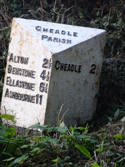
///toasters.thighs.relations. Near Cheadle, Staffordshire

Related Wikis

The Old Furnace

The Old Furnace is a colloquial name given to an historic site in Oakamoor, Staffordshire, England, that supported the development of medieval and post...

Oakamoor railway station

Oakamoor railway station is a closed railway station in the Churnet Valley, Staffordshire. The station was opened in 1849 as part of the Churnet Valley...

Oakamoor Tunnel

Oakamoor Tunnel is a disused 497-yard (454 m) long tunnel located north of Oakamoor railway station on the former Uttoxeter to North Rode section of the...

Oakamoor

Oakamoor is a small village in north Staffordshire, England. Although it is now a rural area, it has an industrial past which drew on the natural resources...

Woodhead Hall

Woodhead Hall is a country house at Cheadle in Staffordshire. It is a Grade II listed building. == History == Woodhead Hall was originally commissioned...

Chained Oak

The Chained Oak is an oak tree, tied in chains, near to the village of Alton, Staffordshire, England. The tree, referred to as "The Old Oak", is the subject...

Submission (Alton Towers)

Submission was a theme park ride at Alton Towers in Staffordshire, England from 2001 until 2013. It was a Chance Rides double swinging inverter. ��2...

Cotton Dell

Cotton Dell is a nature reserve of the Staffordshire Wildlife Trust. It is a wooded valley area near the village of Cotton and about 0.5 miles (0.8 km...

Nearby Amenities

Located within 500m of 52.994785,-1.9338985
Barrier: cattle_grid
Lat/Long: 52.9914069/-1.9293889
Barrier: entrance
Source: survey;gps
Lat/Long: 52.991413/-1.9293229
Barrier: stile
Material: wood
Source: survey;gps
Stile: stepover
Lat/Long: 52.9914343/-1.929406
The data included in this document is from www.openstreetmap.org. The data is made available under ODbL.

Have you been to Lightoaks Wood?

Leave your review of Lightoaks Wood below (or comments, questions and feedback).