Hazel Wood

Wood, Forest in Staffordshire Staffordshire Moorlands

England

Hazel Wood

Closed railway tunnel and former crossing keeper's cottage On the former Churnet Valley line in North Staffordshire.
Closed railway tunnel and former crossing keeper's cottage Credit: John H Darch

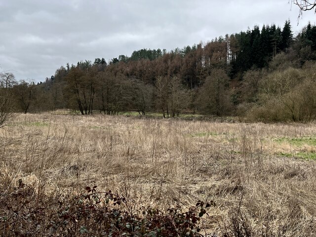
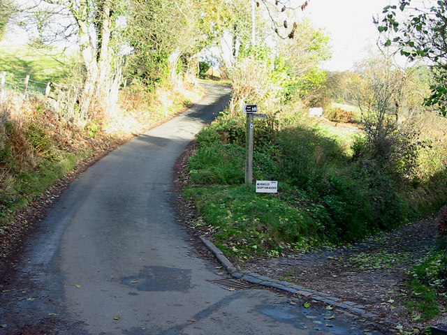
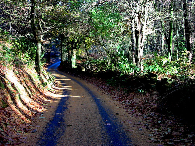
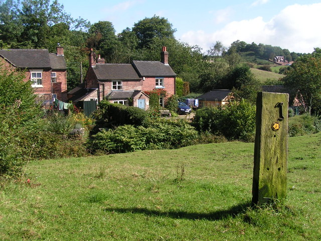
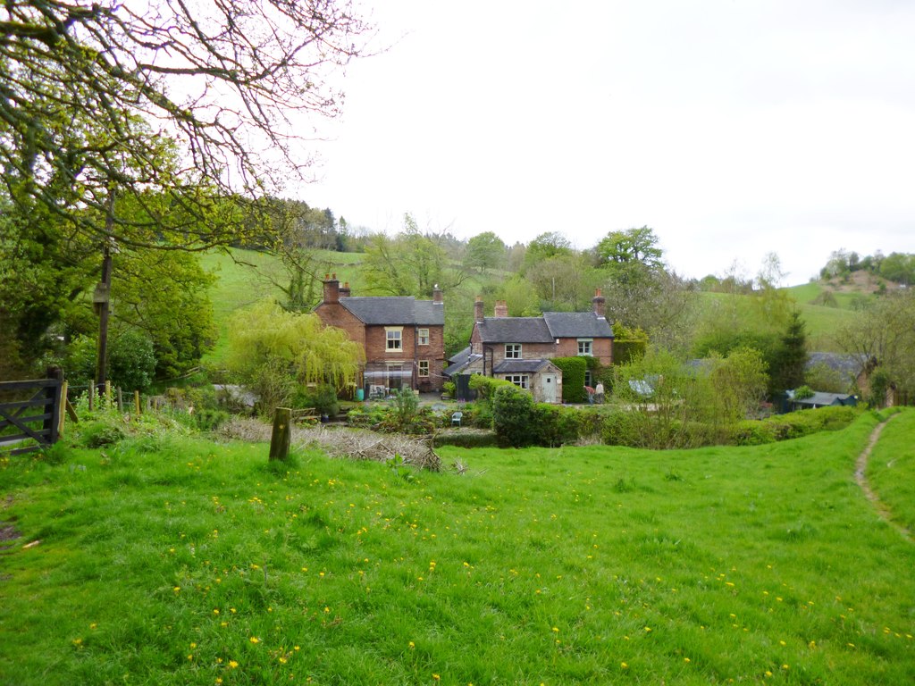
Hazel Wood is a beautiful and enchanting forest located in Staffordshire, England. Covering an area of approximately 100 acres, it is known for its dense hazel trees, hence the name. The forest is located near the small village of Hazelwood, surrounded by rolling hills and picturesque countryside.

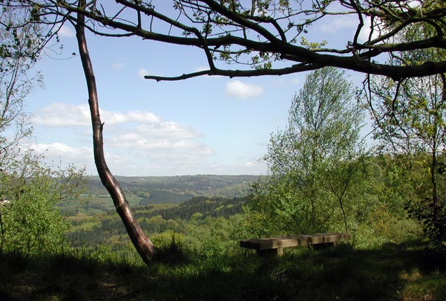
Hazel Wood is a popular destination for nature lovers and outdoor enthusiasts due to its serene and tranquil atmosphere. The forest is home to a diverse range of flora and fauna, making it a haven for wildlife. Visitors can often spot various bird species, rabbits, squirrels, and even deer roaming freely in the woods.

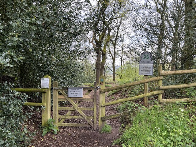
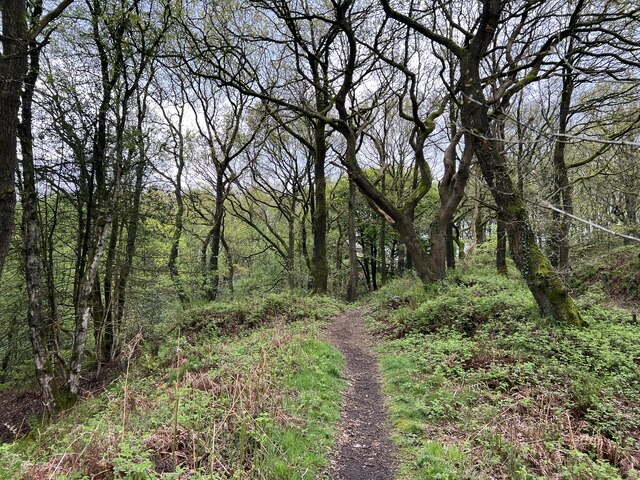
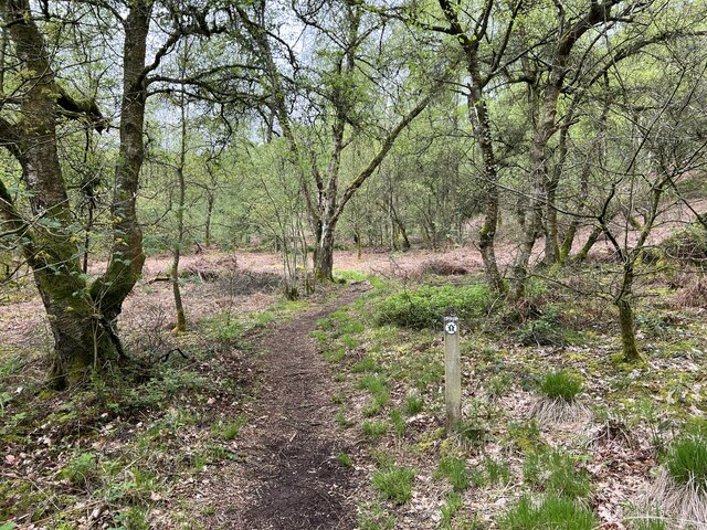
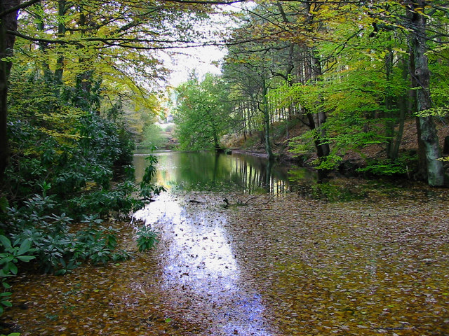
The forest offers numerous walking trails and paths, allowing visitors to explore its hidden gems. The trails vary in difficulty, catering to both casual strollers and avid hikers. Along the way, visitors can admire the stunning scenery, including ancient oak trees, colorful wildflowers, and babbling brooks.

Hazel Wood also holds historical significance, with remnants of ancient stone structures and archaeological artifacts found within its boundaries. These remnants provide insight into the area's rich history and the people who once inhabited it.

For those seeking a peaceful retreat or a chance to reconnect with nature, Hazel Wood is the perfect destination. With its natural beauty, diverse wildlife, and historical significance, it offers a truly immersive experience for visitors of all ages.

If you have any feedback on the listing, please let us know in the comments section below.
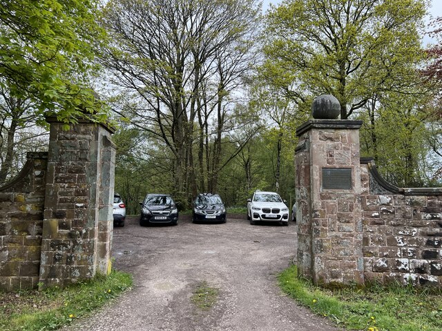
Hazel Wood Images

Images are sourced within 2km of 53.000944/-1.9350513 or Grid Reference SK0444. Thanks to Geograph Open Source API. All images are credited.

Closed railway tunnel and former crossing keeper's cottage On the former Churnet Valley line in North Staffordshire.
Closed railway tunnel and former crossing keeper's cottage
On the former Churnet Valley line in North Staffordshire.
Churnet Valley flood plain
Highshutt entrance to Hawksmoor NT Hawksmoor is an ancient steep-sided oak woodland
Highshutt entrance to Hawksmoor NT
Hawksmoor is an ancient steep-sided oak woodland
Path through Hawksmoor NT Hawksmoor is an ancient steep-sided oak woodland east of Cheadle in Staffordshire towards Oakamoor. It is managed by the National Trust. The habitat attracts specialised bird species such as Wood Warbler and Pied Flycatcher.
Path through Hawksmoor NT
Hawksmoor is an ancient steep-sided oak woodland east of Cheadle in Staffordshire towards Oakamoor. It is managed by the National Trust. The habitat attracts specialised bird species such as Wood Warbler and Pied Flycatcher.
Car parking for Hawksmoor NT 'Limited parking for approx. 6 cars' states the National Trust website, and this is it. However even more limited off-road parking is possible at Highshutt further west outside the entrance shown here <a title="https://www.geograph.org.uk/photo/7667028" href="https://www.geograph.org.uk/photo/7667028">Link</a>
Car parking for Hawksmoor NT
'Limited parking for approx. 6 cars' states the National Trust website, and this is it. However even more limited off-road parking is possible at Highshutt further west outside the entrance shown here Link
Path through Hawksmoor NT Hawksmoor is an ancient steep-sided oak woodland east of Cheadle in Staffordshire towards Oakamoor. It is managed by the National Trust. The habitat attracts specialised bird species such as Wood Warbler and Pied Flycatcher.
Path through Hawksmoor NT
Hawksmoor is an ancient steep-sided oak woodland east of Cheadle in Staffordshire towards Oakamoor. It is managed by the National Trust. The habitat attracts specialised bird species such as Wood Warbler and Pied Flycatcher.
View from Hawksmoor Reserve (NT)
Dimmingsdale in Autumn Autumnal leaves cover one of several ponds in Dimmingsdale in the Staffordshire Moorlands.
Dimmingsdale in Autumn
Autumnal leaves cover one of several ponds in Dimmingsdale in the Staffordshire Moorlands.
Country Lane The Threapwood to Oakamoor road showing the western entrance to Dimmingsdale
Country Lane
The Threapwood to Oakamoor road showing the western entrance to Dimmingsdale
Autumn Lane A country lane near Oakamoor in the Staffordshire Moorlands covered in pine needles.
Autumn Lane
A country lane near Oakamoor in the Staffordshire Moorlands covered in pine needles.
Oldfurnace Cottages at Oldfurnace from the footpath to Newton.
Oldfurnace
Cottages at Oldfurnace from the footpath to Newton.
Oldfurnace Ford on the track to Dimmingsdale, with the chimneys of Oldfurnace beyond the hedge.
Oldfurnace
Ford on the track to Dimmingsdale, with the chimneys of Oldfurnace beyond the hedge.
Greendale Cottages Right on the eastern edge of the square (in fact the far end of the terrace is in <a href="https://www.geograph.org.uk/gridref/SK0443">SK0443</a>). A plaque on the end wall reads "These cottages built for brass and copper workers were given to the National Trust in 1987 by the late Mrs. M. C. Aldridge who loved Hawksmoor and the surrounding countryside". There is also a Victorian postbox in the wall.
Greendale Cottages
Right on the eastern edge of the square (in fact the far end of the terrace is in SK0443). A plaque on the end wall reads "These cottages built for brass and copper workers were given to the National Trust in 1987 by the late Mrs. M. C. Aldridge who loved Hawksmoor and the surrounding countryside". There is also a Victorian postbox in the wall.
Barn at Greendale Farm From Greendale Lane, on the very eastern edge of the square.
Barn at Greendale Farm
From Greendale Lane, on the very eastern edge of the square.
Interior of Oakamoor Church
Geocache stash and landscape This is a picture taken after finding a geocache, a new and fantastic hobby discovered after submitting pictures to this site. The picture shows the field and side of forest shown on the map. The tupperware box is what we found buried about 100 yards away. Get out there and get geo - "graphing" and "caching"!
Geocache stash and landscape
This is a picture taken after finding a geocache, a new and fantastic hobby discovered after submitting pictures to this site. The picture shows the field and side of forest shown on the map. The tupperware box is what we found buried about 100 yards away. Get out there and get geo - "graphing" and "caching"!
Great Marquess steam locomotive on Churnet Valley Railway Great Marquess steam locomotive on Churnet Valley Railway near Oakamoor. This part of the preserved railway line is not yet open to the public
Great Marquess steam locomotive on Churnet Valley Railway
Great Marquess steam locomotive on Churnet Valley Railway near Oakamoor. This part of the preserved railway line is not yet open to the public
Abandoned Canal Milepost and Railway This milepost stands on a section of the former Uttoxeter Canal in the Churnet Valley. The canal was closed in 1849 to make way for the North Staffordshire Railway, pictured in the background. The railway took a straighter route, leaving isolated loops of canal at various points down the valley.
Abandoned Canal Milepost and Railway
This milepost stands on a section of the former Uttoxeter Canal in the Churnet Valley. The canal was closed in 1849 to make way for the North Staffordshire Railway, pictured in the background. The railway took a straighter route, leaving isolated loops of canal at various points down the valley.
Show me another place!

Hazel Wood is located at Grid Ref: SK0444 (Lat: 53.000944, Lng: -1.9350513)

Administrative County: Staffordshire

District: Staffordshire Moorlands

Police Authority: Staffordshire

What 3 Words

///rounds.breached.contain. Near Cheadle, Staffordshire

Related Wikis

Oakamoor Tunnel

Oakamoor Tunnel is a disused 497-yard (454 m) long tunnel located north of Oakamoor railway station on the former Uttoxeter to North Rode section of the...

Oakamoor railway station

Oakamoor railway station is a closed railway station in the Churnet Valley, Staffordshire. The station was opened in 1849 as part of the Churnet Valley...

Oakamoor

Oakamoor is a small village in north Staffordshire, England. Although it is now a rural area, it has an industrial past which drew on the natural resources...

The Old Furnace

The Old Furnace is a colloquial name given to an historic site in Oakamoor, Staffordshire, England, that supported the development of medieval and post...

Woodhead Hall

Woodhead Hall is a country house at Cheadle in Staffordshire. It is a Grade II listed building. == History == Woodhead Hall was originally commissioned...

Cotton Dell

Cotton Dell is a nature reserve of the Staffordshire Wildlife Trust. It is a wooded valley area near the village of Cotton and about 0.5 miles (0.8 km...

Whiston, Staffordshire Moorlands

Whiston is a village in the Staffordshire Moorlands district of Staffordshire, England. Population details as taken at the 2011 census can be found under...

Cotton College

Cotton College was a Roman Catholic boarding school in Cotton, Staffordshire, United Kingdom. It was also known as Saint Wilfrid's College. The school...

Nearby Amenities

Located within 500m of 53.000944,-1.9350513
Railway: switch
Lat/Long: 53.0034064/-1.9400933
Railway: buffer_stop
Lat/Long: 53.0028451/-1.9306876
Oakamoor Sand Sidings
Railway: junction
Lat/Long: 53.0032617/-1.9389444
Railway: switch
Lat/Long: 53.0031464/-1.9326062
Railway: switch
Lat/Long: 53.0030842/-1.9322312
Railway: switch
Lat/Long: 53.0032668/-1.938558
Railway: switch
Lat/Long: 53.0033586/-1.9396164
Railway: buffer_stop
Lat/Long: 53.0031331/-1.93408
Railway: switch
Lat/Long: 53.0032874/-1.9390054
The data included in this document is from www.openstreetmap.org. The data is made available under ODbL.

Have you been to Hazel Wood?

Leave your review of Hazel Wood below (or comments, questions and feedback).