High Trees

Wood, Forest in Wiltshire

England

High Trees

B390 at Maddington Farm
B390 at Maddington Farm Credit: Anthony Parkes

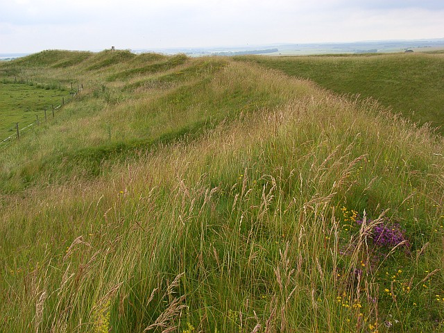
High Trees is a pristine woodland located in Wiltshire, England, renowned for its natural beauty and rich biodiversity. Covering an area of approximately 500 acres, this enchanting forest is a haven for nature enthusiasts and a popular destination for outdoor activities.

The woodland is predominantly comprised of broadleaf trees, including oak, beech, and ash, creating a picturesque landscape that changes with the seasons. Visitors can witness the vibrant hues of autumn leaves, the fresh greens of spring, and the majestic canopy of summer. These trees provide a sanctuary for various bird species, such as woodpeckers, owls, and thrushes, making it a paradise for birdwatching enthusiasts.

High Trees is crisscrossed by numerous walking trails, allowing visitors to immerse themselves in the tranquil surroundings and explore the diverse flora and fauna. The forest floor is carpeted with a myriad of wildflowers, including bluebells, primroses, and foxgloves, adding bursts of color to the scenery. It is also home to an array of wildlife, including deer, badgers, and squirrels, which can often be spotted during a leisurely hike.

In addition to its natural wonders, High Trees offers various recreational activities. The forest has designated picnic areas, perfect for enjoying a scenic lunch or a family gathering. There are also camping facilities available for those wishing to spend more time in this idyllic setting. The combination of peaceful surroundings, abundant wildlife, and well-maintained trails make High Trees an ideal destination for nature lovers, hikers, and outdoor enthusiasts alike.

If you have any feedback on the listing, please let us know in the comments section below.

High Trees Images

Images are sourced within 2km of 51.181296/-1.9449125 or Grid Reference SU0342. Thanks to Geograph Open Source API. All images are credited.

B390 at Maddington Farm
Tank Crossing on Chitterne Down
Chitterne Road under stormy skies
2011 : B390 Chitterne Road two miles to Shrewton An army vehicle comes up the hill outside the official military range.
Maddington Farm hides in the trees and a large piggery reeks on the distant hill.
2011 : B390 Chitterne Road two miles to Shrewton
An army vehicle comes up the hill outside the official military range. Maddington Farm hides in the trees and a large piggery reeks on the distant hill.
2011 : Fence and drinking trough on Maddington Down Maddington Farm is centre frame, bits of Shrewton can be seen beyond. White dots on the hillside to the left mark a piggery. Fields of grain - mostly wheat and barley - are ready for harvesting.
2011 : Fence and drinking trough on Maddington Down
Maddington Farm is centre frame, bits of Shrewton can be seen beyond. White dots on the hillside to the left mark a piggery. Fields of grain - mostly wheat and barley - are ready for harvesting.
2011 : Tracks on Maddington Down Just possible to see a vehicle on the B390 Chitterne Road.
The far hill is claimed as military land although it is well outside the range marked on OS Explorer Maps.
2011 : Tracks on Maddington Down
Just possible to see a vehicle on the B390 Chitterne Road. The far hill is claimed as military land although it is well outside the range marked on OS Explorer Maps.
2011 : East on Chitterne Down Looking toward Maddington Down with the B390 to the left heading for Shrewton - about three miles.
2011 : East on Chitterne Down
Looking toward Maddington Down with the B390 to the left heading for Shrewton - about three miles.
2011 : South from the B390 Chitterne Road Over a large wheatfield near Maddington Farm.
The valley to the left is dry like most valleys on Salisbury Plain. Due to the porous nature of the chalk there is very little running water in this area, especially during summer months.
2011 : South from the B390 Chitterne Road
Over a large wheatfield near Maddington Farm. The valley to the left is dry like most valleys on Salisbury Plain. Due to the porous nature of the chalk there is very little running water in this area, especially during summer months.
2011 : B390 Chitterne Road looking east Passing Maddington Farm.
Shrewton is a little over a mile ahead.
2011 : B390 Chitterne Road looking east
Passing Maddington Farm. Shrewton is a little over a mile ahead.
2011 : B390 Chitterne Road near Maddington Farm A little over one mile out of Shrewton on the way to Chitterne, four miles.
2011 : B390 Chitterne Road near Maddington Farm
A little over one mile out of Shrewton on the way to Chitterne, four miles.
2011 : Sheep near Maddington Farm Is he a threat? Should we run for it?
2011 : Sheep near Maddington Farm
Is he a threat? Should we run for it?
2011 : B390 Chitterne Road passing Maddington Down Climbing the hill out of Shrewton on the way to Chitterne.
2011 : B390 Chitterne Road passing Maddington Down
Climbing the hill out of Shrewton on the way to Chitterne.
2011 : B390 heading east to Shrewton - three miles With ash tree.
At the top of Chitterne Down it is mostly downhill to Shrewton.
2011 : B390 heading east to Shrewton - three miles
With ash tree. At the top of Chitterne Down it is mostly downhill to Shrewton.
2011 : Military Road on Chittern Down Seen from the B390. According to OS Explorer Map 130 this is a byway open to all traffic to the bottom of the hill then it becomes a Restricted Byway open to walkers, horse riders, cyclists and other non-mechanically propelled vehicles. But watch out for tanks.
2011 : Military Road on Chittern Down
Seen from the B390. According to OS Explorer Map 130 this is a byway open to all traffic to the bottom of the hill then it becomes a Restricted Byway open to walkers, horse riders, cyclists and other non-mechanically propelled vehicles. But watch out for tanks.
Shrewton, tank crossing On a military road in Salisbury Plain Military Training Area; crossing B390.
Shrewton, tank crossing
On a military road in Salisbury Plain Military Training Area; crossing B390.
Shrewton, track Running parallel to B390 (left) from <a href="https://www.geograph.org.uk/photo/3689680">SU0243 : Shrewton, tank crossing</a> to the next tank crossing; it is not clear if the track is for military or agricultural use - it is in Salisbury Plain Military Training Area.
Shrewton, track
Running parallel to B390 (left) from SU0243 : Shrewton, tank crossing to the next tank crossing; it is not clear if the track is for military or agricultural use - it is in Salisbury Plain Military Training Area.
Chitterne, byway and track junction On Salisbury Plain Military Training Area; left, byway to Chitterne Road, right, track towards a nearby tank crossing.
Chitterne, byway and track junction
On Salisbury Plain Military Training Area; left, byway to Chitterne Road, right, track towards a nearby tank crossing.
Chitterne, track Running from the Tilshead byway to alongside Chitterne Road - military or agricultural use? - and continuing at <a href="https://www.geograph.org.uk/photo/3689694">SU0243 : Shrewton, track</a>.
Chitterne, track
Running from the Tilshead byway to alongside Chitterne Road - military or agricultural use? - and continuing at SU0243 : Shrewton, track.
Show me another place!

High Trees is located at Grid Ref: SU0342 (Lat: 51.181296, Lng: -1.9449125)

Unitary Authority: Wiltshire

Police Authority: Wiltshire

What 3 Words

///tucked.comedy.fork. Near Shrewton, Wiltshire

Nearby Locations

High Trees

Related Wikis

Parsonage Down

Parsonage Down (grid reference SU050412) is a 188.6 hectare biological Site of Special Scientific Interest in Wiltshire, England, notified in 1971. It...

Yarnbury Castle

Yarnbury Castle is the site of a multiphase, multivallate Iron Age hillfort near the village of Steeple Langford, Wiltshire, England. The site covers an...

River Till SSSI, Wiltshire

The River Till SSSI (grid reference SU051452) is a 32.07 hectares (79.2 acres) biological Site of Special Scientific Interest in Wiltshire, England, notified...

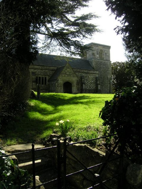
St Mary's Church, Maddington

St Mary's Church in the Maddington area of Shrewton, Wiltshire, in the west of England, was built in the late 12th century. It is recorded in the National...

Have you been to High Trees?

Leave your review of High Trees below (or comments, questions and feedback).