Hollin Side Wood

Wood, Forest in Durham

England

Hollin Side Wood

Bales near, far and beyond Three sets of bales can be seen in the image, (one is quite distant), and there are more such piles on Langleydale Common. They were first thought to be conventional bales of straw or grass but they're not; it's bracken! There are mown areas of bracken on the moor and it seems clear that the 'mowings' have been collected and baled. The purpose of the exercise is uncertain but it is known that bracken is not a favoured species for ground cover so perhaps the plan is to reduce the extent of it. Maybe the hope is that in time, heather will replace the bracken and eventually the land can be used as grouse moor.
Bales near, far and beyond Credit: Trevor Littlewood

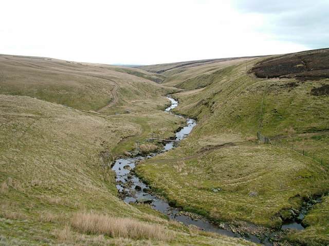
Hollin Side Wood is a picturesque woodland located in Durham, England. Covering an area of approximately 200 acres, it is a popular destination for nature enthusiasts and those seeking tranquility amidst the hustle and bustle of city life.

The wood is predominantly composed of native broadleaf trees, including oak, ash, birch, and beech, which create a vibrant and diverse ecosystem. The trees provide a home to a variety of bird species, such as woodpeckers, tits, and thrushes, making it an ideal spot for birdwatching.

Numerous walking trails crisscross the woodland, allowing visitors to explore its beauty at their own pace. The paths wind through enchanting glades, past babbling brooks, and up gentle slopes, providing breathtaking views of the surrounding countryside.

For those interested in the area's history, Hollin Side Wood has a rich past. It was once part of a larger estate and has remnants of old stone walls and boundaries that speak to its former use as farmland. Exploring the wood, visitors may stumble upon evidence of these former structures, adding an extra layer of intrigue to the experience.

The wood is accessible year-round and offers something for everyone, whether it's a leisurely stroll, a picnic amidst the greenery, or a chance to spot some of the local wildlife. Hollin Side Wood is a cherished natural gem in the heart of Durham, providing a peaceful escape into nature for locals and tourists alike.

If you have any feedback on the listing, please let us know in the comments section below.

Hollin Side Wood Images

Images are sourced within 2km of 54.599546/-1.9441831 or Grid Reference NZ0322. Thanks to Geograph Open Source API. All images are credited.

Bales near, far and beyond Three sets of bales can be seen in the image, (one is quite distant), and there are more such piles on Langleydale Common. They were first thought to be conventional bales of straw or grass but they're not; it's bracken! There are mown areas of bracken on the moor and it seems clear that the 'mowings' have been collected and baled. The purpose of the exercise is uncertain but it is known that bracken is not a favoured species for ground cover so perhaps the plan is to reduce the extent of it. Maybe the hope is that in time, heather will replace the bracken and eventually the land can be used as grouse moor.
Bales near, far and beyond
Three sets of bales can be seen in the image, (one is quite distant), and there are more such piles on Langleydale Common. They were first thought to be conventional bales of straw or grass but they're not; it's bracken! There are mown areas of bracken on the moor and it seems clear that the 'mowings' have been collected and baled. The purpose of the exercise is uncertain but it is known that bracken is not a favoured species for ground cover so perhaps the plan is to reduce the extent of it. Maybe the hope is that in time, heather will replace the bracken and eventually the land can be used as grouse moor.
B6278 towards Eggleston
Beaten path over Access Land below Langleydale Common This side of the wall is CROW Access Land, and the most used path is this one beaten down through bracken within that. There is also a public footpath on the map that goes through the gate seen on the left, deviating a fair way into the field to pick up a track (to Pallet Stone) and rejoin this path in the distance at the edge of the woodland. However, that track is blocked by a padlocked gate (easy enough for a pedestrian to climb, but more of a pain to get a dog over), so it appears that everyone uses the Access land. Behind and to the right of the photographer, the right of way continues over some remarkably boggy ground (but still apparently supporting something with tyres) on its way to Billy Lane.
Beaten path over Access Land below Langleydale Common
This side of the wall is CROW Access Land, and the most used path is this one beaten down through bracken within that. There is also a public footpath on the map that goes through the gate seen on the left, deviating a fair way into the field to pick up a track (to Pallet Stone) and rejoin this path in the distance at the edge of the woodland. However, that track is blocked by a padlocked gate (easy enough for a pedestrian to climb, but more of a pain to get a dog over), so it appears that everyone uses the Access land. Behind and to the right of the photographer, the right of way continues over some remarkably boggy ground (but still apparently supporting something with tyres) on its way to Billy Lane.
Peatmoor crag There is almost no stream in the valley, which has been cut quite deeply, leaving rocky sides. Whilst this is partly explained by the apparent capture of Redmire Gill, which used to flow this way, that would still be nowhere near a big enough stream to cut a valley like this. The answer is that the valley was cut by outflow from a melting ice sheet at the end of the last ice age. It remains oversized for its streams and picks up almost no tributaries for the next five kilometres as the narrow channel cuts down towards Copley. The main sources for the water of Arn Gill are springs on the north bank rather than streams flowing off the moor.
Peatmoor crag
There is almost no stream in the valley, which has been cut quite deeply, leaving rocky sides. Whilst this is partly explained by the apparent capture of Redmire Gill, which used to flow this way, that would still be nowhere near a big enough stream to cut a valley like this. The answer is that the valley was cut by outflow from a melting ice sheet at the end of the last ice age. It remains oversized for its streams and picks up almost no tributaries for the next five kilometres as the narrow channel cuts down towards Copley. The main sources for the water of Arn Gill are springs on the north bank rather than streams flowing off the moor.
The misfit stream of Arn Gill Arn Gill is fed almost entirely from a series of springs on the slopes on the left of the valley, and is a stream far too small to have cut the valley which it now occupies as a narrow channel with almost no tributaries for the next five kilometres. The steep, and in places rocky, valley sides are a clue that this was a glacial outflow channel cut by meltwater from an ice sheet towards the end of the ice age when it would have carried a much bigger stream through ground that was gripped by permafrost. The main valley of Teesdale would still have been occupied by a valley glacier, and as the surface and sides started to melt, water escaped through a gap at the head of Redmire Gill, and cut this channel heading for lower ground to the east. Stream capture by Pallet Crag Gill (the main source for Langley Beck) has removed the Redmire Gill water from this valley, which now has a tiny surface catchment.
The misfit stream of Arn Gill
Arn Gill is fed almost entirely from a series of springs on the slopes on the left of the valley, and is a stream far too small to have cut the valley which it now occupies as a narrow channel with almost no tributaries for the next five kilometres. The steep, and in places rocky, valley sides are a clue that this was a glacial outflow channel cut by meltwater from an ice sheet towards the end of the ice age when it would have carried a much bigger stream through ground that was gripped by permafrost. The main valley of Teesdale would still have been occupied by a valley glacier, and as the surface and sides started to melt, water escaped through a gap at the head of Redmire Gill, and cut this channel heading for lower ground to the east. Stream capture by Pallet Crag Gill (the main source for Langley Beck) has removed the Redmire Gill water from this valley, which now has a tiny surface catchment.
East House Cottage Although Northern Powergrids claim to have restored power to all their customers a couple of days ago (after the major outages caused by storm Arwen), there was a team using a cherry picker to fettle the wires to this property and I would imagine that their power was off for that to be safe.

There are three public footpaths leading into this field, meeting, according to the map, just left of the buildings. None are very apparent on the ground, and the most obvious path is not where any of the rights of way are shown.
East House Cottage
Although Northern Powergrids claim to have restored power to all their customers a couple of days ago (after the major outages caused by storm Arwen), there was a team using a cherry picker to fettle the wires to this property and I would imagine that their power was off for that to be safe. There are three public footpaths leading into this field, meeting, according to the map, just left of the buildings. None are very apparent on the ground, and the most obvious path is not where any of the rights of way are shown.
Arn Gill augmented by Bells spring Arn Gill is a tiny misfit stream flowing in a Glacial Outflow Channel cut about 20m deep into the gently sloping moorland. It has few tributaries other than those from springs on its north side. One of these, Bells spring, joins on the far side of this bracken-covered spur and significantly increases the flow, which continues in a narrow and deeply incised channel for most of the next four kilometres, though there is a brief widening just down from this view, which has been utilised to provide a dammed pond for wildfowl.
Arn Gill augmented by Bells spring
Arn Gill is a tiny misfit stream flowing in a Glacial Outflow Channel cut about 20m deep into the gently sloping moorland. It has few tributaries other than those from springs on its north side. One of these, Bells spring, joins on the far side of this bracken-covered spur and significantly increases the flow, which continues in a narrow and deeply incised channel for most of the next four kilometres, though there is a brief widening just down from this view, which has been utilised to provide a dammed pond for wildfowl.
Peatmoor Crag Peatmoor Crag is a discontinuous band of rock on the north side of the valley of Arn Gill. There's surely sufficient height and extent to attract local climbers especially with the nearby road access.
Peatmoor Crag
Peatmoor Crag is a discontinuous band of rock on the north side of the valley of Arn Gill. There's surely sufficient height and extent to attract local climbers especially with the nearby road access.
Bog at head of Arn Gill Looking east through the valley of Arn Gill with Peatmoor Crag breaking the skyline right of centre. OS mapping at 1:25 000 has a woodland symbol on the sunlit slope; it must refer to the single tree - there are no others! As Andy Waddington comments for his image of a few weeks earlier - <a title="https://www.geograph.org.uk/photo/7039502" href="https://www.geograph.org.uk/photo/7039502">Link</a> - the ground in this vicinity is surprisingly boggy.
Bog at head of Arn Gill
Looking east through the valley of Arn Gill with Peatmoor Crag breaking the skyline right of centre. OS mapping at 1:25 000 has a woodland symbol on the sunlit slope; it must refer to the single tree - there are no others! As Andy Waddington comments for his image of a few weeks earlier - Link - the ground in this vicinity is surprisingly boggy.
Wall rising on moorland of Barnard Castle Allotment Barnard Castle Allotment appears to be on the farther side of the wall with Langleydale Common on the near side.
In the distance beyond Barnard Castle Allotment are moorlands above part of Teesdale and Lunedale.
The far-off cloud formations are very reminiscent of cloud gatherings along a mountain chain.
Wall rising on moorland of Barnard Castle Allotment
Barnard Castle Allotment appears to be on the farther side of the wall with Langleydale Common on the near side. In the distance beyond Barnard Castle Allotment are moorlands above part of Teesdale and Lunedale. The far-off cloud formations are very reminiscent of cloud gatherings along a mountain chain.
East House East House Farm seen along its access road which is also the route of a public footpath.
East House
East House Farm seen along its access road which is also the route of a public footpath.
Gate along grassed road approaching B6282 A public footpath uses the grassy road approaching the gate but not the gate itself - there's a through-stone stile along the wall to the left. The B6282 is a short distance beyond the gate, running at the foot of the bracken and heather slope.
Gate along grassed road approaching B6282
A public footpath uses the grassy road approaching the gate but not the gate itself - there's a through-stone stile along the wall to the left. The B6282 is a short distance beyond the gate, running at the foot of the bracken and heather slope.
Area of mown bracken north of B6282 The B6282 connects Eggleston with Woodland passing below Langleydale Common. In October 2021 large numbers of round bales of cut bracken were stacked in piles along the road and nearby; an example is seen here - <a title="https://www.geograph.org.uk/photo/6985475" href="https://www.geograph.org.uk/photo/6985475">Link</a> . There will have been dozens, perhaps hundreds; all have since been removed. The ground in the foreground of the image shows one of the areas from which the bracken was cut and cleared.
Area of mown bracken north of B6282
The B6282 connects Eggleston with Woodland passing below Langleydale Common. In October 2021 large numbers of round bales of cut bracken were stacked in piles along the road and nearby; an example is seen here - Link . There will have been dozens, perhaps hundreds; all have since been removed. The ground in the foreground of the image shows one of the areas from which the bracken was cut and cleared.
Wall with shooting stance The wall rises on moorland north of B6282 and seems to separate land areas named as Barnard Castle Allotment and Langleydale Common. The shooting stance is a wooden platform between the two nearest posts; there are turfs on the wall top, there, presumably to prevent damage to expensive shotguns.
Wall with shooting stance
The wall rises on moorland north of B6282 and seems to separate land areas named as Barnard Castle Allotment and Langleydale Common. The shooting stance is a wooden platform between the two nearest posts; there are turfs on the wall top, there, presumably to prevent damage to expensive shotguns.
Entrance to Rogermoor Farm
Farmland near Hawkesley Hill
Keeper's Cottage
Keeper's Cottage
Farmland near Kinninvie
Show me another place!

Hollin Side Wood is located at Grid Ref: NZ0322 (Lat: 54.599546, Lng: -1.9441831)

Unitary Authority: County Durham

Police Authority: Durham

What 3 Words

///visit.rests.laughs. Near Eggleston, Co. Durham

Nearby Locations

Hollin Side Wood

Related Wikis

Crag Gill

Crag Gill is a Site of Special Scientific Interest in the Teesdale district in south-west County Durham, England. It lies about 3 km east of the village...

Kinninvie

Kinninvie is a hamlet in County Durham, England. It is situated to the north of Barnard Castle. Kinninvie is in the civil parish of Marwood.The name Kinninvie...

River Balder

The Balder is an English river that rises on the eastern slope of Stainmore Common in the Pennine Chain and flows eastwards for about 23.4 kilometres...

Shipley and Great Woods

Shipley and Great Woods is a Site of Special Scientific Interest in the Teesdale district of south-west County Durham, England. It occupies a steep ravine...

Nearby Amenities

Located within 500m of 54.599546,-1.9441831
Barrier: entrance
Lat/Long: 54.6013284/-1.950894
The data included in this document is from www.openstreetmap.org. The data is made available under ODbL.

Have you been to Hollin Side Wood?

Leave your review of Hollin Side Wood below (or comments, questions and feedback).