Church Moor Copse

Wood, Forest in Dorset

England

Church Moor Copse

Northleigh Lane The bridge over the old Southampton & Dorchester Railway on Northleigh Lane, saw its last passenger trains in 1964 and freight in 1974.
Northleigh Lane Credit: Peter Kazmierczak

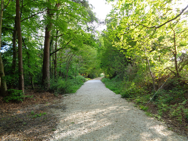
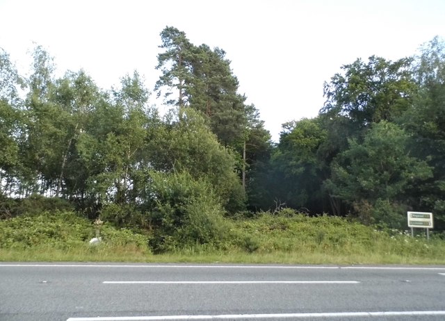
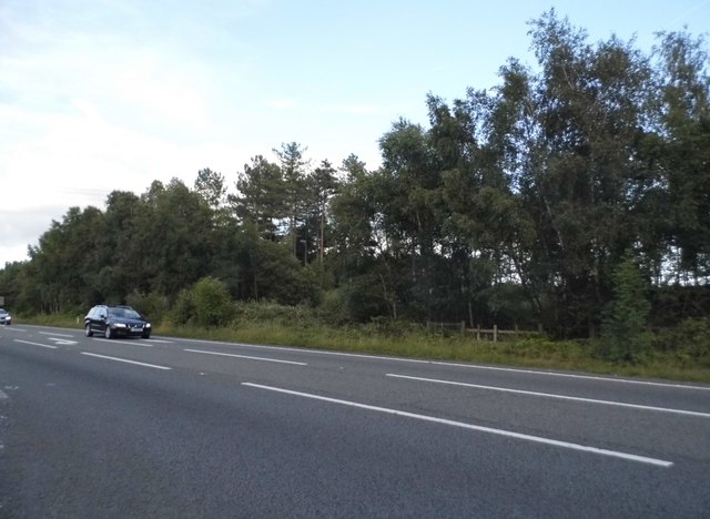
Church Moor Copse is a stunning woodland located in the county of Dorset, England. It covers an expansive area of approximately 50 acres and is a cherished natural gem within the region. The copse is situated near the village of Church Moor and is easily accessible by foot or by car.

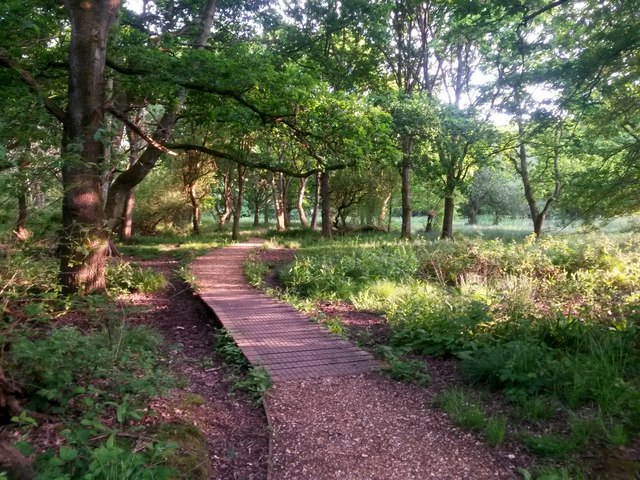
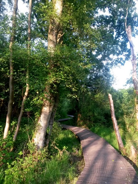
The woodland is characterized by its diverse range of tree species, including oak, beech, and ash. These majestic trees create a lush and vibrant canopy that provides a haven for various wildlife species. The forest floor is adorned with a colorful carpet of wildflowers, such as bluebells and primroses, which bloom in the spring months and add to the copse's natural beauty.

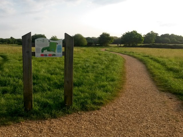
Church Moor Copse is a haven for nature enthusiasts and offers numerous walking trails that wind through the woodland. These trails provide an opportunity to explore the copse's unique ecosystem and discover its hidden treasures. The diverse birdlife in the area, including woodpeckers and songbirds, adds a delightful soundtrack to any visit.

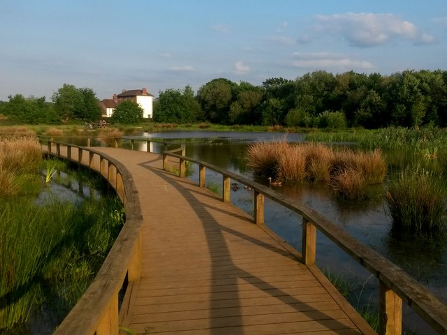
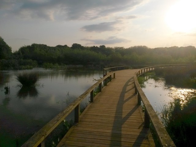
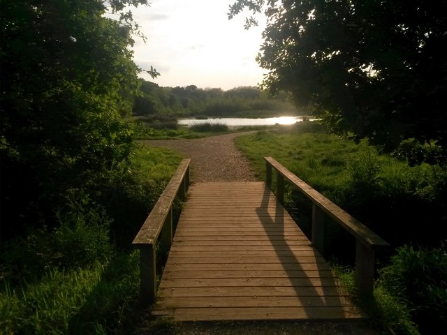
The copse also boasts a small stream that meanders through its heart, enhancing the tranquility of the surroundings. This stream serves as a water source for various animals and creates a peaceful ambiance throughout the woodland.

Visitors to Church Moor Copse can enjoy picnicking in the designated areas or simply find a quiet spot to sit and immerse themselves in nature. The copse is a popular destination for photographers, artists, and nature lovers, who are drawn to its enchanting atmosphere and picturesque scenery.

Overall, Church Moor Copse is a captivating woodland that offers a serene and captivating experience for all who visit.

If you have any feedback on the listing, please let us know in the comments section below.

Church Moor Copse Images

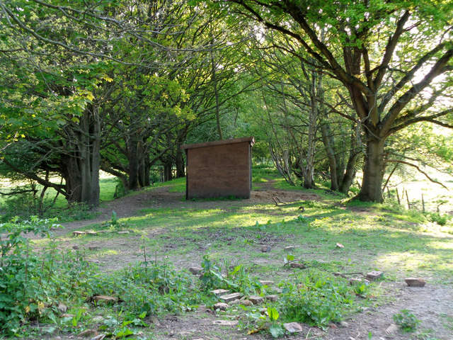
Images are sourced within 2km of 50.803805/-1.9529476 or Grid Reference SU0300. Thanks to Geograph Open Source API. All images are credited.

Northleigh Lane The bridge over the old Southampton & Dorchester Railway on Northleigh Lane, saw its last passenger trains in 1964 and freight in 1974.
Northleigh Lane
The bridge over the old Southampton & Dorchester Railway on Northleigh Lane, saw its last passenger trains in 1964 and freight in 1974.
Colehill Lane Colehill Lane, near the entrance to St Michael's Middle School.
Colehill Lane
Colehill Lane, near the entrance to St Michael's Middle School.
From Railway to Trailway This trailway was once part of the double-track mainline running from London Waterloo to Weymouth. Bicycles are now the only wheeled vehicles you'll see along here nowadays.
From Railway to Trailway
This trailway was once part of the double-track mainline running from London Waterloo to Weymouth. Bicycles are now the only wheeled vehicles you'll see along here nowadays.
Disused mainline A wooden shed stands in the middle of the formation that was once the mainline railway between London Waterloo and Weymouth. A low embankment is all that remains to remind us of its past history.
Disused mainline
A wooden shed stands in the middle of the formation that was once the mainline railway between London Waterloo and Weymouth. A low embankment is all that remains to remind us of its past history.
Woods by the A31, Ferndown
The A31, Ferndown
The A31, Ferndown
Lotus Elan on the Canford Bottom Roundabout This set of multiple traffic lights has artificially created a constant bottleneck. There is a similar one along the A5 in Dunstable and only a few vehicles can get through each time they go green as the next set is still backed up.

The number plate is Dutch in the old monochrome format and the car is left hand drive.
Lotus Elan on the Canford Bottom Roundabout
This set of multiple traffic lights has artificially created a constant bottleneck. There is a similar one along the A5 in Dunstable and only a few vehicles can get through each time they go green as the next set is still backed up. The number plate is Dutch in the old monochrome format and the car is left hand drive.
The Canford Bottom Roundabout
The Canford Bottom Roundabout It's a series of traffic lights with a roundabout going round them. Guaranteed gridlock at all times.
The Canford Bottom Roundabout
It's a series of traffic lights with a roundabout going round them. Guaranteed gridlock at all times.
Old Milepost by Wimborne Road, Wimborne Minster Cast iron post by the UC road, in parish of FERNDOWN TOWN (EAST DORSET District), Wimborne Road, East of bypass roundabout, by No. 210/212, by the road, on South side of road. Ringwood cast iron post (Trust), erected by the Ringwood, Longham & Leigh turnpike trust in the 19th century. 

Inscription reads:- : 2 / WIM- / BORNE : : RINGW'D / TRUST : : 7 / RING- / WOOD :

Milestone Society National ID: DO_WBRW02.
Old Milepost by Wimborne Road, Wimborne Minster
Cast iron post by the UC road, in parish of FERNDOWN TOWN (EAST DORSET District), Wimborne Road, East of bypass roundabout, by No. 210/212, by the road, on South side of road. Ringwood cast iron post (Trust), erected by the Ringwood, Longham & Leigh turnpike trust in the 19th century. Inscription reads:- : 2 / WIM- / BORNE : : RINGW'D / TRUST : : 7 / RING- / WOOD : Milestone Society National ID: DO_WBRW02.
Houses on Pilford Heath Rd This part of Wimborne is very leafy and the large gardens often contain some of the large old pine trees that were here before the houses were built.
Houses on Pilford Heath Rd
This part of Wimborne is very leafy and the large gardens often contain some of the large old pine trees that were here before the houses were built.
Colehill: across Bytheway Field Looking westward across this vast, lovely open space from near the Churchmoor Road entrance, on its eastern side.

The information board proclaims it as "a great place for people and wildlife" and on an evening like this it was certainly very popular.

I recall in the early 1980s, as a child, passing the house called Bytheway just along here, and initially thinking it was Welsh!
Colehill: across Bytheway Field
Looking westward across this vast, lovely open space from near the Churchmoor Road entrance, on its eastern side. The information board proclaims it as "a great place for people and wildlife" and on an evening like this it was certainly very popular. I recall in the early 1980s, as a child, passing the house called Bytheway just along here, and initially thinking it was Welsh!
Colehill: across the pond at Bytheway Field The path rather splendidly goes across the northern corner of the wildlife pond in the centre of this fine open space, which has been established in relatively recent years.

It is the first SANG (Suitable Alternative Natural Green Space) in East Dorset district, and includes a self-led orienteering course. It is very well used by dog walkers and equally people just fancying a stroll in the fresh air.

One of the signboards proclaims Bytheway Field as "a great place for people and wildlife" which has a nice ring to it and is perhaps evidenced by the mallard taking her ducklings out for a swim, centre picture.
Colehill: across the pond at Bytheway Field
The path rather splendidly goes across the northern corner of the wildlife pond in the centre of this fine open space, which has been established in relatively recent years. It is the first SANG (Suitable Alternative Natural Green Space) in East Dorset district, and includes a self-led orienteering course. It is very well used by dog walkers and equally people just fancying a stroll in the fresh air. One of the signboards proclaims Bytheway Field as "a great place for people and wildlife" which has a nice ring to it and is perhaps evidenced by the mallard taking her ducklings out for a swim, centre picture.
Colehill: over the pond and into the sun Looking along the path that crosses the pond within Bytheway Field, in the opposite direction to <a href="https://www.geograph.org.uk/photo/5783609">SU0200 : Colehill: across the pond at Bytheway Field</a>.

Bytheway Field is the first SANG (Suitable Alternative Natural Green Space) in East Dorset district, and includes a self-led orienteering course. It is very well used by dog walkers and equally people just fancying a stroll in the fresh air.

One of the signboards proclaims Bytheway Field as "a great place for people and wildlife" which has a nice ring to it.
Colehill: over the pond and into the sun
Looking along the path that crosses the pond within Bytheway Field, in the opposite direction to SU0200 : Colehill: across the pond at Bytheway Field. Bytheway Field is the first SANG (Suitable Alternative Natural Green Space) in East Dorset district, and includes a self-led orienteering course. It is very well used by dog walkers and equally people just fancying a stroll in the fresh air. One of the signboards proclaims Bytheway Field as "a great place for people and wildlife" which has a nice ring to it.
Colehill: small footbridge in Bytheway Field Ahead is the rather lovely wildlife pond. See <a href="https://www.geograph.org.uk/photo/5783609">SU0200 : Colehill: across the pond at Bytheway Field</a> for more discussion on the Field.
Colehill: small footbridge in Bytheway Field
Ahead is the rather lovely wildlife pond. See SU0200 : Colehill: across the pond at Bytheway Field for more discussion on the Field.
Colehill: eastern edge of Leigh Common The Common features several paths - some gravelled and some, where necessary, elevated as a boardwalk - and is mainly woodland with a little open meadow.
Colehill: eastern edge of Leigh Common
The Common features several paths - some gravelled and some, where necessary, elevated as a boardwalk - and is mainly woodland with a little open meadow.
Colehill: boardwalk on Leigh Common The Common features several paths - some gravelled and some, where necessary, elevated as a boardwalk - and is mainly woodland with a little open meadow.

This boardwalk along the northern side of the common takes a rather splendidly meandering path.
Colehill: boardwalk on Leigh Common
The Common features several paths - some gravelled and some, where necessary, elevated as a boardwalk - and is mainly woodland with a little open meadow. This boardwalk along the northern side of the common takes a rather splendidly meandering path.
B3073 Wimborne Road West The car is emerging from Old Ham Lane.
B3073 Wimborne Road West
The car is emerging from Old Ham Lane.
Show me another place!

Church Moor Copse is located at Grid Ref: SU0300 (Lat: 50.803805, Lng: -1.9529476)

Unitary Authority: Dorset

Police Authority: Dorset

What 3 Words

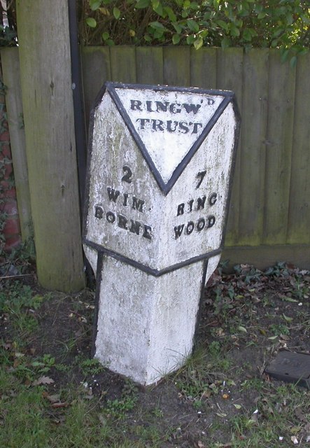
///electrode.flattered.gravest. Near Wimborne Minster, Dorset

Nearby Locations

Church Moor Copse Hayes

Related Wikis

Colehill

Colehill is a parish neighbouring Wimborne Minster, in Dorset, England. It had a population of 7,000 in 2001, which shrunk slightly to 6,927 people at...

Canford School

Canford School is a public school (English fee-charging boarding and day school for pupils aged 13–18). Situated in 300 acres of parkland near to the market...

Canford Magna Parish Church

The Canford Magna Parish Church in Canford Magna, Dorset, England – possibly dedicated to St Augustine – is a mixture of Saxon, Norman and Mid Gothic architecture...

Wimborne Minster

Wimborne Minster (often referred to as Wimborne, ) is a market town in Dorset in South West England, and the name of the Church of England church in that...

Canford Magna

Canford Magna is a village in Dorset, England. The village is situated just south of the River Stour and lies between the towns of Wimborne Minster and...

Dumpton School

Dumpton School is an independent day school in Wimborne, Dorset, South West England, for girls and boys aged 2 to 13 years. == History == The school was...

Wimborne Market

Wimborne Market was an historic market in a large covered structure in Wimborne Minster, Dorset, England. It ceased to trade on 19 December 2021 after...

Wimborne railway station

Wimborne was a railway station in Wimborne Minster in the county of Dorset in England. Open from 1 June 1847 to 2 May 1977, it was sited just north of...

Nearby Amenities

Located within 500m of 50.803805,-1.9529476
Turning Circle
Lat/Long: 50.8028829/-1.9546481
Turning Circle
Lat/Long: 50.8045577/-1.955006
Turning Circle
Lat/Long: 50.8065495/-1.9521288
Addr City: Wimborne
Addr Housenumber: 115
Addr Postcode: BH21 2HY
Addr Street: Cutlers Place
Lat/Long: 50.802664/-1.9547542
Turning Circle
Lat/Long: 50.8056856/-1.9486893
Turning Circle
Lat/Long: 50.8033244/-1.9512293
Turning Circle
Lat/Long: 50.8082571/-1.9536052
Turning Circle
Lat/Long: 50.8034837/-1.9521064
Turning Circle
Lat/Long: 50.8073453/-1.9488953
Turning Circle
Lat/Long: 50.8028076/-1.9540853
Turning Circle
Lat/Long: 50.8062574/-1.9514131
Turning Circle
Lat/Long: 50.8049472/-1.9484243
Turning Circle
Lat/Long: 50.807623/-1.953941
Turning Circle
Lat/Long: 50.8073396/-1.9528283
Post Box
Ref: BH21 182
Ref GB Uprn: 10015279785
Lat/Long: 50.8051989/-1.9531664
Turning Circle
Lat/Long: 50.8030642/-1.946002
Bench
Lat/Long: 50.801445/-1.9564922
Information: board
Tourism: information
Lat/Long: 50.8021374/-1.9566512
Power: pole
Source: bing
Lat/Long: 50.8062898/-1.9588508
Power: pole
Source: bing
Lat/Long: 50.8054737/-1.9585007
Power: pole
Source: bing
Lat/Long: 50.8053686/-1.9566366
Power: pole
Source: bing
Lat/Long: 50.8052635/-1.954869
Bus Stop
Colehill First School
Bearing: SE
Bench: yes
Bin: no
Bus: yes
Lit: yes
Naptan AtcoCode: 1200POA10625
Naptan Indicator: SE-bound
Naptan StopType: bus
Public Transport: platform
Shelter: yes
Tactile Paving: no
Lat/Long: 50.8081895/-1.9520846
Bus Stop
Colehill First School
Bearing: NW
Bench: yes
Bin: no
Bus: yes
Lit: yes
Naptan AtcoCode: 1200POA10624
Naptan Indicator: NW-bound
Naptan StopType: bus
Public Transport: platform
Shelter: yes
Tactile Paving: no
Lat/Long: 50.8081857/-1.9522342
Bus Stop
Hayes Lane
Bearing: NW
Bench: yes
Bin: yes
Bus: yes
Naptan AtcoCode: 1200POA10623
Naptan Indicator: NW-bound
Naptan StopType: bus
Public Transport: platform
Shelter: yes
Tactile Paving: no
Lat/Long: 50.80579/-1.9469307
Bus Stop
Canford Bottom, Hayes Lane
Bench: no
Bin: no
Bus: yes
Lit: yes
Naptan AtcoCode: 1200DOY38544
Naptan Bearing: S
Naptan BusStopType: CUS
Naptan CommonName: Foxcroft Drive
Naptan Indicator: S-bound
Naptan NaptanCode: dordgjgp
Naptan PlusbusZoneRef: BOMO
Naptan Street: Hayes Lane
Naptan Verified: no
Public Transport: platform
Shelter: no
Tactile Paving: no
Lat/Long: 50.8011715/-1.9500732
Bus Stop
Jessopp Road
Bus: yes
Naptan AtcoCode: 1200DOY38542
Naptan Bearing: SW
Naptan BusStopType: CUS
Naptan CommonName: Jessopp Road
Naptan Indicator: SW-bound
Naptan NaptanCode: dordgjmg
Naptan PlusbusZoneRef: BOMO
Naptan Street: Hayes Lane
Naptan Verified: no
Public Transport: platform
Lat/Long: 50.8039541/-1.9477518
Bus Stop
Jessopp Road
Bus: yes
Naptan AtcoCode: 1200DOY38541
Naptan Bearing: NE
Naptan BusStopType: CUS
Naptan CommonName: Jessopp Road
Naptan Indicator: NE-bound
Naptan NaptanCode: dordgjmd
Naptan PlusbusZoneRef: BOMO
Naptan Street: Hayes Lane
Naptan Verified: no
Public Transport: platform
Lat/Long: 50.8037439/-1.94802
Bus Stop
Canford Bottom, Hayes Lane
Bench: no
Bin: no
Bus: yes
Lit: yes
Naptan AtcoCode: 1200POA10609
Naptan Bearing: N
Naptan BusStopType: CUS
Naptan CommonName: Foxcroft Drive
Naptan Indicator: N-bound
Naptan NaptanCode: dordgjgm
Naptan PlusbusZoneRef: BOMO
Naptan Street: Hayes Lane
Naptan Verified: no
Public Transport: platform
Shelter: no
Tactile Paving: no
Lat/Long: 50.8013749/-1.9500652
Bicycle Rental
Middlehill Road
Capacity: 6
Email: support@beryl.cc
Fee: yes
Network: Beryl - Bournemouth Poole Christchurch
Operator: Beryl
Operator Wikidata: Q106575369
Payment App: yes
Payment Cash: no
Payment Credit Cards: no
Payment Cryptocurrencies: no
Payment Debit Cards: no
Payment Electronic Purses: no
Phone: +44 20 3003 5044
Ref Gbfs: beryl_bcp:4190
Rental: city_bike
Website: https://beryl.cc/scheme/bournemouth-christchurch-and-poole
Lat/Long: 50.80654/-1.948831
Bicycle Rental
Hayes Lane
Capacity: 6
Email: support@beryl.cc
Fee: yes
Network: Beryl - Bournemouth Poole Christchurch
Operator: Beryl
Operator Wikidata: Q106575369
Payment App: yes
Payment Cash: no
Payment Credit Cards: no
Payment Cryptocurrencies: no
Payment Debit Cards: no
Payment Electronic Purses: no
Phone: +44 20 3003 5044
Ref Gbfs: beryl_bcp:5181
Rental: city_bike
Website: https://beryl.cc/scheme/bournemouth-christchurch-and-poole
Lat/Long: 50.805663/-1.946664
The data included in this document is from www.openstreetmap.org. The data is made available under ODbL.

Have you been to Church Moor Copse?

Leave your review of Church Moor Copse below (or comments, questions and feedback).