Blackbank Wood

Wood, Forest in Staffordshire Staffordshire Moorlands

England

Blackbank Wood

Harston Wood Harston Wood, a nature reserve of Staffordshire Wildlife Trust. The start of the footpath through the wood.
Harston Wood Credit: David Weston

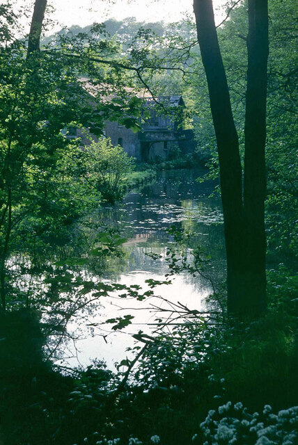
Blackbank Wood is a captivating forest located in Staffordshire, England. Spanning an area of approximately 100 acres, this woodland is a popular destination for nature enthusiasts and hikers alike. The wood is situated in close proximity to the village of Alton and is easily accessible by both car and foot.

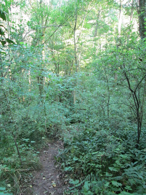
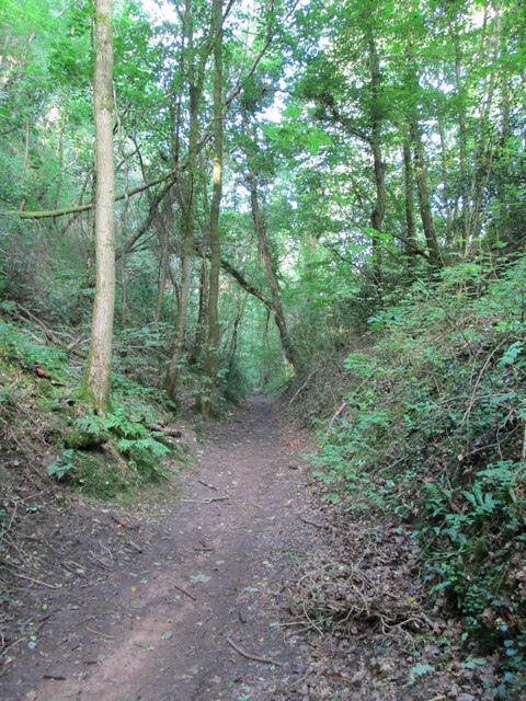
Upon entering Blackbank Wood, visitors are greeted by a dense canopy of trees, predominantly consisting of native species such as oak, birch, and beech. These majestic trees provide shelter and a serene atmosphere, making it an ideal habitat for a variety of wildlife. The forest floor is adorned with a rich carpet of mosses, ferns, and wildflowers, adding to the natural beauty of the surroundings.

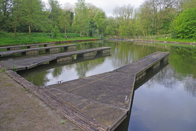
The wood boasts an extensive network of footpaths, allowing visitors to explore and immerse themselves in the tranquil ambiance. The paths wind through the forest, offering glimpses of hidden streams and tranquil ponds along the way. There are also designated picnic areas and benches where visitors can rest and appreciate the peaceful setting.

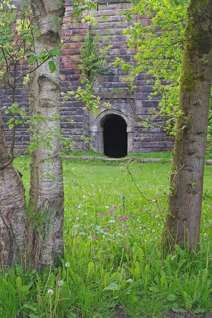
Blackbank Wood holds a significant historical value, with evidence of human activity dating back to the Neolithic period. Remnants of ancient earthworks and burial mounds can still be observed within the woodland, providing a fascinating insight into the area's past.

Overall, Blackbank Wood is a captivating haven of natural beauty and historical significance. Its lush greenery, diverse wildlife, and peaceful atmosphere make it an ideal destination for those seeking solace in nature or a scenic walk through Staffordshire's enchanting woodlands.

If you have any feedback on the listing, please let us know in the comments section below.

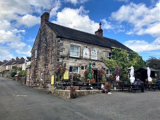
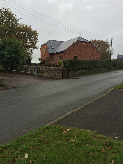
Blackbank Wood Images

Images are sourced within 2km of 53.040998/-1.9506517 or Grid Reference SK0349. Thanks to Geograph Open Source API. All images are credited.

Harston Wood Harston Wood, a nature reserve of Staffordshire Wildlife Trust. The start of the footpath through the wood.
Harston Wood
Harston Wood, a nature reserve of Staffordshire Wildlife Trust. The start of the footpath through the wood.
Tramroad through Harston Wood The line of a former tramroad, looking west, downhill along a steady incline. The tramroad carried limestone from quarries at Caldon Low, westwards to Froghall Wharf at the end of the Caldon Canal.
Tramroad through Harston Wood
The line of a former tramroad, looking west, downhill along a steady incline. The tramroad carried limestone from quarries at Caldon Low, westwards to Froghall Wharf at the end of the Caldon Canal.
Froghall Wharf The end of the Caldon Canal. The lock in the foreground leads to the canal basin.
Froghall Wharf
The end of the Caldon Canal. The lock in the foreground leads to the canal basin.
Lime kilns at Froghall Wharf Lime kilns, long disused, near the canal wharf.
Lime kilns at Froghall Wharf
Lime kilns, long disused, near the canal wharf.
End of Caldon Canal, Froghall Wharf, 1978 Looking from the extreme end back towards the partly derelict warehouse. This was later restored with some alteration, it is a grade II listed building.
End of Caldon Canal, Froghall Wharf, 1978
Looking from the extreme end back towards the partly derelict warehouse. This was later restored with some alteration, it is a grade II listed building.
Woodcutters Row, Foxt Adjacent to the steep road up from Froghall to Foxt is a terrace of cottages called Woodcutters Row including, at the east end, the former pub seen here. See also <a href="https://www.geograph.org.uk/photo/3666275">SK0248 : The Woodcutters' Arms and Woodcutters Row</a> which suggests the pub ceased to be operational sometime in the 1960s.
Woodcutters Row, Foxt
Adjacent to the steep road up from Froghall to Foxt is a terrace of cottages called Woodcutters Row including, at the east end, the former pub seen here. See also SK0248 : The Woodcutters' Arms and Woodcutters Row which suggests the pub ceased to be operational sometime in the 1960s.
Entering Foxt The Staffordshire village of Foxt, high above the Churnet Valley, has an unusual name of Olde English origin. This is the approach heading up the hill from Froghall.
Entering Foxt
The Staffordshire village of Foxt, high above the Churnet Valley, has an unusual name of Olde English origin. This is the approach heading up the hill from Froghall.
New Cottages, Foxt These terraced houses look as they should belong in an industrial town rather than on the edge of a tiny village in the Staffordshire hills. Still, they enjoy a spectacular view down into the valley.
New Cottages, Foxt
These terraced houses look as they should belong in an industrial town rather than on the edge of a tiny village in the Staffordshire hills. Still, they enjoy a spectacular view down into the valley.
The Fox & Goose, Foxt The Fox & Goose seems an appropriate name for this attractive pub in the village of Foxt. It has spectacular views across the Churnet valley.
The Fox & Goose, Foxt
The Fox & Goose seems an appropriate name for this attractive pub in the village of Foxt. It has spectacular views across the Churnet valley.
Moorings at Froghall Some things defy understanding. Here at Froghall a canal basin has been restored capable of taking several full sized boats on the tiny stretch of what remains of the Uttoxeter canal. The moorings are excellent. But there is a huge snag. The only way boats can get here is to navigate the height restricted Froghall Tunnel - so it is only accessible to a small proportion of the craft currently using the canal network. Unsurprisingly on this May morning there was not a boat in site.
Moorings at Froghall
Some things defy understanding. Here at Froghall a canal basin has been restored capable of taking several full sized boats on the tiny stretch of what remains of the Uttoxeter canal. The moorings are excellent. But there is a huge snag. The only way boats can get here is to navigate the height restricted Froghall Tunnel - so it is only accessible to a small proportion of the craft currently using the canal network. Unsurprisingly on this May morning there was not a boat in site.
Lime kiln at Froghall This is one of a set of lime kilns close to Froghall Wharf believed to date from the 1880s. The kilns are set into a retaining wall 50 metres in length and 12 metres high.
Lime kiln at Froghall
This is one of a set of lime kilns close to Froghall Wharf believed to date from the 1880s. The kilns are set into a retaining wall 50 metres in length and 12 metres high.
Hetty's Tea Shop, Froghall Wharf Hetty's Tea Shop is located in this beautifully restored canalside warehouse at Froghall. Upstairs there is a holiday apartment. The building dates from the early 19th century and is grade II listed.
Hetty's Tea Shop, Froghall Wharf
Hetty's Tea Shop is located in this beautifully restored canalside warehouse at Froghall. Upstairs there is a holiday apartment. The building dates from the early 19th century and is grade II listed.
Hetty's Tea Shop, Froghall Wharf The towpath terrace water huts are part of Hetty's Tea Shop in this restored canalside warehouse by bridge 55. Customers are extremely unlikely to see any boats here, however; craft that are able to pass through Froghall Tunnel would turn off and head for the Uttoxeter Canal basin.
Hetty's Tea Shop, Froghall Wharf
The towpath terrace water huts are part of Hetty's Tea Shop in this restored canalside warehouse by bridge 55. Customers are extremely unlikely to see any boats here, however; craft that are able to pass through Froghall Tunnel would turn off and head for the Uttoxeter Canal basin.
The Old Red Lion in Ipstones
The Sea Lion Public House, Ipstones Well-appointed pub tucked away in a quiet corner of the village.
The Sea Lion Public House, Ipstones
Well-appointed pub tucked away in a quiet corner of the village.
New house
New house
The Uplands, 15 Church Lane
Ipstones church
Ipstones church
Show me another place!

Blackbank Wood is located at Grid Ref: SK0349 (Lat: 53.040998, Lng: -1.9506517)

Administrative County: Staffordshire

District: Staffordshire Moorlands

Police Authority: Staffordshire

What 3 Words

///neatly.indoors.solids. Near Cheddleton, Staffordshire

Related Wikis

Harston Wood

Harston Wood is a nature reserve of the Staffordshire Wildlife Trust. It is an ancient woodland, adjacent to the village of Froghall, near Cheadle, Staffordshire...

Ipstones

Ipstones is a village and civil parish in the north of the English county of Staffordshire. Ipstones is part of the Staffordshire Moorlands district; within...

Uttoxeter Canal

The Uttoxeter Canal was a thirteen-mile extension of the Caldon Canal running from Froghall as far as Uttoxeter in Staffordshire, England. It was authorised...

Above Church

Above Church is a hamlet about 0.6 kilometers (0.4 mi) northwest of Ipstones in the English county of Staffordshire. It is located at grid reference SK016504...

Whiston, Staffordshire Moorlands

Whiston is a village in the Staffordshire Moorlands district of Staffordshire, England. Population details as taken at the 2011 census can be found under...

Froghall

Froghall is a village situated approximately ten miles to the east of Stoke-on-Trent and two miles north of Cheadle in Staffordshire, England. Population...

Kingsley and Froghall railway station

Kingsley and Froghall is a former railway station of the North Staffordshire Railway (NSR) that is now preserved on the Churnet Valley Railway in Staffordshire...

Winkhill railway station

Winkhill railway station was a railway station that served the hamlet of Winkhill, Staffordshire. It was opened by the North Staffordshire Railway (NSR...

Nearby Amenities

Located within 500m of 53.040998,-1.9506517
Barrier: stile
Material: wood
Source: survey
Step Count: 0
Stile: stepover
Lat/Long: 53.0393484/-1.9556867
Barrier: stile
Stile: squeezer
Lat/Long: 53.0368283/-1.950835
Barrier: stile
Material: stone
Source: survey;gps
Stile: squeezer
Lat/Long: 53.0405656/-1.9438446
Barrier: stile
Material: wood
Source: survey;gps
Stile: stepover
Lat/Long: 53.0417687/-1.9444981
Barrier: stile
Material: stone
Source: survey;gps
Stile: squeezer
Lat/Long: 53.0423847/-1.9443423
Power: pole
Source: Bing
Lat/Long: 53.0386836/-1.9553072
Barrier: stile
Material: wood
Source: survey
Step Count: 1
Stile: stepover
Lat/Long: 53.0378175/-1.9554128
Power: pole
Source: Bing
Lat/Long: 53.0379311/-1.9559259
Barrier: entrance
Source: survey
Lat/Long: 53.037945/-1.955375
Barrier: stile
Material: stone
Note: with gate
Source: survey
Stile: squeezer
Lat/Long: 53.0386721/-1.9555649
The data included in this document is from www.openstreetmap.org. The data is made available under ODbL.

Have you been to Blackbank Wood?

Leave your review of Blackbank Wood below (or comments, questions and feedback).