Folly Plantation

Wood, Forest in Durham

England

Folly Plantation

White Kirkley White Kirkley is a small settlement on the south side of Weardale consisting of little more accommodation than this single terrace of cottages.
White Kirkley Credit: Trevor Littlewood

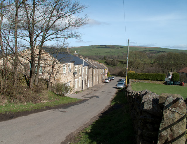
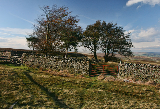
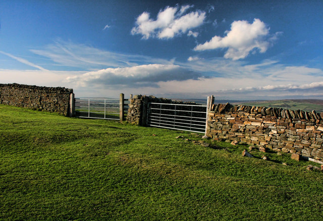
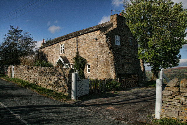
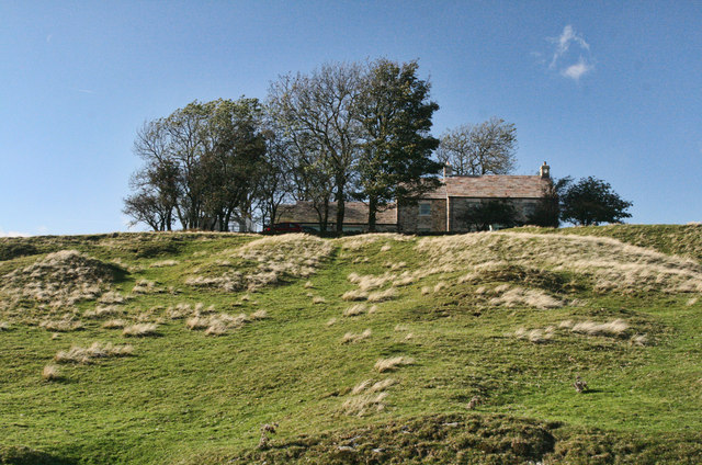
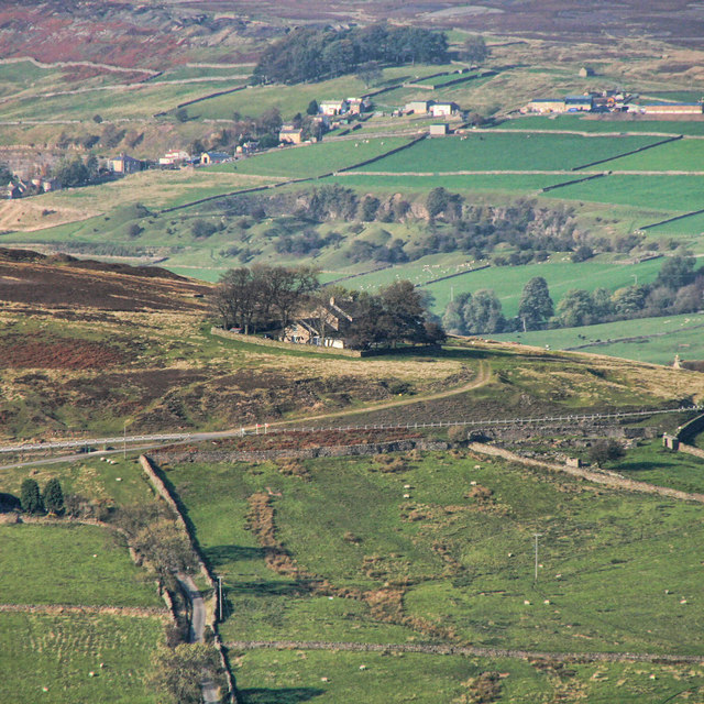
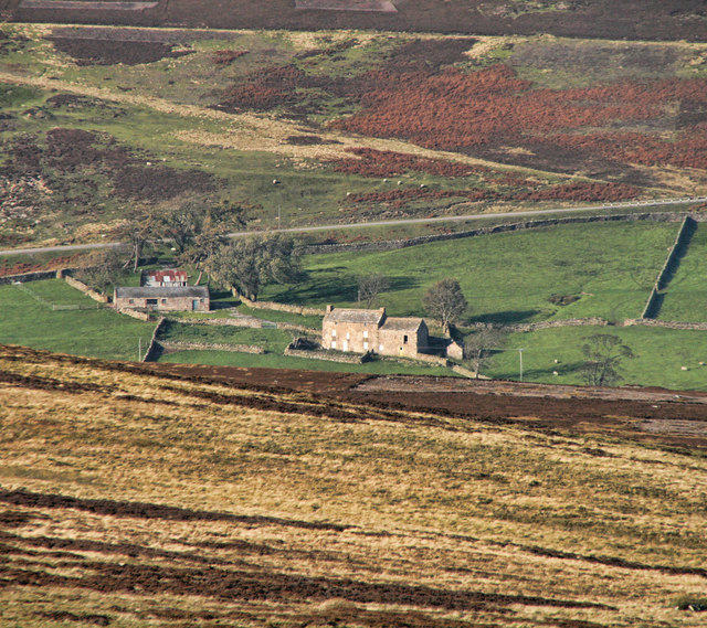
Folly Plantation, located in Durham, England, is a historical site that dates back to the 17th century. Situated in a charming woodland area, this former plantation has been transformed into a well-preserved forest and a popular tourist destination for nature enthusiasts and history buffs alike.

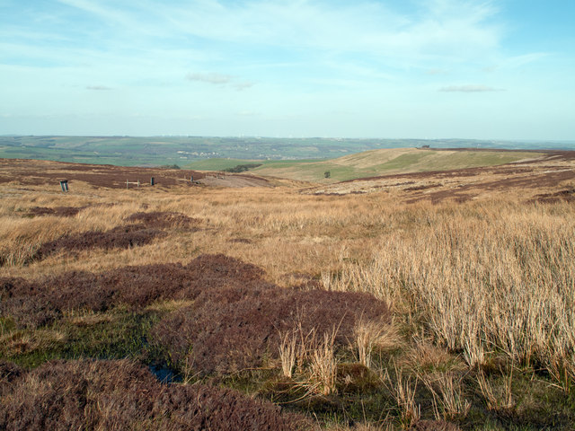
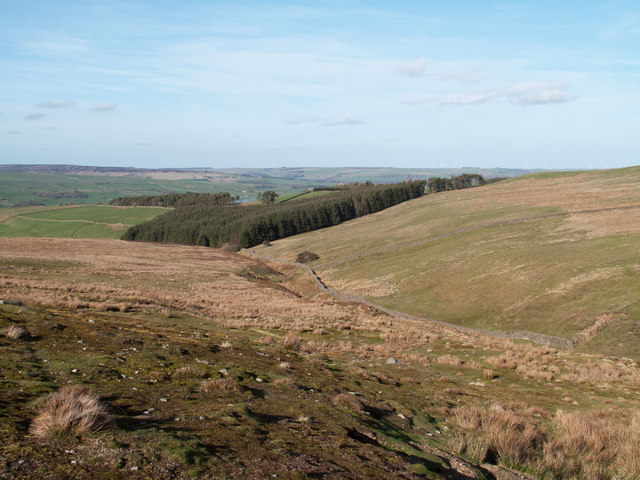
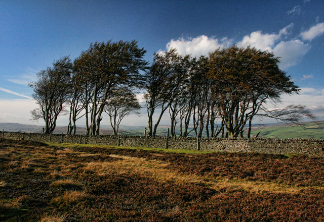
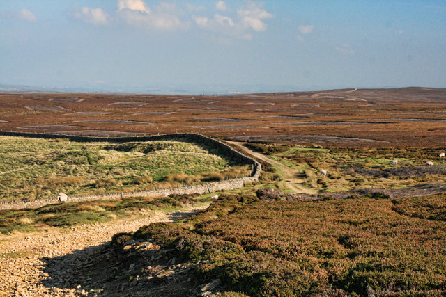
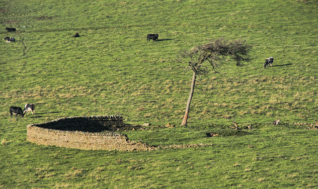
Covering an area of approximately 200 acres, Folly Plantation boasts a diverse range of flora and fauna, making it a haven for wildlife and a delight for botany enthusiasts. The woodland is dominated by a mixture of deciduous and evergreen trees, creating a picturesque landscape that changes with the seasons. Visitors can expect to see oak, beech, birch, and various coniferous species, providing a rich tapestry of color and texture throughout the year.

As visitors explore the plantation, they will come across a number of walking trails that wind through the forest, offering ample opportunities for leisurely strolls and peaceful picnics. Along the trails, there are informative signposts that provide valuable insights into the history and ecological significance of the area.

Furthermore, Folly Plantation is home to a variety of wildlife. Birdwatchers can spot numerous species, including woodpeckers, owls, and various songbirds. The forest is also inhabited by mammals such as deer, foxes, and rabbits, which can occasionally be spotted roaming the grounds.

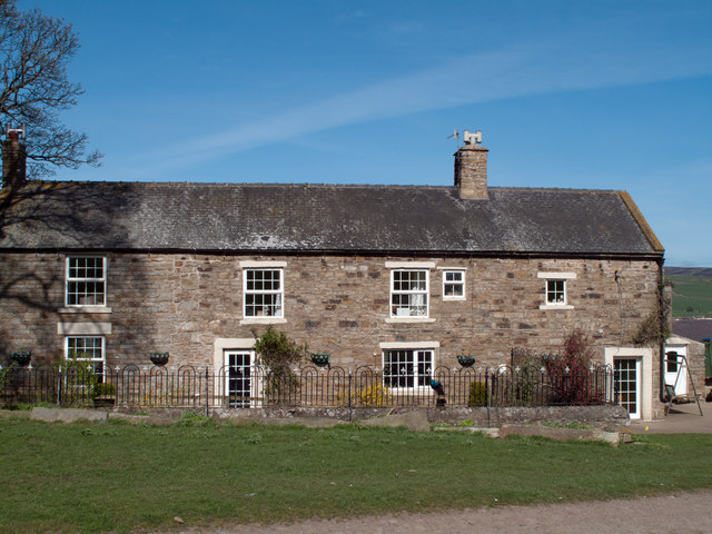
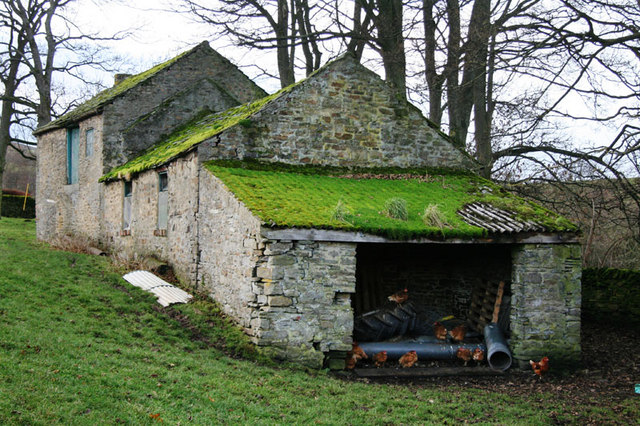
In addition to its natural beauty, Folly Plantation has a rich historical background. Originally established as a working plantation in the 1600s, it was later repurposed as a private estate and eventually opened to the public. The plantation's historical buildings, including a renovated manor house, provide a glimpse into the past, allowing visitors to immerse themselves in the region's heritage.

Overall, Folly Plantation in Durham offers visitors a unique combination of natural beauty and historical significance. Whether it's a leisurely walk through the enchanting woodland or an exploration of the plantation's rich history, this destination is sure to capt

If you have any feedback on the listing, please let us know in the comments section below.

Folly Plantation Images

Images are sourced within 2km of 54.707975/-1.9551782 or Grid Reference NZ0234. Thanks to Geograph Open Source API. All images are credited.

White Kirkley White Kirkley is a small settlement on the south side of Weardale consisting of little more accommodation than this single terrace of cottages.
White Kirkley
White Kirkley is a small settlement on the south side of Weardale consisting of little more accommodation than this single terrace of cottages.
West Biggins The farm at West Biggins occupies an elevated site on the south side of Weardale; the current route  of the Weardale Way, (it has varied hereabouts), passes through the farm.
West Biggins
The farm at West Biggins occupies an elevated site on the south side of Weardale; the current route of the Weardale Way, (it has varied hereabouts), passes through the farm.
Harehope Quarry The sides of the Wear valley have been cut into a great number of quarries, some tiny to extract stone for local use and some on an industrial scale. The disused Harehope Quarry is in view in this image; it's the centre for what is known as The Harehope Quarry Project - <span class="nowrap"><a title="http://www.harehopequarry.org.uk/" rel="nofollow ugc noopener" href="http://www.harehopequarry.org.uk/">Link</a><img style="margin-left:2px;" alt="External link" title="External link - shift click to open in new window" src="https://s1.geograph.org.uk/img/external.png" width="10" height="10"/></span> - which has a partly educational aim but other strands too in its mission.
Harehope Quarry
The sides of the Wear valley have been cut into a great number of quarries, some tiny to extract stone for local use and some on an industrial scale. The disused Harehope Quarry is in view in this image; it's the centre for what is known as The Harehope Quarry Project - LinkExternal link - which has a partly educational aim but other strands too in its mission.
Grouse butt on heather moor Grouse butts come in many varieties; this is one of the more elegant! The photograph was taken from an estate road, (one of many in the area) with the view to the east where the highest point is unnamed but reaches 375m. The pale areas seen to the left of the rise are old mine workings and another estate road.
Grouse butt on heather moor
Grouse butts come in many varieties; this is one of the more elegant! The photograph was taken from an estate road, (one of many in the area) with the view to the east where the highest point is unnamed but reaches 375m. The pale areas seen to the left of the rise are old mine workings and another estate road.
Fine Burn Head The stream, Fine Burn rises in this modest morass north east of the summit of Five Pikes; the developing stream groove can be seen ahead, beyond which lies the Wear Valley.
Fine Burn Head
The stream, Fine Burn rises in this modest morass north east of the summit of Five Pikes; the developing stream groove can be seen ahead, beyond which lies the Wear Valley.
Valley of the Fine Burn Fine Burn rises high on the hill of Five Pikes and descends to join the Bollihope Burn. It's valley is seen here in mid-course approaching the largest of a group of plantations known as Allotment Plantations.
Valley of the Fine Burn
Fine Burn rises high on the hill of Five Pikes and descends to join the Bollihope Burn. It's valley is seen here in mid-course approaching the largest of a group of plantations known as Allotment Plantations.
Barns at East Biggins The name Biggins occurs once on OS Landranger 92, between two sets of farm buildings but at the 1:25 000 scale separate Biggins establishments are named - East and West; these are some of the barns at East Biggins.
Barns at East Biggins
The name Biggins occurs once on OS Landranger 92, between two sets of farm buildings but at the 1:25 000 scale separate Biggins establishments are named - East and West; these are some of the barns at East Biggins.
Fine Burn Head Enclosures near the head of Fine Burn.
Fine Burn Head
Enclosures near the head of Fine Burn.
The Elephant Trees The Elephant Trees on Pikeston Fell above Weardale.
The Elephant Trees
The Elephant Trees on Pikeston Fell above Weardale.
Pikeston Fell Track across Pikeston Fell above Allotment House.
Pikeston Fell
Track across Pikeston Fell above Allotment House.
Harvey Hill Enclosure on pasture land on Harvey Hill seen from Pikeston Fell.
Harvey Hill
Enclosure on pasture land on Harvey Hill seen from Pikeston Fell.
Pikestone Fell Gates and wall on Pikestone Fell.
Pikestone Fell
Gates and wall on Pikestone Fell.
Brown's Houses Cottage beneath Hill End in Weardale.
Brown's Houses
Cottage beneath Hill End in Weardale.
Hill End House above Hill End.
See also <a href="https://www.geograph.org.uk/photo/1644820">NZ0135 : Hill End</a>.
Hill End
House above Hill End. See also NZ0135 : Hill End.
Hill End House above Hill End seen from Pikeston Fell.
See also <a href="https://www.geograph.org.uk/photo/2661168">NZ0135 : Hill End</a> and <a href="https://www.geograph.org.uk/photo/1644820">NZ0135 : Hill End</a>.
Hill End
House above Hill End seen from Pikeston Fell. See also NZ0135 : Hill End and NZ0135 : Hill End.
Bishopley Bishopley Farm above Bollihope seen from Pikeston Fell.
Bishopley
Bishopley Farm above Bollihope seen from Pikeston Fell.
The River Wear south of Frosterley
Footpath down to footbridge over the River Wear
Show me another place!

Folly Plantation is located at Grid Ref: NZ0234 (Lat: 54.707975, Lng: -1.9551782)

Unitary Authority: County Durham

Police Authority: Durham

What 3 Words

///permit.pebble.comply. Near Wolsingham, Co. Durham

Related Wikis

White Kirkley

White Kirkley is a small village in the civil parish of Stanhope, in County Durham, England. It's situated on the south side of Weardale, opposite Frosterley...

Bridge End, County Durham

Bridge End is a hamlet in the civil parish of Stanhope, in County Durham, England. It is situated on the south bank of the River Wear, on the other side...

Hill End, County Durham

Hill End is a village in the civil parish of Stanhope, in County Durham, England. It is situated on the south side of Weardale, near Frosterley. ��2�...

Weardale

Weardale is a dale, or valley, on the east side of the Pennines in County Durham, England. Large parts of Weardale fall within the North Pennines Area...

Wear Valley

Wear Valley was, from 1974 to 2009, a local government district in County Durham, England. Its council and district capital was Crook. The district covered...

Frosterley

Frosterley is a village in the civil parish of Stanhope, in County Durham, England. It is situated in Weardale, on the River Wear close to its confluence...

Cornish Hush Mine

The Cornish Hush Mine was a British lead ore and fluorspar mine in Weardale. == Location == The mine was located in the Howden Burn valley in the Bollihope...

Rogerley Quarry

Rogerley Quarry is a Site of Special Scientific Interest in the Wear Valley district of west County Durham, England. It lies on the edge of the valley...

Nearby Amenities

Located within 500m of 54.707975,-1.9551782
Turning Circle
Lat/Long: 54.7088601/-1.9567953
Barrier: entrance
Lat/Long: 54.7052291/-1.954743
Barrier: entrance
Lat/Long: 54.7097541/-1.9568706
The data included in this document is from www.openstreetmap.org. The data is made available under ODbL.

Have you been to Folly Plantation?

Leave your review of Folly Plantation below (or comments, questions and feedback).