Beesmoor Plantation

Wood, Forest in Gloucestershire Tewkesbury

England

Beesmoor Plantation

Lloyds Bank, Winchcombe
Lloyds Bank, Winchcombe Credit: Chris Allen

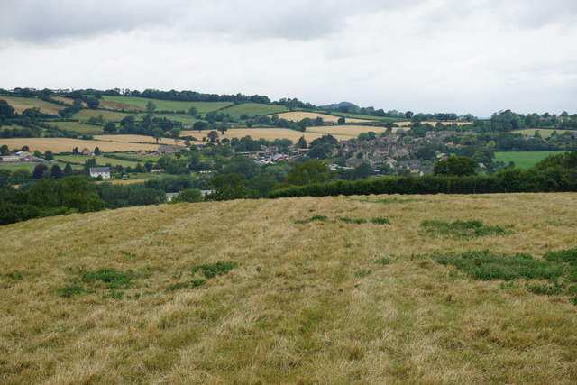
Beesmoor Plantation is a charming woodland area located in Gloucestershire, England. Spanning over a vast expanse of land, this plantation is a natural haven for flora and fauna alike. Situated in the heart of the countryside, it offers visitors a tranquil retreat from the hustle and bustle of city life.

The plantation is primarily composed of a variety of deciduous and evergreen trees, forming a dense canopy that provides shade and shelter to numerous species of wildlife. Oak, ash, beech, and pine trees dominate the landscape, creating a visually stunning and diverse ecosystem. The forest floor is covered in a thick layer of leaf litter, creating a rich and fertile soil that supports a wide range of plant life.

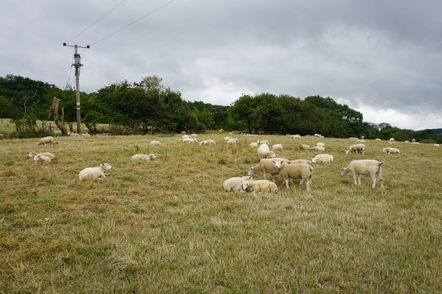
Home to an abundant array of wildlife, Beesmoor Plantation offers nature enthusiasts a chance to observe various species in their natural habitat. Birdwatchers will delight in the opportunity to spot woodpeckers, owls, and various songbirds, while keen-eyed visitors may catch a glimpse of elusive mammals such as badgers, foxes, and deer.

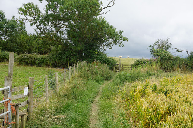
For those seeking outdoor activities, Beesmoor Plantation offers a network of well-maintained trails that wind through the woodland. These paths are perfect for leisurely walks, hiking, or cycling, providing an excellent opportunity to immerse oneself in the beauty of nature while also promoting a healthy lifestyle.

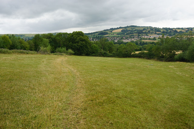
Beesmoor Plantation is a true gem of Gloucestershire, offering visitors an escape into the serene world of woodlands. Its natural beauty and diverse wildlife make it a must-visit destination for anyone seeking a peaceful and enriching experience in the heart of the British countryside.

If you have any feedback on the listing, please let us know in the comments section below.

Beesmoor Plantation Images

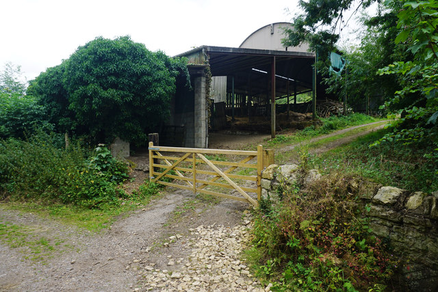
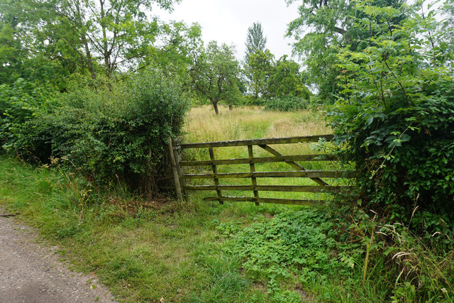
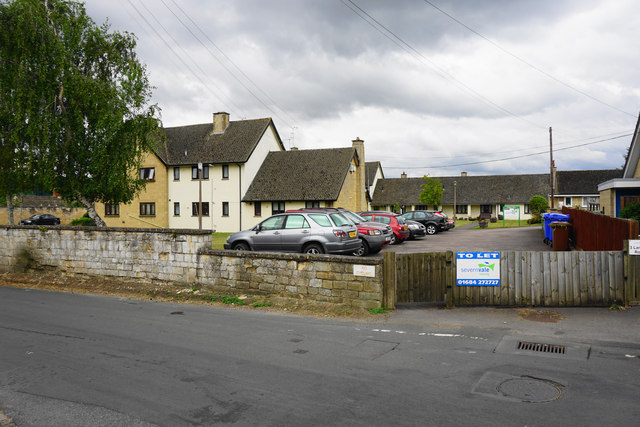
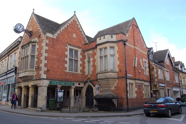
Images are sourced within 2km of 51.949767/-1.9613966 or Grid Reference SP0227. Thanks to Geograph Open Source API. All images are credited.

Lloyds Bank, Winchcombe
Meeting of paths and fields This is the corner of a field of wheat, and it adjoins other fields for sheep and cattle grazing.
Meeting of paths and fields
This is the corner of a field of wheat, and it adjoins other fields for sheep and cattle grazing.
Sheep near Winchcombe The older ones have been recently shorn.
Sheep near Winchcombe
The older ones have been recently shorn.
Field above Greet There are sheep in this field but they have all congregated in another part of it. From here you can see the village of Greet and Winchcombe railway station.
Field above Greet
There are sheep in this field but they have all congregated in another part of it. From here you can see the village of Greet and Winchcombe railway station.
Path towards Winchcombe Winchcombe can be seen ahead. The path will meet the top of Puck Pit Lane in the trees at the other side of the field.
Path towards Winchcombe
Winchcombe can be seen ahead. The path will meet the top of Puck Pit Lane in the trees at the other side of the field.
Orchards Farm On this side of the lane is just a collection of barns.
Orchards Farm
On this side of the lane is just a collection of barns.
Field given over to woodland near Orchards Farm
Puck Pit Lane Approaching Winchcombe on the Cotswold Way in a rain shower.
Puck Pit Lane
Approaching Winchcombe on the Cotswold Way in a rain shower.
New house on Puck Pit Lane This house doesn't yet appear on any maps. It is built in a style similar to a telephone exchange.
New house on Puck Pit Lane
This house doesn't yet appear on any maps. It is built in a style similar to a telephone exchange.
The River Isbourne at Winchcombe Viewed from Broadway Road.
The River Isbourne at Winchcombe
Viewed from Broadway Road.
Broadway Road and Hailes Street, Winchcombe Some roadworks are under way on Hailes Street, making a narrow road even narrower.
Broadway Road and Hailes Street, Winchcombe
Some roadworks are under way on Hailes Street, making a narrow road even narrower.
Housing development on Silk Mill Lane A new development of town houses in a part of town where space is tight.
Housing development on Silk Mill Lane
A new development of town houses in a part of town where space is tight.
Harveys Lane, Winchcombe A residential no through road by which the Winchcombe Way and Gloucestershire Way leave Winchcombe.
Harveys Lane, Winchcombe
A residential no through road by which the Winchcombe Way and Gloucestershire Way leave Winchcombe.
Back Lane, Winchcombe Heading into Winchcombe with the tower of St Peter's Church visible ahead.
Back Lane, Winchcombe
Heading into Winchcombe with the tower of St Peter's Church visible ahead.
Langley Close, Winchcombe A scheme of supported social housing.
Langley Close, Winchcombe
A scheme of supported social housing.
Abbey Fields, Winchcombe Not very much is left of the abbey. Ahead is St Peter's Church and you can also see some signals in the railway museum.
Abbey Fields, Winchcombe
Not very much is left of the abbey. Ahead is St Peter's Church and you can also see some signals in the railway museum.
North Street, Winchcombe One of the main shopping streets of Winchcombe, here covered by ominous clouds.
North Street, Winchcombe
One of the main shopping streets of Winchcombe, here covered by ominous clouds.
Diverging paths near Winchcombe Both branches reach Vineyard Street. St Peter's Church stands tall to the left.
Diverging paths near Winchcombe
Both branches reach Vineyard Street. St Peter's Church stands tall to the left.
Show me another place!

Beesmoor Plantation is located at Grid Ref: SP0227 (Lat: 51.949767, Lng: -1.9613966)

Administrative County: Gloucestershire

District: Tewkesbury

Police Authority: Gloucestershire

What 3 Words

///natively.skippers.appear. Near Winchcombe, Gloucestershire

Related Wikis

Winchcombe Castle

Winchcombe Castle was a castle in the town of Winchcombe in Gloucestershire, England. The motte and bailey castle was built during the chaos of the Anarchy...

Winchcombe Town Hall

Winchcombe Town Hall is a municipal building in the High Street, Winchcombe, Gloucestershire, England. The structure, which accommodates the Winchcombe...

5 North St

5 North St, also known as 5 North Street, is a restaurant located in Winchcombe, Gloucestershire, England, which is owned and run by chef Marcus Ashenford...

Winchcombe Abbey

Winchcombe Abbey is a now-vanished Benedictine abbey in Winchcombe, Gloucestershire; this abbey was once in the heart of Mercia, an Anglo Saxon kingdom...

Winchcombeshire

Winchcombeshire was an ancient county in the South West of England, in the Anglo-Saxon period, with Winchcombe as its county town. The county originated...

Winchcombe Rural District

Winchcombe was, from 1894 to 1935, a rural district in the Cotswolds area of England. It included parts of two administrative counties: Gloucestershire...

Winchcombe

Winchcombe () is a market town and civil parish in the Borough of Tewkesbury in the county of Gloucestershire, England, it is 6 miles north-east of Cheltenham...

Winchcombe meteorite

The Winchcombe meteorite is a carbonaceous chondrite meteorite that was observed entering the Earth's atmosphere as a fluorescent green fireball over Gloucestershire...

Nearby Amenities

Located within 500m of 51.949767,-1.9613966
Winchcombe
Is In: Gloucestershire, England, UK
Note: mapped by John Drinkwater, Matthew Farrer, and Neal Mundy
Place: town
Lat/Long: 51.9529872/-1.9654862
Barrier: kissing_gate
Lat/Long: 51.948335/-1.9648439
Barrier: kissing_gate
Lat/Long: 51.9489773/-1.9605918
Barrier: kissing_gate
Lat/Long: 51.9522982/-1.9616967
Barrier: kissing_gate
Lat/Long: 51.9530698/-1.9617027
Bus Stop
War Memorial
Bus: yes
Naptan AtcoCode: 1600GL5221
Naptan Bearing: NE
Naptan CommonName: War Memorial
Naptan NaptanCode: glogagag
Naptan Street: Abbey Terrace
Naptan Verified: no
Public Transport: platform
Source: naptan_import
Lat/Long: 51.9526774/-1.9662849
Bus Stop
War Memorial
Bus: yes
Naptan AtcoCode: 1600GL5222
Naptan Bearing: SW
Naptan CommonName: War Memorial
Naptan NaptanCode: glogagam
Naptan Street: Abbey Terrace
Naptan Verified: no
Public Transport: platform
Source: naptan_import
Lat/Long: 51.9526644/-1.9660244
Bicycle Parking
Capacity: 2
Source: survey
Lat/Long: 51.9524153/-1.9667377
Historic: memorial
Lat/Long: 51.9526559/-1.9659794
Barrier: kissing_gate
Lat/Long: 51.9464533/-1.9643932
Material: wood
Power: pole
Lat/Long: 51.9467916/-1.9663803
Material: wood
Power: pole
Lat/Long: 51.9471496/-1.9655483
Material: wood
Power: pole
Lat/Long: 51.9474967/-1.9647392
Power: pole
Lat/Long: 51.947897/-1.9638299
Sudeley Castle
Power: pole
Transformer: distribution
Voltage Primary: 11000
Lat/Long: 51.9479748/-1.9575275
Power: pole
Lat/Long: 51.9484257/-1.9626065
Power: pole
Lat/Long: 51.9484016/-1.958698
Power: pole
Lat/Long: 51.9487829/-1.9597473
Power: pole
Lat/Long: 51.9488035/-1.9604507
Power: pole
Lat/Long: 51.9489922/-1.9617435
Power: pole
Lat/Long: 51.9491684/-1.9597523
Power: pole
Lat/Long: 51.9496838/-1.9584939
Power: pole
Lat/Long: 51.9501994/-1.9577022
Power: pole
Lat/Long: 51.9503852/-1.9570626
Power: pole
Lat/Long: 51.9507759/-1.955617
Power: pole
Lat/Long: 51.9512811/-1.9549895
Barrier: kissing_gate
Lat/Long: 51.9513312/-1.966364
Power: pole
Lat/Long: 51.9518881/-1.9553994
Cafe
Kelly's Coffee House & Eatery
Addr City: Cheltenham
Addr Housenumber: 6
Addr Postcode: GL54 5HU
Addr Street: Hailes Street
Cuisine: coffee_shop
Internet Access: wlan
Phone: +44 1242604363
Website: http://www.kellysofwinchcombe.co.uk
Wheelchair: limited
Lat/Long: 51.9540259/-1.9635337
Dentist
Stone House Dental Practice
Healthcare: dentist
Lat/Long: 51.9526148/-1.96553
Pharmacy
Lloyds Pharmacy
Brand: Lloyds Pharmacy
Brand Wikidata: Q6662870
Brand Wikipedia: en:LloydsPharmacy
Healthcare: pharmacy
Lat/Long: 51.9534777/-1.9638535
Restaurant
The Wesley
Addr City: Cheltenham
Addr Housename: Wesley House
Addr Postcode: GL54 5LJ
Addr Street: High Street
Fhrs Id: 114905
Url: http://wesleyhouse.co.uk/
Wikidata: Q26624473
Lat/Long: 51.9532914/-1.9642609
Cafe
Terrace Cafe
Lat/Long: 51.9471092/-1.956579
Cafe
Sudeley Cafe
Lat/Long: 51.9489835/-1.9572163
Turning Circle
Lat/Long: 51.9478421/-1.95584
Bench
Lat/Long: 51.9469893/-1.9558996
Bench
Lat/Long: 51.9470654/-1.9560928
Bench
Lat/Long: 51.9473613/-1.9557253
Access: yes
Entrance: yes
Lat/Long: 51.9475378/-1.9552415
Access: no
Entrance: main
Lat/Long: 51.9475088/-1.955301
Tourism: information
Lat/Long: 51.9535692/-1.9640558
Defibrillator
Emergency: defibrillator
Location: On wall in alleyway off High Street, between RTFP Financial Planners and Lavender Blue
Lat/Long: 51.9534245/-1.9642997
Lavender Blue
Addr City: Cheltenham
Addr Postcode: GL54 5LJ
Addr Street: High Street
Shop: clothes
Website: https://www.lavenderblue.org.uk/
Lat/Long: 51.9534878/-1.9642105
Mercia Fine Art
Addr City: Cheltenham
Addr Housenumber: 3
Addr Parentstreet: High Street
Addr Postcode: GL54 5LJ
Addr Street: The Emporium
Addr Town: Winchcombe
Shop: art
Website: http://www.merciafineart.co.uk/
Lat/Long: 51.9535242/-1.9641519
RTFP Financial Planning Ltd
Office: financial
Website: https://www.rtfp.co.uk/
Lat/Long: 51.9534289/-1.9643403
Bleu
Addr Housenumber: 8
Addr Street: North Street
Shop: beauty
Website: https://bleu-unisex-hairdresser.business.site/
Lat/Long: 51.9537568/-1.9642805
Sue Ryder
Brand: Sue Ryder
Brand Wikidata: Q7634271
Brand Wikipedia: en:Sue Ryder (charity)
Shop: charity
Lat/Long: 51.9537197/-1.9639029
The Shoe & Pet Box
Contact Facebook: https://www.facebook.com/people/The-Shoe-and-Pet-Box/100050931386390/
Shop: pet
Lat/Long: 51.9536833/-1.9641647
Fixme: Check on ground
Shop: estate_agent
Lat/Long: 51.9538271/-1.9640799
John Keeling Newsagents
Addr City: Cheltenham
Addr Housename: Westwold House
Addr Housenumber: 4
Addr Postcode: GL54 5HT
Addr Street: High Street
Addr Town: Winchcombe
Fhrs Id: 114903
Shop: newsagent
Source Addr: FHRS Open Data
Lat/Long: 51.953837/-1.9637339
Fixme: name?
Shop: hairdresser
Lat/Long: 51.9538553/-1.9641174
Union Bathroom
Shop: bathrooms
Lat/Long: 51.9537826/-1.9637795
Abbey Kitchens
Shop: kitchen
Lat/Long: 51.9537544/-1.9638358
Restaurant
5 North Street
Addr City: Cheltenham
Addr Housenumber: 5
Addr Postcode: GL54 5LH
Addr Street: North Street
Addr Town: Winchcombe
Fhrs Id: 114924
Source Addr Postcode: FHRS Open Data
Website: http://www.5northstreetrestaurant.co.uk/
Wikidata: Q4641134
Lat/Long: 51.9537958/-1.9640236
Shop: yes
Lat/Long: 51.9537528/-1.963978
Restaurant
Rosie's
Addr City: Cheltenham
Addr Housenumber: 20
Addr Postcode: GL54 5LJ
Addr Street: High Street
Addr Town: Winchcombe
Cuisine: thai
Fhrs Id: 1026860;1029140
Source Addr: FHRS Open Data
Website: http://rosiesthairestaurant.co.uk/
Lat/Long: 51.953344/-1.9641464
Archway Barn
Shop: antiques
Lat/Long: 51.9533841/-1.9640584
Pritchard Antiques
Shop: antiques
Lat/Long: 51.9534206/-1.9639967
Jodie Brooks
Shop: beauty
Lat/Long: 51.9524845/-1.9663568
Redbrook Kitchens
Addr City: Cheltenham
Addr Housename: Working Mens Cottage
Addr Postcode: GL54 5LP
Addr Street: Vineyard Street
Addr Town: Winchcombe
Shop: kitchen
Website: https://www.redbrookkitchens.com/
Lat/Long: 51.952463/-1.9664373
Ace Hardware
Branch: & DIY
Brand: Ace Hardware
Brand Wikidata: Q4672981
Brand Wikipedia: en:Ace Hardware
Shop: doityourself
Lat/Long: 51.9533838/-1.9644602
Winchcombe Flowers
Shop: florist
Lat/Long: 51.9533391/-1.9646051
Shop: yes
Lat/Long: 51.95328/-1.9647639
Shop: yes
Lat/Long: 51.9533048/-1.9646968
Vale & Hills
Addr City: Cheltenham
Addr Housename: Sudeley House
Addr Postcode: GL54 5LJ
Addr Street: High Street
Addr Town: Winchcombe
Fhrs Id: 683179
Shop: butcher
Source Addr: FHRS Open Data
Lat/Long: 51.9532387/-1.9649114
The Cat's Whiskers
Shop: hairdresser
Lat/Long: 51.9532007/-1.9650401
Disused Shop: gift
Old Name: Past & Present
Lat/Long: 51.9532585/-1.9648309
THR
Shop: hairdresser
Lat/Long: 51.9532188/-1.9649677
Cafe
The Old Bakery Cafe
Addr City: Cheltenham
Addr Postcode: GL54 5LJ
Addr Street: High Street
Addr Town: Winchcombe
Fhrs Id: 1070260
Source Addr: FHRS Open Data
Lat/Long: 51.9531375/-1.9647046
Luella
Shop: clothes
Website: https://www.sassyandboo.co.uk/
Lat/Long: 51.9535611/-1.9637339
Waste Basket
Waste: dog_excrement
Lat/Long: 51.9523443/-1.9617892
Bench
Lat/Long: 51.9525377/-1.9667257
Give Way
Direction: backward
Lat/Long: 51.9524695/-1.9666588
Give Way
Direction: backward
Lat/Long: 51.9531258/-1.9651189
Give Way
Direction: backward
Lat/Long: 51.9536086/-1.9639622
Give Way
Direction: backward
Lat/Long: 51.9531536/-1.9646882
Give Way
Direction: forward
Lat/Long: 51.9538436/-1.963542
Turning Circle
Lat/Long: 51.952108/-1.962079
Location Transition: yes
Power: pole
Lat/Long: 51.9506765/-1.9683529
Power: pole
Lat/Long: 51.9499429/-1.9683991
The Rushleys
Power: pole
Transformer: distribution
Voltage Primary: 11000
Lat/Long: 51.9519159/-1.9573736
Power: pole
Lat/Long: 51.9511285/-1.957216
Coopers Hill Sudeley
Power: pole
Transformer: distribution
Voltage Primary: 11000
Lat/Long: 51.9499718/-1.9541179
Sudeley Dairy
Power: pole
Transformer: distribution
Voltage Primary: 11000
Lat/Long: 51.9506359/-1.9545689
Passing Place
Lat/Long: 51.947356/-1.9619761
Drinking Water
Access: yes
Bottle: yes
Fee: no
Lat/Long: 51.9532061/-1.9648602
Cafe
The Tipsy Egg
Addr Housenumber: 6
Addr Street: Hailes Street
Lat/Long: 51.9539057/-1.9636362
Winchcombe Central
Power: transformer
Transformer: distribution
Voltage Primary: 11000
Lat/Long: 51.9539122/-1.9630317
The data included in this document is from www.openstreetmap.org. The data is made available under ODbL.

Have you been to Beesmoor Plantation?

Leave your review of Beesmoor Plantation below (or comments, questions and feedback).