Salisbury Plantation

Wood, Forest in Dorset

England

Salisbury Plantation

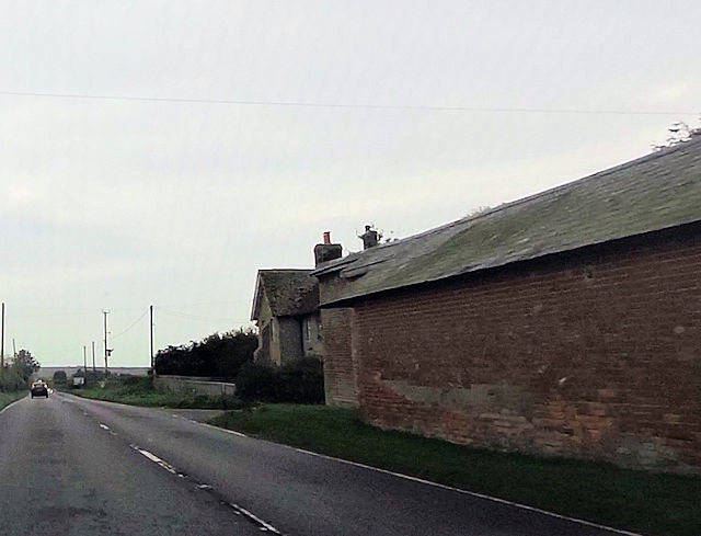
A354 at the roundabout with the B3081
A354 at the roundabout with the B3081 Credit: Paul Barnett

Salisbury Plantation is a historic estate located in Dorset, England. The plantation is known for its vast woodlands and forests, which cover a significant portion of the property. The estate is home to a diverse array of flora and fauna, including ancient oak trees, rare plant species, and various wildlife.

The plantation has a rich history, dating back to the 16th century when it was first established as a hunting ground for the local nobility. Over the centuries, the estate has changed hands several times and has been used for various purposes, including timber production and farming.

Today, Salisbury Plantation is a popular destination for nature lovers and outdoor enthusiasts. The woodlands and forests provide ample opportunities for hiking, birdwatching, and exploring the natural beauty of the area. The estate also offers guided tours and educational programs for visitors interested in learning more about the history and ecology of the plantation.

Overall, Salisbury Plantation is a picturesque and serene retreat, offering a glimpse into the natural wonders of Dorset's countryside.

If you have any feedback on the listing, please let us know in the comments section below.

Salisbury Plantation Images

Images are sourced within 2km of 50.951501/-1.9670639 or Grid Reference SU0216. Thanks to Geograph Open Source API. All images are credited.

A354 at the roundabout with the B3081
Whitegates Farm on A354
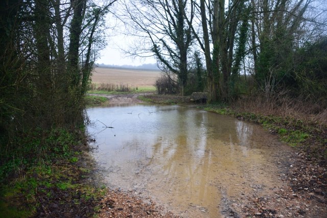
Ford at Waterlake Bottom This ford on the River Crane is found at Waterlake Bottom.
Ford at Waterlake Bottom
This ford on the River Crane is found at Waterlake Bottom.
Pentridge, St Rumbold
Pentridge turning from A354
Old Milestone by the A354, south east of Sixpenny Handley Carved stone post by the A354, in parish of SIXPENNY HANDLEY (EAST DORSET District), East of Sixpenny Handley, just south of roundabout, on South side of road. Dorset 1 (limestone), erected by the Harnham, Blandford & Dorchester turnpike trust in the 19th century. 

Inscription reads:-
Blandford
10
Sarum
12
Carved benchmark bottom left of face.

Grade II Listed. List Entry Number:1120163
<span class="nowrap"><a title="https://historicengland.org.uk/listing/the-list/list-entry/1120163" rel="nofollow ugc noopener" href="https://historicengland.org.uk/listing/the-list/list-entry/1120163">Link</a><img style="margin-left:2px;" alt="External link" title="External link - shift click to open in new window" src="https://s1.geograph.org.uk/img/external.png" width="10" height="10"/></span>

Milestone Society National ID: DO_BFSA10
Old Milestone by the A354, south east of Sixpenny Handley
Carved stone post by the A354, in parish of SIXPENNY HANDLEY (EAST DORSET District), East of Sixpenny Handley, just south of roundabout, on South side of road. Dorset 1 (limestone), erected by the Harnham, Blandford & Dorchester turnpike trust in the 19th century. Inscription reads:- Blandford 10 Sarum 12 Carved benchmark bottom left of face. Grade II Listed. List Entry Number:1120163 LinkExternal link Milestone Society National ID: DO_BFSA10
Old Milestone by the A354, west of Pentridge Carved stone post by the A354, in parish of WIMBORNE ST GILES (EAST DORSET District), just South West of Yew Trees Garage; 2m back from road by hedge and wire fence, on South side of road. Dorset 1 (limestone), erected by the Harnham, Blandford & Dorchester turnpike trust in the 19th century. 

Inscription reads:-
Sarum
11
Blandford
11  
Cancelled benchmark bottom centre of face.

Milestone Society National ID: DO_BFSA11
Old Milestone by the A354, west of Pentridge
Carved stone post by the A354, in parish of WIMBORNE ST GILES (EAST DORSET District), just South West of Yew Trees Garage; 2m back from road by hedge and wire fence, on South side of road. Dorset 1 (limestone), erected by the Harnham, Blandford & Dorchester turnpike trust in the 19th century. Inscription reads:- Sarum 11 Blandford 11 Cancelled benchmark bottom centre of face. Milestone Society National ID: DO_BFSA11
A354 towards Blandford Bowling Green Lane towards Pentridge turns left ahead.
A354 towards Blandford
Bowling Green Lane towards Pentridge turns left ahead.
A354 towards Blandford
A354 towards Blandford Nearing the roundabout junction with the B3081.
A354 towards Blandford
Nearing the roundabout junction with the B3081.
A354 towards Blandford
Field south of Bokerley Farm
Field edge to the sky
Field edge south of Bokerley Farm
View across field north of Pentridge
Field and trees at Pentridge
Handley Cross roundabout
Show me another place!

Salisbury Plantation is located at Grid Ref: SU0216 (Lat: 50.951501, Lng: -1.9670639)

Unitary Authority: Dorset

Police Authority: Dorset

What 3 Words

///botanists.doted.expansion. Near Bower Chalke, Wiltshire

Nearby Locations

Salisbury Plantation

Related Wikis

Oakley Down Barrow Cemetery

Oakley Down Barrow Cemetery is a group of Bronze Age round barrows on Cranborne Chase, about 1 mile (1.6 km) east of the village of Sixpenny Handley in...

Dorset Cursus

The Dorset Cursus is a Neolithic cursus monument that spans across 10 km (6ΒΌ miles) of the chalk downland of Cranborne Chase in east Dorset, United Kingdom...

Pentridge

Pentridge is a village and former civil parish, now in the parish of Sixpenny Handley and Pentridge, in the Dorset district, in the ceremonial of Dorset...

Wor Barrow

Wor Barrow is a Neolithic long barrow on Cranborne Chase, about 1 mile (1.6 km) east of Sixpenny Handley in Dorset, England. It is a scheduled monument...

Nearby Amenities

Located within 500m of 50.951501,-1.9670639
The data included in this document is from www.openstreetmap.org. The data is made available under ODbL.

Have you been to Salisbury Plantation?

Leave your review of Salisbury Plantation below (or comments, questions and feedback).