Barrow Firs

Wood, Forest in Dorset

England

Barrow Firs

Wimborne First School On School Lane, in a building dated 1911.
Wimborne First School Credit: Mike Faherty

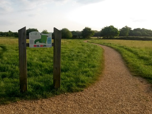
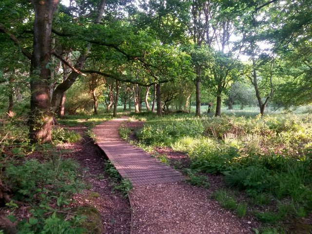
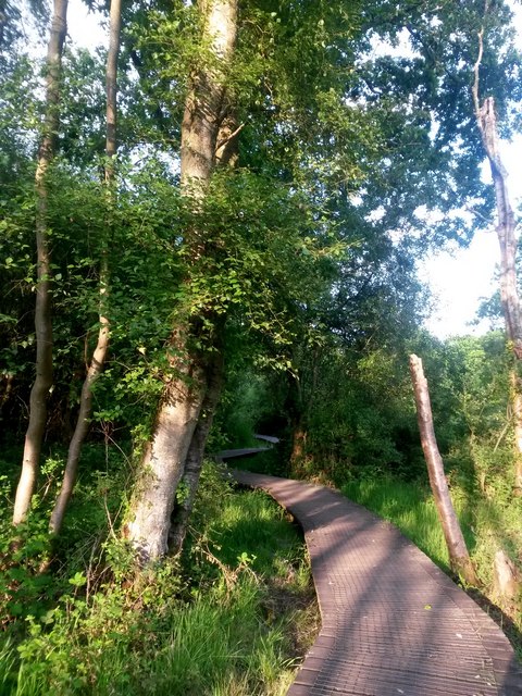
Barrow Firs is a dense woodland located in the county of Dorset, England. Spanning over a vast area, the forest is renowned for its rich biodiversity and stunning natural beauty. The woodland is situated near the village of Barrow, hence its name, and is a popular destination for nature enthusiasts and outdoor lovers.

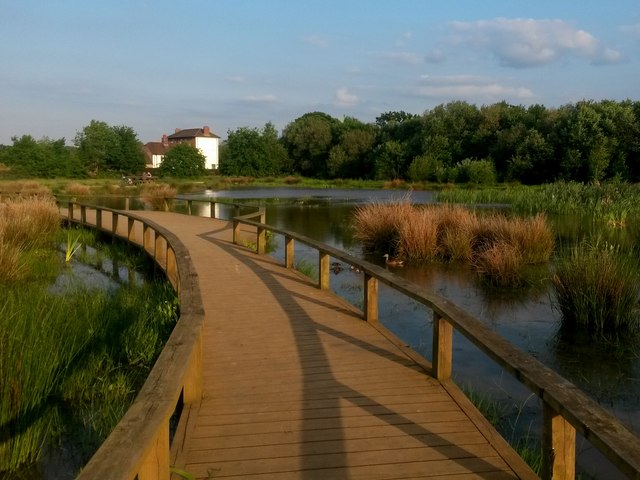
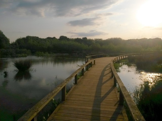
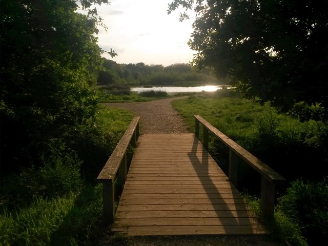
Barrow Firs is primarily composed of coniferous trees, such as pine and fir, creating a lush green canopy that provides shade and shelter to various species of flora and fauna. The forest floor is covered in a thick layer of moss and fallen leaves, contributing to the overall picturesque ambiance of the area.

The woodland boasts a network of well-maintained trails and paths, making it an ideal location for hiking, walking, and exploring. Visitors can enjoy the peaceful atmosphere while immersing themselves in the tranquility of nature. The diverse range of wildlife that calls Barrow Firs home includes deer, rabbits, squirrels, and a plethora of bird species.

Barrow Firs is open to the public throughout the year, offering a range of recreational activities. Picnic areas are available, allowing visitors to relax and enjoy the surroundings. The forest also provides an excellent opportunity for photography enthusiasts, with its captivating landscapes and abundant wildlife.

Overall, Barrow Firs is a magnificent woodland, offering a haven of natural beauty and tranquility. Whether it is for a leisurely stroll, a family picnic, or an exploration of the local wildlife, this forest in Dorset is a must-visit for nature enthusiasts seeking a serene escape from the bustling city life.

If you have any feedback on the listing, please let us know in the comments section below.
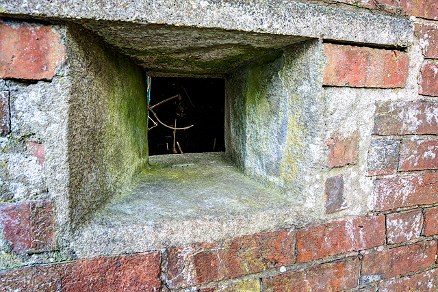
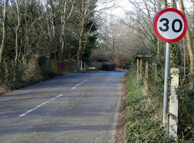
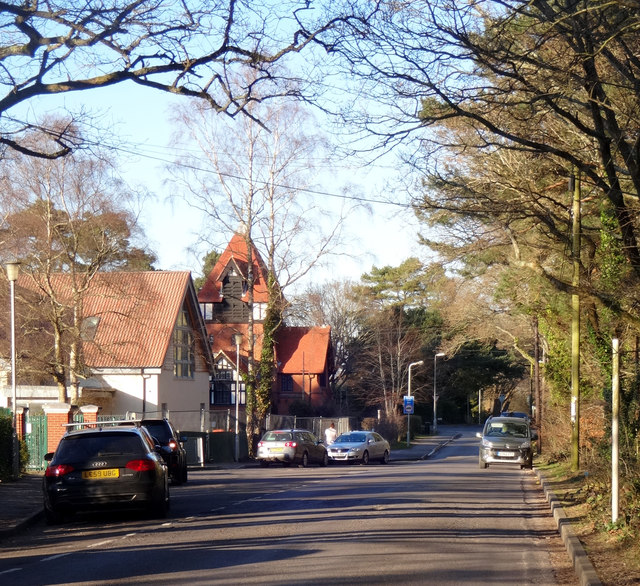
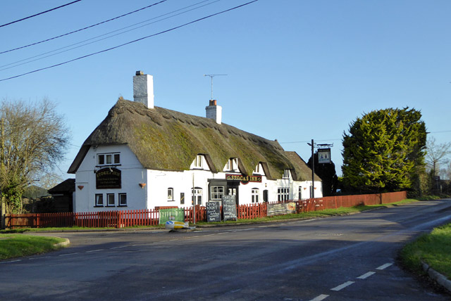
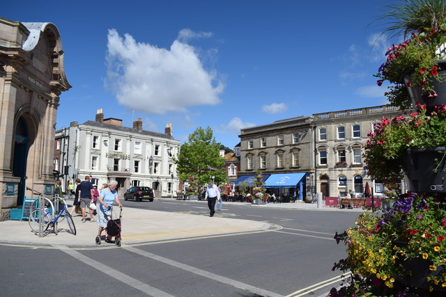
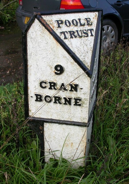
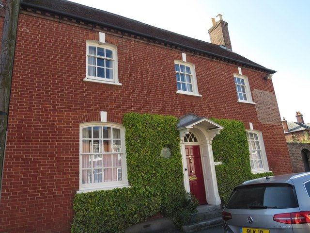
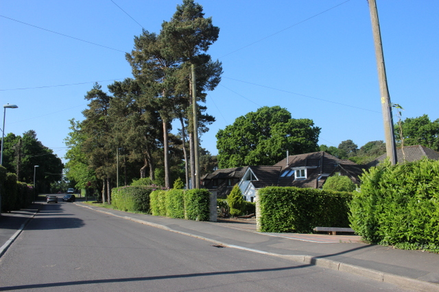
Barrow Firs Images

Images are sourced within 2km of 50.809277/-1.9682844 or Grid Reference SU0201. Thanks to Geograph Open Source API. All images are credited.

Wimborne First School On School Lane, in a building dated 1911.
Wimborne First School
On School Lane, in a building dated 1911.
Wimborne, play area On Redcotts Recreation Ground, at the end of School Lane.
Wimborne, play area
On Redcotts Recreation Ground, at the end of School Lane.
Wimborne, Taphouse The latest addition to Wimborne's pub scene, opened in 2013 on West Borough. Straight bar to right, drinking front, left and back; simple decor with bare brick and wooden panelling, background music. Cask ales on offer at my visit: six, served on gravity, including two from the local Six Arch Brewery. <span class="nowrap"><a title="http://whatpub.com/pubs/SED/72/taphouse-wimborne" rel="nofollow ugc noopener" href="http://whatpub.com/pubs/SED/72/taphouse-wimborne">Link</a><img style="margin-left:2px;" alt="External link" title="External link - shift click to open in new window" src="https://s1.geograph.org.uk/img/external.png" width="10" height="10"/></span>
Wimborne, Taphouse
The latest addition to Wimborne's pub scene, opened in 2013 on West Borough. Straight bar to right, drinking front, left and back; simple decor with bare brick and wooden panelling, background music. Cask ales on offer at my visit: six, served on gravity, including two from the local Six Arch Brewery. LinkExternal link
Defending Dorset in 1940: Wimborne Anti-tank Island (1) -
Loopholed wall: DoB ID: e25267

Wimborne - West Borough - Loopholed Wall.  The only surviving structure in Wimborne of the town's defences when it was designated an anti-tank island in 1940. This loopholed wall between two properties in West Borough was built to bring fire to bear on the approach road from the crossing of the River Allen to the north. The house directly opposite (the Old Saddlery) on the other side of the road was also requisitioned at the time, and handed over to the Home Guard to be used as a defended house. The second floor with its tiny north-facing window overlooking the street, may have served as a discreet observation post.

<a href="https://www.geograph.org.uk/photo/4842582">SU0000 : Defending Dorset in 1940: Wimborne Anti-tank Island (2)</a>
Defending Dorset in 1940: Wimborne Anti-tank Island (1)
- Loopholed wall: DoB ID: e25267 Wimborne - West Borough - Loopholed Wall. The only surviving structure in Wimborne of the town's defences when it was designated an anti-tank island in 1940. This loopholed wall between two properties in West Borough was built to bring fire to bear on the approach road from the crossing of the River Allen to the north. The house directly opposite (the Old Saddlery) on the other side of the road was also requisitioned at the time, and handed over to the Home Guard to be used as a defended house. The second floor with its tiny north-facing window overlooking the street, may have served as a discreet observation post. SU0000 : Defending Dorset in 1940: Wimborne Anti-tank Island (2)
Defending Dorset in 1940: Wimborne Anti-tank Island (2) -
Loopholed wall: DoB ID: e25267

Wimborne - West Borough - Loopholed Wall.  A close-up of one of the three gunloops. Note that the construction of the aperture has been angled to the left of the photo and towards the direction of the perceived threat - the street outside.

<a href="https://www.geograph.org.uk/photo/4842581">SU0000 : Defending Dorset in 1940: Wimborne Anti-tank Island (1)</a>
Defending Dorset in 1940: Wimborne Anti-tank Island (2)
- Loopholed wall: DoB ID: e25267 Wimborne - West Borough - Loopholed Wall. A close-up of one of the three gunloops. Note that the construction of the aperture has been angled to the left of the photo and towards the direction of the perceived threat - the street outside. SU0000 : Defending Dorset in 1940: Wimborne Anti-tank Island (1)
Northleigh Lane The bridge over the old Southampton & Dorchester Railway on Northleigh Lane, saw its last passenger trains in 1964 and freight in 1974.
Northleigh Lane
The bridge over the old Southampton & Dorchester Railway on Northleigh Lane, saw its last passenger trains in 1964 and freight in 1974.
Colehill Lane Colehill Lane, near the entrance to St Michael's Middle School.
Colehill Lane
Colehill Lane, near the entrance to St Michael's Middle School.
The Stocks Inn, Furzehill One of the boards advertises Quiz Night on 'Bank Holiday Sunday'. An odd one - is that Easter Day?
The Stocks Inn, Furzehill
One of the boards advertises Quiz Night on 'Bank Holiday Sunday'. An odd one - is that Easter Day?
The Square, Wimborne View across The Square towards The King's Head.
The Square, Wimborne
View across The Square towards The King's Head.
Old Milepost by the B3078, south west of Furzehill Cast iron post by the B3078, in parish of COLEHILL (EAST DORSET District), Wimborne, 150m South of turning to Furzehill, on grass verge by second lay-by, on West side of road. Poole cast iron post, erected by the Poole turnpike trust in the 19th century. 

Inscription reads:-
: 9 / CRAN- / -BORNE : : POOLE / TRUST : : 1 / WIM- / -BORNE :  

Milestone Society National ID: DO_CBWB09.
Old Milepost by the B3078, south west of Furzehill
Cast iron post by the B3078, in parish of COLEHILL (EAST DORSET District), Wimborne, 150m South of turning to Furzehill, on grass verge by second lay-by, on West side of road. Poole cast iron post, erected by the Poole turnpike trust in the 19th century. Inscription reads:- : 9 / CRAN- / -BORNE : : POOLE / TRUST : : 1 / WIM- / -BORNE : Milestone Society National ID: DO_CBWB09.
Isaac Gulliver's house, Wimborne Gulliver was a notorious smuggler based on the south coast of England during the 18th and 19th centuries.
Isaac Gulliver's house, Wimborne
Gulliver was a notorious smuggler based on the south coast of England during the 18th and 19th centuries.
Houses on Pilford Heath Rd This part of Wimborne is very leafy and the large gardens often contain some of the large old pine trees that were here before the houses were built.
Houses on Pilford Heath Rd
This part of Wimborne is very leafy and the large gardens often contain some of the large old pine trees that were here before the houses were built.
Colehill: across Bytheway Field Looking westward across this vast, lovely open space from near the Churchmoor Road entrance, on its eastern side.

The information board proclaims it as "a great place for people and wildlife" and on an evening like this it was certainly very popular.

I recall in the early 1980s, as a child, passing the house called Bytheway just along here, and initially thinking it was Welsh!
Colehill: across Bytheway Field
Looking westward across this vast, lovely open space from near the Churchmoor Road entrance, on its eastern side. The information board proclaims it as "a great place for people and wildlife" and on an evening like this it was certainly very popular. I recall in the early 1980s, as a child, passing the house called Bytheway just along here, and initially thinking it was Welsh!
Colehill: across the pond at Bytheway Field The path rather splendidly goes across the northern corner of the wildlife pond in the centre of this fine open space, which has been established in relatively recent years.

It is the first SANG (Suitable Alternative Natural Green Space) in East Dorset district, and includes a self-led orienteering course. It is very well used by dog walkers and equally people just fancying a stroll in the fresh air.

One of the signboards proclaims Bytheway Field as "a great place for people and wildlife" which has a nice ring to it and is perhaps evidenced by the mallard taking her ducklings out for a swim, centre picture.
Colehill: across the pond at Bytheway Field
The path rather splendidly goes across the northern corner of the wildlife pond in the centre of this fine open space, which has been established in relatively recent years. It is the first SANG (Suitable Alternative Natural Green Space) in East Dorset district, and includes a self-led orienteering course. It is very well used by dog walkers and equally people just fancying a stroll in the fresh air. One of the signboards proclaims Bytheway Field as "a great place for people and wildlife" which has a nice ring to it and is perhaps evidenced by the mallard taking her ducklings out for a swim, centre picture.
Colehill: over the pond and into the sun Looking along the path that crosses the pond within Bytheway Field, in the opposite direction to <a href="https://www.geograph.org.uk/photo/5783609">SU0200 : Colehill: across the pond at Bytheway Field</a>.

Bytheway Field is the first SANG (Suitable Alternative Natural Green Space) in East Dorset district, and includes a self-led orienteering course. It is very well used by dog walkers and equally people just fancying a stroll in the fresh air.

One of the signboards proclaims Bytheway Field as "a great place for people and wildlife" which has a nice ring to it.
Colehill: over the pond and into the sun
Looking along the path that crosses the pond within Bytheway Field, in the opposite direction to SU0200 : Colehill: across the pond at Bytheway Field. Bytheway Field is the first SANG (Suitable Alternative Natural Green Space) in East Dorset district, and includes a self-led orienteering course. It is very well used by dog walkers and equally people just fancying a stroll in the fresh air. One of the signboards proclaims Bytheway Field as "a great place for people and wildlife" which has a nice ring to it.
Colehill: small footbridge in Bytheway Field Ahead is the rather lovely wildlife pond. See <a href="https://www.geograph.org.uk/photo/5783609">SU0200 : Colehill: across the pond at Bytheway Field</a> for more discussion on the Field.
Colehill: small footbridge in Bytheway Field
Ahead is the rather lovely wildlife pond. See SU0200 : Colehill: across the pond at Bytheway Field for more discussion on the Field.
Colehill: eastern edge of Leigh Common The Common features several paths - some gravelled and some, where necessary, elevated as a boardwalk - and is mainly woodland with a little open meadow.
Colehill: eastern edge of Leigh Common
The Common features several paths - some gravelled and some, where necessary, elevated as a boardwalk - and is mainly woodland with a little open meadow.
Colehill: boardwalk on Leigh Common The Common features several paths - some gravelled and some, where necessary, elevated as a boardwalk - and is mainly woodland with a little open meadow.

This boardwalk along the northern side of the common takes a rather splendidly meandering path.
Colehill: boardwalk on Leigh Common
The Common features several paths - some gravelled and some, where necessary, elevated as a boardwalk - and is mainly woodland with a little open meadow. This boardwalk along the northern side of the common takes a rather splendidly meandering path.
Show me another place!

Barrow Firs is located at Grid Ref: SU0201 (Lat: 50.809277, Lng: -1.9682844)

Unitary Authority: Dorset

Police Authority: Dorset

What 3 Words

///ramble.marriage.spud. Near Wimborne Minster, Dorset

Related Wikis

Dumpton School

Dumpton School is an independent day school in Wimborne, Dorset, South West England, for girls and boys aged 2 to 13 years. == History == The school was...

Wimborne Minster

Wimborne Minster (often referred to as Wimborne, ) is a market town in Dorset in South West England, and the name of the Church of England church in that...

Colehill

Colehill is a parish neighbouring Wimborne Minster, in Dorset, England. It had a population of 7,000 in 2001, which shrunk slightly to 6,927 people at...

East Dorset

East Dorset was a local government district in Dorset, England. Its council met in Wimborne Minster between 2016 and 2019.The district (as Wimborne) was...

Furzehill Wood

Furzehill Wood is a woodland near Colehill in Dorset, England. It covers a total area of 0.84 hectares (2.08 acres). It is owned and managed by the Woodland...

Wimborne Market

Wimborne Market was an historic market in a large covered structure in Wimborne Minster, Dorset, England. It ceased to trade on 19 December 2021 after...

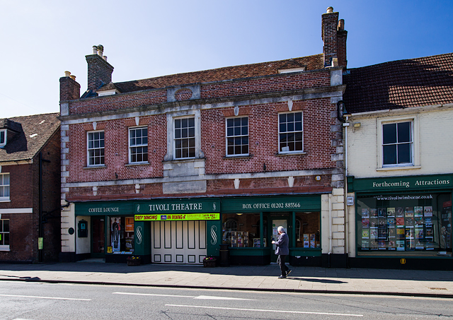
Tivoli Theatre (Wimborne Minster)

The Tivoli Theatre in Wimborne Minster, Dorset, England, was built in 1936 as a theatre and cinema. It has a variety of Art Deco features, including original...

Wimborne railway station

Wimborne was a railway station in Wimborne Minster in the county of Dorset in England. Open from 1 June 1847 to 2 May 1977, it was sited just north of...

Nearby Amenities

Located within 500m of 50.809277,-1.9682844
Colehill
Place: suburb
Lat/Long: 50.8079991/-1.9624426
Turning Circle
Lat/Long: 50.8064389/-1.9695592
Post Box
Post Box Type: lamp
Ref: BH21 124
Ref GB Uprn: 10015466139
Royal Cypher: EIIR
Royal Cypher Wikidata: Q33102113
Lat/Long: 50.810383/-1.974878
Bus Stop
Cobbs Road
Bearing: NE
Bench: yes
Bin: no
Bus: yes
Naptan AtcoCode: 1200POA10631
Naptan Indicator: NE-bound
Naptan StopType: bus
Public Transport: platform
Shelter: yes
Tactile Paving: no
Lat/Long: 50.8065445/-1.9716781
Bus Stop
Cobbs Road
Bearing: SW
Bench: no
Bin: no
Bus: yes
Lit: no
Naptan AtcoCode: 1200POA10632
Naptan Indicator: SW-bound
Naptan StopType: bus
Public Transport: platform
Shelter: no
Tactile Paving: no
Lat/Long: 50.8061516/-1.9727011
Post Box
Colehill Post Office
Location: Inside Co-Op
Operator: Royal Mail
Operator Wikidata: Q638098
Ref: BH21 68
Ref GB Uprn: 10015329852
Lat/Long: 50.8099843/-1.9630675
Bus Stop
Colehill Post Office
Bearing: NE
Bench: yes
Bin: yes
Bus: yes
Lit: yes
Naptan AtcoCode: 1200POA10629
Naptan Indicator: NE-bound
Naptan StopType: bus
Public Transport: platform
Shelter: yes
Tactile Paving: no
Lat/Long: 50.8094559/-1.9639981
Turning Circle
Lat/Long: 50.8103834/-1.9642702
Turning Circle
Lat/Long: 50.8062616/-1.9710016
Colehill Garage
Name En: Colehill Garage
Shop: car_repair
Lat/Long: 50.8088264/-1.9651076
Historic: memorial
Memorial: war_memorial
Lat/Long: 50.8084389/-1.966816
Bus Stop
Colehill Lane
Bearing: NE
Bench: yes
Bin: yes
Bus: yes
Naptan AtcoCode: 1200POA10672
Naptan Indicator: NE-bound
Naptan StopType: bus
Public Transport: platform
Shelter: yes
Lat/Long: 50.8080452/-1.9677459
Bus Stop
Colehill Post Office
Bearing: SW
Bench: yes
Bin: yes
Bus: yes
Lit: yes
Naptan AtcoCode: 1200POA10630
Naptan Indicator: SW-bound
Naptan StopType: bus
Public Transport: platform
Shelter: yes
Tactile Paving: no
Lat/Long: 50.8091863/-1.9643105
Bus Stop
Colehill Lane
Bearing: SW
Bench: yes
Bin: no
Bus: yes
Lit: yes
Naptan AtcoCode: 1200DOA25098
Naptan Indicator: SW-bound
Naptan StopType: bus
Public Transport: platform
Shelter: yes
Tactile Paving: no
Lat/Long: 50.8079485/-1.9676817
Colour: gray
Man Made: street_cabinet
Note: LV fuses?
Source: survey
Lat/Long: 50.8085545/-1.9671031
Power: transformer
Source: survey
Voltage Primary: 11000
Voltage Secondary: 400
Voltage Tertiary: 230
Lat/Long: 50.8085932/-1.9670878
Power: switch
Signed Connections: Transformer
Source: survey
Lat/Long: 50.8085973/-1.9671206
Colehill Church
Information: guidepost
Ref: 025012
Tourism: information
Lat/Long: 50.8103866/-1.9656469
Man Made: water_tap
Lat/Long: 50.8105475/-1.9720821
Man Made: water_tap
Lat/Long: 50.8102094/-1.9730786
Man Made: water_tap
Lat/Long: 50.8103161/-1.972404
Man Made: water_tap
Lat/Long: 50.8097145/-1.9724804
Man Made: water_tap
Lat/Long: 50.8095594/-1.972933
Man Made: water_tap
Lat/Long: 50.8088399/-1.9740307
Man Made: water_tap
Lat/Long: 50.8085721/-1.9740737
Man Made: water_tap
Lat/Long: 50.8082467/-1.9741112
Man Made: water_tap
Lat/Long: 50.8079179/-1.9741648
Man Made: water_tap
Lat/Long: 50.8091814/-1.9742379
Man Made: water_tap
Lat/Long: 50.8097056/-1.9742165
The data included in this document is from www.openstreetmap.org. The data is made available under ODbL.

Have you been to Barrow Firs?

Leave your review of Barrow Firs below (or comments, questions and feedback).