Neighbour Moor

Wood, Forest in Durham

England

Neighbour Moor

Mountain bikers' bridleway, Hamsterley Forest As a public bridleway, the right of way considerably predates Hamsterley Forest's encouragement of mountain biking, and was probably used both in ascent and descent. Walkers (and dogs) still use it in ascent, but I think mountain bikers probably only descend - it would be fit cyclist to take this on uphill, even with a softy E-bike ! Fortunately, on a fairly dreich Monday almost at winter solstice, we didn't meet any bikes hurtling down. You wouldn't catch me cycling down this with my ancient rigid-frame mountain bike, but the next generation have cheating technology like suspension to make it not only survivable, but apparently fun and they tend to go quite fast (I always fear being run into from behind when I'm enjoying a nice long slow descent of one of the easier tracks).
Mountain bikers' bridleway, Hamsterley Forest Credit: Andy Waddington

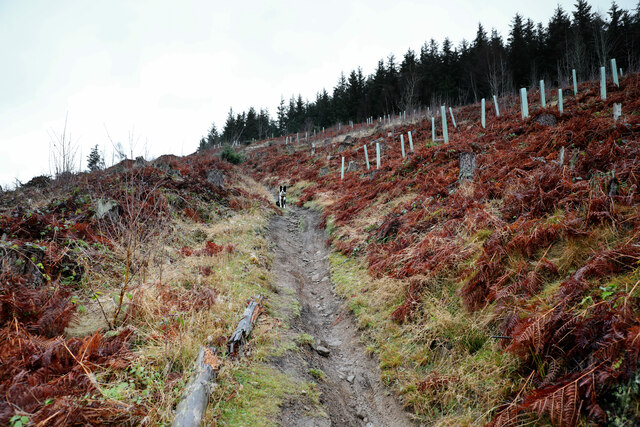
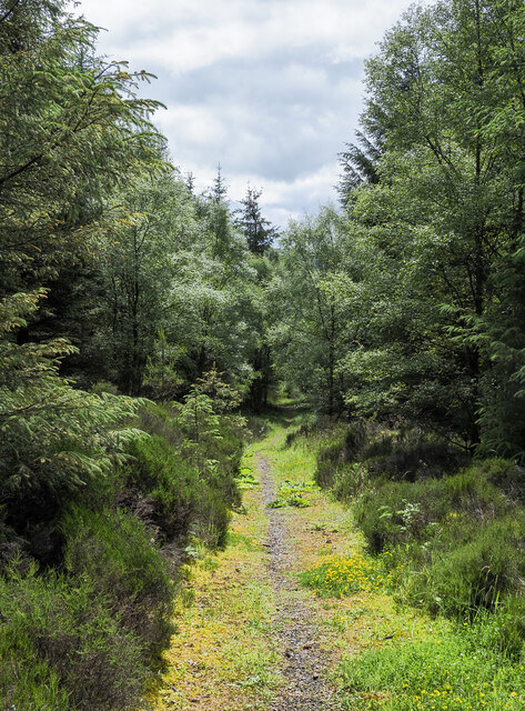
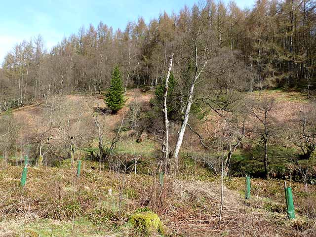
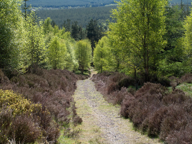
Neighbour Moor is a designated Site of Special Scientific Interest located in Durham, England. The moor is characterized by its diverse woodland and forest ecosystems, offering a rich habitat for a variety of plant and animal species. The area is known for its ancient oak trees, which provide a canopy for a lush understory of ferns, mosses, and wildflowers.

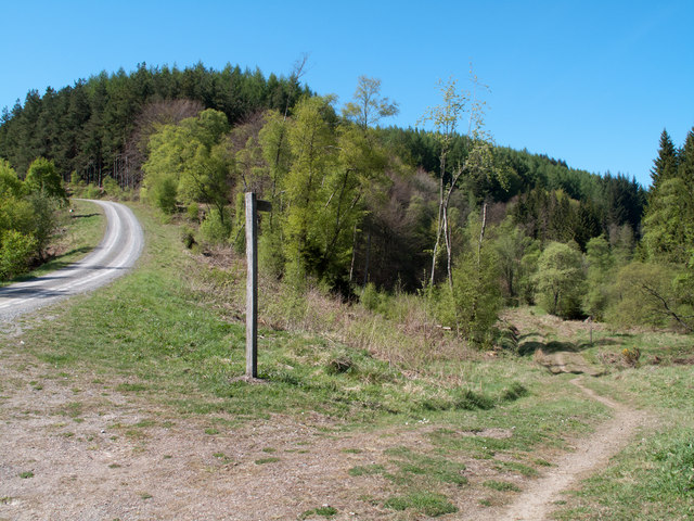
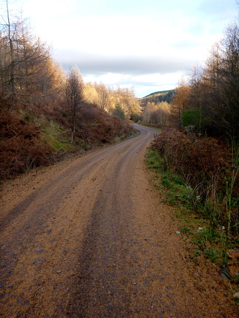
Neighbour Moor is a popular destination for nature enthusiasts and hikers, with several walking trails crisscrossing the area. Visitors can enjoy the peaceful ambiance of the forest, listening to the chirping of birds and rustling of leaves as they explore the winding paths.

The moor is also of historical significance, with evidence of past human activity dating back to the Bronze Age. Archaeological sites, such as burial mounds and stone circles, can be found scattered throughout the area, providing a glimpse into the ancient history of the region.

Overall, Neighbour Moor is a tranquil and enchanting natural space, offering a peaceful retreat for those looking to escape the hustle and bustle of everyday life and immerse themselves in the beauty of the natural world.

If you have any feedback on the listing, please let us know in the comments section below.

Neighbour Moor Images

Images are sourced within 2km of 54.6528/-1.9654677 or Grid Reference NZ0228. Thanks to Geograph Open Source API. All images are credited.

Mountain bikers' bridleway, Hamsterley Forest As a public bridleway, the right of way considerably predates Hamsterley Forest's encouragement of mountain biking, and was probably used both in ascent and descent. Walkers (and dogs) still use it in ascent, but I think mountain bikers probably only descend - it would be fit cyclist to take this on uphill, even with a softy E-bike ! Fortunately, on a fairly dreich Monday almost at winter solstice, we didn't meet any bikes hurtling down. You wouldn't catch me cycling down this with my ancient rigid-frame mountain bike, but the next generation have cheating technology like suspension to make it not only survivable, but apparently fun and they tend to go quite fast (I always fear being run into from behind when I'm enjoying a nice long slow descent of one of the easier tracks).
Mountain bikers' bridleway, Hamsterley Forest
As a public bridleway, the right of way considerably predates Hamsterley Forest's encouragement of mountain biking, and was probably used both in ascent and descent. Walkers (and dogs) still use it in ascent, but I think mountain bikers probably only descend - it would be fit cyclist to take this on uphill, even with a softy E-bike ! Fortunately, on a fairly dreich Monday almost at winter solstice, we didn't meet any bikes hurtling down. You wouldn't catch me cycling down this with my ancient rigid-frame mountain bike, but the next generation have cheating technology like suspension to make it not only survivable, but apparently fun and they tend to go quite fast (I always fear being run into from behind when I'm enjoying a nice long slow descent of one of the easier tracks).
Bridleway descending into valley of Euden Beck From the image the path could be thought to be level but it's certainly descending. The stretch of bridleway here is in good condition but lower down it crosses a forest road; below that road on the way down to the stream, it's noticeably eroded due to (legitimate) use by mountain bikers.
Bridleway descending into valley of Euden Beck
From the image the path could be thought to be level but it's certainly descending. The stretch of bridleway here is in good condition but lower down it crosses a forest road; below that road on the way down to the stream, it's noticeably eroded due to (legitimate) use by mountain bikers.
Trees at entry of bridleway to Hamsterley Forest The bridleway is one of two, close to each other, which enter the forest by crossing Smithy Hirst Sike, this being the more northerly of them. The route has approached the forest edge by crossing the  heather of Eggleston Moor.
Trees at entry of bridleway to Hamsterley Forest
The bridleway is one of two, close to each other, which enter the forest by crossing Smithy Hirst Sike, this being the more northerly of them. The route has approached the forest edge by crossing the heather of Eggleston Moor.
Slope of dead bracken with cluster of boulders The slope is that of the northern side of Spurlswood Gill through which flows Spurlswood Beck.
The distant trees are at the southern edge of Hamsterley Forest.
Slope of dead bracken with cluster of boulders
The slope is that of the northern side of Spurlswood Gill through which flows Spurlswood Beck. The distant trees are at the southern edge of Hamsterley Forest.
Viewpoint in Hamsterley Forest Bench set  in commanding position at the top of a cleared slope leading down to the valley of the Euden Beck in Hamsterley Forest.
Viewpoint in Hamsterley Forest
Bench set in commanding position at the top of a cleared slope leading down to the valley of the Euden Beck in Hamsterley Forest.
The Euden Beck valley The Euden Beck runs the length of the upper part of Hamsterley Forest. Birch and other broadleaf trees occupy the valley floor, larches on the hillside beyond.
The Euden Beck valley
The Euden Beck runs the length of the upper part of Hamsterley Forest. Birch and other broadleaf trees occupy the valley floor, larches on the hillside beyond.
Clear-felled hillside in Hamsterley Forest In the valley of the Euden Beck.
Clear-felled hillside in Hamsterley Forest
In the valley of the Euden Beck.
Bridleway in Hamsterley Forest Often, the existence of public rights of way through forestry plantations has been ignored and they've become overgrown and unusable; not so with this bridleway which here descends towards the valley of the Euden Beck from the vicinity of Black Hill on the northern edge of Hamsterley Forest.
Bridleway in Hamsterley Forest
Often, the existence of public rights of way through forestry plantations has been ignored and they've become overgrown and unusable; not so with this bridleway which here descends towards the valley of the Euden Beck from the vicinity of Black Hill on the northern edge of Hamsterley Forest.
Junction of bridleway and forest road in Hamsterley Forest The bridleway/road junction is in the valley of the Euden Beck with the view being westwards.
Junction of bridleway and forest road in Hamsterley Forest
The bridleway/road junction is in the valley of the Euden Beck with the view being westwards.
Western edge of Hamsterley Forest A view northwards along the fenced edge of Hamsterley Forest where it abuts heather moorland rising (leftwards) for Islington Hill.
Western edge of Hamsterley Forest
A view northwards along the fenced edge of Hamsterley Forest where it abuts heather moorland rising (leftwards) for Islington Hill.
Spurlswood Gill Spurlswood Gill is the slot in which the stream, Spurlswood Beck, flows. The location is the south side of Hamsterley Forest, some trees of which are obvious.
Spurlswood Gill
Spurlswood Gill is the slot in which the stream, Spurlswood Beck, flows. The location is the south side of Hamsterley Forest, some trees of which are obvious.
Moorland with rocks on south side of Spurlswood Gill Spurlswood Gill is a deep cleft in the moorland on the south side of Hamsterley Forest.
Moorland with rocks on south side of Spurlswood Gill
Spurlswood Gill is a deep cleft in the moorland on the south side of Hamsterley Forest.
Forest track,Pennington Plantation
A fast descent in Hamsterley Forest Hamsterley forest is regularly filled with competent and enthusiastic mountain bikers using the graded trails (from blue to black, many of the higher grades looking both difficult and muddy), so your photographer (in riding jodpurs and canoeing helmet complete with two GoPro cameras and with dog in attendance) didn't quite look the part. However, having been riding here years before the sport became popular, we soon found our way off the marked trails (or maybe we just missed one of the rather inconspicuous signs) and away from the crowds. Once we'd visited the highest point in the forest (much whingeing from the youngest member of the team), we were riding back towards civilisation, using this track, well covered in a layer of slippery larch needles, which are great for dog paws (no sharp rocks) but not so reassuring for out-of-practice riders. Heading East North East, a short ascent (maybe 25m height gain) had brought us to this point where a brief stop allowed everyone to regroup before heading off down what proved to be the fastest descent of the day, for a kilometre or so - the gentle gradient being enough to get speed up, but not so steep as to enforce caution. Then we on mountain bikes had to wait again for some time - the dog has no wheels and can't manage 30 mph !
A fast descent in Hamsterley Forest
Hamsterley forest is regularly filled with competent and enthusiastic mountain bikers using the graded trails (from blue to black, many of the higher grades looking both difficult and muddy), so your photographer (in riding jodpurs and canoeing helmet complete with two GoPro cameras and with dog in attendance) didn't quite look the part. However, having been riding here years before the sport became popular, we soon found our way off the marked trails (or maybe we just missed one of the rather inconspicuous signs) and away from the crowds. Once we'd visited the highest point in the forest (much whingeing from the youngest member of the team), we were riding back towards civilisation, using this track, well covered in a layer of slippery larch needles, which are great for dog paws (no sharp rocks) but not so reassuring for out-of-practice riders. Heading East North East, a short ascent (maybe 25m height gain) had brought us to this point where a brief stop allowed everyone to regroup before heading off down what proved to be the fastest descent of the day, for a kilometre or so - the gentle gradient being enough to get speed up, but not so steep as to enforce caution. Then we on mountain bikes had to wait again for some time - the dog has no wheels and can't manage 30 mph !
About to descend from Neighbour Moor No longer moorland, this has been part of Hamsterley Forest for a long time. From this junction, the track we had chosen to ride (not one of the many trails marked out for mountain biking since the sport became very popular) sets off gently enough but then drops very steeply (with plenty of slippery larch needles to make it a tad intimidating) down to Cloudlam Beck.
About to descend from Neighbour Moor
No longer moorland, this has been part of Hamsterley Forest for a long time. From this junction, the track we had chosen to ride (not one of the many trails marked out for mountain biking since the sport became very popular) sets off gently enough but then drops very steeply (with plenty of slippery larch needles to make it a tad intimidating) down to Cloudlam Beck.
Bridleway about the least suitable bike route Although a number of bridleways crossed the area now occupied by Hamsterley Forest, they are not all used or maintained in a state suitable for cyclists. This one, in particular, looks remarkably boggy and overgrown and wouldn't be my first choice on horseback, either. This is despite the extent to which the forest managers have set out to encourage mountain biking, with specially designated, marked and graded (with a colour scheme similar to that used by ski pistes) trails. The sign here indicates that a red trail (moderately hard) heads off to the right , but there is no clue as to where that trail goes in the other direction - presumably signposting is arranged to favour unidirectional traffic which does make sense where the route is off the forest roads on narrower tracks with more gradient. We were clearly not conforming to the plan, having come from the right, and about to head off to the left (not marked as a cycle trail at all, but we found it pleasant enough).
Bridleway about the least suitable bike route
Although a number of bridleways crossed the area now occupied by Hamsterley Forest, they are not all used or maintained in a state suitable for cyclists. This one, in particular, looks remarkably boggy and overgrown and wouldn't be my first choice on horseback, either. This is despite the extent to which the forest managers have set out to encourage mountain biking, with specially designated, marked and graded (with a colour scheme similar to that used by ski pistes) trails. The sign here indicates that a red trail (moderately hard) heads off to the right , but there is no clue as to where that trail goes in the other direction - presumably signposting is arranged to favour unidirectional traffic which does make sense where the route is off the forest roads on narrower tracks with more gradient. We were clearly not conforming to the plan, having come from the right, and about to head off to the left (not marked as a cycle trail at all, but we found it pleasant enough).
Fivelane Ends on Hamsterley Forest Red Trail Strictly speaking the "Red" mountain bike trail comes in on the left here and continues straight ahead, but the track the photographer was on forms a convenient shortcut, missing out a short loop to the south west. This is just as well, as the trail leaflet (of which we had not managed to obtain a copy before riding) indicates that dogs are not allowed on mountain bike trails, a restriction which undoubtedly makes sense on the narrower and more technical single-track descents. Our own route was mainly on the forest roads well away from the crowds - it seems that many recreational mountain bikers pick and choose the highlights from the marked trails and not many come this far up the forest, where we were just below the highest point reachable by bike.
Fivelane Ends on Hamsterley Forest Red Trail
Strictly speaking the "Red" mountain bike trail comes in on the left here and continues straight ahead, but the track the photographer was on forms a convenient shortcut, missing out a short loop to the south west. This is just as well, as the trail leaflet (of which we had not managed to obtain a copy before riding) indicates that dogs are not allowed on mountain bike trails, a restriction which undoubtedly makes sense on the narrower and more technical single-track descents. Our own route was mainly on the forest roads well away from the crowds - it seems that many recreational mountain bikers pick and choose the highlights from the marked trails and not many come this far up the forest, where we were just below the highest point reachable by bike.
Trees at edge of Hamsterley Forest The grey trunks, boughs and twigs of leafless deciduous trees contrast with the adjacent conifers in this image taken from moorland at the western edge of Hamsterley Forest, south of Cloudlam Beck
Trees at edge of Hamsterley Forest
The grey trunks, boughs and twigs of leafless deciduous trees contrast with the adjacent conifers in this image taken from moorland at the western edge of Hamsterley Forest, south of Cloudlam Beck
Show me another place!

Neighbour Moor is located at Grid Ref: NZ0228 (Lat: 54.6528, Lng: -1.9654677)

Unitary Authority: County Durham

Police Authority: Durham

What 3 Words

///professed.registers.solves. Near Eggleston, Co. Durham

Nearby Locations

Neighbour Moor

Related Wikis

Bollihope, Pikestone, Eggleston and Woodland Fells

Bollihope, Pikestone, Eggleston and Woodland Fells is a Site of Special Scientific Interest in the Teesdale district of west County Durham, England. It...

Frog Wood Bog

Frog Wood Bog is a Site of Special Scientific Interest in the Teesdale district of County Durham, England. It lies alongside Bedburn Beck, approximately...

Hill Top, Teesdale

Hill Top is a small village in County Durham, in England. It is situated to the north of Eggleston. == References ==

Crag Gill

Crag Gill is a Site of Special Scientific Interest in the Teesdale district in south-west County Durham, England. It lies about 3 km east of the village...

Nearby Amenities

Located within 500m of 54.6528,-1.9654677
Neighbour Moor House
Historic: ruins
Lat/Long: 54.6536498/-1.9612393
Hiking: yes
Information: guidepost
Tourism: information
Lat/Long: 54.653203/-1.9586912
The data included in this document is from www.openstreetmap.org. The data is made available under ODbL.

Have you been to Neighbour Moor?

Leave your review of Neighbour Moor below (or comments, questions and feedback).