Little Rocks Plantation

Wood, Forest in Staffordshire Staffordshire Moorlands

England

Little Rocks Plantation

The Old Red Lion in Ipstones
The Old Red Lion in Ipstones Credit: Jonathan Clitheroe

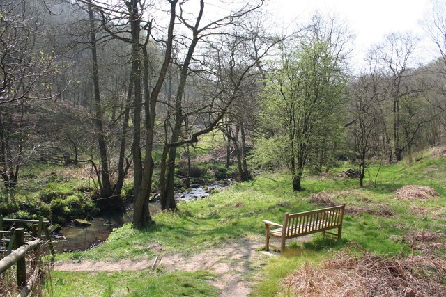
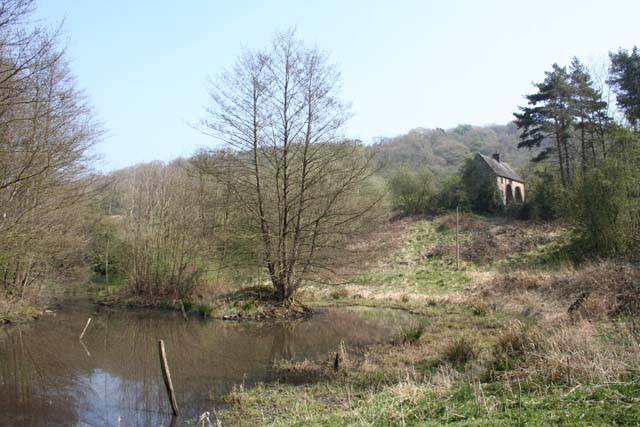
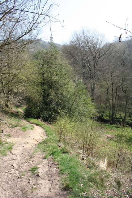
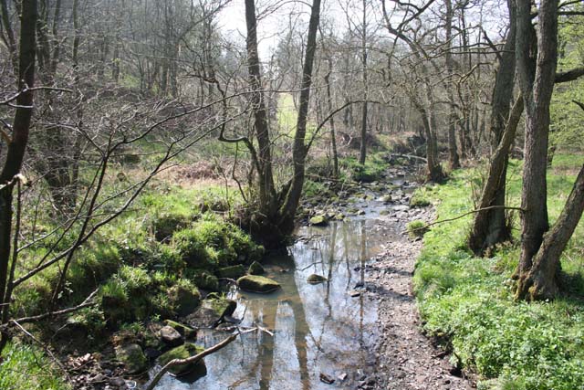
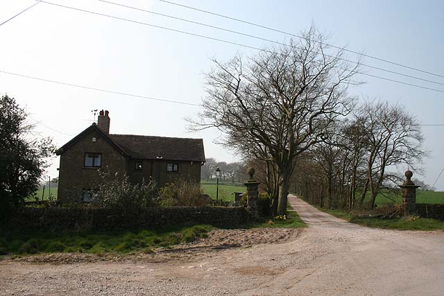
Little Rocks Plantation is a picturesque woodland area located in Staffordshire, England. Spanning over a vast expanse of land, it is a haven for nature enthusiasts and those seeking tranquility amidst the beauty of the natural world. The plantation is known for its dense forest, with tall, majestic trees that provide a canopy of shade and create a serene atmosphere.

The woodland is home to a diverse range of flora and fauna, making it a popular spot for wildlife enthusiasts. Visitors can spot various species of birds, mammals, and insects, as well as a wide variety of plant life. The plantation boasts a rich biodiversity, with different types of trees including oak, beech, and birch, among others.

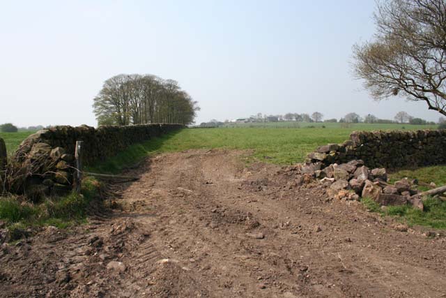
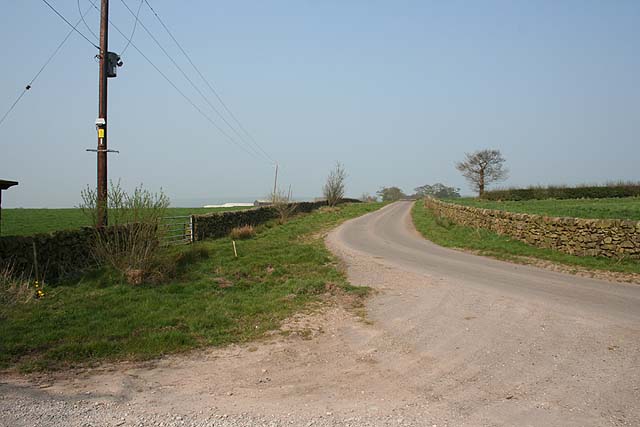
Little Rocks Plantation offers several walking trails, allowing visitors to explore the forest at their own pace. The trails wind through the woodland, offering stunning views of the surrounding landscape and providing ample opportunities for photography and birdwatching. The plantation is also equipped with picnic areas and benches, allowing visitors to relax and soak in the natural beauty.

In addition to its scenic beauty, Little Rocks Plantation holds historical significance. It is believed to have been a site of ancient woodland dating back several centuries. The plantation’s history adds an extra layer of fascination for history enthusiasts.

Overall, Little Rocks Plantation is a hidden gem in Staffordshire, offering a peaceful retreat for nature lovers and a chance to immerse oneself in the tranquil beauty of a woodland sanctuary.

If you have any feedback on the listing, please let us know in the comments section below.

Little Rocks Plantation Images

Images are sourced within 2km of 53.062885/-1.9763226 or Grid Reference SK0151. Thanks to Geograph Open Source API. All images are credited.

The Old Red Lion in Ipstones
Combes Valley Bench at the point where the footpath crosses Combes Brook. A bird hide overlooking a pond is nearby.
Combes Valley
Bench at the point where the footpath crosses Combes Brook. A bird hide overlooking a pond is nearby.
Cloughmeadow Cottage View from the bird hide in RSPB Coombes Valley reserve.
Cloughmeadow Cottage
View from the bird hide in RSPB Coombes Valley reserve.
Descending to Combes Brook Sharp final descent on the public footpath through RSPB Combes Valley reserve.
Descending to Combes Brook
Sharp final descent on the public footpath through RSPB Combes Valley reserve.
Combes Brook Looking downstream from the footbridge. An RSPB bird hide stands behind the photographer. I'd have liked to have found and photographed the Horsley Stone and Buttermilk Spring marked on the map, but they lie within a private area of the reserve.
Combes Brook
Looking downstream from the footbridge. An RSPB bird hide stands behind the photographer. I'd have liked to have found and photographed the Horsley Stone and Buttermilk Spring marked on the map, but they lie within a private area of the reserve.
Towards Padwick View from the footpath; the dry-stone wall in the foreground (to the right of the gap) has been recently rebuilt.
Towards Padwick
View from the footpath; the dry-stone wall in the foreground (to the right of the gap) has been recently rebuilt.
Brown Edge Farm From the end of the minor road. A footpath leads up the farm track then diverts left around the farm (though a stone squeeze stile at the rear of the farm suggests the footpath may originally have passed right through the farmyard).
Brown Edge Farm
From the end of the minor road. A footpath leads up the farm track then diverts left around the farm (though a stone squeeze stile at the rear of the farm suggests the footpath may originally have passed right through the farmyard).
Brown Edge Farm The stone stile, pond and farm make for an attractive photographic subject.
Brown Edge Farm
The stone stile, pond and farm make for an attractive photographic subject.
Walled path from Brown Edge Farm to Gorstead Mill Attractive but little-used footpath; in the background is the long ridge of Morridge.
Walled path from Brown Edge Farm to Gorstead Mill
Attractive but little-used footpath; in the background is the long ridge of Morridge.
Gorstead Mill Farm Attractive view from the heather-clad footpath from Brown Edge Farm. Little or no trace remains of the mill itself.
Gorstead Mill Farm
Attractive view from the heather-clad footpath from Brown Edge Farm. Little or no trace remains of the mill itself.
Ford, Gorstead Mill The road level has been raised and the stream passes through pipes except in times of spate. The site of the mill appears to have been upstream of the ford, beyond the footbridge shown in the picture.
Ford, Gorstead Mill
The road level has been raised and the stream passes through pipes except in times of spate. The site of the mill appears to have been upstream of the ford, beyond the footbridge shown in the picture.
Lower Lady Meadows Farm The building on the right is The Threshing Barn, now run as a craft workshop. The barn houses a pair of Barn Owls (with a camera mounted in their nestbox) as well as traditional-breed pigs. The craft centre also sells the farm's home-reared meat.
Lower Lady Meadows Farm
The building on the right is The Threshing Barn, now run as a craft workshop. The barn houses a pair of Barn Owls (with a camera mounted in their nestbox) as well as traditional-breed pigs. The craft centre also sells the farm's home-reared meat.
Tamworths, Lower Lady Meadows Farm Rare-breed pigs enjoy the spring sunshine at The Threshing Barn craft workshop and farm shop.
Tamworths, Lower Lady Meadows Farm
Rare-breed pigs enjoy the spring sunshine at The Threshing Barn craft workshop and farm shop.
Ford, Combes Brook Cows graze among primroses and violets by this near-dry ford.
Ford, Combes Brook
Cows graze among primroses and violets by this near-dry ford.
Ladyedge Nicely converted farmhouse on no-through road.
Ladyedge
Nicely converted farmhouse on no-through road.
Footpath to Summer Hill Little-used footpath cutting a corner on the no-through road to Ladyedge and Brown Edge Farm.
Footpath to Summer Hill
Little-used footpath cutting a corner on the no-through road to Ladyedge and Brown Edge Farm.
Sharpcliffe Lodge At the entrance to the track to Sharpcliffe Hall.
Sharpcliffe Lodge
At the entrance to the track to Sharpcliffe Hall.
Road to Ladyedge From outside Sharpcliffe Lodge on the sharp right-hand bend.
Road to Ladyedge
From outside Sharpcliffe Lodge on the sharp right-hand bend.
Show me another place!

Little Rocks Plantation is located at Grid Ref: SK0151 (Lat: 53.062885, Lng: -1.9763226)

Administrative County: Staffordshire

District: Staffordshire Moorlands

Police Authority: Staffordshire

What 3 Words

///vote.dumpy.sheds. Near Cheddleton, Staffordshire

Related Wikis

Staffordshire Moorlands (UK Parliament constituency)

Staffordshire Moorlands is a constituency represented in the House of Commons of the UK Parliament since 2010 by Karen Bradley, a Conservative who served...

Coombes Valley RSPB reserve

Coombes Valley RSPB reserve (grid reference SK005525) is a nature reserve, run by the RSPB, near the town of Leek in Staffordshire, England. It is best...

Ipstones railway station

Ipstones railway station was a railway station that served the village of Ipstones, Staffordshire. It was opened by the North Staffordshire Railway (NSR...

Above Church

Above Church is a hamlet about 0.6 kilometers (0.4 mi) northwest of Ipstones in the English county of Staffordshire. It is located at grid reference SK016504...

Nearby Amenities

Located within 500m of 53.062885,-1.9763226
Summer Hill
Ele: 315
Natural: peak
Lat/Long: 53.0618892/-1.9695346
The data included in this document is from www.openstreetmap.org. The data is made available under ODbL.

Have you been to Little Rocks Plantation?

Leave your review of Little Rocks Plantation below (or comments, questions and feedback).