Bear Park Wood

Wood, Forest in Yorkshire Richmondshire

England

Bear Park Wood

Looking towards Ivy Scar Looking towards Ivy Scar from The Straights.
Looking towards Ivy Scar Credit: T Eyre

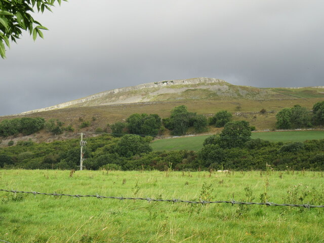
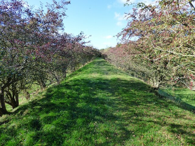
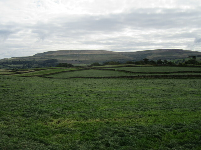
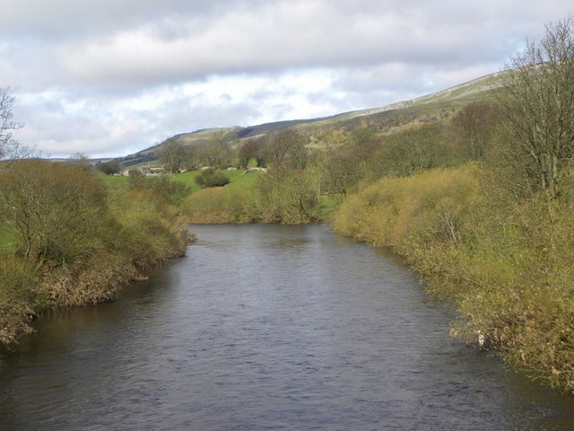
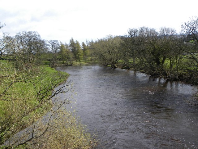
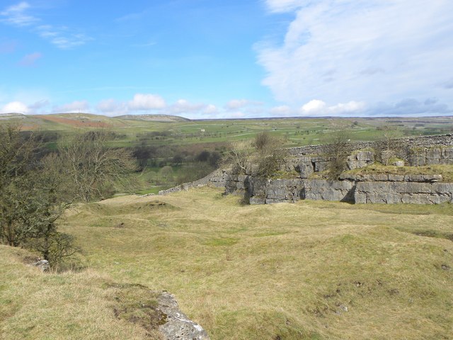
Bear Park Wood is a picturesque woodland located in the county of Yorkshire, England. Covering an area of approximately 100 acres, this enchanting forest is a haven for nature lovers and outdoor enthusiasts alike. Situated near the village of Bear Park, the wood is easily accessible and offers a peaceful retreat from the bustling urban life.

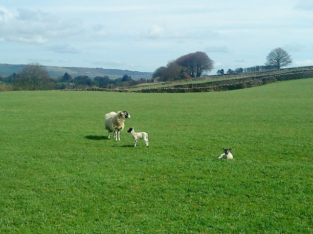
The wood is densely populated with a variety of native tree species, including oak, birch, and beech, creating a vibrant and lush canopy that provides shelter to a diverse range of wildlife. Visitors can expect to encounter an array of birds, such as woodpeckers, owls, and thrushes, as well as small mammals like squirrels, rabbits, and foxes.

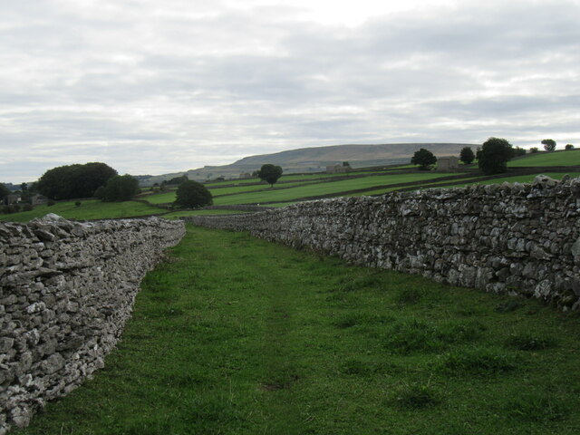
Tranquil walking trails wind their way through the wood, offering visitors the opportunity to explore its beauty at their own pace. These trails are well-maintained and suitable for all levels of fitness, making Bear Park Wood an ideal destination for families, hikers, and nature enthusiasts of all ages.

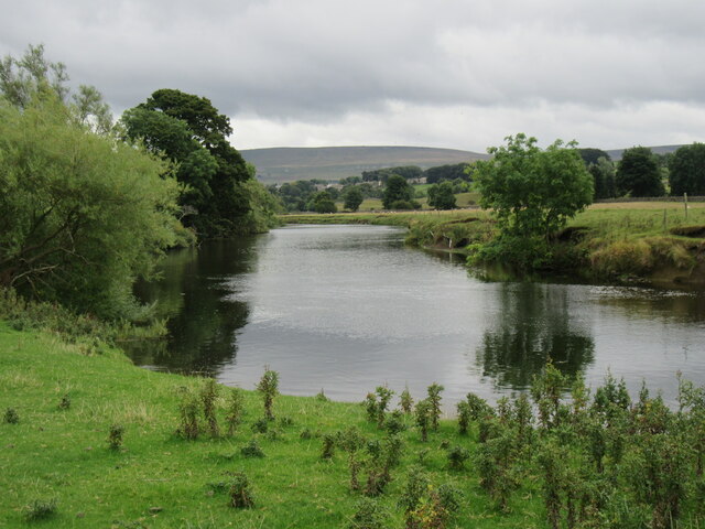
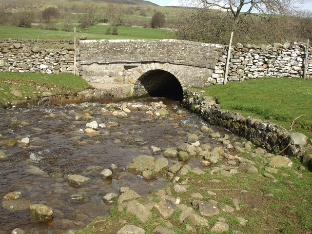
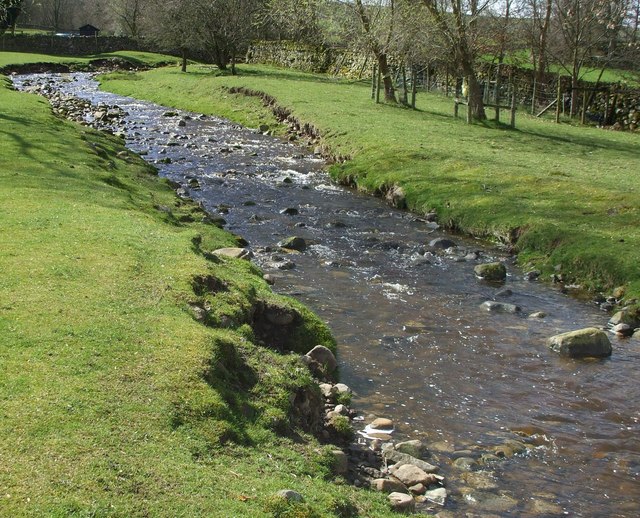
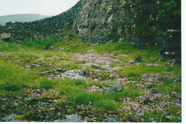
The wood also boasts a small pond, which serves as a watering hole for various species of birds and mammals. This tranquil spot provides a perfect setting for picnics or simply to relax and enjoy the serene surroundings.

Bear Park Wood is not only a natural treasure but also holds historical significance. The wood has been a part of the local landscape for centuries and is believed to have been named after a medieval hunting ground for bears. This rich history adds an extra layer of intrigue to the wood, making it a must-visit destination for history buffs.

In summary, Bear Park Wood is a captivating woodland in Yorkshire, offering visitors a chance to immerse themselves in nature, explore picturesque trails, and discover the area's historical roots.

If you have any feedback on the listing, please let us know in the comments section below.

Bear Park Wood Images

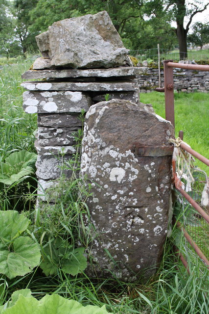
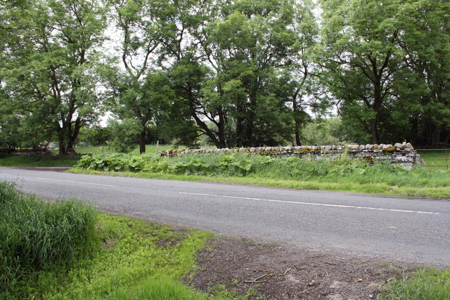
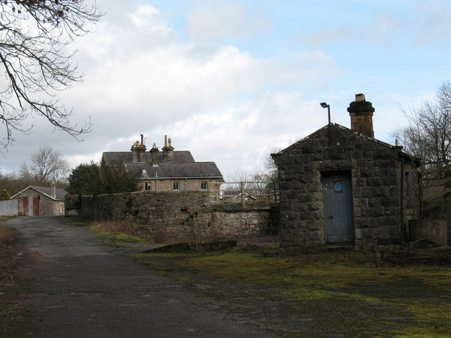
Images are sourced within 2km of 54.293767/-1.9854472 or Grid Reference SE0188. Thanks to Geograph Open Source API. All images are credited.

Looking towards Ivy Scar Looking towards Ivy Scar from The Straights.
Looking towards Ivy Scar
Looking towards Ivy Scar from The Straights.
River Ure near Aysgarth Looking downstream with Penhill in the distance.
River Ure near Aysgarth
Looking downstream with Penhill in the distance.
Footbridge over the River Ure Footbridge over the River Ure near Aysgarth.
Footbridge over the River Ure
Footbridge over the River Ure near Aysgarth.
Footbridge over the River Ure
Disused Wensleydale railway embankment
Limekiln Lane A footpath enclosed by walls near Aysgarth.
Limekiln Lane
A footpath enclosed by walls near Aysgarth.
Folly Lane view Looking east from Folly Lane.
Folly Lane view
Looking east from Folly Lane.
The Gatehouse, Aysgarth On "The Straights" near Ballowfield Bridge (across Eller Beck).
Due South of Mill Hill labelled "Gate House" 1910 and Ballowfield T.P. in 1858 (665 ft ASL). 
The property served the Richmond & Lancaster (Eastern District) Turnpike Trust in the 18ᵗʰ & 19ᵗʰ C.

Milestone Society National ID: YN.AYS
The Gatehouse, Aysgarth
On "The Straights" near Ballowfield Bridge (across Eller Beck). Due South of Mill Hill labelled "Gate House" 1910 and Ballowfield T.P. in 1858 (665 ft ASL). The property served the Richmond & Lancaster (Eastern District) Turnpike Trust in the 18ᵗʰ & 19ᵗʰ C. Milestone Society National ID: YN.AYS
Lowgill Bridge Small stone bridge that allows the A684 to cross over Gill Beck.
Lowgill Bridge
Small stone bridge that allows the A684 to cross over Gill Beck.
Gill Beck Flowing through the pastures at Seata.
Gill Beck
Flowing through the pastures at Seata.
The Ure at Ballowfield Looking upstream from the footbridge near Seata Farm.
The Ure at Ballowfield
Looking upstream from the footbridge near Seata Farm.
The Ure heading for Aysgarth Looking downstream along the Ure from the footbridge near Seata Farm.
The Ure heading for Aysgarth
Looking downstream along the Ure from the footbridge near Seata Farm.
Seata Quarry A general view across this old limestone quarry to the west of Aysgarth. Now a nature reserve with interesting plant species.
Seata Quarry
A general view across this old limestone quarry to the west of Aysgarth. Now a nature reserve with interesting plant species.
Lambs pose in the sunshine Lambs in the pastures above Seata Quarry.
Lambs pose in the sunshine
Lambs in the pastures above Seata Quarry.
Disused Seata Quarry floor with a good cover of Saxifrage in 2002
The small village green
Gatepost with benchmark beside road to Redmire The Ordnance Survey cut mark benchmark is described on the Bench Mark Database at <span class="nowrap"><a title="http://www.bench-marks.org.uk/bm38359" rel="nofollow ugc noopener" href="http://www.bench-marks.org.uk/bm38359">Link</a><img style="margin-left:2px;" alt="External link" title="External link - shift click to open in new window" src="https://s1.geograph.org.uk/img/external.png" width="10" height="10"/></span>
Gatepost with benchmark beside road to Redmire
The Ordnance Survey cut mark benchmark is described on the Bench Mark Database at LinkExternal link
Gateway and minor road junction on road to Redmire The gatepost on LHS of the gateway on RHS of photo has an OS benchmark <a href="https://www.geograph.org.uk/photo/2515931">SE0190 : Gatepost with benchmark beside road to Redmire</a>
Gateway and minor road junction on road to Redmire
The gatepost on LHS of the gateway on RHS of photo has an OS benchmark SE0190 : Gatepost with benchmark beside road to Redmire
Show me another place!

Bear Park Wood is located at Grid Ref: SE0188 (Lat: 54.293767, Lng: -1.9854472)

Division: North Riding

Administrative County: North Yorkshire

District: Richmondshire

Police Authority: North Yorkshire

What 3 Words

///essay.goat.certainly. Near Leyburn, North Yorkshire

Related Wikis

Aysgarth Falls

Aysgarth Falls are a triple flight of waterfalls, surrounded by woodland and farmland, carved out by the River Ure over an almost one-mile (two-kilometre...

St Andrew's Church, Aysgarth

St Andrew's Church, Aysgarth, is a Grade II* listed parish church in the Church of England: 66  in Aysgarth, North Yorkshire. It is located on the south...

Aysgarth railway station

Aysgarth railway station is a disused railway station in North Yorkshire, England, near Aysgarth Falls. It was part of the Hawes Branch of the North Eastern...

Aysgarth

Aysgarth is a village and civil parish in Wensleydale, in North Yorkshire, England. The village is in the Yorkshire Dales National Park, about 16 miles...

Nearby Amenities

Located within 500m of 54.293767,-1.9854472
Cafe
Coppice Cafe
Addr City: Hawes
Addr Postcode: DL8 3TH
Addr Suburb: Aysgarth Falls
Fhrs Id: 1391384
Source Addr: FHRS Open Data
Lat/Long: 54.2945579/-1.9833177
Aysgarth
Historic Railway: station
Railway: site
Wikidata: Q4831709
Wikipedia: en:Aysgarth railway station
Lat/Long: 54.2962231/-1.9817617
Ele: 208
Lat/Long: 54.2967264/-1.9834528
Barrier: stile
Foot: yes
Lat/Long: 54.2978991/-1.9836392
Source: gps survey
Lat/Long: 54.2928287/-1.9828974
Upper Falls
Tourism: viewpoint
Lat/Long: 54.2923505/-1.9861152
Bench
Backrest: yes
Material: wood
Seats: 4
Lat/Long: 54.2942273/-1.9846237
Bench
Backrest: yes
Material: wood
Seats: 4
Lat/Long: 54.2943973/-1.9843115
Middle falls
Source: gps survey
Tourism: viewpoint
Lat/Long: 54.294036/-1.9818752
Bench
Backrest: yes
Material: wood
Seats: 4
Lat/Long: 54.294304/-1.9818269
Bench
Backrest: yes
Material: wood
Seats: 4
Lat/Long: 54.2945628/-1.983999
Bench
Backrest: no
Material: wood
Lat/Long: 54.2944792/-1.9822257
Aysgarth Falls
Place: hamlet
Lat/Long: 54.2908082/-1.9842638
Barrier: stile
Material: stone
Source: survey;gps
Stile: squeezer
Lat/Long: 54.2907862/-1.988044
Barrier: stile
Material: wood
Stile: stepover
Lat/Long: 54.2927097/-1.9801165
Barrier: stile
Material: stone
Stile: squeezer
Lat/Long: 54.2924793/-1.9821865
Barrier: entrance
Source: survey;gps
Lat/Long: 54.2908114/-1.9879149
Barrier: stile
Material: stone
Source: survey;gps
Stile: squeezer
Lat/Long: 54.2908807/-1.9885568
Barrier: stile
Material: stone
Source: survey;gps
Stile: squeezer
Lat/Long: 54.2908913/-1.9870473
Barrier: stile
Material: stone
Source: survey;gps
Stile: squeezer
Lat/Long: 54.2909612/-1.9892042
Barrier: stile
Material: stone
Source: survey;gps
Stile: squeezer
Lat/Long: 54.2911814/-1.9913355
Barrier: stile
Material: stone
Source: survey;gps
Stile: squeezer
Lat/Long: 54.291227/-1.9859198
Barrier: stile
Material: stone
Source: survey;gps
Stile: squeezer
Lat/Long: 54.2918125/-1.9843926
Barrier: stile
Material: stone
Source: survey;gps
Stile: stepover
Lat/Long: 54.2895208/-1.9851483
Post Box
Brand: Royal Mail
Brand Wikidata: Q638098
Brand Wikipedia: en:Royal Mail
Collection Times: Mo-Fr 09:00; Sa 07:00
Operator: Royal Mail
Operator Wikidata: Q638098
Post Box Type: wall
Ref: DL8 140D
Royal Cypher: VR
Royal Cypher Wikidata: Q33102356
Lat/Long: 54.2906543/-1.9838619
Barrier: stile
Material: stone
Source: survey;gps
Stile: squeezer
Lat/Long: 54.2923119/-1.9851348
Barrier: stile
Lat/Long: 54.2962914/-1.9904306
Access: yes
Barrier: entrance
Lat/Long: 54.2978132/-1.9877837
Barrier: stile
Lat/Long: 54.2965234/-1.9910333
Crossing
Lat/Long: 54.2946087/-1.983617
Bicycle Parking
Access: yes
Bicycle Parking: stands
Capacity: 8
Covered: no
Supervised: no
Lat/Long: 54.2946391/-1.9833501
Barrier: kissing_gate
Foot: yes
Lat/Long: 54.2942088/-1.9853318
Charging Station
Sven-Faye
Capacity: 2
Motorcar: yes
Opening Hours: 24/7
Operator: Pod Point
Operator Wikidata: Q42888154
Socket Type2: 2
Lat/Long: 54.2947017/-1.983621
Aysgarth Falls visitor centre
Operator: Yorkshire Dales National Park
Shop: gift
Tourism: attraction
Website: https://www.yorkshiredales.org.uk/places/aysgarth_falls_national_park_centre/
Lat/Long: 54.2945249/-1.9834386
Aysgarth Falls
Information: board
Tourism: information
Lat/Long: 54.2945225/-1.9835144
Barrier: entrance
Lat/Long: 54.2927297/-1.9818185
Entrance: main
Lat/Long: 54.2922981/-1.9832244
Drinking Water
Dog: yes
Lat/Long: 54.2923191/-1.9831848
Entrance: main
Lat/Long: 54.2912619/-1.9838342
Vending Machine
Vending: parking_tickets
Lat/Long: 54.2913174/-1.983794
Historic: memorial
Memorial: war_memorial
Note: War memorial is part of gates!
Lat/Long: 54.2918599/-1.9842695
Aysgarth High Force
Alt Name: Aysgarth Upper Falls
Image: https://www.geograph.org.uk/photo/6422399
Source: Bing imagery
Waterway: waterfall
Lat/Long: 54.2924711/-1.9854975
Aysgarth Middle Force
Alt Name: Aysgarth Middle Falls
Image: https://www.geograph.org.uk/photo/3671274
Source: Bing imagery
Waterway: waterfall
Wikidata: Q1781967
Wikipedia: en:Aysgarth Falls
Lat/Long: 54.2938232/-1.9820935
Aysgarth Falls and Freeholders' Wood
Hiking: yes
Information: map
Tourism: information
Lat/Long: 54.2948391/-1.9832046
Bus Stop
Aysgarth (Palmer Flatts)
Bench: no
Bin: yes
Bus: yes
Departures Board: timetable
Lit: no
Naptan AtcoCode: 3200YNA01869
Naptan NaptanCode: 32001869
Public Transport: platform
Ref: 3200YNA90937
Shelter: yes
Lat/Long: 54.2905966/-1.9835683
Bus Stop
Aysgarth (Palmer Flatts)
Bench: no
Bin: yes
Bus: yes
Departures Board: timetable
Lit: no
Public Transport: platform
Ref: 3200YNA01868
Shelter: no
Lat/Long: 54.2905001/-1.9835738
Bicycle Parking
Bicycle Parking: stands
Capacity: 2
Covered: no
Fee: no
Lat/Long: 54.2905059/-1.9834992
Barrier: entrance
Lat/Long: 54.2980386/-1.9867846
Restaurant
Palmers Restaurant
Website: https://www.aysgarthfallshotel.com/restaurant/
Lat/Long: 54.2905768/-1.9842213
Bar
Aysgarth Falls Bar
Opening Hours: Mo-Su 11:00-23:00
Website: https://www.aysgarthfallshotel.com/the-pub/
Lat/Long: 54.290575/-1.9843525
The data included in this document is from www.openstreetmap.org. The data is made available under ODbL.

Have you been to Bear Park Wood?

Leave your review of Bear Park Wood below (or comments, questions and feedback).