Coldwell Hill Plantation

Wood, Forest in Northumberland

England

Coldwell Hill Plantation

Trig point at Whitehill. The trig point known to the OS as Whitehill lies north-east of the farm at West Whitehill and sits beside a grass covered reservoir within a fenced enclosure.
Trig point at Whitehill. Credit: Trevor Littlewood

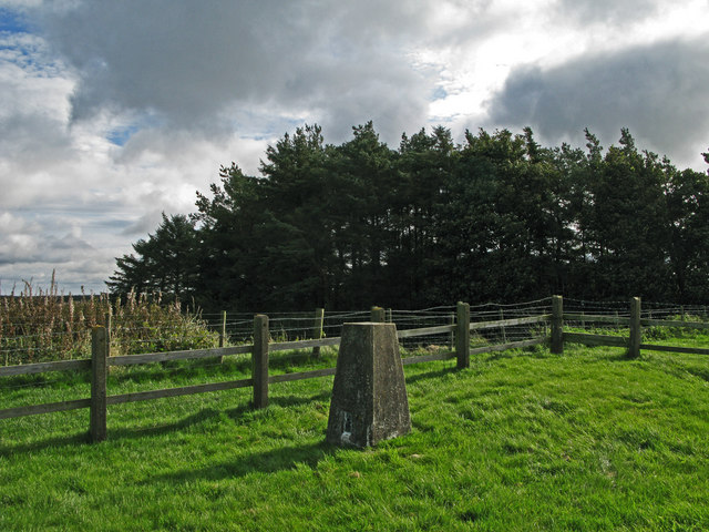
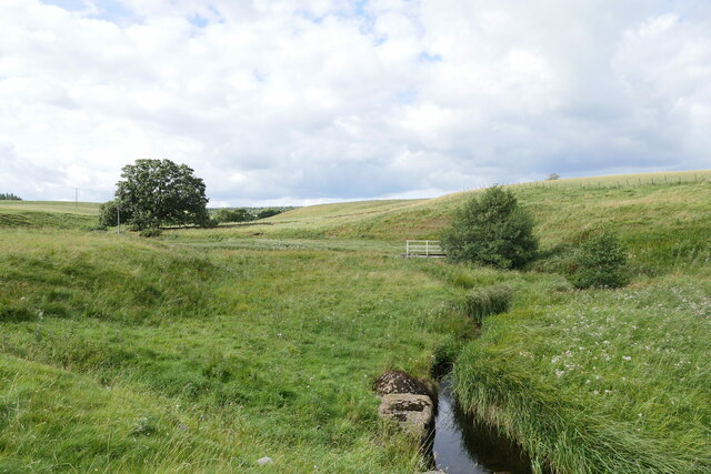
Coldwell Hill Plantation is a sprawling woodland located in Northumberland, England. Spanning over several acres, it is nestled in the heart of the picturesque countryside and is known for its abundant natural beauty.

The plantation is primarily made up of dense woodlands, with towering trees creating a canopy that provides a cool and tranquil atmosphere. The area is home to a diverse range of flora and fauna, including various species of birds, mammals, and plant life. The forest floor is covered in a thick carpet of moss and ferns, adding to the enchanting ambiance.

Coldwell Hill Plantation offers a haven for nature enthusiasts and hikers, with numerous walking trails crisscrossing through the forest. These trails are well-maintained and cater to different levels of difficulty, ensuring that visitors of all ages and abilities can enjoy the plantation’s natural wonders.

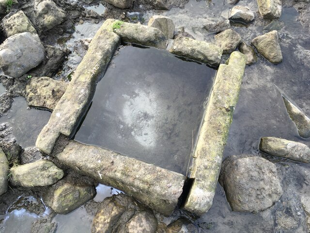
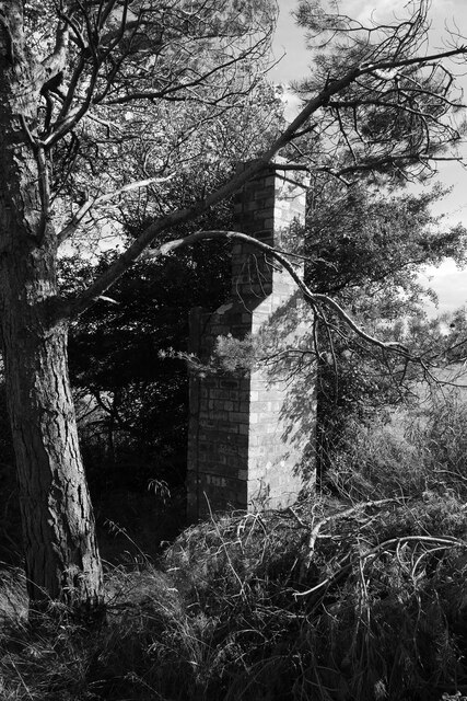
The plantation also boasts a rich history, with remnants of its past still visible today. The estate was once home to a grand manor house, which has since been demolished, but traces of its foundations can still be seen in certain areas. This adds an air of mystery and intrigue to the plantation, inviting visitors to explore and uncover its secrets.

Overall, Coldwell Hill Plantation is a captivating destination that offers a peaceful retreat from the hustle and bustle of everyday life. With its lush greenery, diverse wildlife, and historical significance, it is a must-visit for anyone seeking a connection with nature and a glimpse into the past.

If you have any feedback on the listing, please let us know in the comments section below.

Coldwell Hill Plantation Images

Images are sourced within 2km of 55.176318/-1.9880222 or Grid Reference NZ0086. Thanks to Geograph Open Source API. All images are credited.

Trig point at Whitehill. The trig point known to the OS as Whitehill lies north-east of the farm at West Whitehill and sits beside a grass covered reservoir within a fenced enclosure.
Trig point at Whitehill.
The trig point known to the OS as Whitehill lies north-east of the farm at West Whitehill and sits beside a grass covered reservoir within a fenced enclosure.
Farmland, West Whitehill
Road heading east towards Cambo
Rough grazing near Knowesgate
Jemmy's Well
Jemmy's Well
Jemmy's Well In good condition.  It is well protected with stone slabs and the water looked clean.  I'm sure the sheep appreciate it.  Cambo First School in the background.
Jemmy's Well
In good condition. It is well protected with stone slabs and the water looked clean. I'm sure the sheep appreciate it. Cambo First School in the background.
Holy Well The spring is quite prolific and generates a fair stream.  The water is crystal clear and has no smell. Some considerable thought and effort obviously went into the design of the trough which is now in need of a little care and attention as one of the jointed walls has fallen away somewhat since Andrew Curtis' picture in 2014. <a href="https://www.geograph.org.uk/photo/4028175">NZ0186 : Holy Well near Rugley Walls</a>
Holy Well
The spring is quite prolific and generates a fair stream. The water is crystal clear and has no smell. Some considerable thought and effort obviously went into the design of the trough which is now in need of a little care and attention as one of the jointed walls has fallen away somewhat since Andrew Curtis' picture in 2014. NZ0186 : Holy Well near Rugley Walls
Holy Well Judging by this heavily worn track the local livestock have a fine appreciation of quality water!  The well  lies in the distance amongst the rocks.
Holy Well
Judging by this heavily worn track the local livestock have a fine appreciation of quality water! The well lies in the distance amongst the rocks.
Hart Burn near Low Fairnley A small burn draining both improved pasture and rough grazings.

This photograph was taken during the Coronavirus (COVID-19) pandemic of 2020/21/22.
Hart Burn near Low Fairnley
A small burn draining both improved pasture and rough grazings. This photograph was taken during the Coronavirus (COVID-19) pandemic of 2020/21/22.
A stoney track in the grass Rather obscured in this shot, but the remains of a stone-based track lies within this pasture south of Low Fairnley - perhaps a former cart track?  

This photograph was taken during the Coronavirus (COVID-19) pandemic of 2020/21/22.
A stoney track in the grass
Rather obscured in this shot, but the remains of a stone-based track lies within this pasture south of Low Fairnley - perhaps a former cart track? This photograph was taken during the Coronavirus (COVID-19) pandemic of 2020/21/22.
A shaded style near Chesters A style and footbridge enables the walker to follow the National Trust's 'Wannie Line walk' north-east of Chesters.

This photograph was taken during the Coronavirus (COVID-19) pandemic of 2020/21/22.
A shaded style near Chesters
A style and footbridge enables the walker to follow the National Trust's 'Wannie Line walk' north-east of Chesters. This photograph was taken during the Coronavirus (COVID-19) pandemic of 2020/21/22.
A narrow path in the trees This section of the National Trust's 'Wannie Line walk' east of Chesters follows a narrow right of way at the edge of a small shelterbelt.

This photograph was taken during the Coronavirus (COVID-19) pandemic of 2020/21/22.
A narrow path in the trees
This section of the National Trust's 'Wannie Line walk' east of Chesters follows a narrow right of way at the edge of a small shelterbelt. This photograph was taken during the Coronavirus (COVID-19) pandemic of 2020/21/22.
The remains of a platelayer's hut on the former Wannie Line The brick chimney breast and the remains of some timbers are all that remains of this former platelayer's hut.

This photograph was taken during the Coronavirus (COVID-19) pandemic of 2020/21/22.
The remains of a platelayer's hut on the former Wannie Line
The brick chimney breast and the remains of some timbers are all that remains of this former platelayer's hut. This photograph was taken during the Coronavirus (COVID-19) pandemic of 2020/21/22.
Cambo Burial Ground That's what the sign says --- still plenty of room.
Cambo Burial Ground
That's what the sign says --- still plenty of room.
Cambo First School
Cambo First School
Plantation and Water Resource Marked as a Water Tower on the OS Map.
Plantation and Water Resource
Marked as a Water Tower on the OS Map.
Whinny Plantation and Footpath
Footpath towards Cambo Burial Ground and Cambo
Show me another place!

Coldwell Hill Plantation is located at Grid Ref: NZ0086 (Lat: 55.176318, Lng: -1.9880222)

Unitary Authority: Northumberland

Police Authority: Northumbria

What 3 Words

///control.gamer.upwardly. Near Rothley, Northumberland

Related Wikis

Northumberland

Northumberland ( nor-THUM-bər-lənd) is a ceremonial county in North East England, bordering Scotland. It is bordered by the Scottish Borders to the north...

Cambo, Northumberland

Cambo is a village and former civil parish, now in the parish of Wallington Demesne, in Northumberland, England. It is about 11 miles (18 km) to the west...

Knowesgate railway station

Knowesgate was a stone-built railway station with goods sidings in Northumberland, England on the Wansbeck Railway between Morpeth and Reedsmouth, which...

Kirkwhelpington

Kirkwhelpington is a village and civil parish in the English county of Northumberland about 13 miles (21 km) northeast of Hexham. It is on the River Wansbeck...

Little Harle Tower

Little Harle Tower is a Grade II* listed privately owned country house with 15th-century origins, located at Little Harle, Kirkwhelpington, Northumberland...

Scotsgap railway station

Scotsgap was a stone-built railway station in Northumberland on the Wansbeck Railway, which served the villages of Scots' Gap and Cambo. It was located...

Scots Gap

Scots Gap is a small village in Northumberland, United Kingdom. == Population == Scots Gap has approximately 70 private residential dwellings, the oldest...

West Grange Hall

West Grange Hall is an English country house and estate in the village of Scots Gap, Northumberland, built between 1863 and 1896 and originally part of...

Nearby Amenities

Located within 500m of 55.176318,-1.9880222
The data included in this document is from www.openstreetmap.org. The data is made available under ODbL.

Have you been to Coldwell Hill Plantation?

Leave your review of Coldwell Hill Plantation below (or comments, questions and feedback).