Duke's Plantation

Wood, Forest in Staffordshire Staffordshire Moorlands

England

Duke's Plantation

Bridge 52, Caldon Canal Bridge 52 carries the towpath across the canal, changing from the left to the right hand side.
Bridge 52, Caldon Canal Credit: Stephen McKay

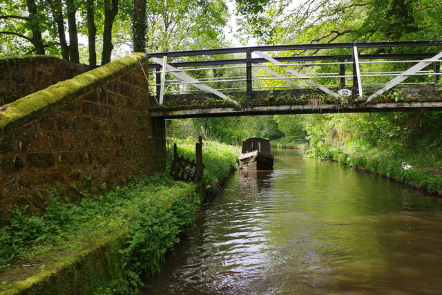
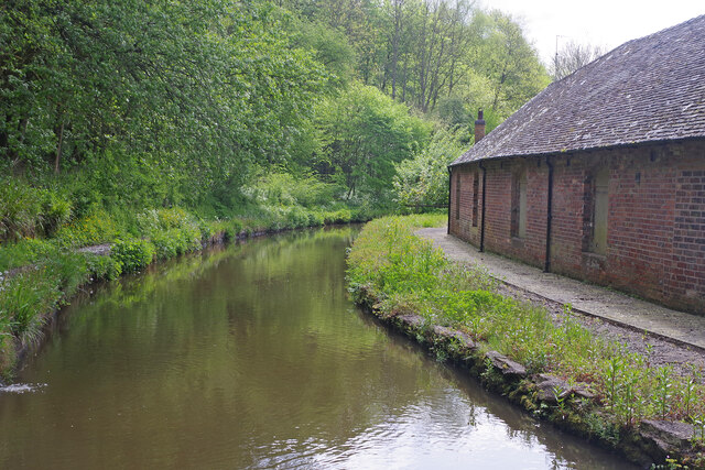
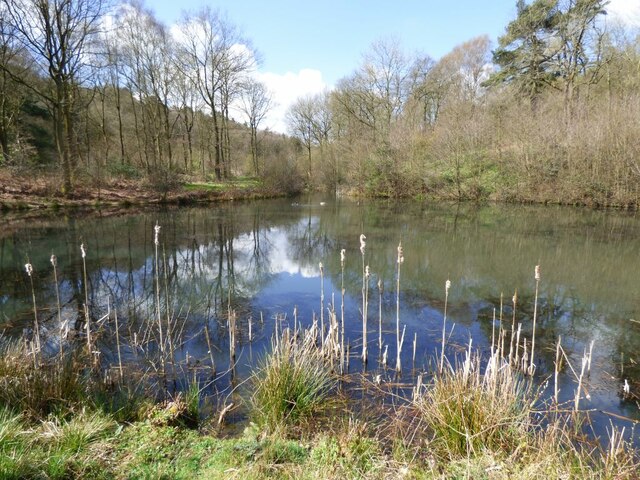
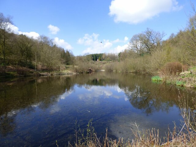
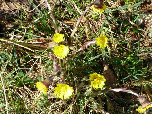
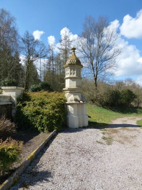
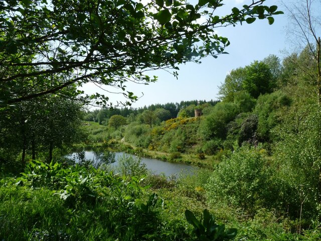
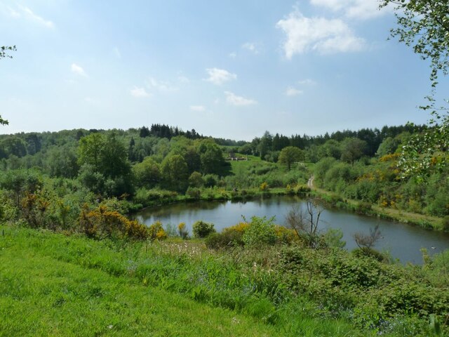
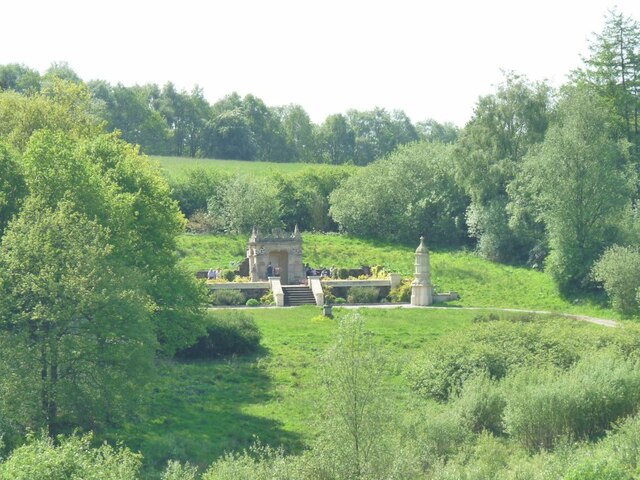
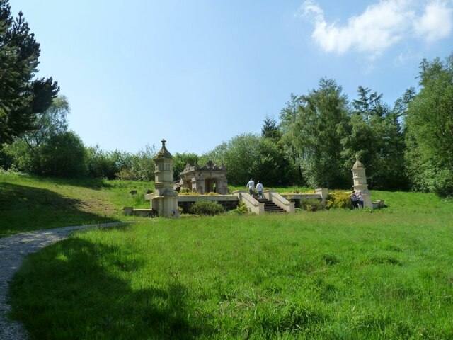
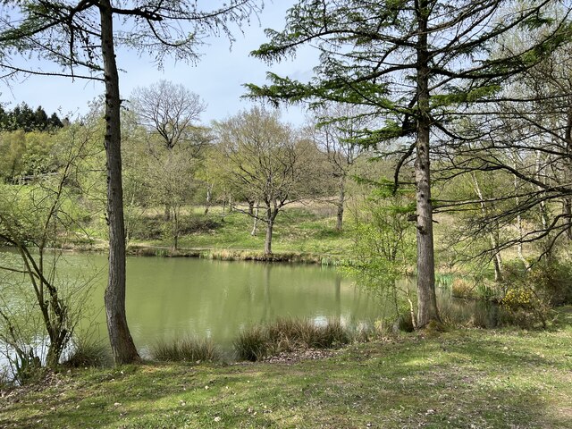
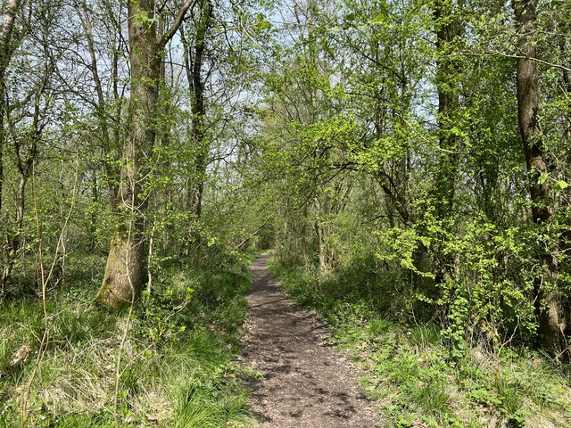
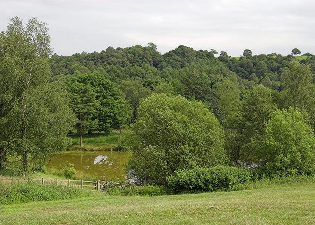
Duke's Plantation is a sprawling woodland area located in Staffordshire, England. Covering an extensive area of land, it is a popular destination for nature enthusiasts and outdoor adventurers. The plantation is characterized by its dense forest, encompassing a wide variety of tree species and offering a picturesque landscape for visitors to explore.

The woodland is named after the Duke family, who once owned and managed the plantation. Over the years, it has been carefully maintained to preserve its natural beauty and ecological diversity. The forest is home to an array of wildlife, including various bird species, small mammals, and insects.

Duke's Plantation offers a range of activities for visitors to enjoy. There are numerous walking trails that wind through the forest, providing opportunities for peaceful strolls and hikes. The plantation also features designated picnic areas, where families and friends can gather to enjoy a meal surrounded by the tranquility of nature.

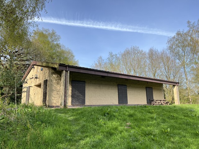
For those seeking more adventurous pursuits, Duke's Plantation offers mountain biking trails, providing an exhilarating experience for cycling enthusiasts. The rugged terrain and varying difficulty levels make it suitable for riders of all skill levels. Additionally, the plantation hosts regular events and workshops, such as guided nature walks and educational sessions on wildlife conservation.

Duke's Plantation is a cherished natural gem in Staffordshire, offering a serene and captivating experience for nature lovers. Its well-preserved forest and diverse range of activities make it a must-visit destination for anyone looking to connect with the beauty of the great outdoors.

If you have any feedback on the listing, please let us know in the comments section below.

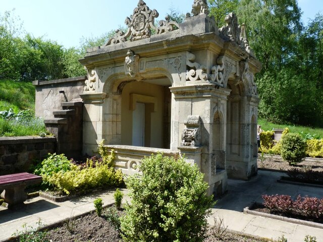
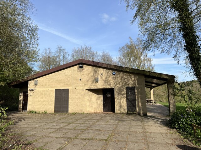
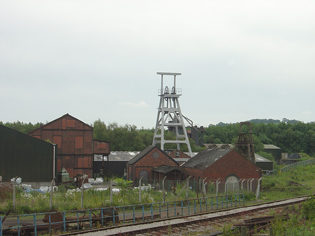
Duke's Plantation Images

Images are sourced within 2km of 53.016746/-2.0048183 or Grid Reference SJ9946. Thanks to Geograph Open Source API. All images are credited.

Bridge 52, Caldon Canal Bridge 52 carries the towpath across the canal, changing from the left to the right hand side.
Bridge 52, Caldon Canal
Bridge 52 carries the towpath across the canal, changing from the left to the right hand side.
Caldon Canal below Flint Mill Lock The canal curls round towards Froghall on the final stretch from Etruria. The building on the right is part of Consall Flint Mill, built in the 1830s to supply ground flint for use in the Potteries ceramic industry. The mill ceased production around 1970.
Caldon Canal below Flint Mill Lock
The canal curls round towards Froghall on the final stretch from Etruria. The building on the right is part of Consall Flint Mill, built in the 1830s to supply ground flint for use in the Potteries ceramic industry. The mill ceased production around 1970.
One of the lakes at Consall Hall There are six lakes in the grounds.
One of the lakes at Consall Hall
There are six lakes in the grounds.
Across the lake to the Viewing tower On one of the high points of the estate is a viewing tower.
Across the lake to the Viewing tower
On one of the high points of the estate is a viewing tower.
Tussilago farfara, Coltsfoot Coltsfoot, is a plant in the groundsel tribe in the daisy family. It was used to get rid if coughs.
Tussilago farfara, Coltsfoot
Coltsfoot, is a plant in the groundsel tribe in the daisy family. It was used to get rid if coughs.
Detail of one of the Follies at Consall Hall The owner bought and had re-erected various buildings from elsewhere.
Detail of one of the Follies at Consall Hall
The owner bought and had re-erected various buildings from elsewhere.
View across the Dingle to the Lookout The look out is a tower on the high land above the pool.
View across the Dingle to the Lookout
The look out is a tower on the high land above the pool.
View across Quarry pool to another of the estate's follies The previous owner Mr. Podmore added many follies to the estate.
View across Quarry pool to another of the estate's follies
The previous owner Mr. Podmore added many follies to the estate.
View of the Folly Mr. Podmore rescued this building when it was in danger of being demolished.
View of the Folly
Mr. Podmore rescued this building when it was in danger of being demolished.
The Folly at Consall Hall
Detail of the Folly There  are towers like this on either side of the folly
Detail of the Folly
There are towers like this on either side of the folly
The steps up to the Folly Delightful flower beds in the small courtyard of the folly.
The steps up to the Folly
Delightful flower beds in the small courtyard of the folly.
A highly decorated building Flowerbeds in the courtyard outside the folly.
A highly decorated building
Flowerbeds in the courtyard outside the folly.
Lake at Consall Woods RSPB reserve Consall Woods is an RSPB Nature Reserve in Staffordshire. 194ha in area, the site was formally an industrial valley, now occupied by mixed woodland and various water features. Link to RSPB website: <span class="nowrap"><a title="https://www.rspb.org.uk/reserves-and-events/reserves-a-z/consall-woods/" rel="nofollow ugc noopener" href="https://www.rspb.org.uk/reserves-and-events/reserves-a-z/consall-woods/">Link</a><img style="margin-left:2px;" alt="External link" title="External link - shift click to open in new window" src="https://s1.geograph.org.uk/img/external.png" width="10" height="10"/></span>
Lake at Consall Woods RSPB reserve
Consall Woods is an RSPB Nature Reserve in Staffordshire. 194ha in area, the site was formally an industrial valley, now occupied by mixed woodland and various water features. Link to RSPB website: LinkExternal link
Path at Consall Woods RSPB reserve Consall Woods is an RSPB Nature Reserve in Staffordshire. 194ha in area, the site was formally an industrial valley, now occupied by mixed woodland and various water features. Link to RSPB website: <span class="nowrap"><a title="https://www.rspb.org.uk/reserves-and-events/reserves-a-z/consall-woods/" rel="nofollow ugc noopener" href="https://www.rspb.org.uk/reserves-and-events/reserves-a-z/consall-woods/">Link</a><img style="margin-left:2px;" alt="External link" title="External link - shift click to open in new window" src="https://s1.geograph.org.uk/img/external.png" width="10" height="10"/></span>
Path at Consall Woods RSPB reserve
Consall Woods is an RSPB Nature Reserve in Staffordshire. 194ha in area, the site was formally an industrial valley, now occupied by mixed woodland and various water features. Link to RSPB website: LinkExternal link
Closed visitor centre at RSPB Consall Woods The visitor centre has been closed for several years. Consall Woods reserve was formerly managed by Staffordshire County Council before the RSPB took it over in September 2019. At that time it was stated there were no plans to reopen the visitor centre.
Closed visitor centre at RSPB Consall Woods
The visitor centre has been closed for several years. Consall Woods reserve was formerly managed by Staffordshire County Council before the RSPB took it over in September 2019. At that time it was stated there were no plans to reopen the visitor centre.
Consall Nature Park A very well hidden nature reserve and park near Consall
Consall Nature Park
A very well hidden nature reserve and park near Consall
Show me another place!

Duke's Plantation is located at Grid Ref: SJ9946 (Lat: 53.016746, Lng: -2.0048183)

Administrative County: Staffordshire

District: Staffordshire Moorlands

Police Authority: Staffordshire

What 3 Words

///louder.manage.pickup. Near Cheadle, Staffordshire

Related Wikis

Kingsley, Staffordshire

Kingsley is a small village in the Staffordshire Moorlands near to Cheadle, and situated on the A52 from Stoke on Trent to Ashbourne. The civil parish...

Cheadle Coalfield

The Cheadle Coalfield is a coalfield in the United Kingdom. Centred on the town of Cheadle, Staffordshire and its outlying villages it lies to the east...

Consall railway station

Consall railway station is a former passenger railway station of the North Staffordshire Railway (NSR) and is now a preserved station on the Churnet Valley...

Consall

Consall is a small village situated in the Staffordshire Moorlands, Staffordshire, England. It is approximately 6 miles south of the market town of Leek...

Froghall

Froghall is a village situated approximately ten miles to the east of Stoke-on-Trent and two miles north of Cheadle in Staffordshire, England. Population...

Kingsley and Froghall railway station

Kingsley and Froghall is a former railway station of the North Staffordshire Railway (NSR) that is now preserved on the Churnet Valley Railway in Staffordshire...

Uttoxeter Canal

The Uttoxeter Canal was a thirteen-mile extension of the Caldon Canal running from Froghall as far as Uttoxeter in Staffordshire, England. It was authorised...

Cheadle Rural District

Cheadle Rural District was a rural district in the administrative county of Staffordshire, England from 1894 to 1974, covering an area in the north of...

Nearby Amenities

Located within 500m of 53.016746,-2.0048183
Bus Stop
Hollins Lane
Bus: yes
Naptan AtcoCode: 3800C838701
Naptan Bearing: NE
Naptan CommonName: Hollins Lane
Naptan Indicator: Adj
Naptan Landmark: Hollins Ln
Naptan PlusbusZoneRef: STOKEOT
Naptan Street: Kingsley Road (A52)
Naptan Verified: no
Public Transport: platform
Source: naptan_import
Lat/Long: 53.0188304/-2.0087208
Bus Stop
Hollins Lane
Bus: yes
Naptan AtcoCode: 3800C838702
Naptan Bearing: SW
Naptan CommonName: Hollins Lane
Naptan Indicator: opp
Naptan PlusbusZoneRef: STOKEOT
Naptan Street: Kingsley Road (A52)
Naptan Verified: no
Public Transport: platform
Source: naptan_import
Lat/Long: 53.0186506/-2.0088401
Fixme: stile, gate or entramce?
Lat/Long: 53.0168459/-1.9973879
The data included in this document is from www.openstreetmap.org. The data is made available under ODbL.

Have you been to Duke's Plantation?

Leave your review of Duke's Plantation below (or comments, questions and feedback).