Hart's Copse

Wood, Forest in Dorset

England

Hart's Copse

Wimborne First School On School Lane, in a building dated 1911.
Wimborne First School Credit: Mike Faherty

Hart's Copse is a picturesque woodland area located in the county of Dorset, England. Covering an area of approximately 50 acres, it is renowned for its natural beauty and diverse wildlife. The copse is situated near the village of Hartland, surrounded by rolling hills and charming countryside.

The woodland itself is predominantly comprised of native broadleaf trees, such as oak, beech, and ash, which create a dense canopy overhead. These trees provide ample shade during the summer months and display vibrant autumnal colors in the fall. The forest floor is covered with a rich carpet of mosses, ferns, and wildflowers, adding to its enchanting atmosphere.

Hart's Copse is home to a wide range of wildlife species, including various mammals, birds, and insects. Visitors may spot roe deer, foxes, and badgers roaming the woodland, while birdwatchers can observe woodpeckers, owls, and numerous songbirds. The copse also serves as a habitat for butterflies, bees, and other pollinators, contributing to the local ecosystem.

The copse is a popular destination for nature enthusiasts and walkers who can enjoy the tranquil surroundings while exploring the network of walking trails. These paths wind through the woodland, offering glimpses of hidden clearings, babbling brooks, and small ponds. There are also designated picnic areas where visitors can relax and take in the peaceful ambiance.

Hart's Copse is managed and maintained by the local authorities, ensuring the preservation of its natural habitat for future generations to enjoy. The copse's serene atmosphere, coupled with its abundant flora and fauna, make it a haven of tranquility and a must-visit destination for nature lovers in Dorset.

If you have any feedback on the listing, please let us know in the comments section below.
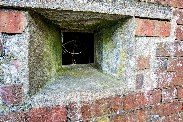
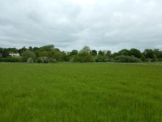
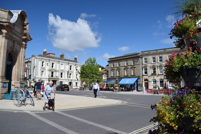
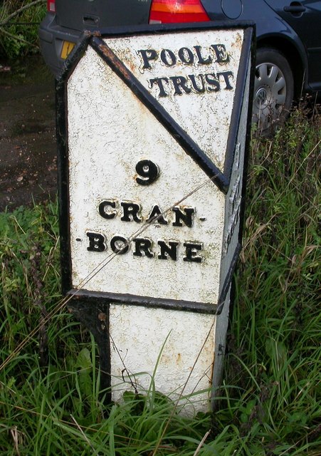
Hart's Copse Images

Images are sourced within 2km of 50.806619/-2.0087188 or Grid Reference ST9900. Thanks to Geograph Open Source API. All images are credited.

Wimborne First School On School Lane, in a building dated 1911.
Wimborne First School
On School Lane, in a building dated 1911.
Wimborne, play area On Redcotts Recreation Ground, at the end of School Lane.
Wimborne, play area
On Redcotts Recreation Ground, at the end of School Lane.
Wimborne, Taphouse The latest addition to Wimborne's pub scene, opened in 2013 on West Borough. Straight bar to right, drinking front, left and back; simple decor with bare brick and wooden panelling, background music. Cask ales on offer at my visit: six, served on gravity, including two from the local Six Arch Brewery. <span class="nowrap"><a title="http://whatpub.com/pubs/SED/72/taphouse-wimborne" rel="nofollow ugc noopener" href="http://whatpub.com/pubs/SED/72/taphouse-wimborne">Link</a><img style="margin-left:2px;" alt="External link" title="External link - shift click to open in new window" src="https://s1.geograph.org.uk/img/external.png" width="10" height="10"/></span>
Wimborne, Taphouse
The latest addition to Wimborne's pub scene, opened in 2013 on West Borough. Straight bar to right, drinking front, left and back; simple decor with bare brick and wooden panelling, background music. Cask ales on offer at my visit: six, served on gravity, including two from the local Six Arch Brewery. LinkExternal link
Defending Dorset in 1940: Wimborne Anti-tank Island (1) -
Loopholed wall: DoB ID: e25267

Wimborne - West Borough - Loopholed Wall.  The only surviving structure in Wimborne of the town's defences when it was designated an anti-tank island in 1940. This loopholed wall between two properties in West Borough was built to bring fire to bear on the approach road from the crossing of the River Allen to the north. The house directly opposite (the Old Saddlery) on the other side of the road was also requisitioned at the time, and handed over to the Home Guard to be used as a defended house. The second floor with its tiny north-facing window overlooking the street, may have served as a discreet observation post.

<a href="https://www.geograph.org.uk/photo/4842582">SU0000 : Defending Dorset in 1940: Wimborne Anti-tank Island (2)</a>
Defending Dorset in 1940: Wimborne Anti-tank Island (1)
- Loopholed wall: DoB ID: e25267 Wimborne - West Borough - Loopholed Wall. The only surviving structure in Wimborne of the town's defences when it was designated an anti-tank island in 1940. This loopholed wall between two properties in West Borough was built to bring fire to bear on the approach road from the crossing of the River Allen to the north. The house directly opposite (the Old Saddlery) on the other side of the road was also requisitioned at the time, and handed over to the Home Guard to be used as a defended house. The second floor with its tiny north-facing window overlooking the street, may have served as a discreet observation post. SU0000 : Defending Dorset in 1940: Wimborne Anti-tank Island (2)
Defending Dorset in 1940: Wimborne Anti-tank Island (2) -
Loopholed wall: DoB ID: e25267

Wimborne - West Borough - Loopholed Wall.  A close-up of one of the three gunloops. Note that the construction of the aperture has been angled to the left of the photo and towards the direction of the perceived threat - the street outside.

<a href="https://www.geograph.org.uk/photo/4842581">SU0000 : Defending Dorset in 1940: Wimborne Anti-tank Island (1)</a>
Defending Dorset in 1940: Wimborne Anti-tank Island (2)
- Loopholed wall: DoB ID: e25267 Wimborne - West Borough - Loopholed Wall. A close-up of one of the three gunloops. Note that the construction of the aperture has been angled to the left of the photo and towards the direction of the perceived threat - the street outside. SU0000 : Defending Dorset in 1940: Wimborne Anti-tank Island (1)
Netherwood Mead towards the River Stour
The Square, Wimborne View across The Square towards The King's Head.
The Square, Wimborne
View across The Square towards The King's Head.
Old Milepost by the B3078, south west of Furzehill Cast iron post by the B3078, in parish of COLEHILL (EAST DORSET District), Wimborne, 150m South of turning to Furzehill, on grass verge by second lay-by, on West side of road. Poole cast iron post, erected by the Poole turnpike trust in the 19th century. 

Inscription reads:-
: 9 / CRAN- / -BORNE : : POOLE / TRUST : : 1 / WIM- / -BORNE :  

Milestone Society National ID: DO_CBWB09.
Old Milepost by the B3078, south west of Furzehill
Cast iron post by the B3078, in parish of COLEHILL (EAST DORSET District), Wimborne, 150m South of turning to Furzehill, on grass verge by second lay-by, on West side of road. Poole cast iron post, erected by the Poole turnpike trust in the 19th century. Inscription reads:- : 9 / CRAN- / -BORNE : : POOLE / TRUST : : 1 / WIM- / -BORNE : Milestone Society National ID: DO_CBWB09.
Isaac Gulliver's house, Wimborne Gulliver was a notorious smuggler based on the south coast of England during the 18th and 19th centuries.
Isaac Gulliver's house, Wimborne
Gulliver was a notorious smuggler based on the south coast of England during the 18th and 19th centuries.
Meadows Beside the River Allen The river is in the trees on the right. This picture is take from just east of Fitches bridge where the lane from Wimborne crosses the river.
Meadows Beside the River Allen
The river is in the trees on the right. This picture is take from just east of Fitches bridge where the lane from Wimborne crosses the river.
Wimborne Minster: ...but not close enough Pictured about 10 minutes after kick-off of the World Cup semi-final between England and Croatia, which England would lose 2-1 after extra time.

Three Lions Close is a modern development of infill housing around the back of the pub on the corner of West Street and Victoria Road, currently called the Minster Arms. The name has nothing to do with the England football team: the pub was previously known as the Pudding and Pye, before that the Pye Corner (the name of the junction), and originally the Three Lions, hence the name of the close.

See <a href="https://www.geograph.org.uk/photo/2785664">SU0000 : Wimborne, The Pudding and Pye</a> for the pub in its Pudding & Pye guise (in 2012), and
<a href="https://www.geograph.org.uk/photo/334906">SU0000 : Pye Corner</a> when it was the Pye Corner (2007).
Wimborne Minster: ...but not close enough
Pictured about 10 minutes after kick-off of the World Cup semi-final between England and Croatia, which England would lose 2-1 after extra time. Three Lions Close is a modern development of infill housing around the back of the pub on the corner of West Street and Victoria Road, currently called the Minster Arms. The name has nothing to do with the England football team: the pub was previously known as the Pudding and Pye, before that the Pye Corner (the name of the junction), and originally the Three Lions, hence the name of the close. See SU0000 : Wimborne, The Pudding and Pye for the pub in its Pudding & Pye guise (in 2012), and SU0000 : Pye Corner when it was the Pye Corner (2007).
Hanham Road, Wimborne Minster
B3078 West Borough, Wimborne Minster Heading north out of town.
B3078 West Borough, Wimborne Minster
Heading north out of town.
Old Bridge Marker by the B3078, Walford Bridge, Wimborne Minster Parish Bridge Weight Plate by the B3078, in parish of Wimborne Minster (East Dorset District), Walford Bridge, South West corner of bridge parapet.

'Lost'

Inscription reads:-
COUNTY COUNCIL OF DORSET.
TAKE NOTICE THAT THIS BRIDGE
(WHICH IS A COUNTY BRIDGE) IS INSUFFICIENT
TO CARRY WEIGHTS BEYOND THE ORDINARY
TRAFFIC OF THE DISTRICT; AND THAT THE
OWNERS AND PERSONS IN CHARGE OF
LOCOMOTIVE TRACTION ENGINES AND OTHER
PONDEROUS CARRIAGES ARE WARNED AGAINST
USING THE BRIDGE FOR THE PASSAGE OF
ANY SUCH ENGINE OR CARRIAGE.
E. ARCHDALL FFOOKS
CLERK OF THE COUNTY COUNCIL OF DORSET

Walford Bridge is Grade II* Listed.
List Entry Number: 1119538 <span class="nowrap"><a title="https://historicengland.org.uk/listing/the-list/list-entry/1119538" rel="nofollow ugc noopener" href="https://historicengland.org.uk/listing/the-list/list-entry/1119538">Link</a><img style="margin-left:2px;" alt="External link" title="External link - shift click to open in new window" src="https://s1.geograph.org.uk/img/external.png" width="10" height="10"/></span>

Surveyed

Milestone Society National ID: DO_WEIWIWbbr
Old Bridge Marker by the B3078, Walford Bridge, Wimborne Minster Parish
Bridge Weight Plate by the B3078, in parish of Wimborne Minster (East Dorset District), Walford Bridge, South West corner of bridge parapet. 'Lost' Inscription reads:- COUNTY COUNCIL OF DORSET. TAKE NOTICE THAT THIS BRIDGE (WHICH IS A COUNTY BRIDGE) IS INSUFFICIENT TO CARRY WEIGHTS BEYOND THE ORDINARY TRAFFIC OF THE DISTRICT; AND THAT THE OWNERS AND PERSONS IN CHARGE OF LOCOMOTIVE TRACTION ENGINES AND OTHER PONDEROUS CARRIAGES ARE WARNED AGAINST USING THE BRIDGE FOR THE PASSAGE OF ANY SUCH ENGINE OR CARRIAGE. E. ARCHDALL FFOOKS CLERK OF THE COUNTY COUNCIL OF DORSET Walford Bridge is Grade II* Listed. List Entry Number: 1119538 LinkExternal link Surveyed Milestone Society National ID: DO_WEIWIWbbr
Old Bridge Marker by the B3078, Walford Bridge, Wimborne Minster Bridge Weight Plate by the B3078, in parish of Wimborne Minster (East Dorset District), Walford Bridge, on East parapet, mid bridge, visible from road or by leaning over parapet from footpath. Partly buried in tarmac.

Inscription reads:-
NOTICE
TO OWNERS AND DRIVERS
OF TRACTION ENGINES
THIS BRIDGE IS INSUFFICIENT
TO CARRY WEIGHTS BEYOND
THE ORDINARY TRAFFIC OF
THE DISTRICT

Walford Bridge is Grade II* listed.
List Entry Number: 1119538 <span class="nowrap"><a title="https://historicengland.org.uk/listing/the-list/list-entry/1119538" rel="nofollow ugc noopener" href="https://historicengland.org.uk/listing/the-list/list-entry/1119538">Link</a><img style="margin-left:2px;" alt="External link" title="External link - shift click to open in new window" src="https://s1.geograph.org.uk/img/external.png" width="10" height="10"/></span>

Surveyed

Milestone Society National ID: DO_WEIWIWabr
Old Bridge Marker by the B3078, Walford Bridge, Wimborne Minster
Bridge Weight Plate by the B3078, in parish of Wimborne Minster (East Dorset District), Walford Bridge, on East parapet, mid bridge, visible from road or by leaning over parapet from footpath. Partly buried in tarmac. Inscription reads:- NOTICE TO OWNERS AND DRIVERS OF TRACTION ENGINES THIS BRIDGE IS INSUFFICIENT TO CARRY WEIGHTS BEYOND THE ORDINARY TRAFFIC OF THE DISTRICT Walford Bridge is Grade II* listed. List Entry Number: 1119538 LinkExternal link Surveyed Milestone Society National ID: DO_WEIWIWabr
The Albion Inn, 19 High Street, Wimborne Minster Grade II Listed 18th century inn. A plaque on the wall reads 'THE ALBION INN Town's oldest surviving licensed house. Formerly THE NEW INN, a 17th century coaching halt. In 1834 the Tolpuddle Martyrs stopped here en route to transportation to Australia as convicts.' It has housed the magistrates’ court, a school house and reputedly was once a place of refreshment for King George III as he travelled to Weymouth. The 1777 refers to the establishment of Hall and Woodhouse Brewery. Searching my directories produces a confused picture. In 1842-1844 we have Edward White Bowles (& posting house), New Inn, High Street. In the 1850s two New Inns are listed, interestingly under 'Taverns & Public Houses' not 'Inns'. One is at 'Hill butts' that I'm ignoring but otherwise; 1851 Winter Lamiman, New Inn, Stocks; 1852 not listed with just the 'Bell' and 'Greyhound' in High Street; 1855 C Bagg, New Inn, Holt. By 1859 it is listed again in High Street and by 1889 as the Albion; 1859 Henry Braine, New Inn; 1889 Tom Coombs, Albion; 1895 Albion no victualler given; 1911-1915 Mrs A M Meek, Albion. Was the New Inn, apparently in a location named 'Holt' or 'Stocks', another pub and this one closed? I can't locate a Holt or Stocks on the Wimborne maps I have access to.
The Albion Inn, 19 High Street, Wimborne Minster
Grade II Listed 18th century inn. A plaque on the wall reads 'THE ALBION INN Town's oldest surviving licensed house. Formerly THE NEW INN, a 17th century coaching halt. In 1834 the Tolpuddle Martyrs stopped here en route to transportation to Australia as convicts.' It has housed the magistrates’ court, a school house and reputedly was once a place of refreshment for King George III as he travelled to Weymouth. The 1777 refers to the establishment of Hall and Woodhouse Brewery. Searching my directories produces a confused picture. In 1842-1844 we have Edward White Bowles (& posting house), New Inn, High Street. In the 1850s two New Inns are listed, interestingly under 'Taverns & Public Houses' not 'Inns'. One is at 'Hill butts' that I'm ignoring but otherwise; 1851 Winter Lamiman, New Inn, Stocks; 1852 not listed with just the 'Bell' and 'Greyhound' in High Street; 1855 C Bagg, New Inn, Holt. By 1859 it is listed again in High Street and by 1889 as the Albion; 1859 Henry Braine, New Inn; 1889 Tom Coombs, Albion; 1895 Albion no victualler given; 1911-1915 Mrs A M Meek, Albion. Was the New Inn, apparently in a location named 'Holt' or 'Stocks', another pub and this one closed? I can't locate a Holt or Stocks on the Wimborne maps I have access to.
Old Toll House by West Borough, Wimborne Minster Toll House by the B3078, in the parish of Wimborne Minster (East Dorset District), Nos. 46-49, (GR II listed as No.63) West Borough. The centre section with the bay windows is believed to have been the toll house.

Grade II listed.
List Entry Number: 1304037 <span class="nowrap"><a title="https://historicengland.org.uk/listing/the-list/list-entry/1304037" rel="nofollow ugc noopener" href="https://historicengland.org.uk/listing/the-list/list-entry/1304037">Link</a><img style="margin-left:2px;" alt="External link" title="External link - shift click to open in new window" src="https://s1.geograph.org.uk/img/external.png" width="10" height="10"/></span>

Surveyed

Milestone Society National ID: DO.WIM02
Old Toll House by West Borough, Wimborne Minster
Toll House by the B3078, in the parish of Wimborne Minster (East Dorset District), Nos. 46-49, (GR II listed as No.63) West Borough. The centre section with the bay windows is believed to have been the toll house. Grade II listed. List Entry Number: 1304037 LinkExternal link Surveyed Milestone Society National ID: DO.WIM02
The Square, Wimborne Minster
Show me another place!

Hart's Copse is located at Grid Ref: ST9900 (Lat: 50.806619, Lng: -2.0087188)

Unitary Authority: Dorset

Police Authority: Dorset

What 3 Words

///trailer.hulk.reinvest. Near Wimborne Minster, Dorset

Related Wikis

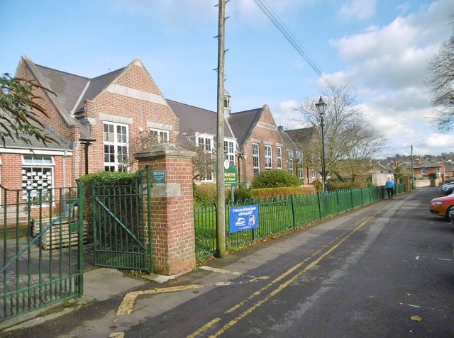
Queen Elizabeth's School, Wimborne Minster

Queen Elizabeth's School (also known as QE) is a co-educational secondary school in Wimborne Minster, Dorset, England. == Introduction == QE is an upper...
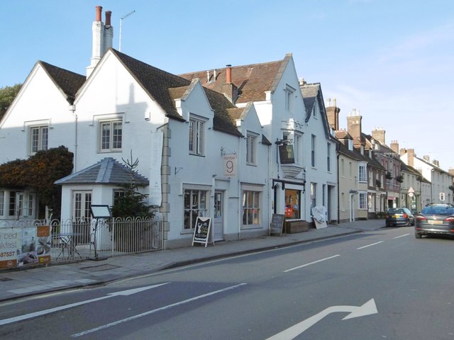
The Vine, Pamphill

The Vine Inn is a public house at Vine Hill, Pamphill, Dorset BH21 4EE. It is on the Campaign for Real Ale's National Inventory of Historic Pub Interiors...

St Stephen's Church, Pamphill

St Stephen's is the parish church of Pamphill in Dorset, England.The current church lies on the site of a former church dating from 1229. The current church...

Pamphill

Pamphill is a village in south-east Dorset, England, just outside Wimborne Minster, four miles north of Poole. The village has a population of 704 (2001...

Wimborne Town F.C.

Wimborne Town Football Club is a football club based in Wimborne Minster in Dorset, England. They were established in 1878 and won the FA Vase in 1992...

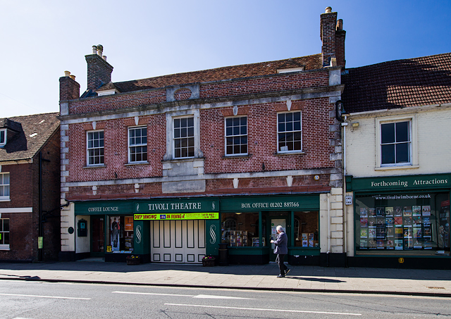
Tivoli Theatre (Wimborne Minster)

The Tivoli Theatre in Wimborne Minster, Dorset, England, was built in 1936 as a theatre and cinema. It has a variety of Art Deco features, including original...

Wimborne Model Town

Wimborne Model Town, situated on the edge of the town of Wimborne Minster, Dorset, England, is one of the largest and most established model towns in England...

Wimborne Minster astronomical clock

Wimborne Minster astronomical clock is a fourteenth-century astronomical clock in Wimborne Minster in Dorset, regarded as "one of the most ancient working...

Nearby Amenities

Located within 500m of 50.806619,-2.0087188
Pub
Vine Inn
Addr Postcode: BH21 4EE
Fhrs Id: 340827
Phone: +44 1202 882259
Source Addr Postcode: FHRS Open Data
Wikidata: Q18162967
Lat/Long: 50.802517/-2.0089604
Cafe
Pamphill Dairy
Lat/Long: 50.8084087/-2.0151824
Post Box
Note: There seems to be an old PO here.
Post Box Type: lamp
Ref: BH21 69
Ref GB Uprn: 10015393175
Royal Cypher: EIIR
Royal Cypher Wikidata: Q33102113
Lat/Long: 50.8087133/-2.0120326
Traffic Signals
Lat/Long: 50.8065201/-2.0021638
Power: tower
Source: Bing
Lat/Long: 50.8033648/-2.0099486
Power: tower
Source: Bing
Lat/Long: 50.8073723/-2.0068607
Power: tower
Source: Bing
Lat/Long: 50.8097994/-2.0048329
Crossing
Button Operated: yes
Crossing: traffic_signals
Crossing Island: no
Sloped Curb: both
Tactile Paving: yes
Lat/Long: 50.80643/-2.0018196
Post Box
Post Box Type: lamp
Ref: BH21 93
Ref GB Uprn: 10015303329
Lat/Long: 50.8035975/-2.0119097
Post Box
Post Box Type: lamp
Ref: BH21 178
Ref GB Uprn: 10015298087
Lat/Long: 50.8062916/-2.0021784
Crossing
Bicycle: yes
Crossing: marked
Crossing Island: no
Crossing Ref: toucan
Tactile Paving: yes
Lat/Long: 50.8063666/-2.0022355
Barrier: stile
Bicycle: no
Foot: yes
Material: wood
Lat/Long: 50.8029691/-2.0080865
Barrier: stile
Bicycle: no
Foot: yes
Material: wood
Lat/Long: 50.803436/-2.0092844
Barrier: stile
Bicycle: no
Foot: yes
Material: wood
Lat/Long: 50.8038505/-2.0085794
Barrier: stile
Bicycle: no
Foot: yes
Material: wood
Lat/Long: 50.8038714/-2.0081338
Barrier: stile
Bicycle: no
Material: wood
Lat/Long: 50.8044266/-2.0085554
Power: pole
Lat/Long: 50.8044962/-2.0078016
Barrier: kissing_gate
Bicycle: no
Foot: yes
Lat/Long: 50.8054048/-2.0067422
Power: pole
Source: bing
Lat/Long: 50.8054718/-2.0074651
Power: pole
Lat/Long: 50.8058339/-2.0063788
Barrier: stile
Bicycle: no
Foot: yes
Material: wood
Lat/Long: 50.8060032/-2.0082937
Power: pole
Lat/Long: 50.806455/-2.0059218
Fixme: continues
Lat/Long: 50.8064787/-2.0088717
Material: steel
Power: pole
Lat/Long: 50.8070975/-2.0055149
Power: pole
Lat/Long: 50.8027383/-2.0072701
Power: pole
Lat/Long: 50.8036605/-2.0076931
Pamphill
Place: village
Source: NLS - OS 1:25k 1st Series 1937-61
Lat/Long: 50.8035506/-2.0126468
Power: pole
Source: bing
Transformer: distribution
Lat/Long: 50.8080467/-2.0141834
Power: pole
Source: bing
Lat/Long: 50.8075195/-2.0131615
Power: pole
Source: bing
Lat/Long: 50.8069407/-2.0120484
Power: pole
Source: bing
Lat/Long: 50.8056288/-2.0093702
Power: pole
Source: bing
Lat/Long: 50.8062839/-2.0107046
Bus Stop
Queen Elizabeth's School
Bus: yes
Naptan AtcoCode: 1200DOY29291
Naptan Bearing: NW
Naptan CommonName: Queen Elizabeth School
Naptan Indicator: NW-bound
Naptan NaptanCode: dordapdm
Naptan Verified: no
Public Transport: platform
Lat/Long: 50.8063585/-2.0033795
Artwork Type: sculpture
Tourism: artwork
Lat/Long: 50.8063494/-2.004268
Crossing
Lat/Long: 50.8059865/-2.0154385
Bicycle Parking
Lat/Long: 50.8051122/-2.0044428
The data included in this document is from www.openstreetmap.org. The data is made available under ODbL.

Have you been to Hart's Copse?

Leave your review of Hart's Copse below (or comments, questions and feedback).