Sargent's Plantation

Wood, Forest in Dorset

England

Sargent's Plantation

Bridleway heading to Kingswood Heath From Kingswood Farm the bridleway heading to Kingswood Heath
Bridleway heading to Kingswood Heath Credit: Shaun Ferguson

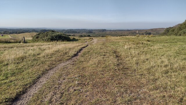
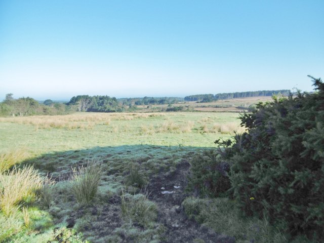
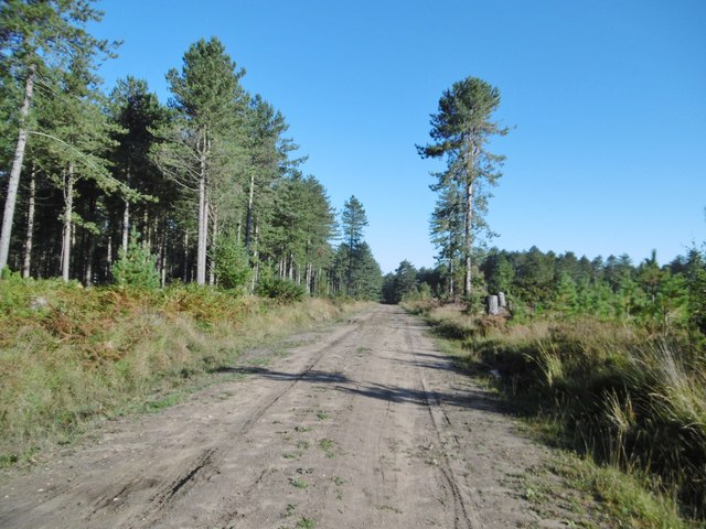
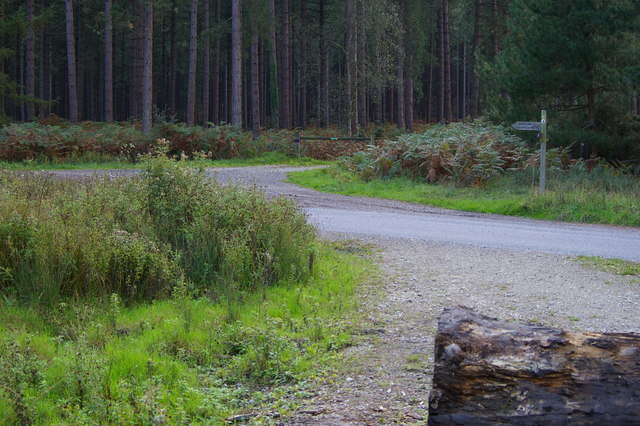
Sargent's Plantation is a picturesque woodland located in the county of Dorset, England. Situated near the village of Sargent's Green, the plantation covers an area of approximately 100 acres, providing a serene and tranquil escape for nature enthusiasts and outdoor adventurers alike.

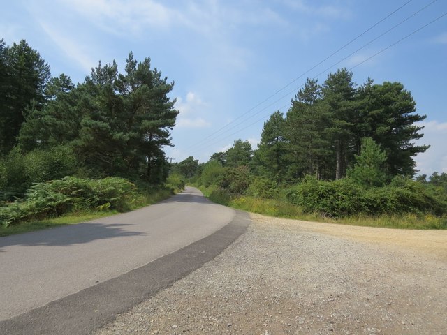
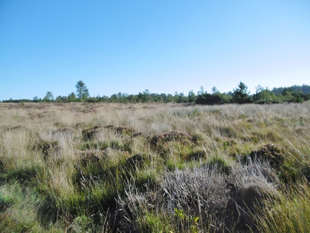
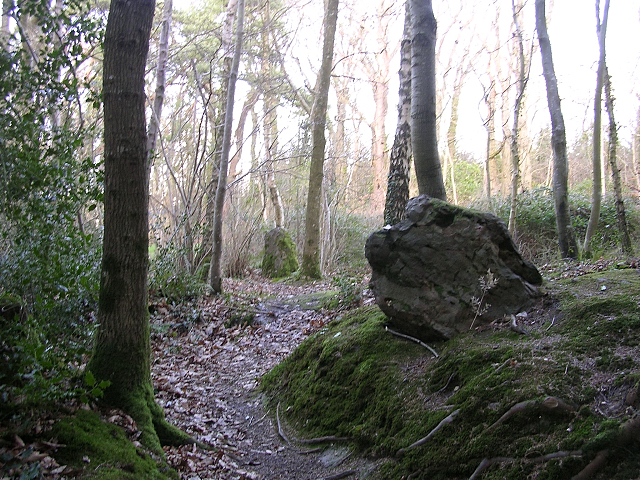
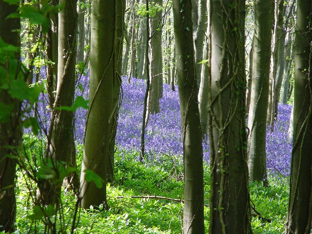
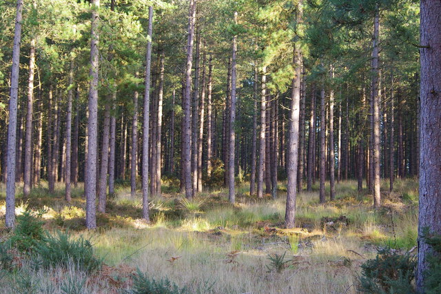
The plantation features a diverse range of tree species, including oak, beech, and birch, creating a dense and lush forest environment. The tall, majestic trees provide ample shade during the summer months and a vibrant display of colors during the autumn season.

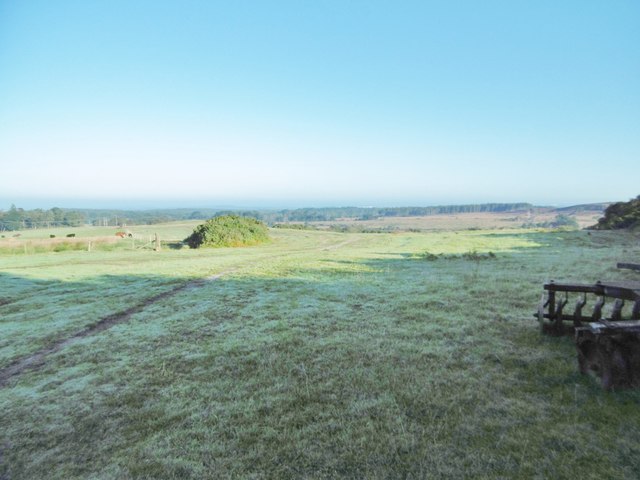
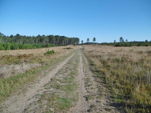
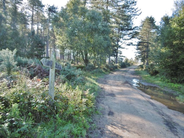
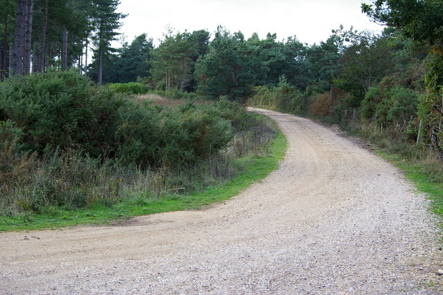
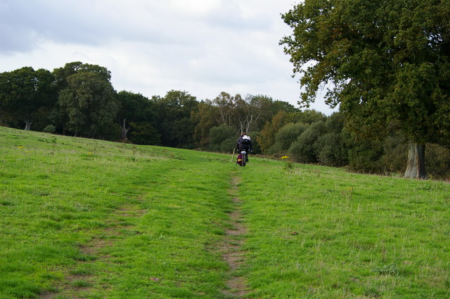
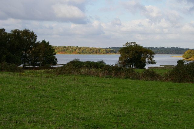
A network of well-maintained footpaths crisscrosses the plantation, allowing visitors to explore its natural beauty at their own pace. These paths lead to several scenic spots, such as a small pond teeming with wildlife and a clearing that offers panoramic views of the surrounding countryside.

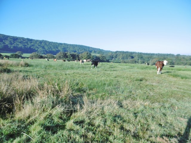
Sargent's Plantation is home to a rich array of flora and fauna, providing a haven for various bird species, mammals, and insects. Birdwatchers can spot elusive species such as woodpeckers, owls, and songbirds, while nature enthusiasts may encounter rabbits, squirrels, and deer.

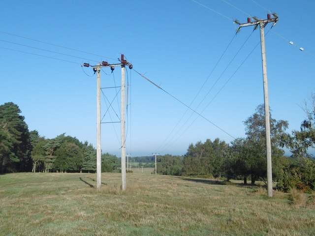
The plantation is a popular destination for outdoor activities, with designated areas for picnicking, birdwatching, and nature photography. It is also a favored spot for walking and hiking, offering a peaceful and refreshing retreat from the hustle and bustle of everyday life.

Overall, Sargent's Plantation in Dorset is a beautiful woodland oasis, offering visitors a chance to immerse themselves in the tranquility of nature while enjoying its diverse flora and fauna.

If you have any feedback on the listing, please let us know in the comments section below.

Sargent's Plantation Images

Images are sourced within 2km of 50.653267/-2.0119571 or Grid Reference SY9983. Thanks to Geograph Open Source API. All images are credited.

Bridleway heading to Kingswood Heath From Kingswood Farm the bridleway heading to Kingswood Heath
Bridleway heading to Kingswood Heath
From Kingswood Farm the bridleway heading to Kingswood Heath
Junction at Newton Heath The path on the right is part of the Poole Harbour Trail, the one on the left is a dismantled tramway and cycle route/bridleway.
Junction at Newton Heath
The path on the right is part of the Poole Harbour Trail, the one on the left is a dismantled tramway and cycle route/bridleway.
Rempstone, bridleway From Kingswood Farm Cottage to Rempstone Forest.
Rempstone, bridleway
From Kingswood Farm Cottage to Rempstone Forest.
Rempstone, cattle grazing
Rempstone, Kingswood Heath Gorse, bramble and sedge.
Rempstone, Kingswood Heath
Gorse, bramble and sedge.
Rempstone, power lines
Kingswood Heath, bridleway From Kingswood Farm Cottage to Ower.
Kingswood Heath, bridleway
From Kingswood Farm Cottage to Ower.
Kingswood Heath A sombre scene, now that heather has gone over.
Kingswood Heath
A sombre scene, now that heather has gone over.
Kingswood Heath, bridleway From Kingswood Farm Cottage to Ower.
Kingswood Heath, bridleway
From Kingswood Farm Cottage to Ower.
Newton Heath, signpost On the bridleway from Ower to Kingswood Farm.
Newton Heath, signpost
On the bridleway from Ower to Kingswood Farm.
Part of the Rempstone stone circle in birch woodland, Purbeck About half of this stone circle remains amongst the trees to the south of the Studland-Corfe Castle road (B3351).
Part of the Rempstone stone circle in birch woodland, Purbeck
About half of this stone circle remains amongst the trees to the south of the Studland-Corfe Castle road (B3351).
Brenscombe Outdoor Centre, Corfe Castle, Dorset The centre offers a wide range of outdoor activities and farmhouse accommodation.
<span class="nowrap"><a title="http://www.brenscombeoutdoor.co.uk/index.html" rel="nofollow ugc noopener" href="http://www.brenscombeoutdoor.co.uk/index.html">Link</a><img style="margin-left:2px;" alt="External link" title="External link - shift click to open in new window" src="https://s1.geograph.org.uk/img/external.png" width="10" height="10"/></span>
Brenscombe Outdoor Centre, Corfe Castle, Dorset
The centre offers a wide range of outdoor activities and farmhouse accommodation. LinkExternal link
Bluebells at Brenscombe Hill
Bridleway towards Newton
Bridleway across fields near Newton, Purbeck
The shore of Newton Bay, Poole Harbour Taken from the adjacent bridleway
The shore of Newton Bay, Poole Harbour
Taken from the adjacent bridleway
Junction of bridleways, Rempstone Forest
Forestry plantation, Rempstone Forest Photo taken from the adjacent bridleway
Forestry plantation, Rempstone Forest
Photo taken from the adjacent bridleway
Show me another place!

Sargent's Plantation is located at Grid Ref: SY9983 (Lat: 50.653267, Lng: -2.0119571)

Unitary Authority: Dorset

Police Authority: Dorset

What 3 Words

///thrusters.reception.giant. Near Corfe Castle, Dorset

Related Wikis

Brenscombe Heath

Brenscombe Heath (grid reference SY985829) is a 34.7 hectare biological Site of Special Scientific Interest in Corfe Castle, Dorset, notified in 1985....

Rempstone Stone Circle

Rempstone Stone Circle (grid reference SY994820) is a stone circle located near to Corfe Castle on the Isle of Purbeck in the south-western English county...

Wessex Basin

The Wessex Basin is a petroleum-bearing geological area located along the southern coast of England and extending into the English Channel. The onshore...

Wytch Farm

Wytch Farm is an oil field and processing facility in the Purbeck district of Dorset, England. It is the largest onshore oil field in western Europe. The...

Nine Barrow Down

Nine Barrow Down is an elongated hill forming the northern ridge of the Purbeck Hills on the Isle of Purbeck in Dorset, England. The chalk down is part...

Green Island (Dorset)

Green Island is an island in Poole Harbour in the English county of Dorset. It lies in the central south part of the harbour, south of Brownsea Island...
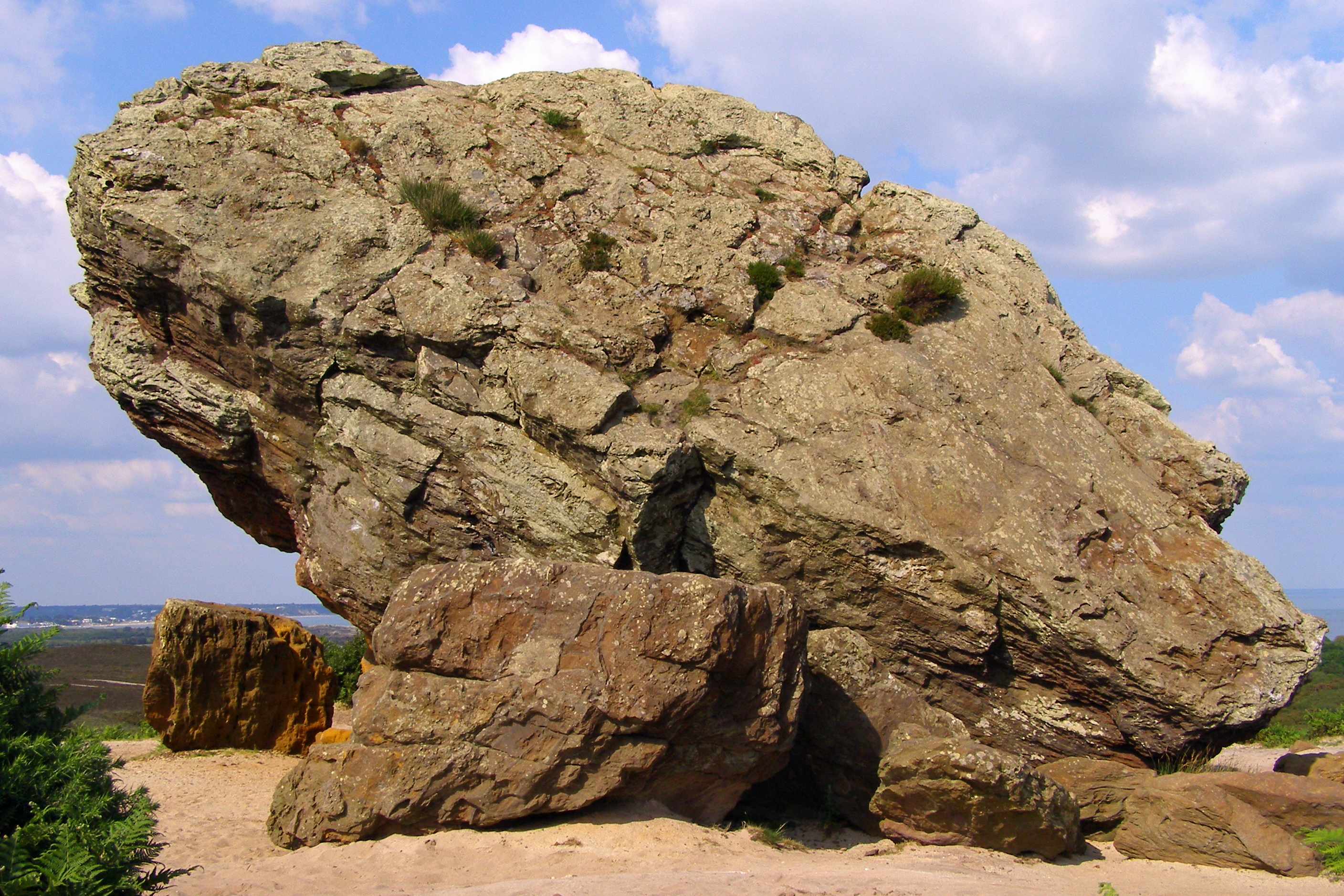
Agglestone Rock

Agglestone Rock, also known as the Devil's Anvil, is a sandstone block of about 400 tonnes weight, perched on a conical hill, approximately 1-mile (1.6...

Rowbarrow Hundred

Rowbarrow Hundred or Rowberrow Hundred was a hundred in the county of Dorset, England, containing the following parishes: Langton Matravers Studland Swanage...

Nearby Amenities

Located within 500m of 50.653267,-2.0119571
Material: wood
Power: pole
Ref: 4
Source: bing
Source Ref: interpolation
Lat/Long: 50.6508046/-2.0177636
Material: wood
Power: pole
Ref: 5
Source: bing
Source Ref: interpolation
Lat/Long: 50.6512563/-2.0169651
Material: wood
Power: pole
Ref: 6
Source: bing
Source Ref: interpolation
Lat/Long: 50.6517169/-2.0161609
Material: wood
Power: pole
Ref: 7
Source: bing
Source Ref: interpolation
Lat/Long: 50.6521936/-2.0153735
Material: wood
Power: pole
Ref: 8
Source: bing
Source Ref: interpolation
Lat/Long: 50.652877/-2.0144161
Material: wood
Power: pole
Ref: 9
Source: bing
Source Ref: interpolation
Lat/Long: 50.6534319/-2.0132437
Material: wood
Power: pole
Ref: 10
Source: bing
Source Ref: interpolation
Lat/Long: 50.6540237/-2.0135614
Material: wood
Power: pole
Ref: 11
Source: survey;bing
Source Ref: survey
Lat/Long: 50.6546346/-2.0139065
Material: wood
Power: pole
Ref: 12
Ref Switch: 7?928
Source: survey;bing
Source Ref: survey
Switch: yes
Lat/Long: 50.654987/-2.0129379
Material: wood
Power: pole
Ref: 13
Source: survey;bing
Source Ref: survey
Lat/Long: 50.6553357/-2.011955
Material: wood
Power: pole
Ref: 14
Source: survey;bing
Source Ref: survey
Lat/Long: 50.6556983/-2.0110386
Material: wood
Power: pole
Lat/Long: 50.6559441/-2.0095765
Material: wood
Power: pole
Ref: 50803167;15
Source: survey;bing
Source Ref: survey
Lat/Long: 50.6561057/-2.0100057
Material: wood
Power: pole
Ref: 50803168;16
Source Ref: survey
Lat/Long: 50.656226/-2.0093035
Material: wood
Power: pole
Ref: 17
Source Ref: interpolation
Lat/Long: 50.6569251/-2.008565
Reception
Building: office
Lat/Long: 50.6516271/-2.0071372
Burnbake
Place: locality
Source: OS-OpenData_StreetView
Lat/Long: 50.6518582/-2.0106218
Toilets
Lat/Long: 50.6508584/-2.006365
Shop: convenience
Lat/Long: 50.6508821/-2.0064321
Cafe
Fixme: check location
Lat/Long: 50.6508974/-2.0065099
Power: pole
Source: bing
Transformer: distribution
Lat/Long: 50.651219/-2.0080921
Power: pole
Source: bing
Lat/Long: 50.6504851/-2.0091382
Power: pole
Source: bing
Lat/Long: 50.6511178/-2.0128785
Power: pole
Source: bing
Lat/Long: 50.6515047/-2.0143215
The data included in this document is from www.openstreetmap.org. The data is made available under ODbL.

Have you been to Sargent's Plantation?

Leave your review of Sargent's Plantation below (or comments, questions and feedback).